Bolton Potholes
Check Bolton Potholes access before visiting: no visitor parking, foot or bicycle entry only, serious swimming hazards, current rules and a reviewed photo.
Discover 21 amazing natural swimming destinations across Vermont. From pristine lakes to refreshing rivers, find your perfect swimming spot.
The historical state inventory is not a current bathing permit, depth survey or maintained rope-swing authorization. No new blanket legal swimming ban is asserted; exact present access remains unresolved.
Read the correction and official sourcesThe recreation pond, Battenkill river accesses and privately operated campgrounds are distinct places. A town-plan facility description or river view does not authorize every shoreline or establish today's bathing operation.
Read the correction and official sourcesThe current Grout Pond notice keeps the beach and boat launch open during construction, with day-use parking in the upper campground loop. This does not certify swimming conditions or river access at Arlington Green.
Read the correction and official sourcesConfirm a lawful entry and current local restrictions before entering. Statewide safety guidance does not establish landowner permission or Benson's Hole water-quality clearance.
Read the correction and official sourcesNo visitor parking: access is by foot or bicycle only. Never swim or jump in Eagle's Eye. Stay out of frothy or fast-moving water and avoid swimming for at least 48 hours after heavy rain; waiting does not guarantee safe conditions.
Read the correction and official sourcesBartlett Falls swimming is at your own risk. Do not jump, climb cascades or rely on old depths. Circle Current's exact current entry and permission require separate confirmation; do not transfer town-park rules to every roadside bank.
Read the correction and official sourcesA state recreation inventory does not establish a maintained swimming descent, jumping permission or a blanket prohibition. Stay out of rail corridors and respect actual signs and property boundaries.
Read the correction and official sourcesUse a named official swimming beach only when open and follow current city notices and posted rules. This area listing is not permission to swim at marinas or any shoreline access. North Shore Natural Area is not a designated swimming area.
Read the correction and official sourcesThe city explicitly provides a public beach/swimming area. Follow current beach signs, boundaries and any water-quality closure. Do not jump or dive from cliffs or substitute the archive's informal overlook descent for the municipal beach.
Read the correction and official sourcesVermont River Conservancy confirms public access and swimming, with a drowning-risk warning. Keep dogs leashed. Public access does not establish safe water conditions; follow posted restrictions and do not jump or dive from rocks.
Read the correction and official sourcesRespect warning signs, fences and marked restricted areas around the hydro facility. Operator guidance warns of sudden changes in flow and remote releases. No site-wide swimming ban is invented, but no specific current gorge bathing entrance is established.
Read the correction and official sourcesVRC confirms public swimming and fishing at Lower Clarendon Gorge State Forest, cared for by Vermont FPR. Changing water levels and drowning risk remain explicit; no jumping permission or surveyed entry claimed.
Read the correction and official sourcesChittenden's adopted town plan recognizes limited public reservoir access for swimming and other recreation. That regional support does not verify this precise point, dam-side entry or permission to enter fenced power infrastructure.
Read the correction and official sourcesPrevious promises of gentle summer flow, clear water and a free, easy descent were not supported by this incomplete archive. No new river-wide swimming ban is asserted.
Read the correction and official sourcesUse the signed natural-area access and obey current notices. Swimming depends on river conditions, not simply public access. No lifeguard coverage verified; avoid diving, jumping and high flows.
Read the correction and official sourcesSwimming is at your own risk with no lifeguard. The operator prohibits diving, alcohol, drugs, motorized vehicles and unaccompanied minors. Register through the operator and check closures.
Read the correction and official sourcesRock River Preservation maintains publicly accessible land, trails and swimming holes. Follow stewards, posted rules and changing river conditions. The surviving regional directions stop after Route 30 and do not recover four individual historical entrances.
Read the correction and official sourcesThe archived Route 125 bridge reference has no verified current public bathing entrance. Harold Curtiss Park and the town pool are separate facilities; their status does not supply gorge permission.
Read the correction and official sourcesThe association describes informal opportunities to cool off, not verified current waterfall permissions or supervision. Follow posted restrictions and avoid jumping, climbing wet ledges or using cascades as slides. Branbury beach rules are separate.
Read the correction and official sourcesVRC confirms public swimming, walking and fishing at Twenty-Foot Hole with Vermont FPR caretaker. The incomplete archive does not establish a second separately authorized destination or measured twenty-foot depth.
Read the correction and official sourcesTown sources identify the bridge over Sunset Lake and planning materials acknowledge lake swimming and Hippo Park. This is not a verified current bridge-jumping permission, exact swimming entrance or service inventory.
Read the correction and official sourcesCurrent swimming permission unverified. Do not use historical swimming references as authorization; respect posted property restrictions. Do not jump, dive or use rope swings.
Read the correction and official sourcesConfirm Glen Lake water recreation with park staff. Bomoseen's designated sandy swim beach is a separate lake destination, not permission at this marker. No clothing-optional designation was verified.
Read the correction and official sourcesUse the designated beach when open and follow posted boundaries and closures. No lifeguard on duty; supervise children and swim within your abilities. A managed beach does not establish today's water quality or safe depth everywhere in the pond.
Read the correction and official sourcesVermont State Parks explicitly supports swimming at Salmon Hole in the West River. Pets are not allowed in that swimming area. Do not transfer Salmon Hole's permission to Pikes Falls or Hamilton Falls.
Read the correction and official sourcesConfirm the intended destination and current notices with Calais. Its ordinance index links separate Curtis Pond recreation-area and island rules; those linked documents were not reviewed here. Do not assume public access to unnamed ponds or riverbanks.
Read the correction and official sourcesVermont Land Trust expressly describes opportunities to enter the Brewster River from its trail corridor. This does not certify gorge pool depth or authorize jumping, sliding, crossing private turnarounds or entering every bridge-side bank in the region.
Read the correction and official sourcesFollow Great River Hydro rules and current signs. Its recreation facilities are day-use only, with no overnight camping; areas may close when full. Clothing-optional use is historical context from saved site signs, not a current legal designation or permission for all reservoir shores.
Read the correction and official sourcesDo not enter until current authorization is established. Do not jump or dive from quarry edges. Historical swimming descriptions do not establish permitted access.
Read the correction and official sourcesFor a beach outing, use Branbury's designated Lake Dunmore swimming area and current park guidance. Vermont State Parks provides lifeguards only at Button Bay pool, not Branbury. Wright Park and TAM walking permission is not verified swimming or jumping permission.
Read the correction and official sourcesNo maintained bathing entrance, measured depth or child-suitable pool is verified. A historical restaurant reference does not establish present swimming permission.
Read the correction and official sourcesThe Upper Missisquoi and Trout Wild and Scenic Committee identifies Riverwalk as a town-owned access for swimming, wading and canoeing. That support is site-specific, not permission for every covered bridge or Trout River frontage.
Read the correction and official sourcesUSACE genuinely advertises swimming in the Ompompanoosuc at its recreation area, but the current seasonal notice takes precedence over generic summer descriptions. This is not a riverwide legal swimming ban or a verified Thetford Center pool entrance.
Read the correction and official sourcesNo current manager source establishes bathing permission or a blanket swimming ban at this historical culvert. Do not enter or pass through a culvert, climb road structures or assume a road right-of-way permits crossing adjacent land.
Read the correction and official sourcesPoultney Recreation genuinely recognizes river swimming while warning about waterfalls, off-trail hazards and private access. At Lake St. Catherine use the designated swim area under current park rules; pets are not permitted on sandy beaches or in designated swimming areas.
Read the correction and official sourcesDo not enter restricted infrastructure areas, approach intakes or outlets, or use dam structures for jumping. An old report of a pool cannot establish present flow, depth or an escape route.
Read the correction and official sourcesConfirm any water activity with park staff. A public gorge trail does not establish swimming permission beside a dam or at every riverbank. Do not jump from bridges or rocks.
Read the correction and official sourcesWhite River Partnership recognizes swimming and maintained public access in the watershed, including Stockbridge's Peavine site. This support is not permission to enter every private bank, jump from ledges or use an unverified Tweed River slide.
Read the correction and official sourcesStay away from gorge edges and behind protective ropes. Do not turn the old Coty jumping-rock description into a recommendation. Foster, Cady and the vaguely named Gorge require their own entrance and permission checks.
Read the correction and official sourcesFollow current Trust signs and any closures. A saved named site sign prohibits night use, fires, motorized vehicles, horses and disruptive activity, but its current wording has not been checked in person. Do not use an old photograph as the sole rule source.
Read the correction and official sourcesThe Corps separately identifies a swimming beach at Stoughton Pond Recreation Area. That is a named alternative, not approval to enter the historical dam pool or jump from infrastructure.
Read the correction and official sourcesThe archived Quechee-West Hartford Road bridge approach has current entrance and parking permission unresolved. White River Partnership monitoring supplies dated site results, not blanket water clearance or private-bank access.
Read the correction and official sources
Check Bolton Potholes access before visiting: no visitor parking, foot or bicycle entry only, serious swimming hazards, current rules and a reviewed photo.
Use Bristol's current Bartlett Falls information for at-own-risk swimming. Keep Circle Current access and nearby Eagle and Sycamore park facilities separate.
Plan a Burlington beach visit with official Lake Champlain closure updates, parking information and a clear North Beach map reference.
Use Red Rocks Park's municipal Lake Champlain beach at 4 Central Avenue. Plan dawn-to-dusk access, seasonal toilets and current beach notices, not cliff entries.
Visit Buttermilk Falls near Ludlow, Vermont. See seasonal photos, confirmed public-access information, caretaker contact details and swimming cautions.
VRC confirms public swimming and fishing at Lower Clarendon Gorge State Forest, cared for by Vermont FPR. Changing water levels and drowning risk remain explicit; no jumping permission or surveyed entry claimed.
Plan a Dog River Natural Area visit near West Berlin with the conserved Jacuzzi swimming site, signed access, river-condition cautions and four reviewed photos.
Plan a Dorset Quarry visit with operator registration, seasonal hours, no-diving rules and parking checks. No lifeguard is on duty.
Use Rock River Preservation's actual Route 30 access and visitor rules. Separate the West River covered bridge from Rock River beaches and dated water samples.
Plan Falls of Lana with the short waterfall approach, Silver Lake and Branbury distinctions, five visitor FAQs and four reviewed trail and waterfall photos.
VRC confirms public swimming, walking and fishing at Twenty-Foot Hole with Vermont FPR caretaker. The incomplete archive does not establish a second separately authorized destination or measured twenty-foot depth.
Plan Hapgood Pond's designated swimming beach near Peru, Vermont, with day-use fees, seasonal access, camping options and reviewed pond photos. No lifeguard.
Plan Jamaica's genuine Salmon Hole river swim with the park season, pet restriction and 8-ton bridge limit. Keep Pikes and Hamilton Falls rules separate.
Separate Johnson, Jeff Falls, Brewster Gorge and Waterville. Use Vermont Land Trust's actual Brewster River parking and seasonal trail rules, not old pool depths.
Plan the historical Moretown Gorge stop without confusing it with other Mad River Valley sites, hotel amenities or a current water-quality clearance.
Plan a named Lake Dunmore beach visit near Middlebury, understand Branbury's season, fees and water testing, and distinguish Otter Creek trails from swimming access.
Find the documented Riverwalk Park and Caleb's Field option on the Trout River. Separate its town-owned setting from three missing historical swimming-hole routes.
Compare unmarked Poultney River access with Lake St. Catherine's managed sandy swim area. Check private-property limits, seasonal facilities and beach pet rules.
Use White River Partnership's actual access and dated monitoring near Stockbridge and Gaysville. Distinguish Peavine in Stockbridge from Bethel and missing old stops.
Plan the Bingham Falls approach with the land trust map and gorge warnings. Do not treat old Foster, Coty, Cady or unnamed gorge routes as five verified swimming entrances.
Explore Green River's Timber Crib Dam with reviewed photos, the preservation trust's site information, dated water-test context and responsible parking guidance.
Safety & Access Notice
This information is for general planning only and may be incomplete, outdated, or inaccurate. Access rules, closures, water levels, currents, hazards, and legal restrictions can change at any time. Always verify current rules with the land manager or official source before visiting.
You are responsible for your own safety and for following all posted signs, laws, and local regulations. Read the full disclaimer.
Vermont features 21 natural swimming spots across 12 water types. Expect varying access and conditions by season; arrive early on weekends, pack out trash, and always verify current rules and water levels before you go.
A municipal beach, conserved riverbank, private quarry and hydroelectric gorge have different rules. Start with a named destination and its current manager information. Public scenery, an old photograph or a regional listing with several promised pools does not establish a usable swimming entrance.
This October 20, 2026 planning update combines the directory's completed source reviews. It is not a field inspection or live water-quality report. The former top-twelve ranking, rock-slide recommendations, fixed water temperatures and two-day swim circuit have been withdrawn.
| Destination | Documented opportunity | Important limit |
|---|---|---|
| Red Rocks Park | Public municipal Lake Champlain beach | Use the beach, not an informal cliff descent |
| Jamaica State Park | Salmon Hole river swimming | Pets excluded from the swim area; park season and bridge limits apply |
| Lake St. Catherine | Designated sandy swimming area | Separate from unnamed Poultney River entries |
| Rock River Preservation | Public conserved trails and swimming holes | Route 30 parking limits, challenging trails and no sanitary facilities |
| Brewster corridor | Land-trust river-entry opportunities | No Canyon Road parking; private-property and winter trail boundaries |
| Union Village | USACE-recognized river swimming | The 2026 recreation season is over |
| Grout Pond | Separately named day-use beach alternative | Construction restrictions and non-potable pump water |
| Historical gorges and bank routes | Some have unresolved current entrances | A missing route is not a newly invented riverwide ban |
Red Rocks Park Swimming Area, Burlington Vt
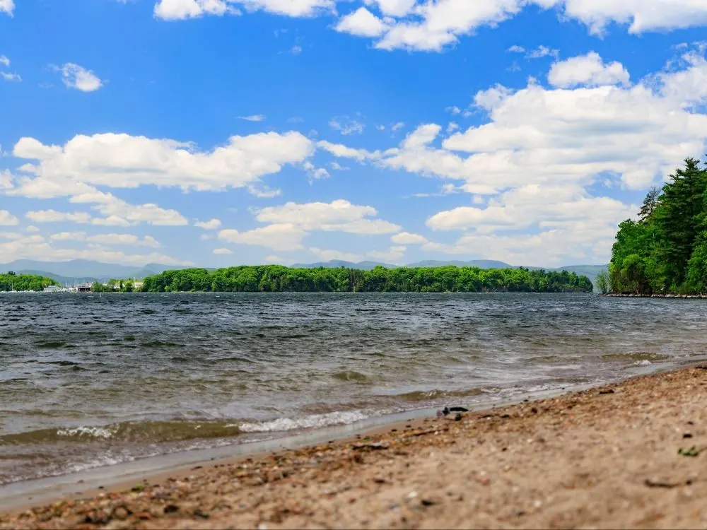
South Burlington's municipal page identifies the public beach at 4 Central Avenue, dawn-to-dusk hours and limited outside parking year-round. Toilets are portable and seasonal, normally May-October. Follow current beach notices; neither the archive's overlook path nor a photograph establishes a second authorized cliffside swimming entrance.
The Poultney Recreation Commission recognizes river swimming but warns that access is unmarked and sometimes crosses private property. The surviving historical route names neither of its two promised river stops. Lake St. Catherine State Park is a separately documented alternative with a designated sandy swim area. Its services and gallery do not belong to the missing Route 140 river pools. Pets are excluded from its sandy beaches and designated swimming areas.
Hapgood Pond has a managed swimming beach, camping and seasonal services, not a general family-safety guarantee. The reviewed manager information lists no lifeguard and separates day-use charges from camping. Confirm the current season and payment method before visiting; campground accessibility does not establish accessible water entry.
Dorset is privately operated, with registration and waiver requirements. Follow the operator's current calendar, parking arrangements and rules, including its diving restriction. A historical photograph of someone jumping does not establish permission or a safe landing. Do not revive the former Kelly Road parking instructions.
Jamaica Vermont Swimming Holes
Vermont State Parks explicitly supports swimming at Salmon Hole in the West River. Pets are not allowed in its swimming area. The entrance bridge has an 8-ton limit, important for RVs and trailers. Regular park operation ends the second Monday in October, so confirm off-season arrangements rather than assuming showers or campsites are available on October 20.
Pikes Falls is a separate historical destination. Hamilton Falls has its own explicit danger guidance, including no safe middle-pool entry or exit. The current West River Trail landslide notice concerns the dam-release shuttle; it is not evidence that every park trail or river activity is closed.
Dummerston Region Swimming Holes
Rock River Preservation identifies Route 30 parking in Dummerston within signed and painted limits. Its woodland trails and swimming holes are publicly accessible under steward rules. There are no sanitary facilities. Leash dogs, carry drinking water, keep soap out of the river and obtain permission before photographing other people. Strong-current crossings and high water are reasons to turn back.
The town's recreation park and a Lions Club pond appear in municipal planning, but a current bathing timetable was not established for that separate Arlington record. The Arlington Green covered-bridge archive is another identity with unresolved bank permission. Neither should be filled with invented entrances.
For a separately named alternative, the Grout Pond operator notice closes Pond Loop Trail, campsites 1-11 and lower parking from September 16 through late November 2026. The beach and boat launch remain open during construction with day-use parking in the upper campground loop. The hand pump is non-potable until further notice. Bring drinking water; an open beach does not reopen campsites.
Bristol Falls & Circle Current
The town recognizes Bartlett Falls swimming at the visitor's own risk. Circle Current remains a separate historical reference, not a verified slide or circular-current attraction. Sycamore and Eagle parks have their own services; Eagle's accessible fishing platform is not an accessible bathing entrance.
Stockbridge Vermont River Swimming Holes
White River Partnership documents swimming and maintained access in the watershed. Stockbridge's Peavine site is not Peavine Park in Bethel. Use the actual Water Trail access and match any bacteria result to its site and date. The Partnership recommends avoiding swimming and tubing during and immediately after rain; an earlier favorable sample is not a current clearance.
Lamoille River Valley Swimming Holes
Vermont Land Trust welcomes river entry along its Brewster corridor, with real boundaries. Use Brewster River Park parking before the covered bridge; parking is not allowed on Canyon Road. Northern Alden Bryan trail sections close December 15-April 15 for deer habitat. The accessible Pond Loop and West Farm Road toilet do not make a gorge descent accessible. Johnson and Waterville's old bridge references need their own entrance checks.
Montgomery Center Vermont Swimming Holes
The Wild and Scenic Committee identifies town-owned Riverwalk Park/Caleb's Field for Trout River swimming, wading and canoeing. Its account of a 2018 access project is not a 2026 inspection of steps or services. This is a separately sourced modern option, not three reconstructed historical pools.
Bingham Falls has land-trust-documented public access and a history of swimming. The Route 108 descent becomes steep and potentially slippery; stay behind protective ropes and away from gorge edges. Foster, Cady, Coty and the vaguely named Gorge are not all verified by Bingham's access information.
Ompompanoosuc River Swimming Spots in Vermont (Swimming temporarily closed)
USACE genuinely recognizes swimming at Union Village, but its notice updated September 10, 2026 says the recreation season is over. The main gate is closed, and Buzzell Bridge Road is closed to vehicles beyond the Route 113 parking area. Its West Branch Road notice concerns September, not guaranteed October access. The announced next season begins May 29, 2027. These are scoped recreation and access notices, not a prohibition on every Ompompanoosuc River activity.
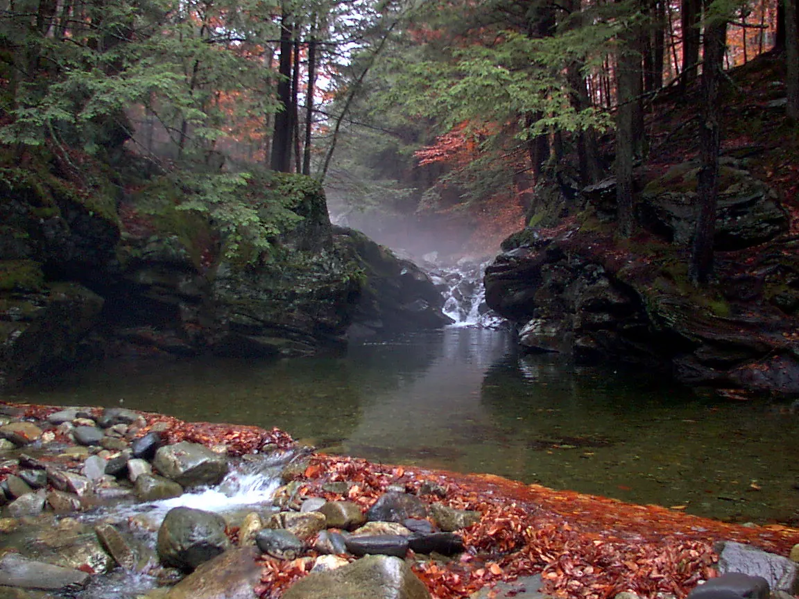
The caretaker urges visitors to choose safer swimming locations. There is no visitor parking for the potholes at the school, Route 2, the specified Bolton Valley Access Road stretch or residents-only Curtis Lane. Eagle's Eye is specifically a place never to swim or jump. Follow the current caretaker rules, not the old jump or roadside directions.
The hydroelectric project documents free canoe portage, picnic and fishing access, not a verified bathing entrance beside the powerhouse. Do not pass a gate, approach dam infrastructure or use breaks in a gorge wall as a swim route. No blanket legal swimming ban has been invented.
Historical geological and recreation recognition does not confirm a modern water entrance. Do not walk railway property or park near tracks on the strength of the old route.
The incomplete East Randolph approach does not identify a maintained public bathing entrance. Do not enter drainage structures. Randolph's town pool is a separate managed facility, not a replacement pin or source of brook amenities.
The town plan recognizes limited reservoir recreation, but the exact informal point route remains unresolved. Chittenden Reservoir, Lefferts Pond and a dam boat launch are not interchangeable bathing entrances.
Quechee Gorge is planned as a viewpoint and trail outing, not a guaranteed river-bottom swim. Floating Bridge at Brookfield's Sunset Lake is not a bridge-jumping platform. Dog Team Tavern's former restaurant parking and The Power Station's utility driveway likewise need current property authorization.
Q: Which Vermont destinations have genuine documented swimming support?
A: Reviewed sources support Red Rocks beach, Salmon Hole, Lake St. Catherine, Rock River and the Brewster corridor, among other individually described places. That support has exact boundaries and does not guarantee present opening, water quality or every historical pool entrance.
Q: Is Union Village's normal recreation operation open in October 2026?
A: USACE's September 10 notice says the season is over, with specific gate and vehicle-road restrictions. It announces May 29, 2027 as the next season's first day; confirm later notices rather than extending September access into October.
Q: Does Grout Pond construction close the entire beach?
A: No. The reviewed notice keeps the beach and launch open with upper-loop day-use parking, while closing the Pond Loop Trail, campsites 1-11 and lower parking through late November 2026. The hand pump is non-potable.
Q: Can dogs use all river and beach swimming areas?
A: No. Salmon Hole excludes pets from its swimming area, Lake St. Catherine excludes them from sandy beaches and designated swim areas, and Bolton Potholes allows no dogs. Rock River and Brewster have their own leash rules; check the exact destination.
Q: Do public scenery or an unofficial label establish free access?
A: No. Municipal beaches, private quarries, conserved land, state parks and utility property have different parking, admission and activity rules. A historical route or absence of a listed fee does not authorize crossing private land.
Q: Can I use the former jumping, slide or fixed-depth advice?
A: No. Those recommendations are withdrawn. Follow current site restrictions and avoid jumps, improvised slides, strong flow and unverified bank descents. A photograph, elapsed time after rain or older sample is not a present entry assessment.
Choose one confirmed destination, read its current notices, arrange the actual admission or parking and keep a non-swimming alternative. Respect stewards, private property and other visitors' privacy, stay on authorized routes and pack out waste. Accessible buildings or fishing platforms do not establish accessible bathing routes.
Ready to discover more? Check out swimming holes in other states or browse our complete directory.