
Four Corners
Background: generated illustration, not a photograph of this location.
Identify Four Corners on Jay Branch in Troy, Vermont. Preview reviewed gorge photos and understand which parking, access and swimming details still need confirmation.
Swimming permission unconfirmed
Current swimming permission unverified. Do not use historical swimming references as authorization; respect posted property restrictions. Do not jump, dive or use rope swings.
Status summarizes our reviewed record, not today's opening or safety. Check current rules, swimming boundaries and notices before visiting.
Location
Map & Directions
A closer look
Photos of Four Corners
Photos show past visits, not current water levels or swimming conditions. Select a photo to view it larger.
Sources & checks
This is a desk-researched listing. A record update or map check does not confirm current swimming permission or water conditions.
- Swimming rules
- Current swimming permission has not been independently confirmed for this listing. Check with the land manager before entering the water.
- Access location not verified
- The recorded location has no completed source check. Confirm the entrance, legal access, and parking before travelling.
- Record updated
- · This is a data update, not a field visit.
Found an error? Send a correction with the location and a source. How we research listings.
Four Corners is Jay Branch Gorge
The March 2013 river management plan identifies Four Corners on Jay Branch in Troy. This corrects the previous Bugbee Brook description. The November 2019 proposed Troy municipal plan also inventories Jay Branch Gorge east of Route 101. These documents explain the name and location context, not today's visitor rules.
Preview the landscape
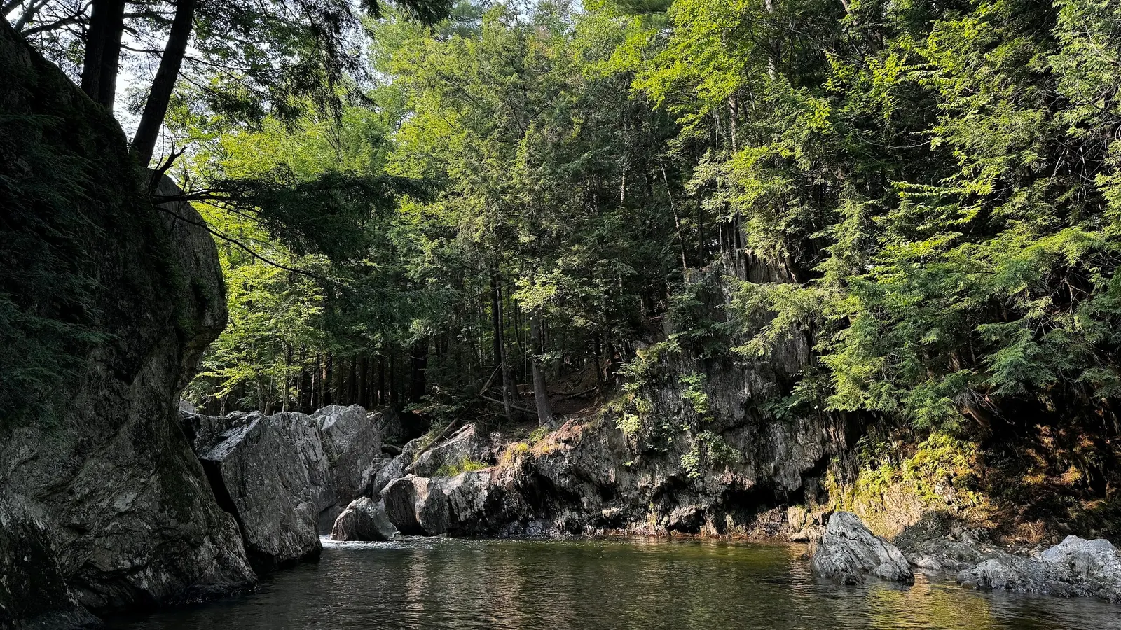
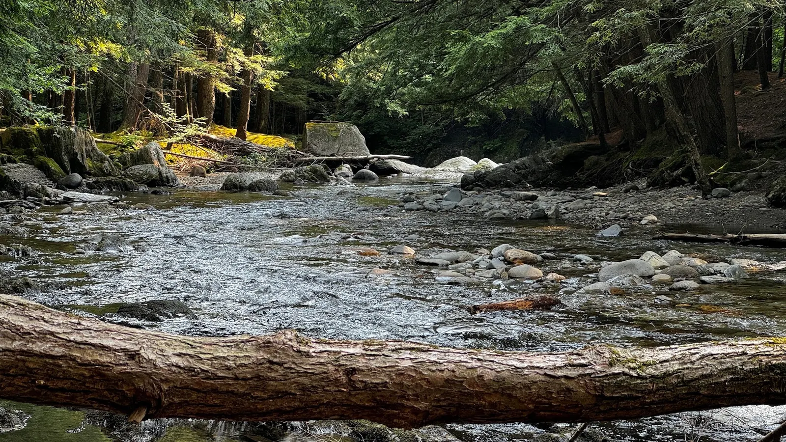
The reviewed gallery shows wooded rock walls around a pool and a boulder-lined stream. It is useful scenery context, but does not measure present depth or establish a safe water entrance.
Confirm parking and permission
Current swimming permission, parking arrangements and an authorized approach remain unverified. Do not follow the old dirt-lot instructions or treat the retained map point as a confirmed entrance. Respect property signs and barriers.
Plan around confirmed information
No current hours, fees or visitor services were established in this review. Before choosing this stop, resolve access and facilities. This directory does not recommend jumping, diving or rope swings, and does not describe the gorge as a managed family swimming area.
Getting There
Historical planning references identify Four Corners, also called Jay Branch Gorge, in Troy near Route 101. Confirm authorized parking and the permitted approach before travel. The retained map point is not a verified entrance; the old convenience-store and dirt-lot directions are historical, not an endorsed current route.
Quick Navigation
Access Notes
The March 2013 river plan identifies Four Corners on Jay Branch, not Bugbee Brook. The November 2019 proposed Troy plan inventories the gorge east of Route 101. Neither document establishes current visitor access, public parking or swimming authorization.
Plan Your Visit
Parking & Access
Confirm the entrance, parking arrangements, and legal access with the land manager. A map pin does not establish a public right of access. Follow posted routes and never block gates or driveways.
Regulations & Fees
Current swimming permission unverified. Do not use historical swimming references as authorization; respect posted property restrictions. Do not jump, dive or use rope swings. Public park access does not necessarily include permission to swim. Respect private property and posted restrictions.
Seasonality & Flow
Water conditions can change quickly. This listing does not provide a current safety or water-quality assessment. Check official alerts and avoid entering water when conditions or permission are uncertain.
Frequently Asked Questions About Four Corners
Is Four Corners the same as Jay Branch Gorge?
Yes. The March 2013 river management plan uses both names for the Jay Branch destination in Troy.
Can I currently swim at Four Corners?
Current swimming permission has not been verified. Historical recreation references do not establish today's access rules.
Is the map pin a verified entrance?
No. The retained point is unverified, and the old convenience-store parking directions are not endorsed as a current route.
Do the photos show current water conditions?
No. The gallery provides scenery context, not measured depth, water-quality results or a verified safe entrance.
Highlights
Location & Area Map
Safety Information
Important Safety Tips
- Water clarity and photographs do not establish depth, water quality or a safe exit
- Respect barriers and posted restrictions
Cultural & Historical Context
Historical Background
Four Corners and Jay Branch Gorge refer to the same destination in the historical river management plan.
Photography Guide
Photo Opportunities
Two reviewed scenery photos show the wooded rocky pool and a boulder-lined stream. They are not verified entrance views or evidence of present water conditions.
Conservation & Ethics
Protect This Place
Respect property boundaries, use only authorized routes and pack out all waste.
Explore More Nearby Swimming Guides
More Vermont swimming holes
Browse every listed natural swimming spot in Vermont.
Brook swimming holes
Find similar brook destinations across the directory.
Hidden gems in Vermont
See under-the-radar places and local favorites in the same state.
Family-friendly spots in Vermont
Compare easier-access destinations and safer planning options.
Check water quality before swimming
Use this safety guide before entering any natural water.
You Might Also Like
At a Glance
Safety & Access Notice
This information is for general planning only and may be incomplete, outdated, or inaccurate. Access rules, closures, water levels, currents, hazards, and legal restrictions can change at any time. Always verify current rules with the land manager or official source before visiting.
You are responsible for your own safety and for following all posted signs, laws, and local regulations. Read the full disclaimer.
Camping Information
No authorized camping at this listing verified. Book any overnight accommodation separately.
Loading weather data…
Safety & Access Notice
This information is for general planning only and may be incomplete, outdated, or inaccurate. Access rules, closures, water levels, currents, hazards, and legal restrictions can change at any time. Always verify current rules with the land manager or official source before visiting.
- Do not swim where swimming is prohibited, unsafe, or not clearly allowed.
- Follow posted signs, local regulations, closures, and private-property boundaries.
- Assess conditions on site. Water flow, depth, temperature, and underwater hazards change quickly.
- Never jump or dive without personally confirming depth and underwater obstacles.
- Swim with a buddy and consider flotation for weak or non-swimmers.
- Pack out all trash; respect wildlife and fragile environments.
You are responsible for your own safety and for following all posted signs, laws, and local regulations. Read the full disclaimer.
Joshua Havens created Hidden Swimming Holes to make it easier for people to find — and safely visit — natural freshwater swimming destinations across the United States. He researches access conditions, water quality resources, and land management rules so you don't have to start from scratch. He holds a strong belief that good outdoor recreation information should be accurate, honest about its limitations, and freely available.
Explore More Swimming Holes
Discover other amazing natural swimming destinations across America