
Falls Of Lana
Background: generated illustration, not a photograph of this location.
Plan Falls of Lana with the short waterfall approach, Silver Lake and Branbury distinctions, five visitor FAQs and four reviewed trail and waterfall photos.
Swimming restriction
The association describes informal opportunities to cool off, not verified current waterfall permissions or supervision. Follow posted restrictions and avoid jumping, climbing wet ledges or using cascades as slides. Branbury beach rules are separate.
Location
Map & Directions
A closer look
Photos of Falls Of Lana
Photos show past visits, not current water levels or swimming conditions. Select a photo to view it larger.
Sources & checks
This is a desk-researched listing. A record update or map check does not confirm current swimming permission or water conditions.
- Swimming rules
- Current swimming permission has not been independently confirmed for this listing. Check with the land manager before entering the water.
- Access location not verified
- The recorded location has no completed source check. Confirm the entrance, legal access, and parking before travelling.
- Record updated
- · This is a data update, not a field visit.
Found an error? Send a correction with the location and a source. How we research listings.
Falls of Lana: choose a waterfall walk or a beach outing
Falls of Lana is a rocky Sucker Brook destination near Lake Dunmore, not the beach at Branbury State Park. The Moosalamoo Association describes informal places to cool off but does not certify today's water quality, safe depth or supervised swimming. A waterfall-viewing visit is a worthwhile option when water access or conditions are uncertain.
Use the signed waterfall approach
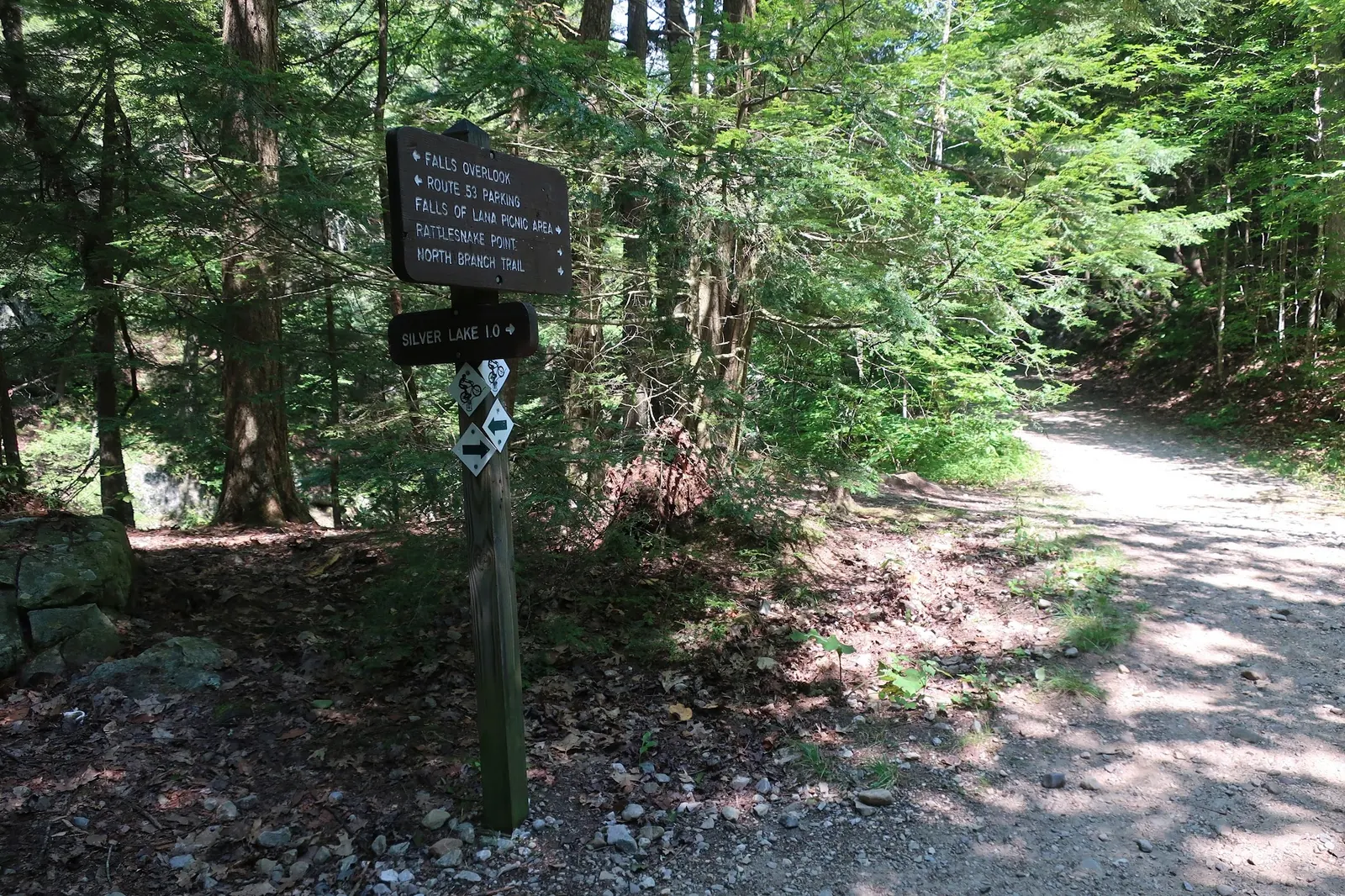
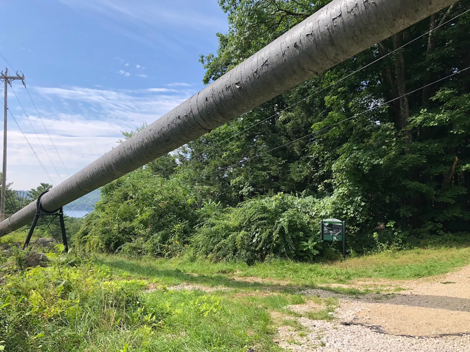
Start at the Silver Lake/Falls of Lana trailhead on Route 53. The Brandon Chamber guide places the falls about 0.3 mile along the Silver Lake Trail, with a short side approach on the left. That is not the full journey to Silver Lake. Follow current signs and allow time for the return. Uneven footing and wet rock call for shoes with traction; the penstock and junction signs in the gallery are landmarks, not shortcuts down unmarked slopes.
Silver Lake is a longer outing
The nearby Silver Lake described by the association is reached on foot or bicycle and has a small beach. It is not Silver Lake State Park in Barnard. Plan the longer route and supplies separately rather than treating the waterfall approach as a lakeside arrival.
Branbury offers a separate managed beach
Branbury State Park has a sandy Lake Dunmore beach with its own seasonal operations and day-use fees. Published park guidance prohibits pets on the sandy beach and in the designated swimming area. Its beach wheelchair can be reserved or used if available; no beach mat is listed. Call 802-247-5925 about current service and mobility needs. Those facilities and rules do not apply automatically to the waterfall.
Bring supplies and read current notices
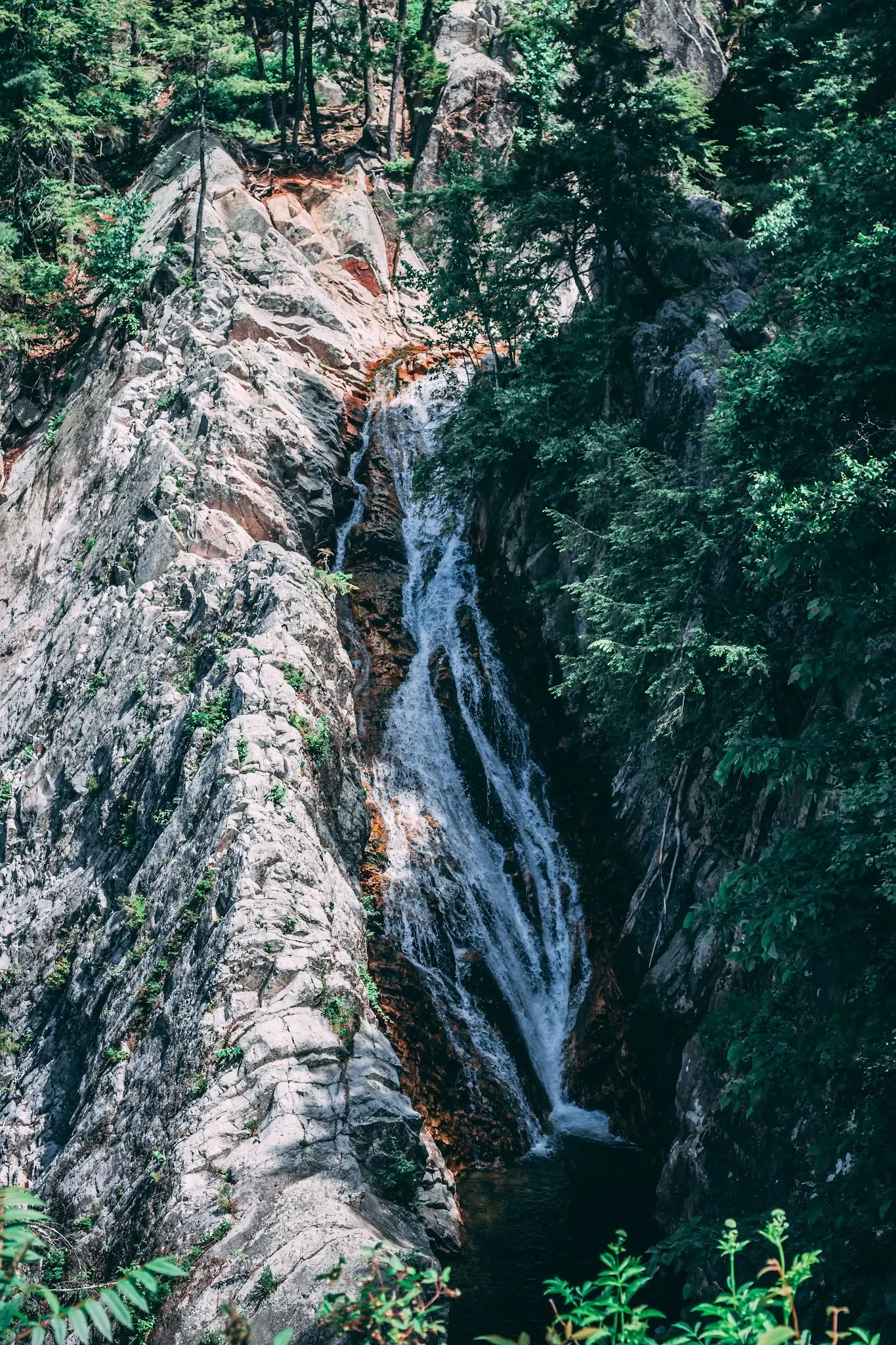
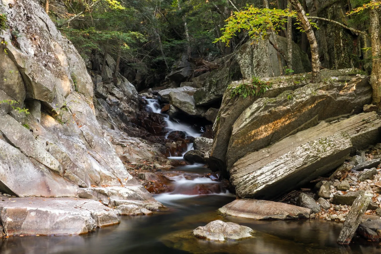
Current waterfall trailhead fees, restroom availability and dog rules were not confirmed. Bring drinking water and follow posted information. Avoid jumping, rock slides and fast-moving water. Four historical gallery views provide waterfall, cascade, trail-sign and penstock context; they are not current access reports or a verified water-entry route.
Getting There
Use the Silver Lake / Falls of Lana trailhead on Route 53 near Branbury State Park. The Brandon visitor guide places the falls about 0.3 mile along the Silver Lake Trail, with a short side approach to the left. Follow current signs and take care with footing. This distance is to the falls, not Silver Lake. Avoid unmarked steep descents.
Quick Navigation
Access Notes
Use the signed Route 53 Silver Lake/Falls of Lana trailhead. The chamber's roughly 0.3-mile waterfall approach is not the full Silver Lake hike. Current trailhead fees, facilities and waterfall dog rules remain unconfirmed.
Plan Your Visit
Parking & Access
Confirm the entrance, parking arrangements, and legal access with the land manager. A map pin does not establish a public right of access. Follow posted routes and never block gates or driveways.
Regulations & Fees
The association describes informal opportunities to cool off, not verified current waterfall permissions or supervision. Follow posted restrictions and avoid jumping, climbing wet ledges or using cascades as slides. Branbury beach rules are separate. Public park access does not necessarily include permission to swim. Respect private property and posted restrictions.
Seasonality & Flow
Water conditions can change quickly. This listing does not provide a current safety or water-quality assessment. Check official alerts and avoid entering water when conditions or permission are uncertain.
What to Bring
Bring sturdy water shoes to protect your feet on rocks and slippery surfaces. A waterproof dry bag keeps your phone, keys, and valuables safe. Pack a quick-dry towel, sun protection, and drinking water - never drink from the natural water source.
Live Conditions Nearby
Checking nearby USGS water conditions…
Frequently Asked Questions About Falls Of Lana
How far is the walk to Falls of Lana?
The Brandon Chamber guide places the falls about 0.3 mile along the Silver Lake Trail from Route 53, with a short side approach. That is not the distance to Silver Lake; follow current signs and plan the return.
Is the nearby Silver Lake the state park in Barnard?
No. The association describes a lake above Lake Dunmore reached on foot or bicycle, with a small beach. Silver Lake State Park in Barnard is another destination.
Is Branbury's sandy beach at the waterfall?
No. Branbury is a separate Lake Dunmore state park with its own fees, season and rules. Its amenities are not verified waterfall facilities.
Can Branbury's beach wheelchair help with a waterfall visit?
The wheelchair is a service at Branbury's separate sandy beach, not a verified waterfall access option. Call that park about availability; its published guidance lists no beach mat.
Can the gallery confirm safe swimming conditions?
No. The four photos show past visits and trail context, not present water quality, levels or restrictions. Avoid jumping, slippery ledges and fast-moving water, and follow current notices.
Highlights
Unique Features
Location & Area Map
Safety Information
Important Safety Tips
- Stay back from steep or wet rock edges
- Do not jump or use the cascades as slides
- Avoid fast-moving water
- Bring shoes with traction and drinking water
- Follow current posted access information
Cultural & Historical Context
Historical Background
Use local interpretation for the area's history; the penstock visible in the gallery is a trail landmark, not a recreational climbing structure.
Photography Guide
Photo Opportunities
Waterfalls, smaller cascades, wooded trail junctions and the penstock landmark. Stay on appropriate paths and away from slippery edges.
Conservation & Ethics
Protect This Place
Visitors are encouraged to follow Leave No Trace principles, carry out all trash, and avoid disturbing wildlife or plant life. Respect the natural beauty of the area by minimizing your impact.
Explore More Nearby Swimming Guides
More Vermont swimming holes
Browse every listed natural swimming spot in Vermont.
Brook swimming holes
Find similar brook destinations across the directory.
Hidden gems in Vermont
See under-the-radar places and local favorites in the same state.
Family-friendly spots in Vermont
Compare easier-access destinations and safer planning options.
Vermont waterfall swimming spots
Explore waterfall-focused swimming destinations in Vermont.
Check water quality before swimming
Use this safety guide before entering any natural water.
You Might Also Like
At a Glance
Safety & Access Notice
This information is for general planning only and may be incomplete, outdated, or inaccurate. Access rules, closures, water levels, currents, hazards, and legal restrictions can change at any time. Always verify current rules with the land manager or official source before visiting.
You are responsible for your own safety and for following all posted signs, laws, and local regulations. Read the full disclaimer.
Camping Information
Camping is a separate booking and destination decision. Neither a waterfall visit nor a nearby campground listing establishes permission to camp beside the falls.
Nearby Attractions
- Silver Lake - Lake
- Branbury State Park - State Park
Loading weather data…
Safety & Access Notice
This information is for general planning only and may be incomplete, outdated, or inaccurate. Access rules, closures, water levels, currents, hazards, and legal restrictions can change at any time. Always verify current rules with the land manager or official source before visiting.
- Do not swim where swimming is prohibited, unsafe, or not clearly allowed.
- Follow posted signs, local regulations, closures, and private-property boundaries.
- Assess conditions on site. Water flow, depth, temperature, and underwater hazards change quickly.
- Never jump or dive without personally confirming depth and underwater obstacles.
- Swim with a buddy and consider flotation for weak or non-swimmers.
- Pack out all trash; respect wildlife and fragile environments.
You are responsible for your own safety and for following all posted signs, laws, and local regulations. Read the full disclaimer.
Joshua Havens created Hidden Swimming Holes to make it easier for people to find — and safely visit — natural freshwater swimming destinations across the United States. He researches access conditions, water quality resources, and land management rules so you don't have to start from scratch. He holds a strong belief that good outdoor recreation information should be accurate, honest about its limitations, and freely available.
Explore More Swimming Holes
Discover other amazing natural swimming destinations across America