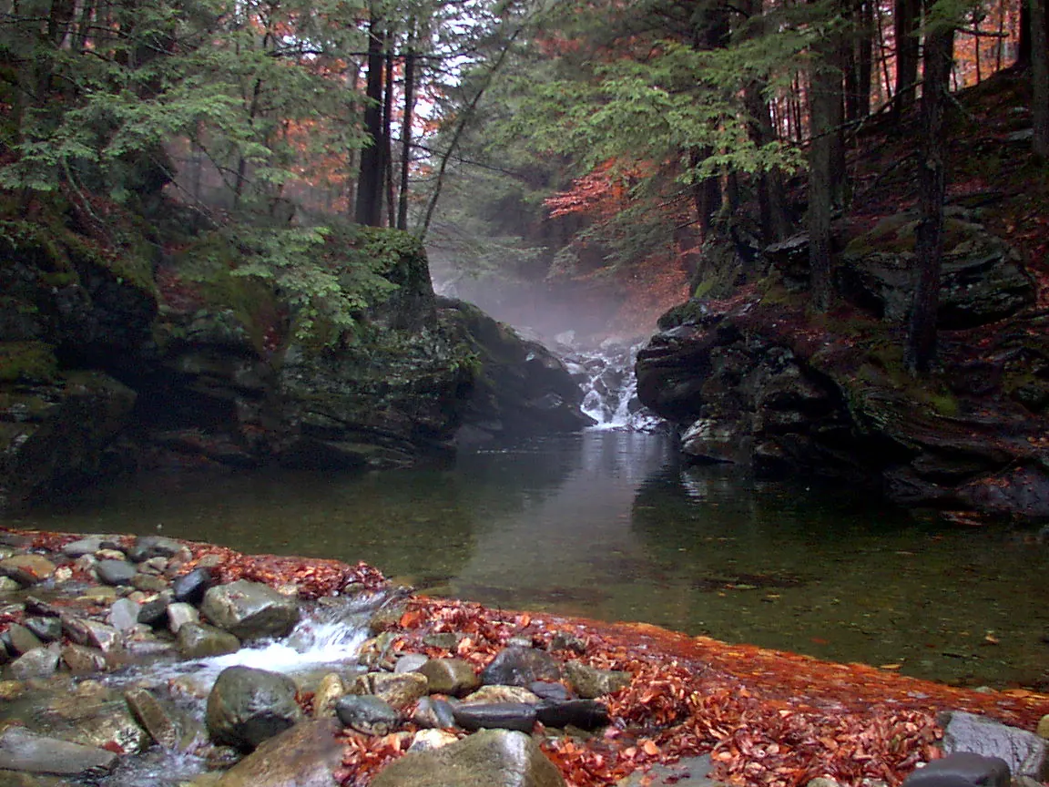
Explore swimming-hole listings in Vermont and plan beyond the familiar stops.
"Hidden gem" is a browsing theme, not a promise of solitude, clear water or public access.
10
Planning candidates
21
Total in Vermont
2
No entry fee listed
Use this collection to research places in Vermont, then check each listing's sources and access notes.
Descriptive detail is not evidence that a site is uncrowded or that its water is suitable for swimming.
By Hidden Swimming Holes Team-
How We Selected These Hidden Gems
This shortlist uses discoverable records, whether free or fee-based. Records with a dated rules-source field come first, followed by records with source links, then a stable alphabetical order. Read the fee notes for each place; the separate budget guide focuses on records reporting no entry fee.
Description length, legacy confidence labels and photo counts do not affect placement. A recorded source date is not a current water-quality or access clearance.
We show up to ten candidates, not a ranking of safety or seclusion.
Confirm permission and any permit or reservation requirements
Check the actual route and parking location with the land manager
Read current closure and water-quality notices
Keep an alternative plan if the site is closed or crowded
Pro Tip
Download offline maps and save each stop before you drive - signal can vanish when you're closest to the good stuff.
Timing and Advisories in Vermont
Check current conditions and local advisories for the exact waterbody before travelling.
Do not assume water is suitable simply because a day or two has passed since rain, or because it looks clear.
Follow posted closures and the land manager's guidance instead of a fixed waiting period.
See the CDC's natural-water swimming guidance for advisory checks, especially after heavy rain.
Access, Parking, and Navigation
Save the official entrance, permitted parking area and return route before leaving. A map pin can describe a broad
recreation area rather than the route to the water; read the pin note and approach details in each full listing.
Ask the operator about reservations, road access and the actual route surface and distance. Do not treat a photograph,
a turnout or a path worn by other visitors as permission to enter. Never block gates or use unauthorized parking.
Respect the Place
If authorized parking is full, use a separately checked backup plan. Do not create new paths or park in vegetation
to reach the water. A backup destination needs its own access and condition checks.
Pack for the Confirmed Route
Footwear appropriate to the confirmed approach, plus a towel and dry layers
Sun protection, drinking water and food matched to your trip
Saved maps, operator contacts and a way to carry out your waste
Any required permit or reservation confirmation; check equipment rules with the operator
Before You Go
Check the named destination's current rules and advisories before deciding whether to swim.
A quiet location or calm-looking surface does not establish suitable conditions. If permission or conditions
remain uncertain, keep the outing on land instead of looking for an unverified water entry.
Joiner Brook cuts through sculpted rock into a series of cascades and pools in Bolton, Vermont. The setting is striking, but this is not a managed swimming beach. Vermont River Conservancy, the caretaker, urges visitors to choose safer swimming locations. The caretaker currently lists access by foot or bicycle only.…
Listing Planning Notes
Sculpted rock and cascades on Joiner Brook
Foot or bicycle access only
No visitor parking
Serious current and drowning hazards
Water Body:Joiner Brook
Recorded Timing:Choose a visit based on current access and weather, not a promised swimming season. Avoid entering after heavy rain or when water is frothy or fast-moving.
Bristol's municipal recreation page identifies Bartlett Falls as a swimming hole and explicitly says to swim at your own risk. This supports an actual regional water outing, but it does not establish a guarded beach, a fixed landing depth or jumping clearance. The archive adds pull-offs farther along the road for…
Water Body:New Haven River at Bartlett/Bristol Falls; Separate Circle Current Reference
Recorded Timing:Check current conditions and posted access before visiting. Town parks close dusk to dawn unless stated otherwise; a scenic waterfall description does not guarantee appropriate water conditions or a bathing season.
Fee Notes:No current Bartlett swimming admission or Circle Current parking charge established by the town page. Check posted parking and actual property terms; a public recreation description is not permission to park anywhere.
This is an area-planning listing, not a single mountain swimming hole. Burlington's official beach directory identifies five Lake Champlain beaches. Choose a named beach and check its current swimming status before travelling. Waterfront paths, marinas and scenic shoreline views are not interchangeable with…
Listing Planning Notes
Named Lake Champlain beach options
Official beach-closure tracker
Beach-specific parking information
Water Body:Lake Champlain; Choose A Named Official Beach
Recorded Timing:Routine city water monitoring runs from Memorial Day through Labor Day; off-season checks are as needed. Check current beach status for every visit.
Fee Notes:Parking varies by beach. North Beach: $3/hour May-October 15; Oakledge: $3/hour May-October 31; Leddy: free at review. Foot and bicycle park admission is free. Recheck city rates.
This Vermont destination is on Branch Brook, not the similarly named state park in New York. Vermont River Conservancy confirms public access and identifies Camp Plymouth State Park as caretaker. For site questions, call 802-228-2025. Follow the directions below to Buttermilk Falls Road. Our former pin represented…
Listing Planning Notes
Waterfalls and pools on Branch Brook
Conserved public river access
Short approach near Ludlow
Water Body:Branch Brook
Recorded Timing:Choose a visit around local weather, water conditions and posted notices. A warm day does not guarantee safe swimming.
The surviving archive gives one Lower Clarendon approach. Vermont River Conservancy confirms public swimming and fishing and identifies Vermont FPR as caretaker. This review retains that public recreation evidence rather than calling the site wholly unverified. The source directs visitors via Route 103 and Route 7B…
Listing Planning Notes
Lower Clarendon Gorge: Public Access & Gorge Planning
Current source context
Historical routes kept separate
Water Body:Mill River
Recorded Timing:Check current access, weather and notices before choosing a date.
Fee Notes:Confirm charges for the destination and activity; no general free swimming claim
This listing now focuses on the named Dog River Natural Area near West Berlin rather than suggesting visitors find arbitrary roadside access. The town recreation page lists the park, while its conservation-partner profile confirms public swimming access at the Jacuzzi site. Consult the partner's directions for 2095…
Listing Planning Notes
Conserved public-access swimming site
Named Dog River Natural Area sign
Bench and picnic-table setting
Four reviewed river-area photos
Water Body:Dog River
Recorded Timing:Check weather and river conditions before leaving. Vermont Health advises waiting at least 48 hours after heavy rain before natural-water swimming; keep out longer if conditions remain unsuitable.
Fee Notes:No current admission or parking charge verified in the reviewed profiles; do not infer a fee policy from the older listing.
Dorset Quarry is a privately operated marble quarry at 1848 Vermont Route 30 in Dorset. Check the operator website for registration and closure updates before travelling. The operator's registration form asks for each visitor's details and a phone number to receive a QR code by text. It also provides an option to add…
Listing Planning Notes
Privately operated marble quarry
Visitor registration through the operator
Seasonal access; check closures
No lifeguard and no diving
Water Body:Dorset Quarry
Recorded Timing:Operator generally lists Memorial Day through Columbus Day, 9 a.m. to dusk. Check current hours and closures.
Fee Notes:Confirm current parking and access charges with the operator; not verified as free.
Dummerston's surviving regional archive names no four individual stops. A useful documented option is Rock River Preservation's public land and maintained swimming-hole trails. The West Dummerston Covered Bridge monitoring site is on the West River and must not be relabeled as a Rock River beach. The preservation…
Water Body:West River and Rock River
Recorded Timing:Check current steward notices and time-stamped monitoring. Upstream rain can quickly increase level and current; a past sample or reassuring scenery is not today's water-quality or crossing clearance.
Fee Notes:No paid bathing ticket established by the preservation visitor page. Donations support stewardship; absence of admission does not permit parking outside signed legal spaces.
VRC identifies Twenty-Foot Hole in Reading with public swimming, walking and fishing, cared for by Vermont FPR. The historical Felchville text cuts off after the first named pool, so this review does not invent a second destination. From Felchville, VRC directs visitors west on Tyson Road for approximately 1.25 miles…
Hapgood Pond combines a sandy swimming beach, picnic grounds and a wooded campground near Peru. The Forest Service profile confirms managed beach recreation but no lifeguard. Treat a swim as your responsibility, not as a guarantee of clear water or safe depth. Day use is $5 per vehicle, or $2.50 per motorcycle,…
Listing Planning Notes
Designated swimming beach
Seasonal day use and camping
Bathhouse and drinking water
Three reviewed pond-area photos
Water Body:Hapgood Pond
Recorded Timing:Plan during the operating season, confirm day-use hours and check current beach notices. Earlier guaranteed clarity and ideal-temperature claims are withdrawn.
Fee Notes:Day use: $5 per vehicle per day; $2.50 per motorcycle, bicycle or walk-in visitor per day. Standard season pass: $35. The operator lists day-use fee waivers for America the Beautiful Pass holders. Camping is separate at $20 per single site per night; payment-channel service fees can apply.