
The Ledges
Background: generated illustration, not a photograph of this location.
Plan a visit to The Ledges on Harriman Reservoir with reviewed shoreline photos, clothing-optional context, operator rules and access cautions. No jumping advice.
Swimming permission unconfirmed
Follow Great River Hydro rules and current signs. Its recreation facilities are day-use only, with no overnight camping; areas may close when full. Clothing-optional use is historical context from saved site signs, not a current legal designation or permission for all reservoir shores.
Official sources checked:
Location
Map & Directions
A closer look
Photos of The Ledges
Photos show past visits, not current water levels or swimming conditions. Select a photo to view it larger.
Sources & checks
This is a desk-researched listing. A record update or map check does not confirm current swimming permission or water conditions.
- Swimming rules
- Official sources checked . Swimming permission remains unconfirmed.
- Access location not verified
- The recorded location has no completed source check. Confirm the entrance, legal access, and parking before travelling.
- Record updated
- · This is a data update, not a field visit.
Found an error? Send a correction with the location and a source. How we research listings.
The Ledges: rocky shoreline, privacy and changing reservoir levels
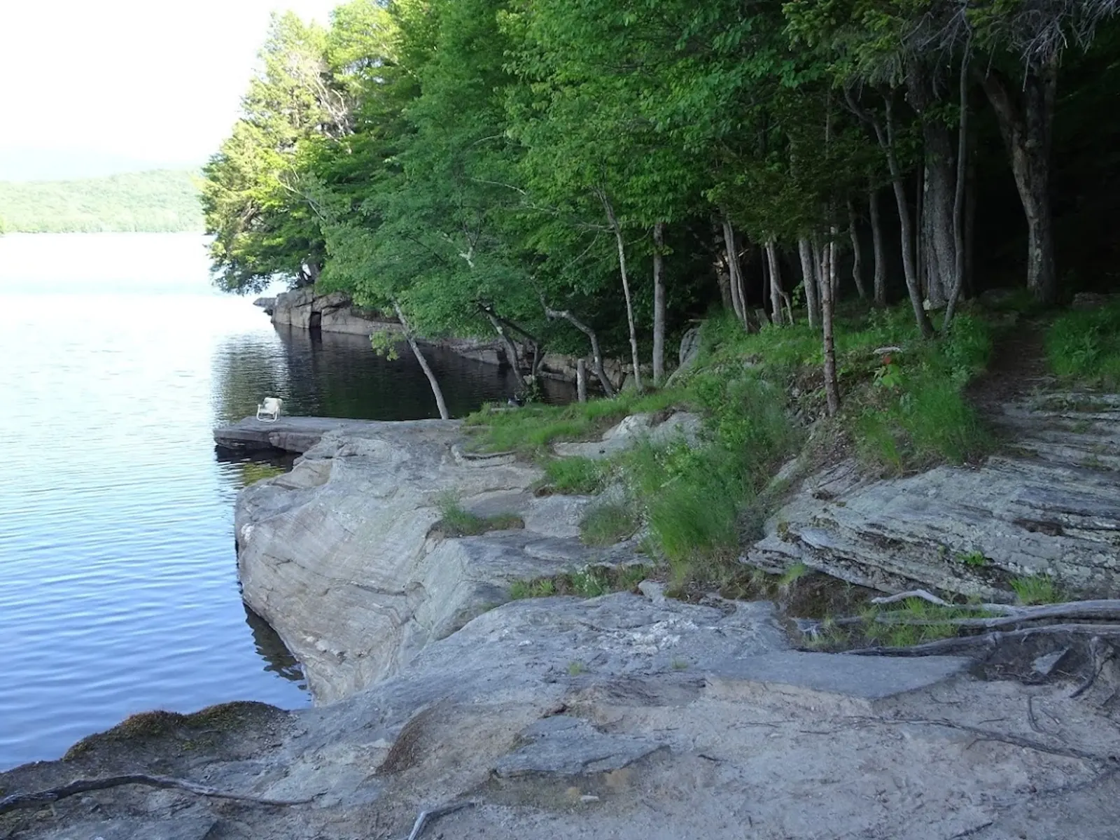
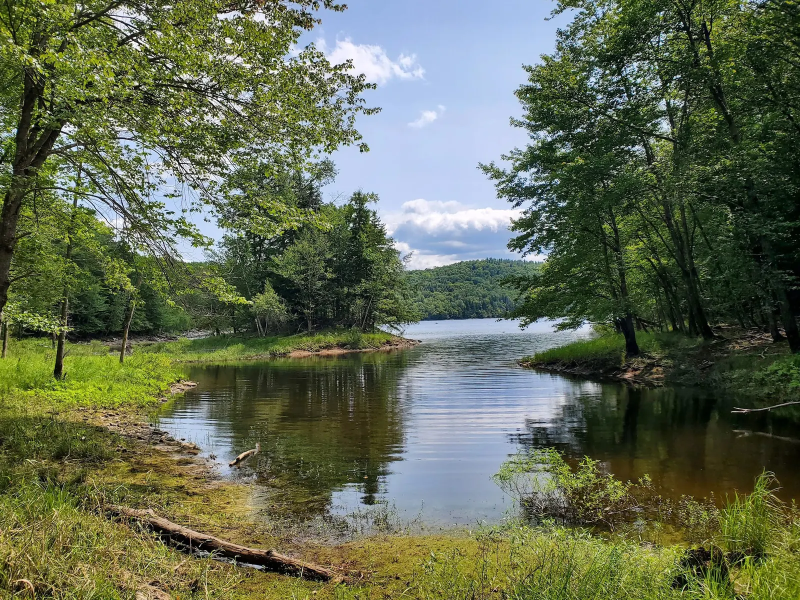
The Ledges is associated with Harriman Reservoir in southern Vermont. Its saved photo collection shows wooded coves, exposed rock and signs describing traditional clothing-optional use. Those images provide context, not current swimming clearance or measured water depth. We have removed the earlier cliff-jumping recommendations.
Confirm the route rather than following the old directions
The operator's Harriman map shows Jacksonville Picnic Area accessed via Wards Boat Access Road off Route 100. Boyd Hill Road appears farther north near Castle Hill, not as the mapped Jacksonville approach. The map does not label The Ledges or establish the old 0.75-mile trail claim. Confirm the permitted onward route and parking before travel; our retained pin is not a verified water entry.
Clothing-optional context and visitor privacy
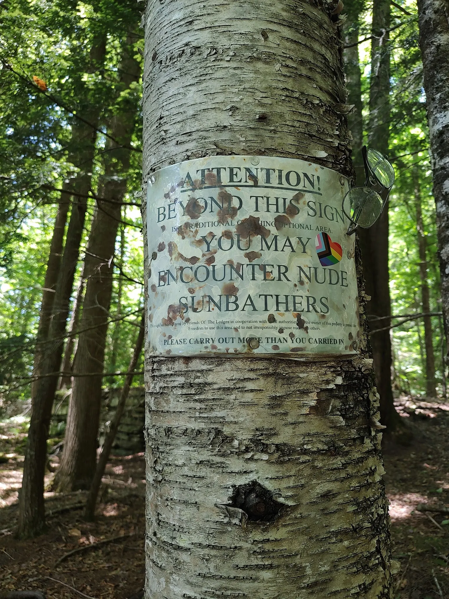
Two reviewed historical signs identify Friends of The Ledges, a traditional clothing-optional area and a clothing-required boundary. Follow the signs currently on site and respect visitors' comfort. This is not a claim that every reservoir shore has the same policy. Do not photograph people without consent; our selected gallery has no visible visitors.
Day use, camping and seasonal uncertainty
Great River Hydro's recreation rules prohibit overnight camping, warn that vehicles left after closing may be towed and allow areas to close when full. Its Harriman map and current project page give different seasonal end dates. Confirm the intended facility's opening rather than assuming access into October.
Do not treat exposed rock as a jumping platform
The Harriman operator profile identifies a hydroelectric reservoir. Operator guidance explains that reservoir levels fluctuate. Stay out of warning areas and do not jump, dive or use ropes above the water. Vermont Health cautions that natural waters can conceal hazards; an attractive or clear-looking shore is not evidence of safe conditions.
What the gallery and facility information establish
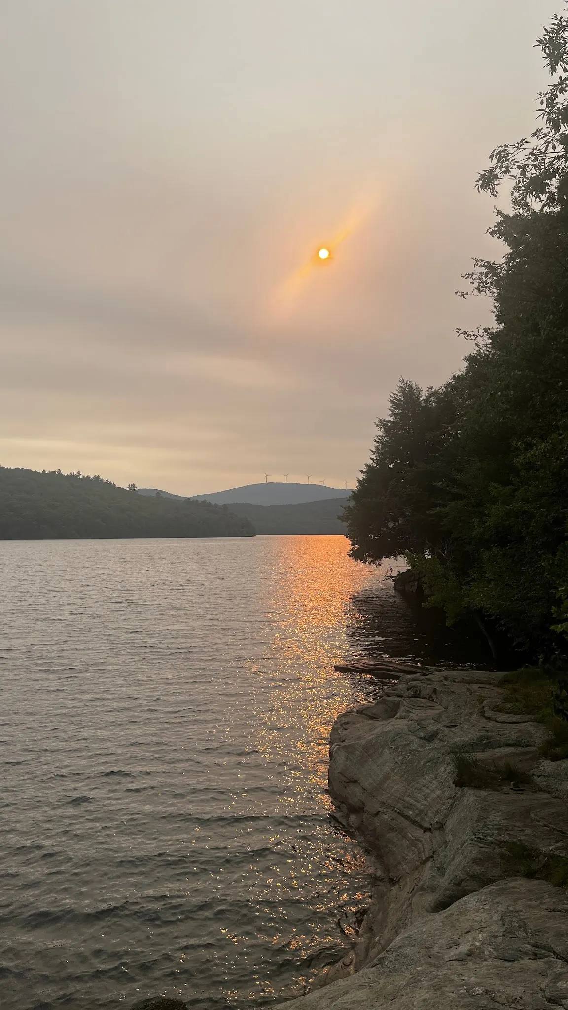
Four photographs offer distinct shoreline, cove, sunset and sign context without publishing identifiable bathers. A rope scene was withheld. The mapped Jacksonville picnic area does not establish current toilets, drinking water, lifeguards or accessible entry at The Ledges. Confirm amenities and bring supplies.
Getting There
Use the operator's Harriman recreation map for reservoir orientation. It shows Jacksonville Picnic Area reached by Wards Boat Access Road from Route 100, while Boyd Hill Road appears farther north near Castle Hill. The older Boyd Hill-to-Jacksonville route and claimed 0.75-mile approach are not verified and should not be followed as current directions. The map does not label The Ledges or measure its trail. Confirm the permitted parking area and onward route with the operator before setting out. The retained pin is not a verified entry.
Quick Navigation
Access Notes
The historical map pin and saved exact-name Maps record differ by about 2.2 miles. Neither is treated as a surveyed access point. Operator public-recreation information is reservoir-wide and does not confirm every bank or a specific Ledges entry.
Plan Your Visit
Parking & Access
Confirm the entrance, parking arrangements, and legal access with the land manager. A map pin does not establish a public right of access. Follow posted routes and never block gates or driveways.
Regulations & Fees
Follow Great River Hydro rules and current signs. Its recreation facilities are day-use only, with no overnight camping; areas may close when full. Clothing-optional use is historical context from saved site signs, not a current legal designation or permission for all reservoir shores. Public park access does not necessarily include permission to swim. Respect private property and posted restrictions.
Seasonality & Flow
Water conditions can change quickly. This listing does not provide a current safety or water-quality assessment. Check official alerts and avoid entering water when conditions or permission are uncertain.
Frequently Asked Questions About The Ledges
Is The Ledges clothing optional?
Saved Friends of The Ledges signs describe traditional clothing-optional use and a clothing-required boundary. They provide historical visitor context, not a verified current legal designation. Respect current signs and other visitors.
Should I follow Boyd Hill Road to Jacksonville Picnic Area?
The operator map places Jacksonville Picnic Area on Wards Boat Access Road, while Boyd Hill Road appears farther north near Castle Hill. The older route is withdrawn. Confirm the intended access and onward path with the operator.
Is the trail definitely 0.75 miles?
No current measured route verifies that figure, and the operator map does not label The Ledges. Do not plan around the old distance or assume accessible entry.
Can I jump from the rocks or use a rope swing?
Do not jump, dive or use ropes above the reservoir. Water levels change and hidden obstacles or insufficient depth may not be visible.
Can I camp overnight?
Great River Hydro's recreation rules prohibit overnight camping. Vehicles remaining after closing may be towed; arrange lodging elsewhere.
Are toilets and lifeguards available at The Ledges?
Current toilets and lifeguard service at the shoreline have not been verified. A mapped picnic area does not establish those amenities at the swimming entry.
Highlights
Location & Area Map
Safety Information
Important Safety Tips
- Do not jump, dive or use rope swings
- Hydroelectric reservoir levels fluctuate daily, weekly and seasonally, so an old photograph does not establish current depth
- Stay away from operational structures and warning areas
- If permitted access and suitable conditions are confirmed, never swim alone and supervise children closely
- No current site-specific water tests reviewed
Cultural & Historical Context
Historical Background
Saved site signs identify Friends of The Ledges and describe traditional clothing-optional use with a clothing-required boundary. This visitor context is distinct from a verified current operator dress policy.
Photography Guide
Photo Opportunities
Four reviewed context photographs show an empty rocky shoreline, a cove, sunset light and a historical clothing-optional boundary sign. Do not photograph visitors without consent. Photo dates do not establish current water levels or rules.
Conservation & Ethics
Protect This Place
Carry out litter, remain on permitted routes and respect shoreline vegetation and other visitors. Operator rules prohibit overnight camping and allow recreation areas to close when full.
Explore More Nearby Swimming Guides
More Vermont swimming holes
Browse every listed natural swimming spot in Vermont.
Swimming holes near Brattleboro
Compare nearby options around Brattleboro before you choose a route.
Hidden gems in Vermont
See under-the-radar places and local favorites in the same state.
Family-friendly spots in Vermont
Compare easier-access destinations and safer planning options.
Check water quality before swimming
Use this safety guide before entering any natural water.
You Might Also Like
At a Glance
Safety & Access Notice
This information is for general planning only and may be incomplete, outdated, or inaccurate. Access rules, closures, water levels, currents, hazards, and legal restrictions can change at any time. Always verify current rules with the land manager or official source before visiting.
You are responsible for your own safety and for following all posted signs, laws, and local regulations. Read the full disclaimer.
Camping Information
Great River Hydro prohibits overnight camping in its recreation areas. Arrange overnight accommodation elsewhere and remove your vehicle before closing.
Loading weather data…
Safety & Access Notice
This information is for general planning only and may be incomplete, outdated, or inaccurate. Access rules, closures, water levels, currents, hazards, and legal restrictions can change at any time. Always verify current rules with the land manager or official source before visiting.
- Do not swim where swimming is prohibited, unsafe, or not clearly allowed.
- Follow posted signs, local regulations, closures, and private-property boundaries.
- Assess conditions on site. Water flow, depth, temperature, and underwater hazards change quickly.
- Never jump or dive without personally confirming depth and underwater obstacles.
- Swim with a buddy and consider flotation for weak or non-swimmers.
- Pack out all trash; respect wildlife and fragile environments.
You are responsible for your own safety and for following all posted signs, laws, and local regulations. Read the full disclaimer.
Joshua Havens created Hidden Swimming Holes to make it easier for people to find — and safely visit — natural freshwater swimming destinations across the United States. He researches access conditions, water quality resources, and land management rules so you don't have to start from scratch. He holds a strong belief that good outdoor recreation information should be accurate, honest about its limitations, and freely available.
Explore More Swimming Holes
Discover other amazing natural swimming destinations across America