Blue Hole
Hiking area
0.4 mi
4.8 (508)
Elizabethton, TN 37643

Background: generated illustration, not a photograph of this location.
Explore Blue Hole Falls near Elizabethton with source-checked stair warnings, route context and reviewed waterfall photos. Swimming access remains unverified.
Swimming permission unconfirmed
Confirm current site-specific access with the land manager before entering water. Do not jump or dive; a clear-looking pool does not establish depth, water quality or permission.
Official sources checked:
Status summarizes our reviewed record, not today's opening or safety. Check current rules, swimming boundaries and notices before visiting.
Location
A closer look
Photos show past visits, not current water levels or swimming conditions. Select a photo to view it larger.
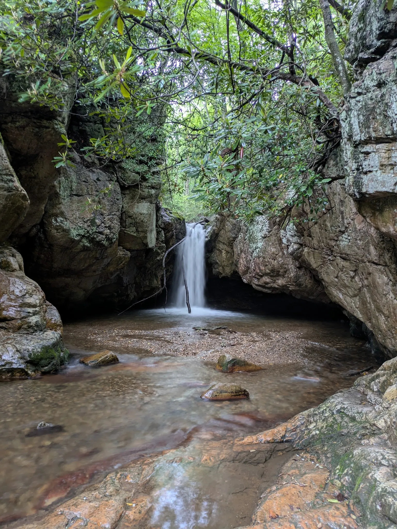
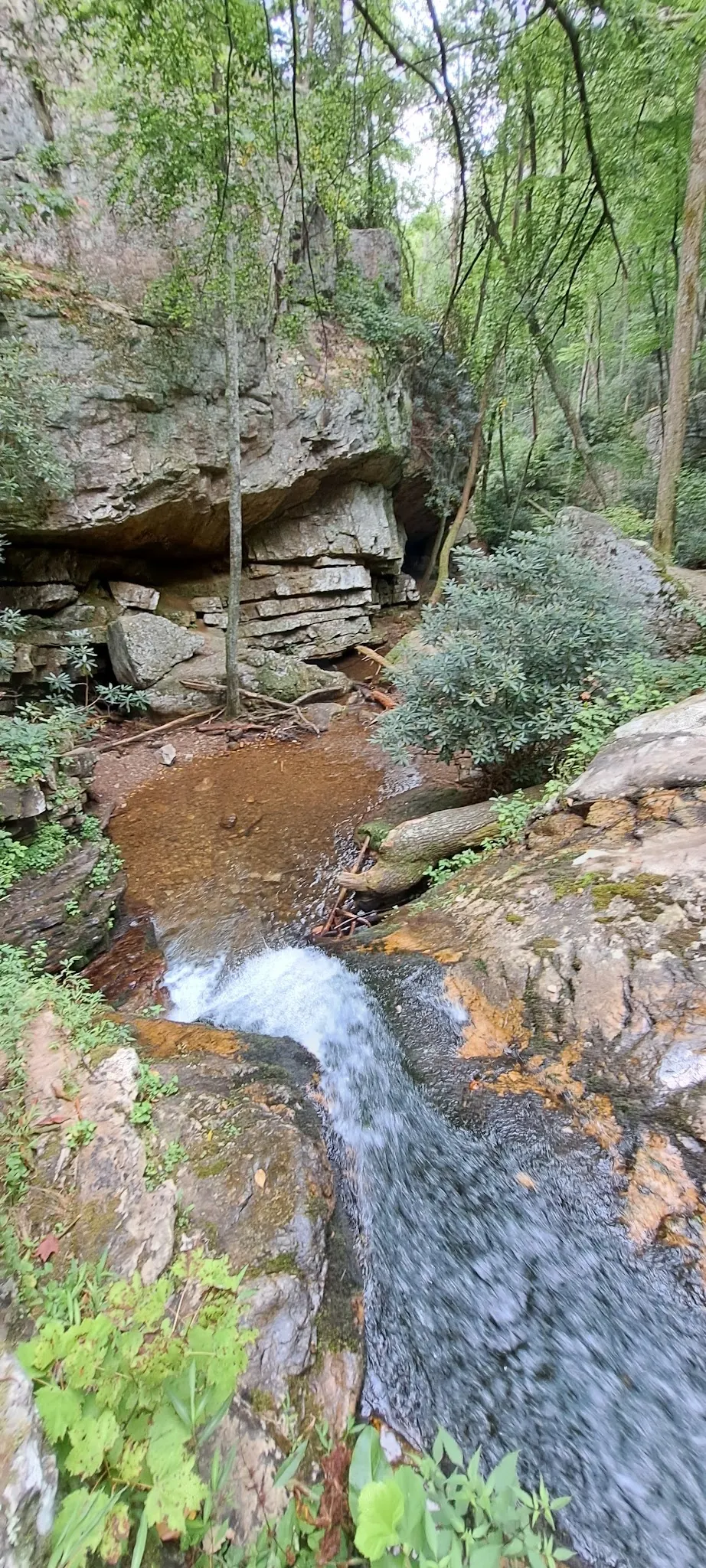
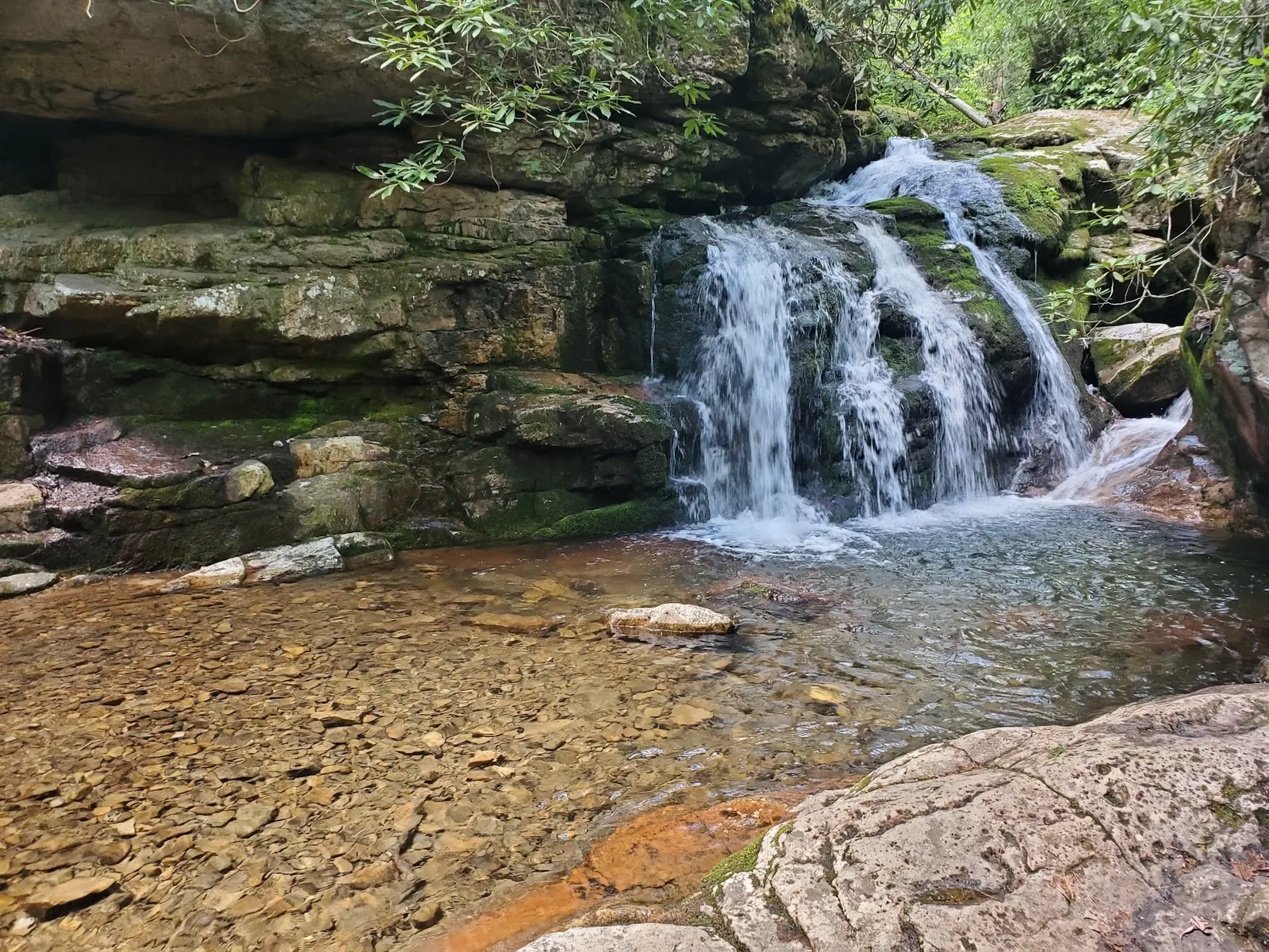
This is a desk-researched listing. A record update or map check does not confirm current swimming permission or water conditions.
Found an error? Send a correction with the location and a source. How we research listings.
This listing refers to Blue Hole near Holston Mountain, not the similarly named sites in Manchester or Tracy City. Its historical Mill Creek name is retained, while the county tourism profile identifies the destination as Blue Hole Falls.
The local guide describes a short hike from parking and warns of slippery stairs in rainy or icy weather. A short distance is not a promise of an easy, accessible descent. Wear footwear suited to the terrain and turn back when footing is unsafe.
Our review confirms waterfall-viewing context, not a current swimming authorization or water-quality result. The earlier invitation to jump has been removed. Do not jump, dive or judge depth from photographs; confirm site-specific water access with the land manager.
Use the Elizabethton destination and TN-91 approach, then confirm the final parking route locally. The old gas-station landmark, road mileage and gated-road shortcut are not verified navigation. Fees, facilities and on-site camping permission remain unconfirmed. Cherokee forest alerts are a starting point for regional notices, not proof that this exact site is open.
The selected images show a narrow waterfall, rocky stream channel and low cascade. They come from the matched Elizabethton Blue Hole collection, but individual camera positions are not independently verified. Crowded and occupied scenes were not selected; their omission does not mean you should expect solitude.
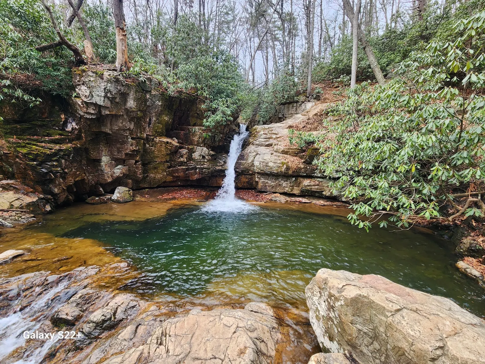
An additional unoccupied landscape photograph shows the waterfall and a broader view of the rock-walled pool. The source image retains its camera watermark. Visible water color and rock shelves do not establish depth, legal swimming permission or a suitable entry. The camera position is not an approved ledge route, and the photograph does not change the existing no-jumping guidance or verify current stair conditions.
Use the Blue Hole Falls destination near Elizabethton and Holston Mountain, not a similarly named waterfall in Manchester or Tracy City. Carter County Tourism identifies the TN-91 approach; confirm the final parking and road route locally. Earlier Panhandle Road mileage, gas-station landmark, gated-road shortcut and exact step-off instructions remain historical context, not current navigation. Retained coordinates are unverified.
Carter County Tourism identifies a short approach from parking near TN-91 and stairs down to the lower pool. Stairs may be slippery in rain or ice. Our reference pin does not identify verified parking or a lawful swimming entry.
Confirm the entrance, parking arrangements, and legal access with the land manager. A map pin does not establish a public right of access. Follow posted routes and never block gates or driveways.
Confirm current site-specific access with the land manager before entering water. Do not jump or dive; a clear-looking pool does not establish depth, water quality or permission. Public park access does not necessarily include permission to swim. Respect private property and posted restrictions.
Water conditions can change quickly. This listing does not provide a current safety or water-quality assessment. Check official alerts and avoid entering water when conditions or permission are uncertain.
Nearby places from saved public map data, not necessarily facilities at the swimming spot. Confirm access, hours, fees, and amenities with the operator before you drive.
Map data retrieved 2026-06-15
Hiking area
Elizabethton, TN 37643
Campground
200 Blevins, Johnson City, TN 37601
Visitor services
302 Buffalo St, Johnson City, TN 37604
Free parking lot
324 S Commerce St, Johnson City, TN 37604
Visitor center
527 TN-143, Roan Mountain, TN 37687
Public male bathroom
2011 N Roan St, Johnson City, TN 37601
Public bathroom
3207 Peoples St, Johnson City, TN 37604
Campground
496 Pearl Ln, Blountville, TN 37617
The waterfall destination near Elizabethton and Holston Mountain, identified by Carter County Tourism. It is not the Blue Hole in Manchester or Tracy City.
No. The tourism profile identifies stairs to the lower pool and warns that they may be slippery in rain or ice. Exact accessibility is not independently verified.
No. Waterfall identity is supported, but current swimming authorization and a lawful water entry have not been independently established.
No. Do not jump or dive, and do not judge depth or submerged hazards from photos. The earlier jumping recommendation has been withdrawn.
Current fees and facility availability are not confirmed by the sources reviewed. Do not treat the earlier free-entry and no-facilities claims as verified.
No. They are reviewed historical collection images, not live water, weather or access reports.
This review does not establish the earlier listing's specific settlement, wildlife or geological-origin claims.
An additional unoccupied landscape photograph shows the waterfall and a broader view of the rock-walled pool. The source image retains its camera watermark. Visible water color and rock shelves do not establish depth, legal swimming permission or a suitable entry. The camera position is not an approved ledge route, and the photograph does not change the existing no-jumping guidance or verify current stair conditions.
Stay on authorized paths, obey signs, leave rocks and vegetation in place and pack out litter.
Browse every listed natural swimming spot in Tennessee.
See under-the-radar places and local favorites in the same state.
Compare easier-access destinations and safer planning options.
Explore waterfall-focused swimming destinations in Tennessee.
Use this safety guide before entering any natural water.
Safety & Access Notice
This information is for general planning only and may be incomplete, outdated, or inaccurate. Access rules, closures, water levels, currents, hazards, and legal restrictions can change at any time. Always verify current rules with the land manager or official source before visiting.
You are responsible for your own safety and for following all posted signs, laws, and local regulations. Read the full disclaimer.
No on-site camping permission established. Arrange authorized overnight accommodation separately rather than camping beside the falls.
Loading weather data…
Safety & Access Notice
This information is for general planning only and may be incomplete, outdated, or inaccurate. Access rules, closures, water levels, currents, hazards, and legal restrictions can change at any time. Always verify current rules with the land manager or official source before visiting.
You are responsible for your own safety and for following all posted signs, laws, and local regulations. Read the full disclaimer.
Joshua Havens created Hidden Swimming Holes to make it easier for people to find — and safely visit — natural freshwater swimming destinations across the United States. He researches access conditions, water quality resources, and land management rules so you don't have to start from scratch. He holds a strong belief that good outdoor recreation information should be accurate, honest about its limitations, and freely available.
Discover other amazing natural swimming destinations across America