Woodsmoke Campground
Campground
4.9 mi
4.3 (122)
215 Woodsmoke Dr, Unicoi, TN 37692

Background: generated illustration, not a photograph of this location.
Plan Rock Creek near Erwin with pond photos, $2 day-use fees, campsite options and a drinking-water warning. Confirm current swimming conditions before travel.
Swimming restriction
Use only the swimming area currently allowed by signs and staff. Do not jump or dive or treat creek cascades and water-control structures as swimming entries. Alcohol is prohibited; secure food and refuse as required by forest guidance.
Official sources checked:
Location
A closer look
Photos show past visits, not current water levels or swimming conditions. Select a photo to view it larger.
This is a desk-researched listing. A record update or map check does not confirm current swimming permission or water conditions.
Found an error? Send a correction with the location and a source. How we research listings.
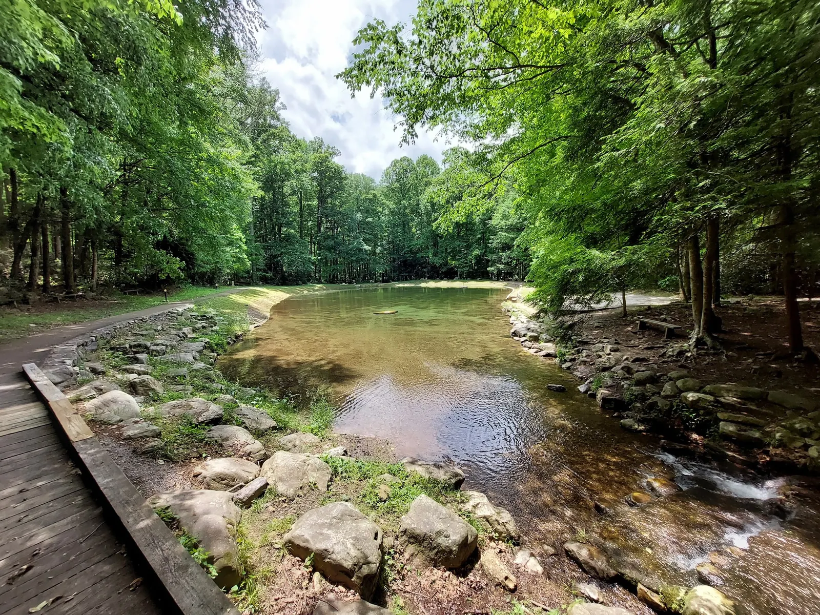
Rock Creek near Erwin has a creek-fed concrete swimming pond, rather than a graded natural beach. The Forest Service and Recreation.gov identify swimming as an activity. Confirm the pond is currently available and obey local signs; we have not verified today's depth, lifeguard coverage or water quality.
Published Forest Service rates are $2 per vehicle for day use, $12 per night for a non-electric tent site, $20 for a single electric site and $40 for a double electric site. Walk-in tent camping is distinct from electric sites. Check the specific booking and equipment requirements, including arrival before the campground gate closes at 10 PM.
Sources do not agree on water availability: Recreation.gov describes shared spigots, while the Forest Service says potable water is unavailable. Bring your own drinking water and confirm services before travel. Toilets, showers and camping amenities are listed, but a facility description is not a live service report.
Both sources direct visitors along TN 395 east from Erwin but give different I-26 exits. Confirm your route and check forest alerts, particularly if traveling through Indian Gap. That mountain-access notice is not proof the recreation area is closed. The campground opening date is not a verified swimming-season date, and accessible campsite descriptions do not establish a step-free water entry.
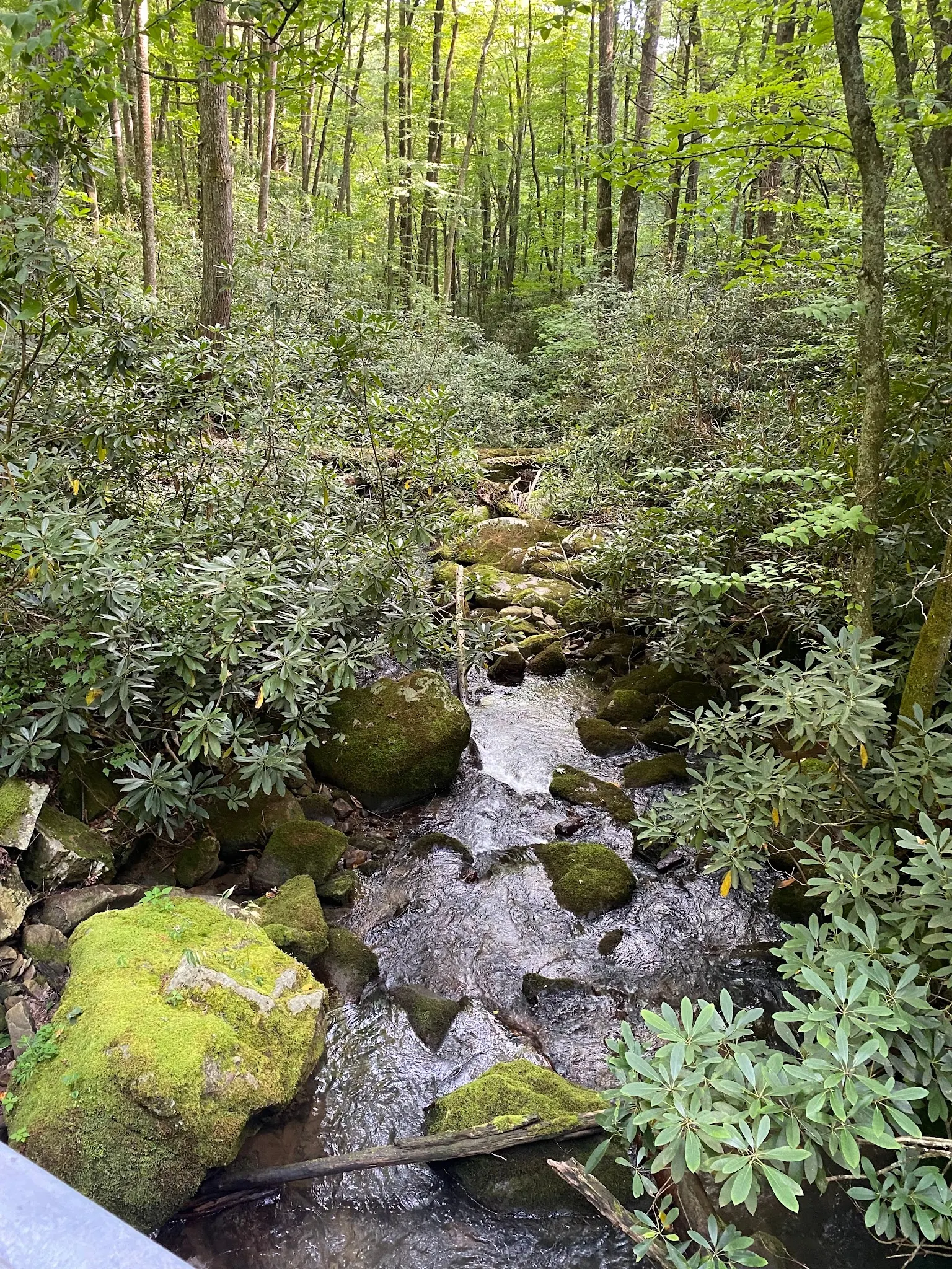
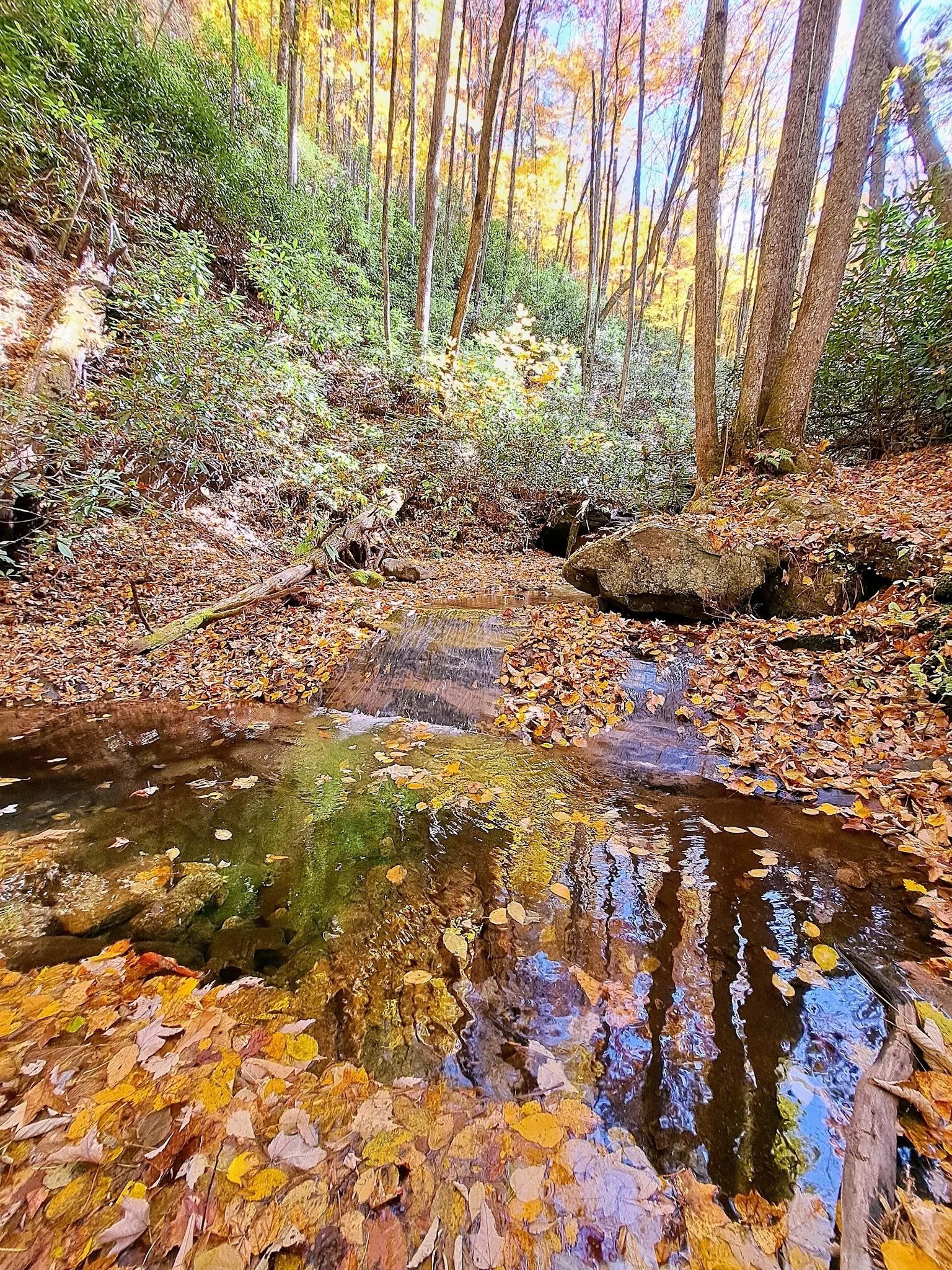
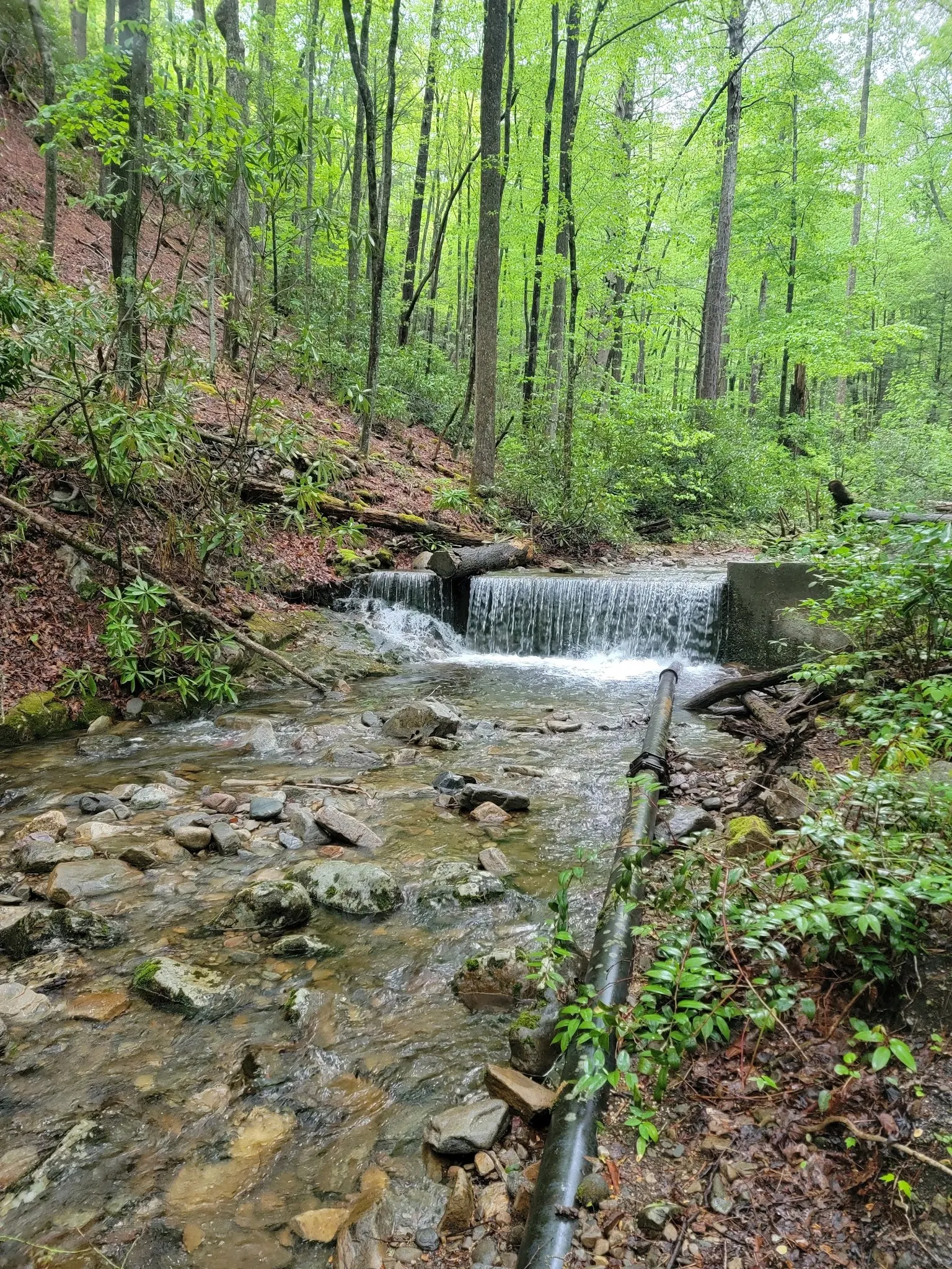
The gallery shows the developed pond, wooded creek scenery, an autumn low cascade and a constructed weir. These are historical photos, not instructions to swim at every pictured feature. Do not climb or enter water-control structures, jump or dive, or assume creek-fed water has the conditions of a treated municipal pool.
Use TN 395 east from Erwin for about 3.5 miles to the signed recreation area. USFS and Recreation.gov give conflicting I-26 exit numbers, so confirm the current route rather than relying on our old step-by-step directions. Check road alerts before travel, especially for routes through Indian Gap. Within the site follow current parking and swimming signs; the retained historical pin is not a verified entry and ample parking is not guaranteed.
Official sources identify the developed pond, not a graded natural beach. No exact step-free swimming entry verified. Check forest alerts and road access; the HWY395/IndianGap notice concerns UnakaMountain access and is not proof that RockCreek itself is closed.
Confirm the entrance, parking arrangements, and legal access with the land manager. A map pin does not establish a public right of access. Follow posted routes and never block gates or driveways.
Use only the swimming area currently allowed by signs and staff. Do not jump or dive or treat creek cascades and water-control structures as swimming entries. Alcohol is prohibited; secure food and refuse as required by forest guidance. Public park access does not necessarily include permission to swim. Respect private property and posted restrictions.
Water conditions can change quickly. This listing does not provide a current safety or water-quality assessment. Check official alerts and avoid entering water when conditions or permission are uncertain.
Bring sturdy water shoes to protect your feet on rocks and slippery surfaces. A waterproof dry bag keeps your phone, keys, and valuables safe. Pack a quick-dry towel, sun protection, and drinking water - never drink from the natural water source.
Nearby places from saved public map data, not necessarily facilities at the swimming spot. Confirm access, hours, fees, and amenities with the operator before you drive.
Map data retrieved 2026-06-15
Campground
215 Woodsmoke Dr, Unicoi, TN 37692
Hiking area
Dry Creek Rd, Johnson City, TN 37604
Hiking area
Johnson City, TN 37604
Parking garage
Bradford Pear Rd, Johnson City, TN 37604
Free parking lot
324 S Commerce St, Johnson City, TN 37604
Parking lot
110 Cherry St, Johnson City, TN 37604
Visitor services
302 Buffalo St, Johnson City, TN 37604
Tourist information center
280 Jennie Moore Rd, Flag Pond, TN 37657
Checking nearby USGS water conditions…
No. Official sources describe a creek-fed concrete swimming pond in the recreation area. Confirm current pond operation and obey posted rules.
The Forest Service lists $2 per vehicle for day use, and nightly camping rates of $12 for non-electric tent sites, $20 for single electric sites and $40 for double electric sites. Confirm booking charges and pass eligibility.
Yes. The Forest Service says potable water is unavailable, while Recreation.gov describes shared spigots. Do not rely on those spigots as confirmed drinking-water supplies.
No. Electric single and double sites are listed separately from non-electric walk-in tent sites. Check the specific site for access, equipment and booking requirements.
No. The May 5, 2026 opening listed by the Forest Service applies to the campground. Exact pond opening and closing dates are not independently confirmed here.
No. They are reviewed historical collection images. Creek cascades and the constructed weir are not identified as swimming entries, and the pond photo is not a current operation report.
Official sources attribute early picnic, pond and bathhouse facilities to the Civilian Conservation Corps in the 1930s. Camping development was added later by the Forest Service.
Reviewed images show the developed pond beside a bridge, mossy woodland creek, autumn low cascade and a small constructed weir with a pipe. These are historical collection images, not current opening evidence or swimming-entry instructions.
Secure food and refuse according to forest guidance, use authorized trails and designated campsites, obey signs and keep litter out of the creek.
Browse every listed natural swimming spot in Tennessee.
Find similar creek-fed concrete swimming pond and recreation area destinations across the directory.
See under-the-radar places and local favorites in the same state.
Compare easier-access destinations and safer planning options.
Use this safety guide before entering any natural water.
Safety & Access Notice
This information is for general planning only and may be incomplete, outdated, or inaccurate. Access rules, closures, water levels, currents, hazards, and legal restrictions can change at any time. Always verify current rules with the land manager or official source before visiting.
You are responsible for your own safety and for following all posted signs, laws, and local regulations. Read the full disclaimer.
Electric single and double campsites and separate non-electric walk-in tent sites are described. Recreation.gov says walk-in tent sites are first-come, first-served; use its specific campsite pages for other booking and equipment requirements. Campground gates close 10 PM to 7 AM, so plan arrival accordingly.
Loading weather data…
Safety & Access Notice
This information is for general planning only and may be incomplete, outdated, or inaccurate. Access rules, closures, water levels, currents, hazards, and legal restrictions can change at any time. Always verify current rules with the land manager or official source before visiting.
You are responsible for your own safety and for following all posted signs, laws, and local regulations. Read the full disclaimer.
Joshua Havens created Hidden Swimming Holes to make it easier for people to find — and safely visit — natural freshwater swimming destinations across the United States. He researches access conditions, water quality resources, and land management rules so you don't have to start from scratch. He holds a strong belief that good outdoor recreation information should be accurate, honest about its limitations, and freely available.
Discover other amazing natural swimming destinations across America