Horse Creek Recreation Area
Park
0.1 mi
4.5 (92)
2415 Horse Creek Park Rd, Chuckey, TN 37641
Barbecue grillPicnic tablesPublic restroom

Background: generated illustration, not a photograph of this location.
Visit Horse Creek near Greeneville with free day-use information, camping details, pavilion closure updates and reviewed creek photos. Check conditions before swimming.
Swimming restriction
Use only areas currently allowed by posted signs and staff. Do not jump or dive. Alcohol is not allowed; store food and refuse securely and follow current forest restrictions.
Official sources checked:
Location
A closer look
Photos show past visits, not current water levels or swimming conditions. Select a photo to view it larger.
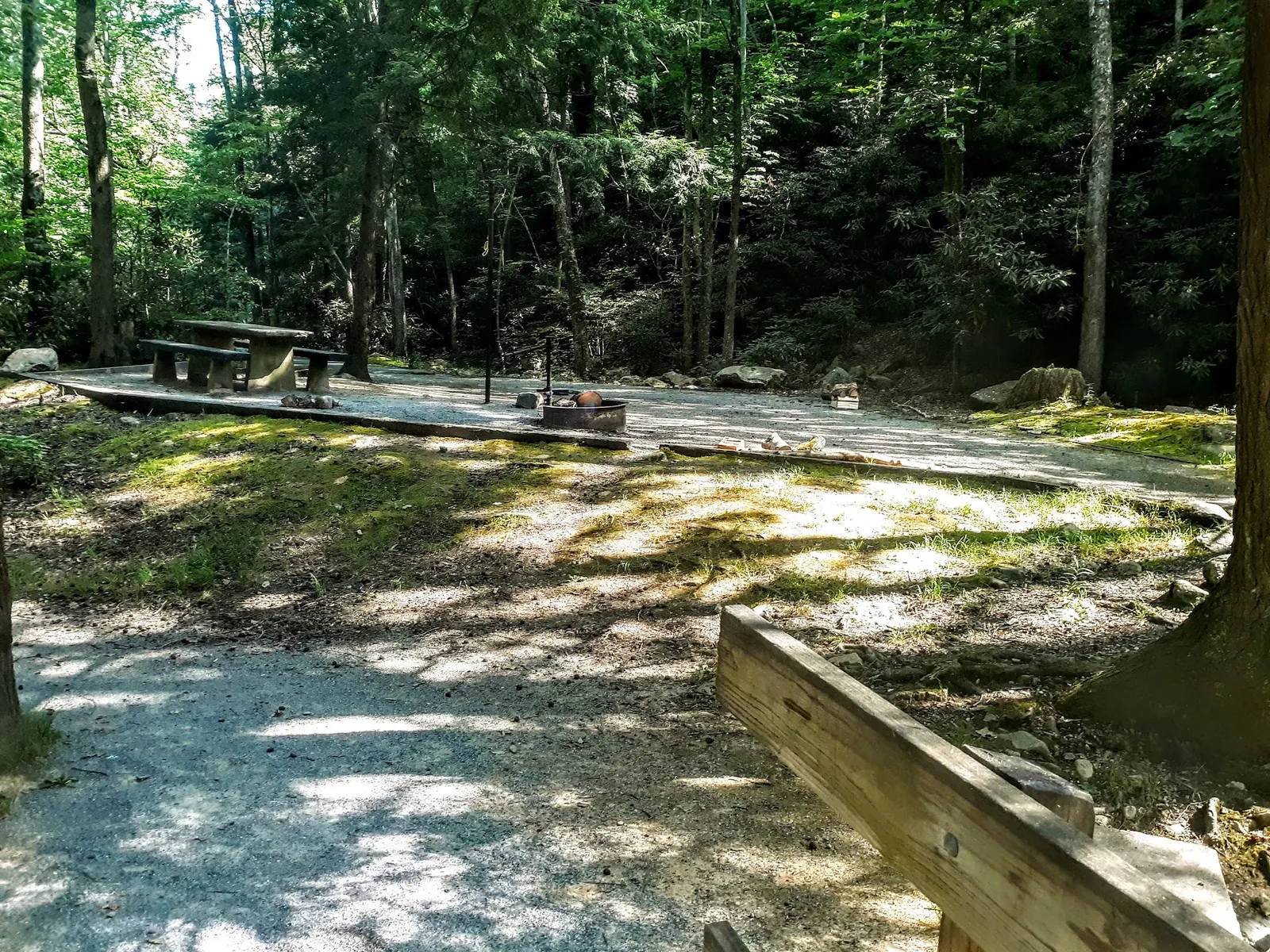
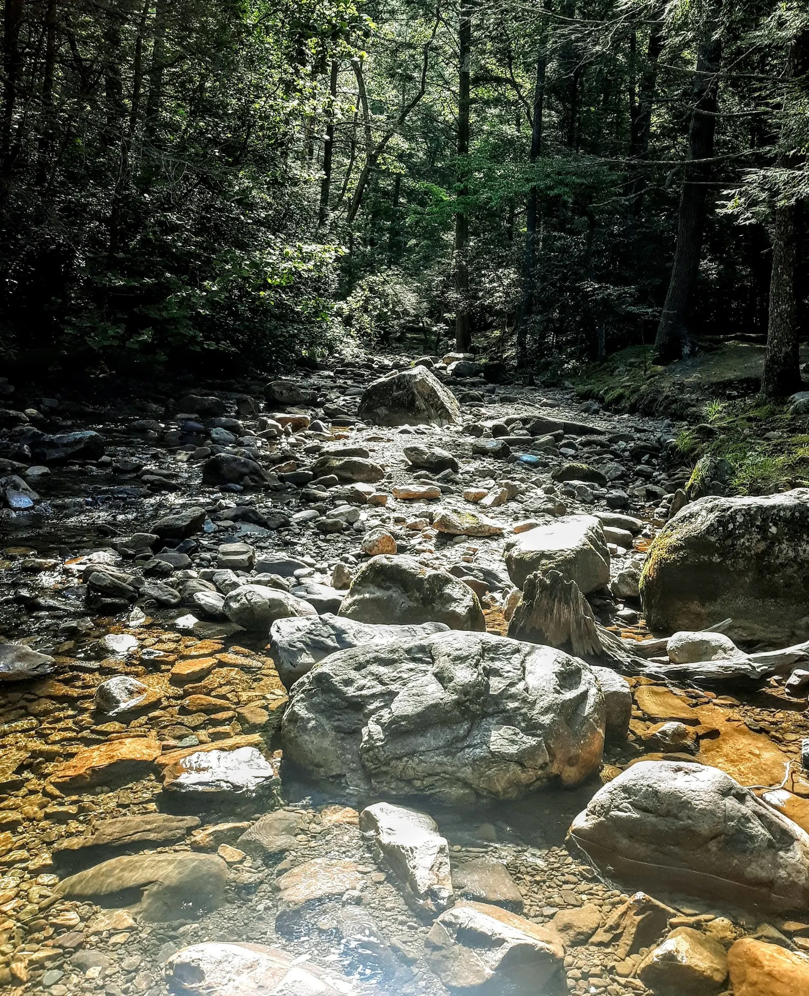
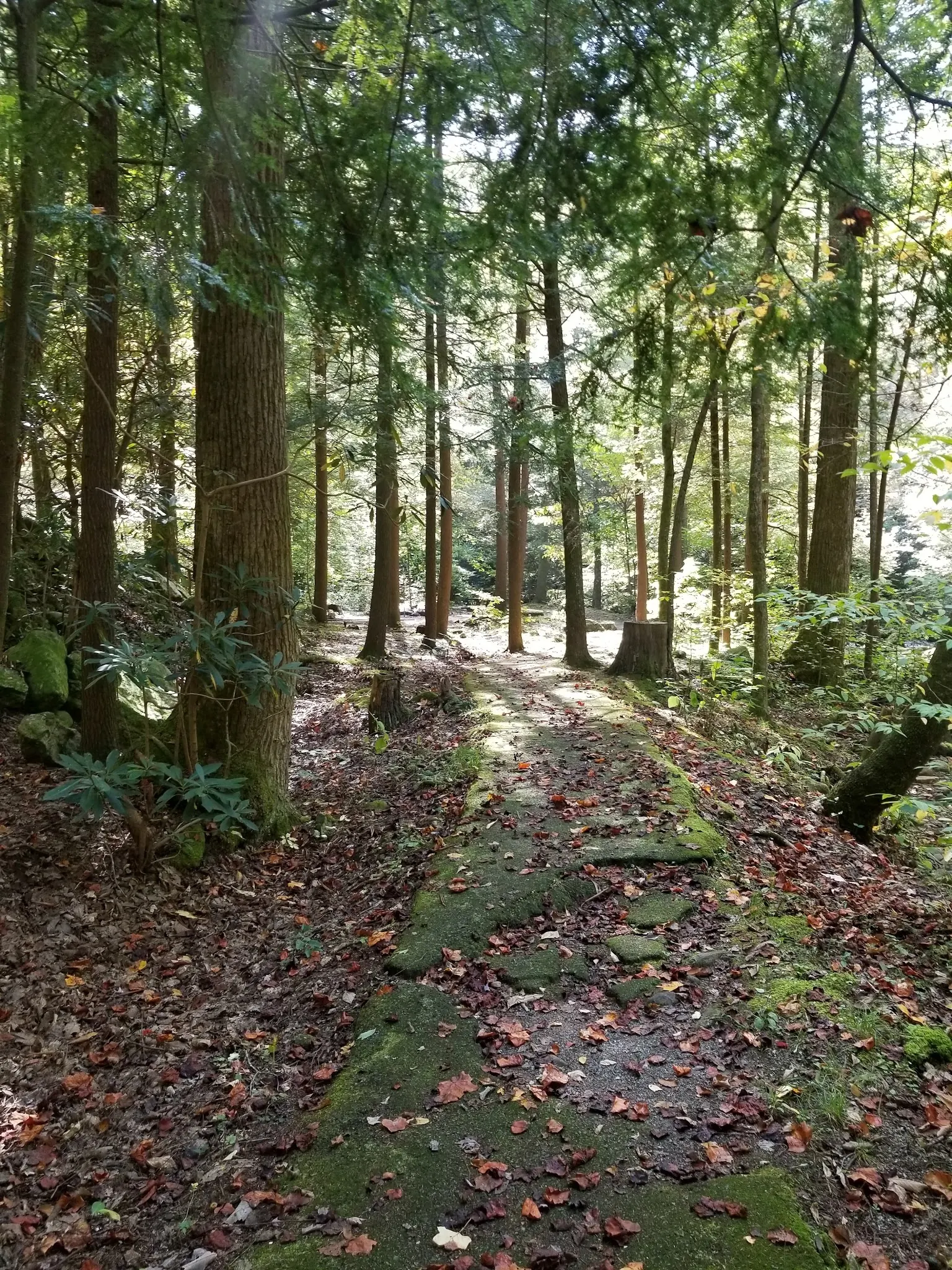
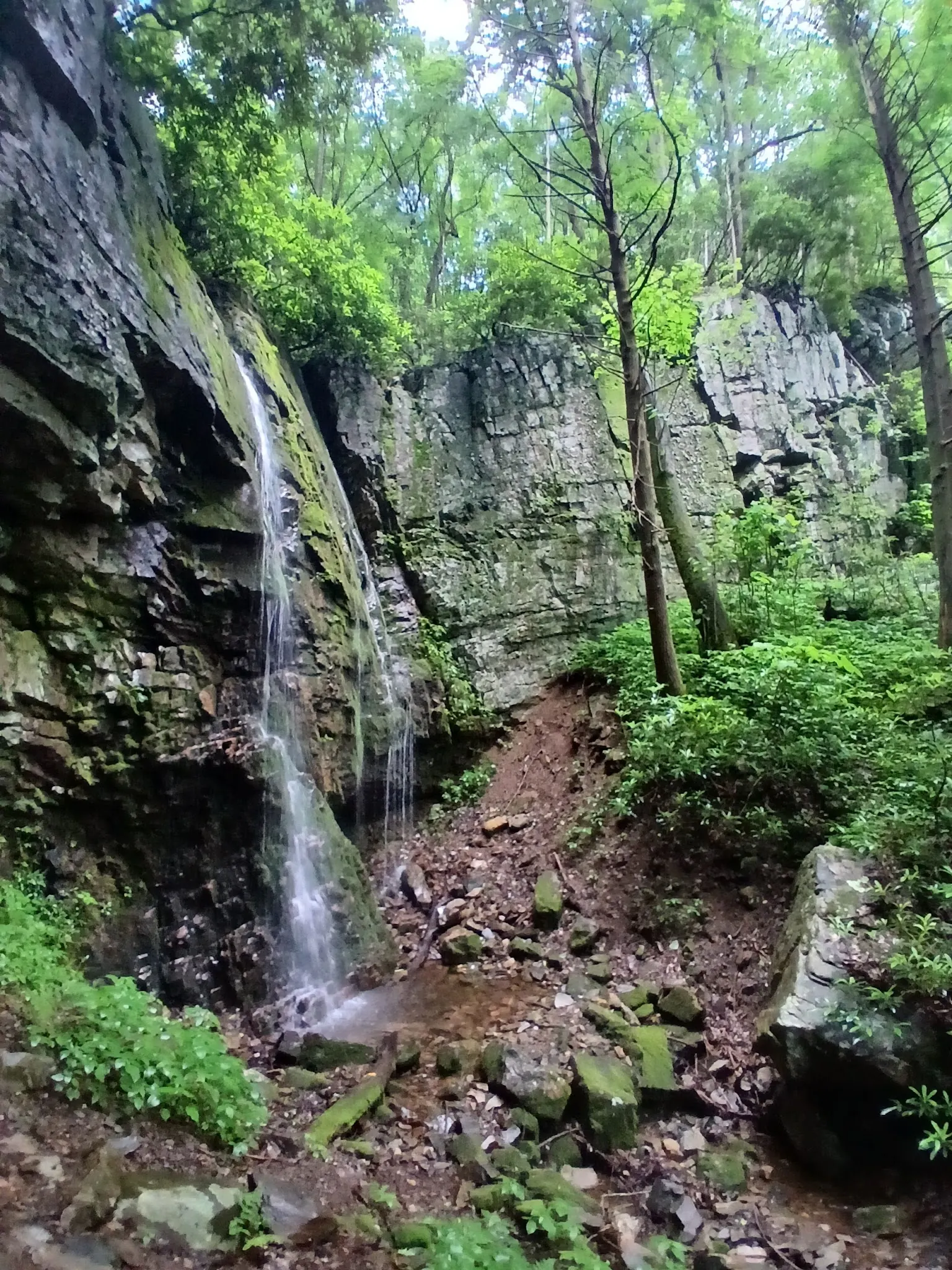
This is a desk-researched listing. A record update or map check does not confirm current swimming permission or water conditions.
Found an error? Send a correction with the location and a source. How we research listings.
Horse Creek Recreation Area combines wooded creek scenery with camping and day-use recreation near Greeneville. The Forest Service profile includes swimming as an activity, but we have not confirmed current pool depth, lifeguard coverage or a water-quality result. Use only the water access currently allowed by signs and staff.
As checked October 9, 2026, the forest reports Horse Creek reopened after a storm closure. The picnic pavilion remains closed indefinitely because of damage. Consult current forest alerts before departure; reopening does not guarantee every trail or facility is usable.
Published fees are free day use and $10 for a single campsite per night. The campground is primarily walk-in tent camping, with a pedestrian bridge from parking near the bathhouse. Use Recreation.gov for site-specific booking information and confirm any charges. Picnic tables, flush toilets and potable water are listed; campsite hookups and camper showers are separate considerations.
The manager directs drivers via TN 107 north and Horse Creek Road, replacing our old eastbound instructions. The retained pin is not a verified swim entry. Recreation.gov warns that waterfall routes can involve unblazed terrain and creek crossings, so a short campground approach must not be treated as the difficulty rating for a falls outing.
Four reviewed images show an empty camp pad, rocky creek, wooded path and waterfall. Individual camera positions and the waterfall name are not independently established. These are landscape and facility-context photos, not proof of current pool operation or an invitation to enter water.
Use the Forest Service approach from Greeneville: TN 107 north for about six miles, right onto Horse Creek Road, then follow signs roughly two miles to the recreation area. The old eastbound route and vague forest-sign turn are superseded. Campground parking is in the first loop on the left near the bathhouse, with pedestrian-bridge access to campsites. The historical pin is not an independently verified swimming entry; follow current signs.
Horse Creek is reported reopened after storm closure in current forest alerts, but the pavilion remains closed. Recheck access and posted swimming conditions before travel. A creek or waterfall photograph does not identify an authorized swim entry.
Confirm the entrance, parking arrangements, and legal access with the land manager. A map pin does not establish a public right of access. Follow posted routes and never block gates or driveways.
Use only areas currently allowed by posted signs and staff. Do not jump or dive. Alcohol is not allowed; store food and refuse securely and follow current forest restrictions. Public park access does not necessarily include permission to swim. Respect private property and posted restrictions.
Water conditions can change quickly. This listing does not provide a current safety or water-quality assessment. Check official alerts and avoid entering water when conditions or permission are uncertain.
Bring sturdy water shoes to protect your feet on rocks and slippery surfaces. A waterproof dry bag keeps your phone, keys, and valuables safe. Pack a quick-dry towel, sun protection, and drinking water - never drink from the natural water source.
Nearby places from saved public map data, not necessarily facilities at the swimming spot. Confirm access, hours, fees, and amenities with the operator before you drive.
Map data retrieved 2026-06-15
Park
2415 Horse Creek Park Rd, Chuckey, TN 37641
Hiking area
1362 Shelton Mission Rd, Greeneville, TN 37743
Hiking area
Greeneville, TN 37743
Campground
1074 Old Mountain Rd, Greeneville, TN 37743
Tourist information center
280 Jennie Moore Rd, Flag Pond, TN 37657
Public bathroom
Greeneville, TN 37745
Public bathroom
Greeneville, TN 37745
Public male bathroom
Greeneville, TN 37745
Checking nearby USGS water conditions…
Current forest alerts report it reopened, as checked October 9, 2026. Recheck before travel; the pavilion remains closed indefinitely due to damage.
The Forest Service lists free day use and $10 per night for a single campsite. Confirm current booking charges and site availability before reserving.
The manager lists swimming and describes a historical CCC swimming area. Current pool condition, depth, lifeguard coverage and water-quality clearance are not independently confirmed.
The campground is primarily walk-in. The Forest Service describes parking near the bathhouse and crossing a pedestrian bridge; check your specific campsite's access requirements.
The Forest Service lists flush toilets and potable water. Recreation.gov identifies a public spigot near the host site and a camper bathhouse, but primitive campsites lack water and electricity hookups.
No. They provide Horse Creek collection context. The waterfall name, exact camera locations and a permitted swimming entry are not independently established.
The Forest Service attributes the historical picnic pavilion and swimming area to CCC Company 1455 in the 1930s. That history does not establish today's pool condition.
Reviewed gallery includes an empty camp pad, rocky creek, leaf-covered woodland path and waterfall in the matched Horse Creek collection. The waterfall is not independently identified as Squibb Creek or Pete's Branch Falls; no exact camera position or swim entry is established.
Keep food and refuse secured according to forest guidance, stay on authorized paths and pack out litter. Do not move firewood between distant locations.
Browse every listed natural swimming spot in Tennessee.
Compare nearby options around Johnson City before you choose a route.
Find similar creek recreation area with a historical developed swimming area destinations across the directory.
See under-the-radar places and local favorites in the same state.
Compare easier-access destinations and safer planning options.
Use this safety guide before entering any natural water.
Safety & Access Notice
This information is for general planning only and may be incomplete, outdated, or inaccurate. Access rules, closures, water levels, currents, hazards, and legal restrictions can change at any time. Always verify current rules with the land manager or official source before visiting.
You are responsible for your own safety and for following all posted signs, laws, and local regulations. Read the full disclaimer.
Primarily walk-in tent camping; park near the bathhouse and cross the pedestrian bridge to the campground. Check Recreation.gov for the specific site's booking, equipment and access requirements. The Forest Service page contains both reservation and first-come wording, so confirm arrangements before departure.
Loading weather data…
Safety & Access Notice
This information is for general planning only and may be incomplete, outdated, or inaccurate. Access rules, closures, water levels, currents, hazards, and legal restrictions can change at any time. Always verify current rules with the land manager or official source before visiting.
You are responsible for your own safety and for following all posted signs, laws, and local regulations. Read the full disclaimer.
Joshua Havens created Hidden Swimming Holes to make it easier for people to find — and safely visit — natural freshwater swimming destinations across the United States. He researches access conditions, water quality resources, and land management rules so you don't have to start from scratch. He holds a strong belief that good outdoor recreation information should be accurate, honest about its limitations, and freely available.
Discover other amazing natural swimming destinations across America