Big Creek Parking Area
Parking lot
4.5 (8)
Waynesville, NC 28785

Background: generated illustration, not a photograph of this location.
Plan Big Creek in the Smokies with parking-tag costs, picnic facilities, current trail limits and NPS water warnings. View reviewed creek and trail photos.
Swimming restriction
NPS discourages swimming and tubing because of serious hazards and has no lifeguarded swimming areas. Do not jump, dive, climb wet waterfall rocks or cross swollen streams. Follow current closures.
Official sources checked:
Location
A closer look
Photos show past visits, not current water levels or swimming conditions. Select a photo to view it larger.
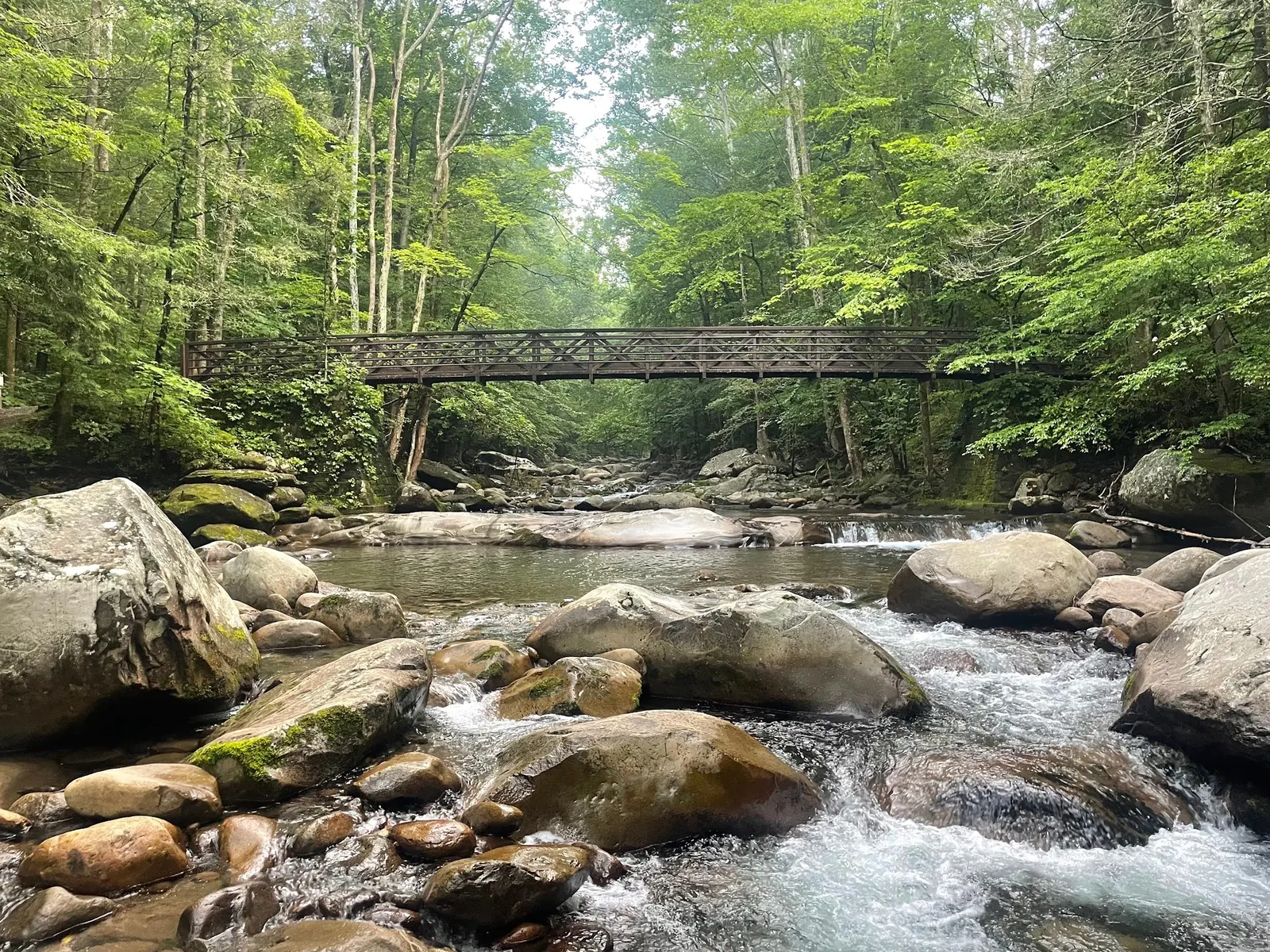

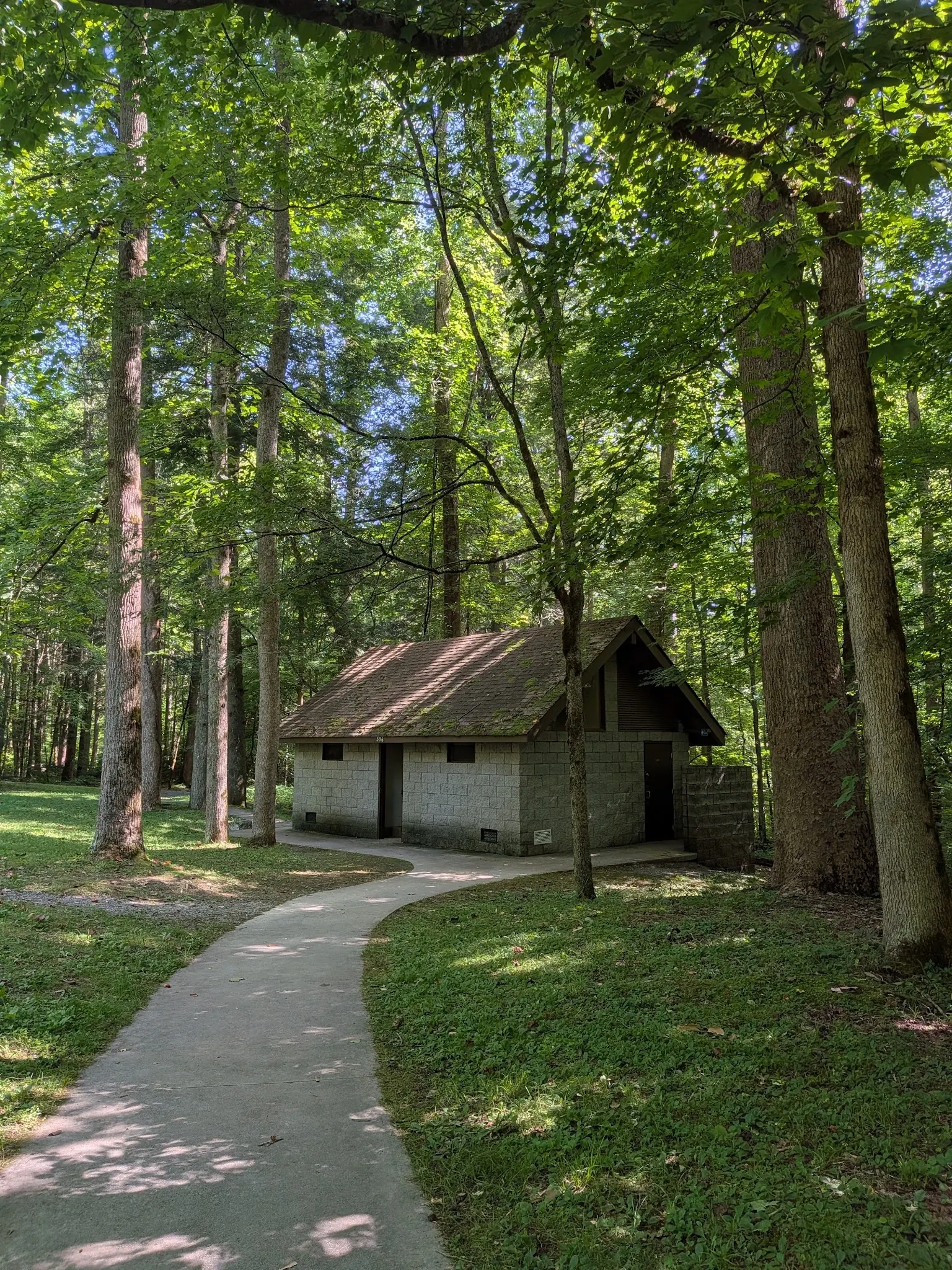
This is a desk-researched listing. A record update or map check does not confirm current swimming permission or water conditions.
Found an error? Send a correction with the location and a source. How we research listings.
Big Creek lies in the Smokies near the North Carolina-Tennessee border. Our established Tennessee route is retained as a border-area reference, not proof that every trail or photo is in Tennessee. The NPS area guide confirms a campground, picnic area and trails.
NPS discourages water recreation and provides no lifeguarded swimming areas. A clear pool or a photo of other visitors swimming is not evidence of safe conditions. Do not jump, dive or climb slippery waterfall rocks.
The closure notice reviewed October 9, 2026 keeps Big Creek Trail open only for its first two miles. The damaged section beyond Mouse Creek Falls is closed, with no access to campsites 36 and 37 from this trail. The normal falls walk is four miles roundtrip; do not extend it past the closure.
Parking tags normally apply to stops longer than 15 minutes. A physical tag is required and does not guarantee a space. The picnic area lists seasonal restrooms and normally opens mid-April through late October, sunrise to sunset. Bring drinking water and check availability.
The reviewed gallery includes creek scenery, a Baxter Creek trail bridge and a facility building. Baxter Creek is a different route, not a shortcut to Midnight Hole. Use the marked Big Creek Trail and current NPS information; the retained reference pin does not identify a verified water entry.
Navigate to the named Big Creek Picnic Area and consult NPS road conditions before travel. NPS identifies parking there near Big Creek Trailhead. Follow marked Big Creek Trail for the falls walk, not the Baxter Creek route shown in a gallery photo. Our retained reference coordinates are not independently verified parking or water-entry coordinates; do not use a generic Big Creek search or informal roadside pull-off as access proof.
Use designated Big Creek Picnic Area parking near Big Creek Trailhead. The first two miles of Big Creek Trail are open according to the current NPS notice; beyond Mouse Creek Falls the trail is closed. Gunter Fork and Swallow Fork trails are also closed. Check the notice before each trip. The named Baxter Creek bridge in the gallery is not a direction to Midnight Hole.
Confirm the entrance, parking arrangements, and legal access with the land manager. A map pin does not establish a public right of access. Follow posted routes and never block gates or driveways.
NPS discourages swimming and tubing because of serious hazards and has no lifeguarded swimming areas. Do not jump, dive, climb wet waterfall rocks or cross swollen streams. Follow current closures. Public park access does not necessarily include permission to swim. Respect private property and posted restrictions.
Water conditions can change quickly. This listing does not provide a current safety or water-quality assessment. Check official alerts and avoid entering water when conditions or permission are uncertain.
Bring sturdy water shoes to protect your feet on rocks and slippery surfaces. A waterproof dry bag keeps your phone, keys, and valuables safe. Pack a quick-dry towel, sun protection, and drinking water - never drink from the natural water source.
Nearby places from saved public map data, not necessarily facilities at the swimming spot. Confirm access, hours, fees, and amenities with the operator before you drive.
Map data retrieved 2026-06-15
Parking lot
Waynesville, NC 28785
Hiking area
Coalmont, TN 37313
Hiking area
Newport, TN 37821
Campground
Unnamed Road, Silver Point, TN 38582
Campground
89 Wilderness Wy, Crossville, TN 38571
Campground
4178 Hennessee Bridge Rd, Rock Island, TN 38581
Public bathroom
55 Water St, Brooklyn, NY 11201
Public bathroom
99 Plymouth St, Brooklyn, NY 11201
Checking nearby USGS water conditions…
No. Its Smokies water guidance discourages swimming and tubing, warns of serious hazards and states that the park has no lifeguarded swimming areas.
A physical tag is normally required for stops longer than 15 minutes. Published prices are $5 daily, $15 weekly and $40 annual; check current exemptions and rates. It does not guarantee a space.
No. The October 9, 2026 notice allows only its first two miles and closes the damaged route beyond Mouse Creek Falls. Recheck before travel; campsites 36 and 37 are inaccessible from this trail.
NPS lists seasonal restrooms at the picnic area. That does not mean there are facilities at every pool or that they operate year-round.
Dogs may accompany you in the picnic area on a leash and must not be left unattended. They are not permitted on Big Creek or Baxter Creek trails; NPS allows pets on only Gatlinburg and Oconaluftee River trails.
Do not use that photograph as route guidance. It names Baxter Creek, a different trail; use NPS directions and signs for Big Creek Trail.
NPS describes the area as a former logging town reclaimed by forest; this does not verify the earlier listing's specific settlement claims.
Creek boulders, wooded bridge views and picnic-area facilities. Selected photos are area context, not independently geolocated swimming entries or proof of today's conditions.
Keep food and garbage away from bears, use the provided charcoal grills rather than wood fires and leave stream rocks in place.
Browse every listed natural swimming spot in Tennessee.
Find similar mountain creek and picnic-area trails destinations across the directory.
See under-the-radar places and local favorites in the same state.
Compare easier-access destinations and safer planning options.
Use this safety guide before entering any natural water.
Safety & Access Notice
This information is for general planning only and may be incomplete, outdated, or inaccurate. Access rules, closures, water levels, currents, hazards, and legal restrictions can change at any time. Always verify current rules with the land manager or official source before visiting.
You are responsible for your own safety and for following all posted signs, laws, and local regulations. Read the full disclaimer.
A campground is part of the Big Creek area. Check its reservation and seasonal terms separately. As reviewed October 9, 2026, campsites 36 and 37 cannot be reached from Big Creek Trail because of storm-damage closures.
Loading weather data…
Safety & Access Notice
This information is for general planning only and may be incomplete, outdated, or inaccurate. Access rules, closures, water levels, currents, hazards, and legal restrictions can change at any time. Always verify current rules with the land manager or official source before visiting.
You are responsible for your own safety and for following all posted signs, laws, and local regulations. Read the full disclaimer.
Joshua Havens created Hidden Swimming Holes to make it easier for people to find — and safely visit — natural freshwater swimming destinations across the United States. He researches access conditions, water quality resources, and land management rules so you don't have to start from scratch. He holds a strong belief that good outdoor recreation information should be accurate, honest about its limitations, and freely available.
Discover other amazing natural swimming destinations across America