Wildcat Falls
Hiking area
4.6 (18)
Lake Logan Rd, Canton, NC 28716

Background: generated illustration, not a photograph of this location.
Plan a Wildcat Falls visit along Flat Laurel Creek Trail with reviewed waterfall photos and qualified approach notes. Swimming permission and current access remain unverified.
Swimming permission unconfirmed
A firsthand waterfall guide identifies this as a Flat Laurel Creek Trail destination. It is not a manager-issued swimming permission or a current access notice. Water entry remains unverified.
Status summarizes our reviewed record, not today's opening or safety. Check current rules, swimming boundaries and notices before visiting.
Location
A closer look
Photos show past visits, not current water levels or swimming conditions. Select a photo to view it larger.
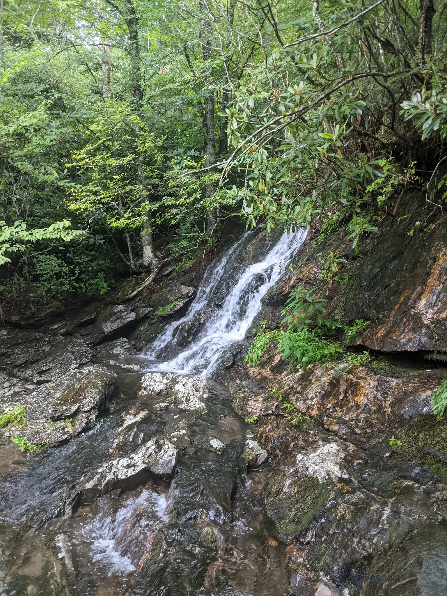
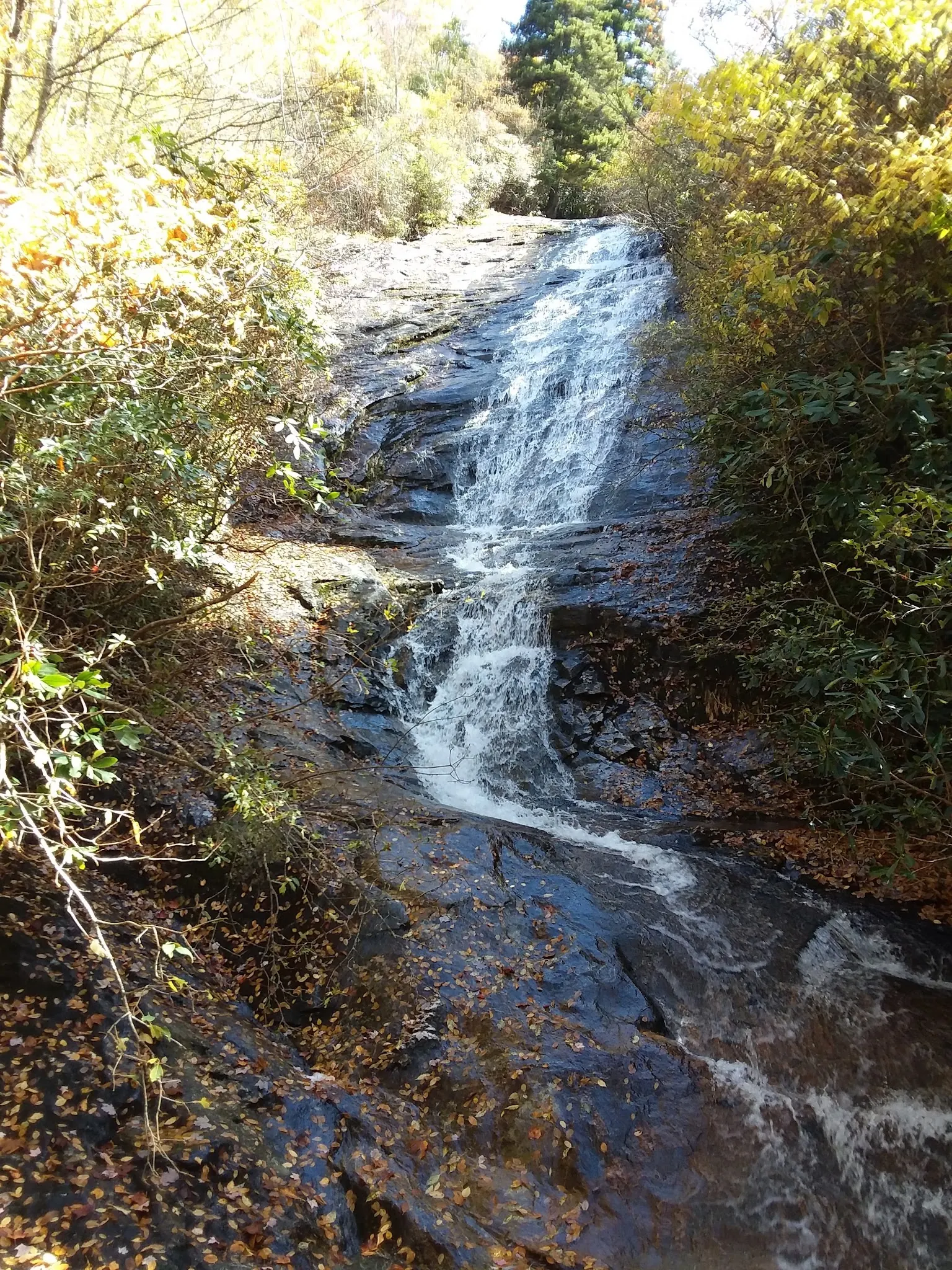
This is a desk-researched listing. A record update or map check does not confirm current swimming permission or water conditions.
Found an error? Send a correction with the location and a source. How we research listings.
The firsthand NC Waterfalls account helps identify the destination. Its age matters: use it for orientation, not as proof of today's access, facilities or permission.
Confirm an authorized space and trailhead for your chosen route. If parking is unavailable, change the plan rather than obstructing access or walking a curving highway to reach the trail.
Do not turn a scenic hike into a scramble down wet banks or into a waterfall pool. Arrange another verified swimming destination if water recreation is the main purpose of the day.
The gallery shows the waterfall with contrasting foliage and flow. Photos cannot tell you whether a route is open, whether rocks are stable or whether entering the water is allowed.
Historical firsthand guide places Wildcat Falls on Flat Laurel Creek Trail, with an NC 215 approach north of the Blue Ridge Parkway and a longer Black Balsam Road approach. Confirm current trailhead access and parking before using either route; the retained pin is not a verified entrance.
Reviewed October 8, 2026: available firsthand route account dates to 2013. It describes limited parking at the shorter approach, not a current reservation or access guarantee. No current manager closure or swimming clearance established.
Confirm the entrance, parking arrangements, and legal access with the land manager. A map pin does not establish a public right of access. Follow posted routes and never block gates or driveways.
A firsthand waterfall guide identifies this as a Flat Laurel Creek Trail destination. It is not a manager-issued swimming permission or a current access notice. Water entry remains unverified. Public park access does not necessarily include permission to swim. Respect private property and posted restrictions.
Water conditions can change quickly. This listing does not provide a current safety or water-quality assessment. Check official alerts and avoid entering water when conditions or permission are uncertain.
Nearby places from saved public map data, not necessarily facilities at the swimming spot. Confirm access, hours, fees, and amenities with the operator before you drive.
Map data retrieved 2026-06-15
Hiking area
Lake Logan Rd, Canton, NC 28716
Hiking area
3823 Gerton Hwy, Gerton, NC 28735
Campground
24798 North Carolina Hwy 12, Waves, NC 27982
Oceanfront campsite for tents & RVs, providing indoor/outdoor pools, sports courts & group events.
Campground
964 Crestview Church Rd, Asheboro, NC 27205
Sprawling 100-acre campsite & RV park with themed activities, a pool & fishing ponds.
Campground
6254 North Carolina Hwy 150, Denver, NC 28037
Public bathroom
11 Montague St, Brooklyn, NY 11201
Tourist information center
1600 Pisgah Hwy, Pisgah Forest, NC 28768
District government office
109 E Lawing Dr, Nebo, NC 28761
No. Treat this as a waterfall-viewing listing until permission and access are established.
No. Confirm the current trailhead and parking situation before departure.
No. Neither depth, exit conditions nor permission can be verified from these photos.
Historically used by Native Americans for spiritual renewal and later by settlers as a recreational retreat.
Two reviewed empty waterfall views show seasonal scenery, not current flow, swimming conditions or permission to leave the trail.
Stay on authorized routes, leave natural features undisturbed and carry out litter.
Browse every listed natural swimming spot in North Carolina.
See under-the-radar places and local favorites in the same state.
Compare easier-access destinations and safer planning options.
Explore waterfall-focused swimming destinations in North Carolina.
Use this safety guide before entering any natural water.
Safety & Access Notice
This information is for general planning only and may be incomplete, outdated, or inaccurate. Access rules, closures, water levels, currents, hazards, and legal restrictions can change at any time. Always verify current rules with the land manager or official source before visiting.
You are responsible for your own safety and for following all posted signs, laws, and local regulations. Read the full disclaimer.
Historical guide describes a small camping area near one approach, not current camping permission. Confirm legal overnight arrangements independently.
Loading weather data…
Safety & Access Notice
This information is for general planning only and may be incomplete, outdated, or inaccurate. Access rules, closures, water levels, currents, hazards, and legal restrictions can change at any time. Always verify current rules with the land manager or official source before visiting.
You are responsible for your own safety and for following all posted signs, laws, and local regulations. Read the full disclaimer.
Joshua Havens created Hidden Swimming Holes to make it easier for people to find — and safely visit — natural freshwater swimming destinations across the United States. He researches access conditions, water quality resources, and land management rules so you don't have to start from scratch. He holds a strong belief that good outdoor recreation information should be accurate, honest about its limitations, and freely available.
Discover other amazing natural swimming destinations across America