Portsmouth Forest Trail
Hiking area
8.7 mi
4.2 (5)
45 Harvard St, Portsmouth, NH 03801

Background: generated illustration, not a photograph of this location.
Plan a Packers Falls visit with town-source directions, limited Bennett Road parking, property rules and reviewed Lamprey River photos. Check river conditions before any entry.
Swimming restriction
The town park page describes swimming as a popular use. This is not a lifeguard, water-quality or safe-entry assurance. Obey current signs and avoid entering unsuitable river conditions.
Official sources checked:
Location
A closer look
Photos show past visits, not current water levels or swimming conditions. Select a photo to view it larger.
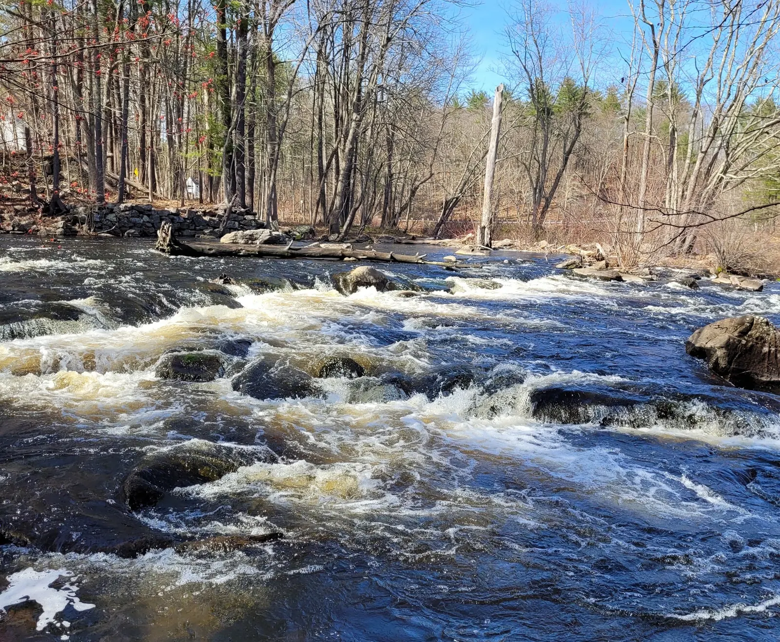
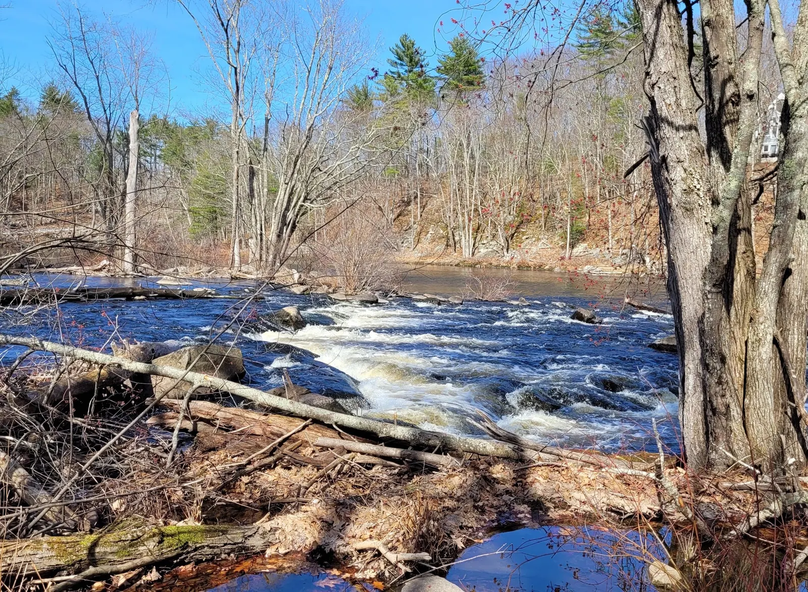
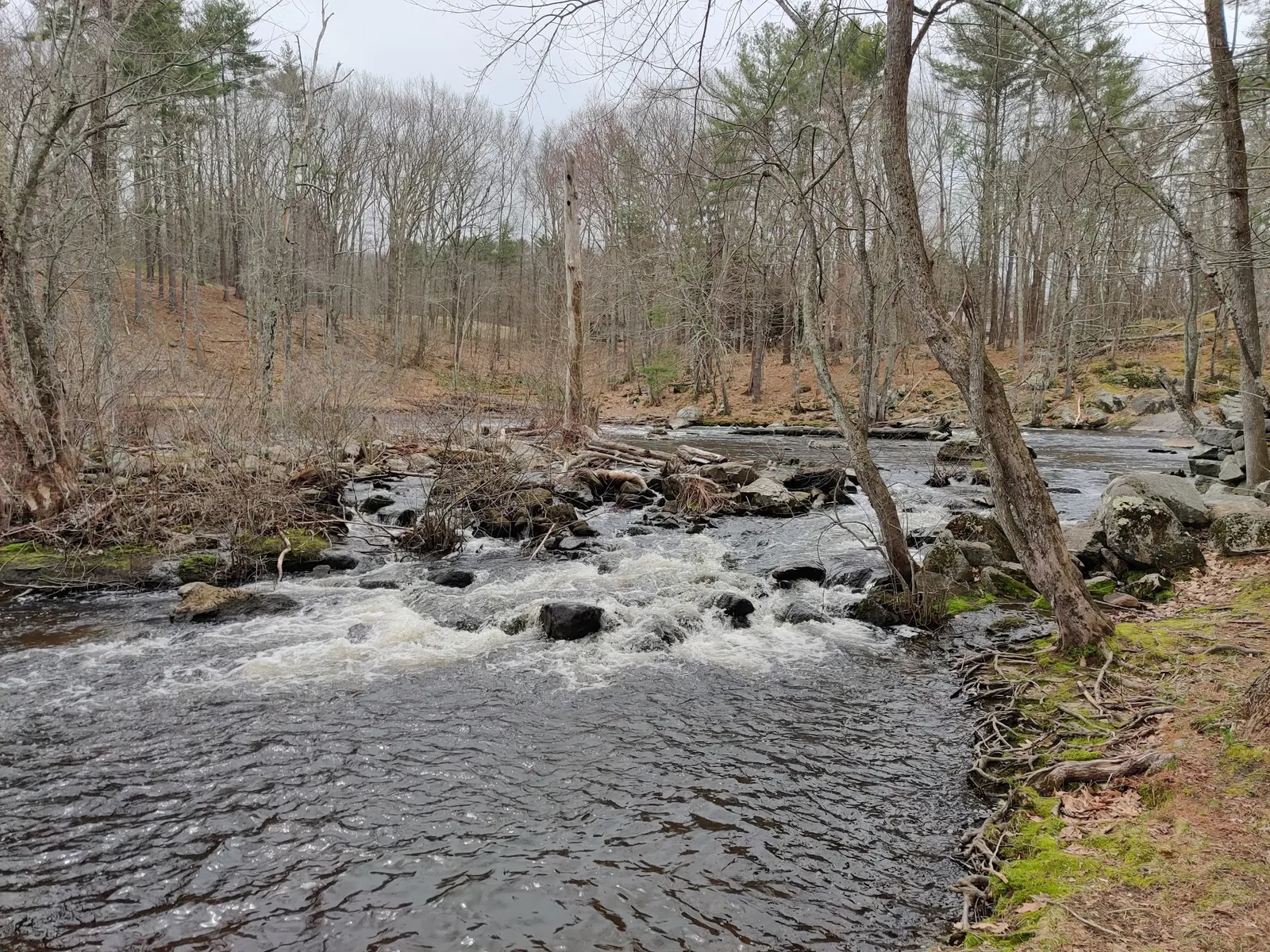
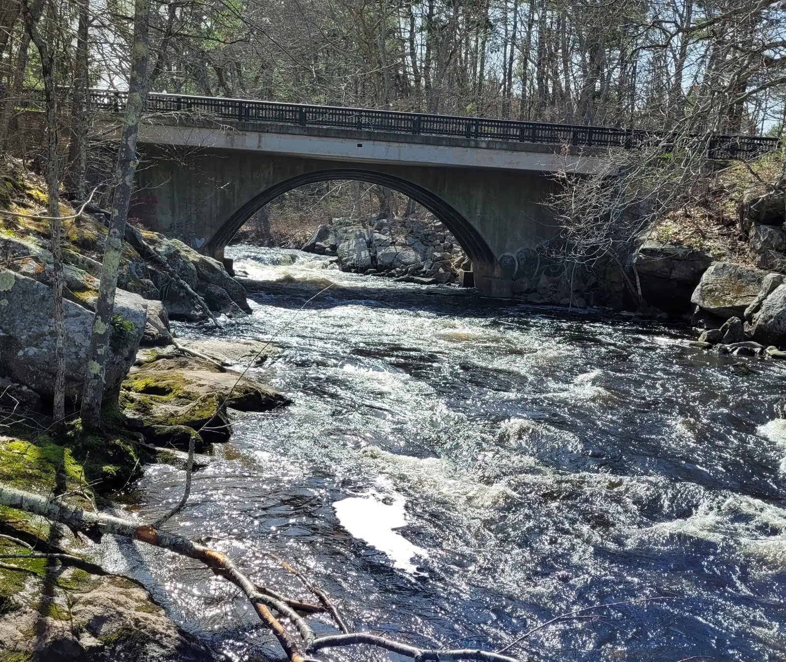
This is a desk-researched listing. A record update or map check does not confirm current swimming permission or water conditions.
Found an error? Send a correction with the location and a source. How we research listings.
The town's Packers Falls page supplies the Bennett Road approach recorded below. The linked property summary contains inconsistent directions to another named destination; do not use that line to locate these falls.
The small parking area can fill quickly. If there is no legal space, choose another destination rather than blocking the road, bridge or neighboring property. A river visit should not depend on finding an improvised shoulder space.
The town recognizes swimming as a use, but this review has not verified supervision, a tested water-entry point or current water quality. Read current notices and be willing to keep the visit entirely on land. Photographing moving water does not establish that entering it is sensible.
Keep the visit within posted property boundaries and daylight rules. Pack out everything you bring. The reviewed images show river scenery rather than instructions for crossing rocks, jumping or reaching a particular pool.
The additional views show a concrete arch bridge, uneven rocky banks and moving water in the historical Packers Falls collection. The town describes pedestrian access across the road bridge, but these photographs do not establish a path to a particular pool, stable footing or present river conditions. Use the town's park-specific directions and legal parking rather than treating a scenic photograph as a route or a jumping recommendation.
Town park-page route from Durham Town Hall: Route 108 south 1.4 miles, right onto Bennett Road for 1.6 miles; small parking area on the left just before Packers Falls Road. Use this park-specific route, not the inconsistent Mill Pond Road direction printed in the downloadable summary. Historical pin remains unverified.
Town summary: dawn to dusk, carry in/carry out; no hunting, fireworks, motorized wheeled vehicles or horseback riding. Do not disturb plants, animals or historic features. Its map says boundaries are approximate.
Confirm the entrance, parking arrangements, and legal access with the land manager. A map pin does not establish a public right of access. Follow posted routes and never block gates or driveways.
The town park page describes swimming as a popular use. This is not a lifeguard, water-quality or safe-entry assurance. Obey current signs and avoid entering unsuitable river conditions. Public park access does not necessarily include permission to swim. Respect private property and posted restrictions.
Water conditions can change quickly. This listing does not provide a current safety or water-quality assessment. Check official alerts and avoid entering water when conditions or permission are uncertain.
Bring sturdy water shoes to protect your feet on rocks and slippery surfaces. A waterproof dry bag keeps your phone, keys, and valuables safe. Pack a quick-dry towel, sun protection, and drinking water - never drink from the natural water source.
Nearby places from saved public map data, not necessarily facilities at the swimming spot. Confirm access, hours, fees, and amenities with the operator before you drive.
Map data retrieved 2026-06-15
Hiking area
45 Harvard St, Portsmouth, NH 03801
Campground
350 Banfield Rd, Portsmouth, NH 03801
Public bathroom
Portsmouth, NH 03801
Parking garage
34 Hanover St, Portsmouth, NH 03801
Parking lot
Portsmouth, NH 03801
Children's camp
190 Court St, Exeter, NH 03833
Park
Portsmouth, NH 03801
Campground
115 Lafayette Rd, North Hampton, NH 03862
Checking nearby USGS water conditions…
Use the Bennett Road route on the town's park page. The downloadable summary has an inconsistent direction line and should not guide arrival.
No lifeguard service was verified. The town's description of swimming use is not a promise of supervision or safe river conditions.
No. The town property summary prohibits camping and campfires; plan overnight accommodation elsewhere.
The Lamprey River played a historical role in local industry, powering mills and sustaining early settlers. Durham's proximity adds cultural and educational significance.
Two reviewed rocky-river views show historical flow and banks without visible visitors. Log close-ups, a soft-focus frame and an aerial winter image were not selected.
Use authorized access, respect nearby homes, leave natural features undisturbed and take litter away.
Browse every listed natural swimming spot in New Hampshire.
Find similar waterfalls destinations across the directory.
See under-the-radar places and local favorites in the same state.
Compare easier-access destinations and safer planning options.
Explore waterfall-focused swimming destinations in New Hampshire.
Use this safety guide before entering any natural water.
Safety & Access Notice
This information is for general planning only and may be incomplete, outdated, or inaccurate. Access rules, closures, water levels, currents, hazards, and legal restrictions can change at any time. Always verify current rules with the land manager or official source before visiting.
You are responsible for your own safety and for following all posted signs, laws, and local regulations. Read the full disclaimer.
The town property summary prohibits camping and campfires.
Loading weather data…
Safety & Access Notice
This information is for general planning only and may be incomplete, outdated, or inaccurate. Access rules, closures, water levels, currents, hazards, and legal restrictions can change at any time. Always verify current rules with the land manager or official source before visiting.
You are responsible for your own safety and for following all posted signs, laws, and local regulations. Read the full disclaimer.
Joshua Havens created Hidden Swimming Holes to make it easier for people to find — and safely visit — natural freshwater swimming destinations across the United States. He researches access conditions, water quality resources, and land management rules so you don't have to start from scratch. He holds a strong belief that good outdoor recreation information should be accurate, honest about its limitations, and freely available.
Discover other amazing natural swimming destinations across America