Pisgah State Park - OHRV Staging Area
State park
1.5 mi
4.7 (15)
Ashuelot, NH 03441

Background: generated illustration, not a photograph of this location.
Plan a Pisgah State Park visit with Kilburn Pond access notes, park rules, trail guidance and reviewed photos. Confirm current restrictions before swimming.
Swimming restriction
Check current postings and ask the park office about your intended entry. General permission is not a designated-beach, lifeguard or water-quality guarantee.
Official sources checked:
Location
A closer look
Photos show past visits, not current water levels or swimming conditions. Select a photo to view it larger.
This is a desk-researched listing. A record update or map check does not confirm current swimming permission or water conditions.
Found an error? Send a correction with the location and a source. How we research listings.
Forested water views and woodland trails make this a destination to explore on foot, with a map and a realistic plan for your group. This listing retains the historical Kilburn Pond reference, but its map pin and precise swimming entry have not been independently verified.
The June 2011 approved management plan includes swimming among permitted park activities and allows access limitations. That is not proof that every shoreline is appropriate for entry. Ask the office about your destination and follow current restrictions. No current depth, water-quality clearance or lifeguard service was established. Avoid jumping and diving from rocks.
Start with the trail-map link on the official park page. Retire the old makeshift-bridge directions and fixed approach-distance promise. Carry navigation and supplies for woodland travel, and confirm the route before setting out.
Use this as a day-trip plan rather than a camping itinerary. For dogs, review the state pet policy and local postings. Ask the office about specific accessibility needs instead of assuming a smooth approach or an accessible pond entry.
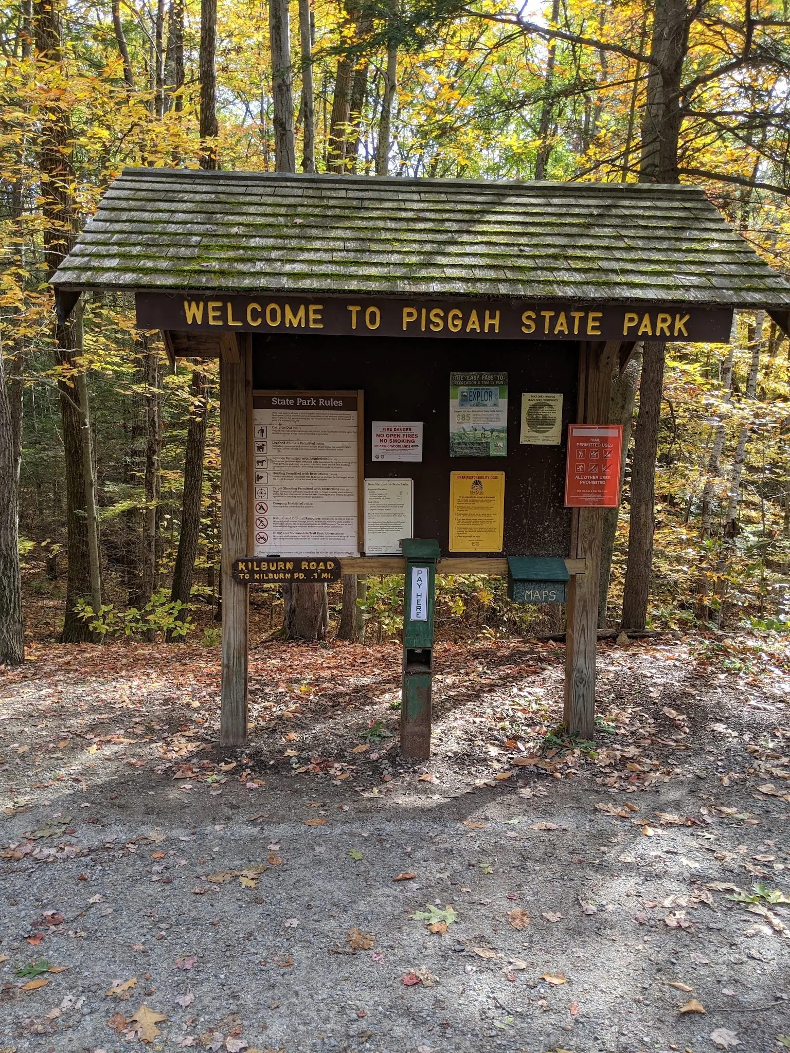
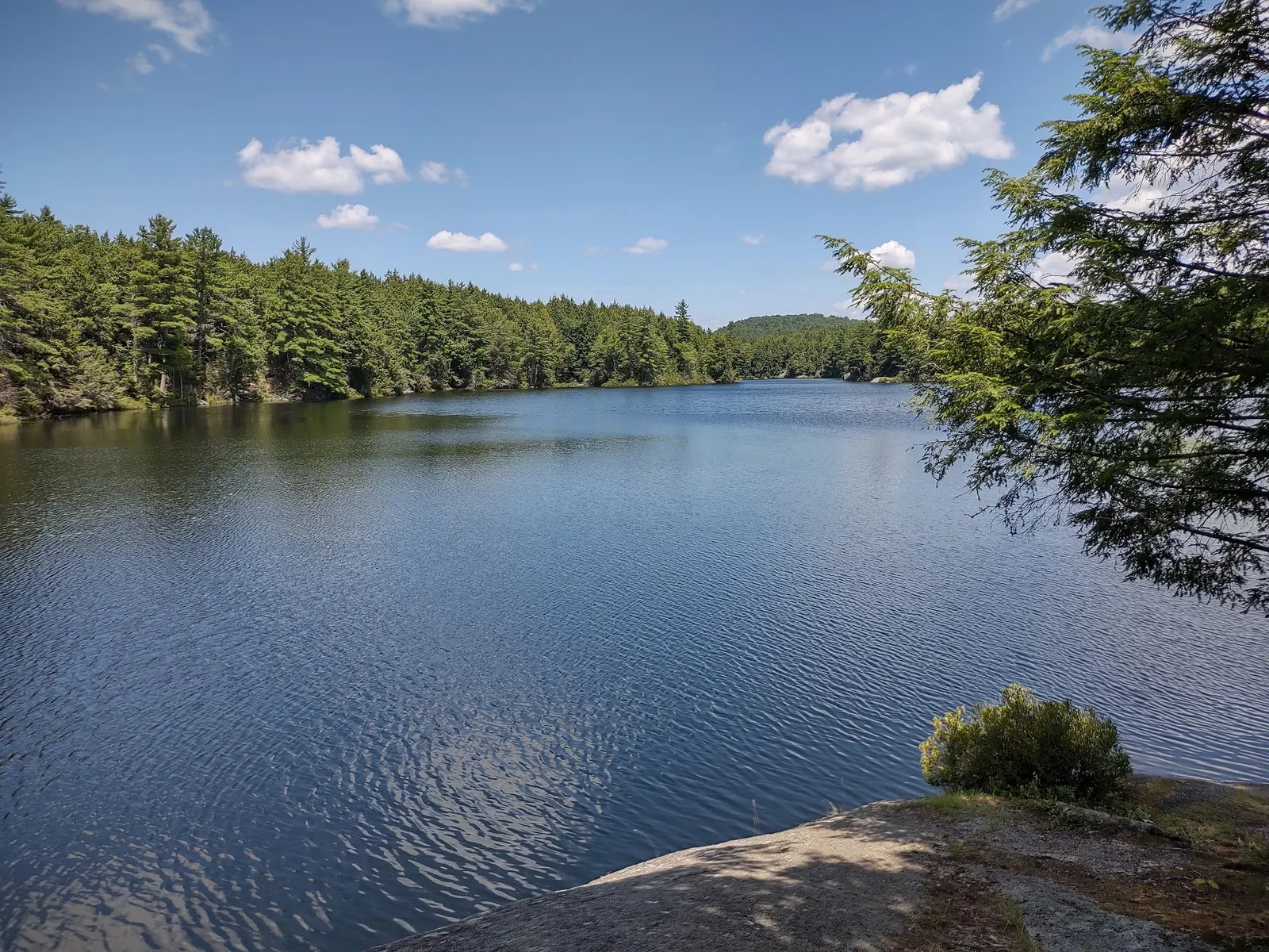
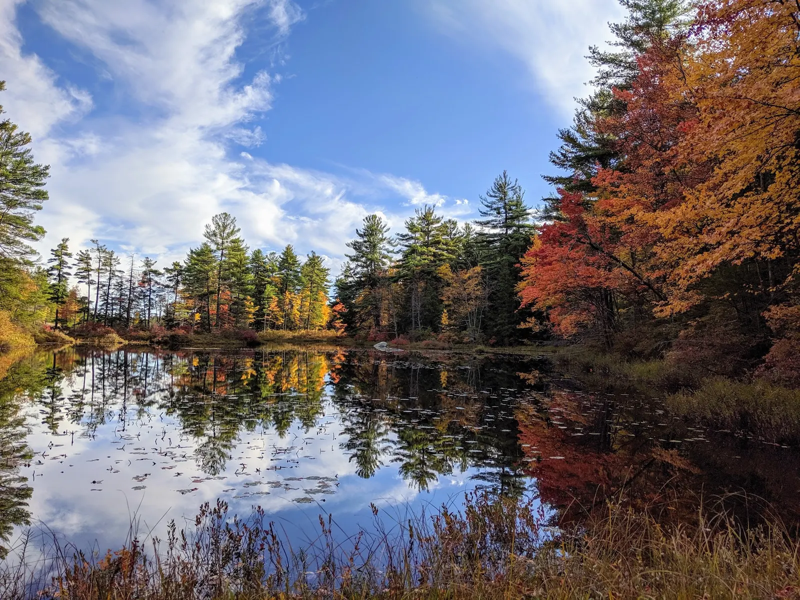
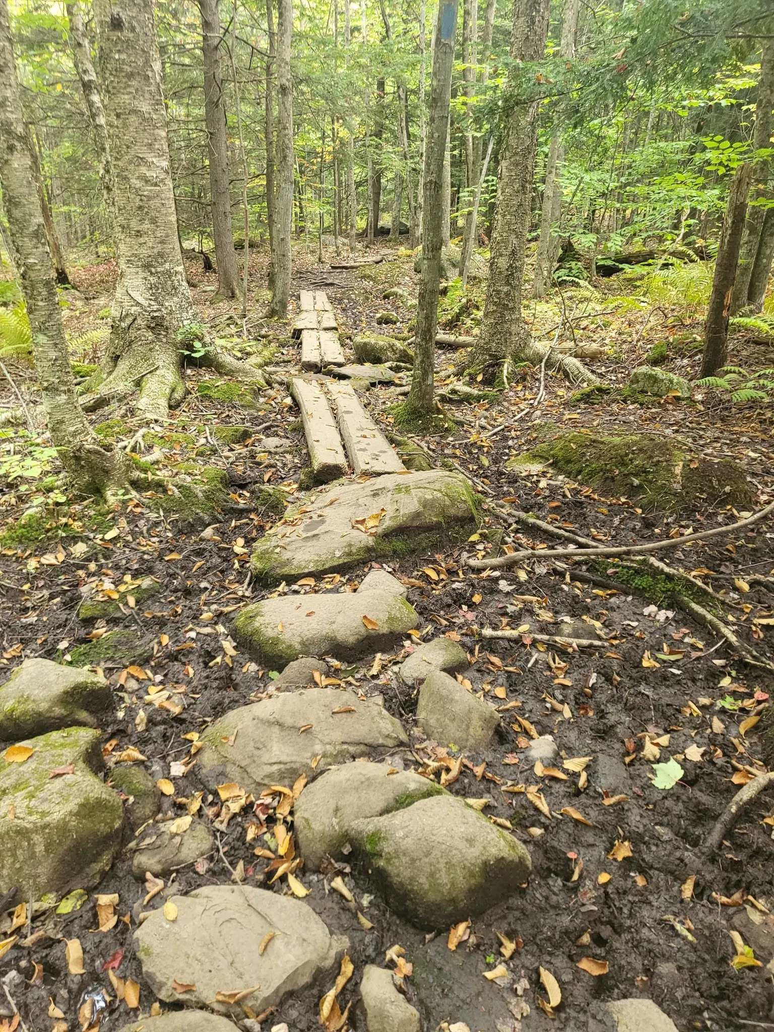
Four reviewed scenes show the named kiosk, wooded water, autumn reflections and an uneven trail with narrow planks. They are historical context, not a present-day route survey. The water scenes have not been independently identified as Kilburn Pond, and old kiosk notices should not be used as today's fee or fire-status information.
Use the park's official trail map to select an appropriate trailhead for Kilburn Pond. The office address, 520 Old Chesterfield Road in Winchester, is not the Kilburn trailhead or a verified swim entry. The retained historical pin is unverified. Do not navigate by the old 0.7-mile, makeshift log bridge and unmarked-path instructions.
Gates close through mud season; other trail restrictions may apply. Follow posted closures rather than treating year-round recreation as unrestricted vehicle access.
Confirm the entrance, parking arrangements, and legal access with the land manager. A map pin does not establish a public right of access. Follow posted routes and never block gates or driveways.
Check current postings and ask the park office about your intended entry. General permission is not a designated-beach, lifeguard or water-quality guarantee. Public park access does not necessarily include permission to swim. Respect private property and posted restrictions.
Water conditions can change quickly. This listing does not provide a current safety or water-quality assessment. Check official alerts and avoid entering water when conditions or permission are uncertain.
Bring sturdy water shoes to protect your feet on rocks and slippery surfaces. A waterproof dry bag keeps your phone, keys, and valuables safe. Pack a quick-dry towel, sun protection, and drinking water - never drink from the natural water source.
Nearby places from saved public map data, not necessarily facilities at the swimming spot. Confirm access, hours, fees, and amenities with the operator before you drive.
Map data retrieved 2026-06-15
State park
Ashuelot, NH 03441
Hiking area
Hinsdale, NH 03451
State park
Davis Hill Trail, Hinsdale, NH 03451
State park
Spofford, NH 03462
Campground
331 Keene Rd, Winchester, NH 03470
Hiking area
Horseshoe Rd, Chesterfield, NH 03443
Hiking area
Ashuelot Rail Trail, Winchester, NH 03470
Campground
152 Pine St, Swanzey, NH 03446
Checking nearby USGS water conditions…
The June 2011 approved management plan lists swimming as a permitted park use, subject to restrictions. Check current postings and confirm your intended pond entry with the park office.
No. The historical pin is retained as unverified, and the office address is not a swimming-entry coordinate. Use the official map and current route guidance.
The approved management plan prohibits camping and campfires. Arrange overnight accommodation elsewhere.
No. They show park context, not measured depth, today's water quality or a confirmed entry. Do not jump or dive from rocks.
No. The named kiosk anchors park identity, but the individual water scenes have not been independently identified as Kilburn Pond.
Pisgah State Park in southwestern New Hampshire, not Pisgah National Forest in North Carolina.
The gallery shows a named park kiosk, forested pond scenery, autumn reflections and rocky trail footing with narrow planks. Pond views are not independently identified as Kilburn Pond.
Carry out litter and protect shoreline plants. Keep pets on a leash no longer than six feet and clean up after them; check any area-specific pet restrictions.
Browse every listed natural swimming spot in New Hampshire.
Find similar forested pond and park recreation context destinations across the directory.
See under-the-radar places and local favorites in the same state.
Compare easier-access destinations and safer planning options.
Use this safety guide before entering any natural water.
Safety & Access Notice
This information is for general planning only and may be incomplete, outdated, or inaccurate. Access rules, closures, water levels, currents, hazards, and legal restrictions can change at any time. Always verify current rules with the land manager or official source before visiting.
You are responsible for your own safety and for following all posted signs, laws, and local regulations. Read the full disclaimer.
Camping and campfires are prohibited in the approved June 2011 management plan. Plan a day visit and follow current postings.
Loading weather data…
Safety & Access Notice
This information is for general planning only and may be incomplete, outdated, or inaccurate. Access rules, closures, water levels, currents, hazards, and legal restrictions can change at any time. Always verify current rules with the land manager or official source before visiting.
You are responsible for your own safety and for following all posted signs, laws, and local regulations. Read the full disclaimer.
Joshua Havens created Hidden Swimming Holes to make it easier for people to find — and safely visit — natural freshwater swimming destinations across the United States. He researches access conditions, water quality resources, and land management rules so you don't have to start from scratch. He holds a strong belief that good outdoor recreation information should be accurate, honest about its limitations, and freely available.
Discover other amazing natural swimming destinations across America