Historic Big Eddie Covered Bridge
Historical landmark
05 (3)
Historic Swiftwater Covered Bridge, 7 Porter Rd, Bath, NH 03740

Background: generated illustration, not a photograph of this location.
Explore Swiftwater Covered Bridge and the Big Eddy river setting in Bath, NH, with reviewed photos, access cautions and local historical sources.
Swimming restriction
Historical swimming recognition is not clearance for every pool or bank. Follow current postings and confirm the intended approach with the town or land manager. Do not jump from the bridge or rocks.
Official sources checked:
Location
A closer look
Photos show past visits, not current water levels or swimming conditions. Select a photo to view it larger.
This is a desk-researched listing. A record update or map check does not confirm current swimming permission or water conditions.
Found an error? Send a correction with the location and a source. How we research listings.
At Swiftwater, the Wild Ammonoosuc River runs through a rocky setting beneath a historic wooden bridge. A land-based visit can combine bridge photography with river scenery. Plan the approach carefully rather than treating the bridge pin as a verified swimming entry.
Bath's bridge-history page distinguishes Swiftwater from the town's other covered bridges. Its 2007 master plan recognizes Big Eddy and Little Eddy as swimming areas, but explicitly says the plan has no regulatory power. That historical description is not today's permission notice or a safety inspection.
The old advice that water is easily accessible from the area surrounding the bridge is too broad. Confirm which bank and path you may use, keep driveways and traffic lanes clear, and turn back if legal parking is unavailable. Do not interpret a river-side road name as public access.
Moving water over rock can be difficult to judge from shore or a photograph. Do not jump from the bridge, dive from ledges or approach the base of cascades. No current water-quality clearance, safe depth or supervised swimming service was established in this review. Plan a scenery-only visit when permission or conditions are uncertain.
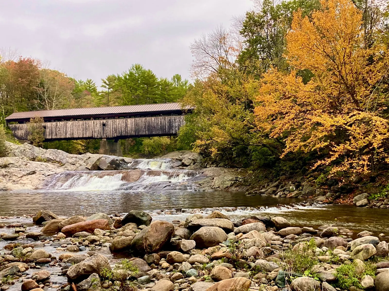
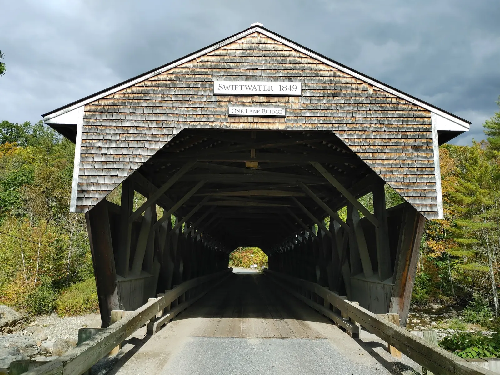
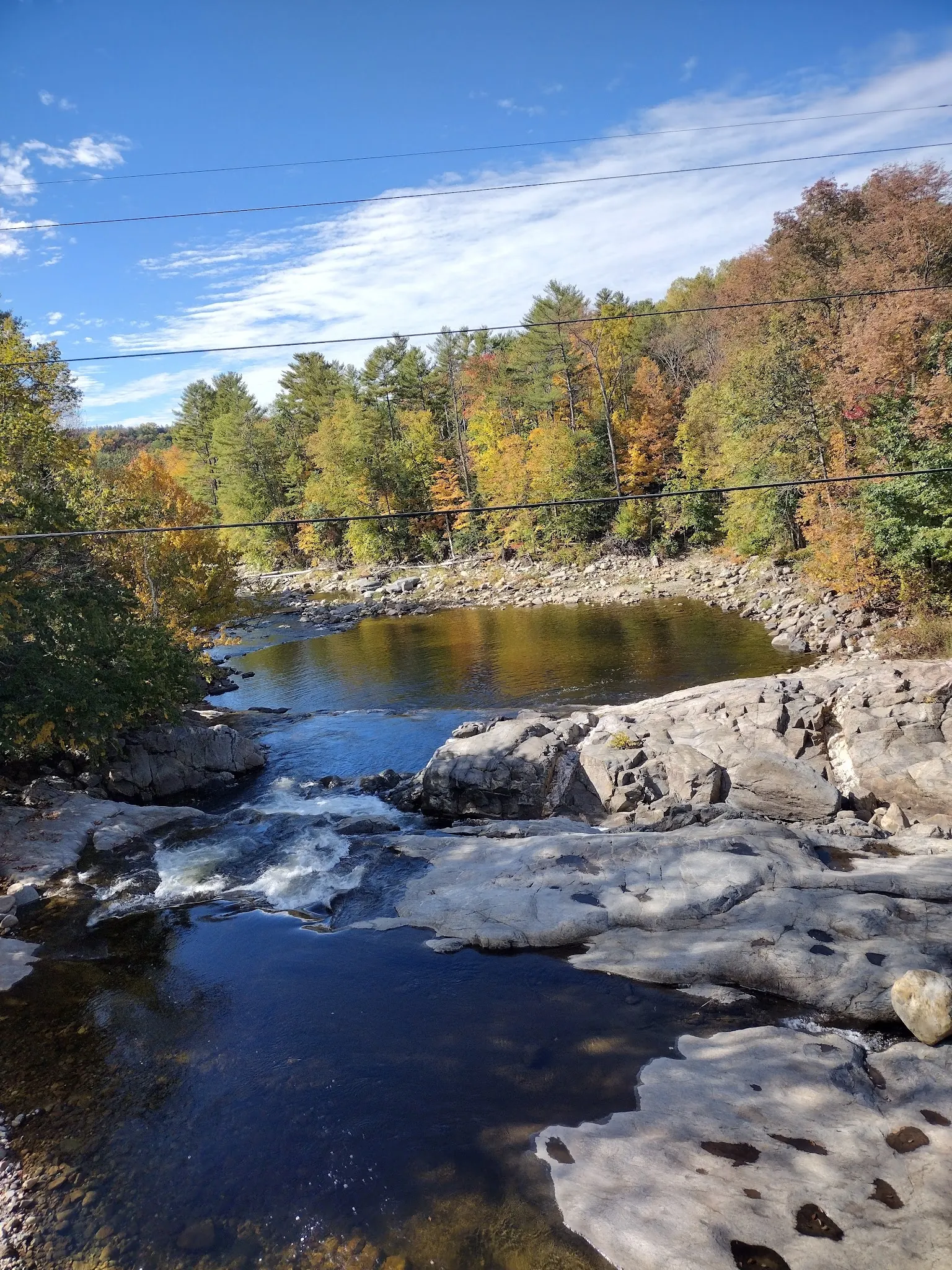
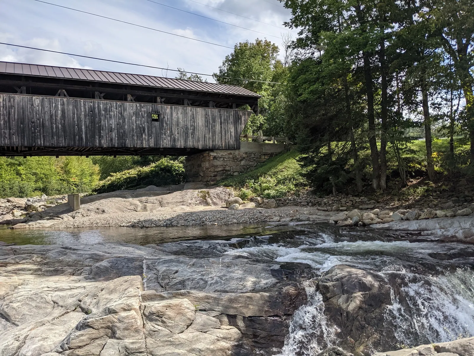
The selected photographs connect the named bridge facade with its river and autumn setting. They show exposed rock and moving water, not a certified swimming route. Photo dates and water levels differ, so none should be used to predict the day you arrive.
Plan for Swiftwater Covered Bridge in Bath near NH Route 112. The saved landmark record identifies Porter Road; confirm current routing and bridge restrictions before driving. The retained pin marks historical bridge context, not a surveyed swimming entry. Find legal parking and a permitted land approach; do not assume any roadside shoulder or path is public.
The 2007 town road inventory lists Little Eddy Lane as private. Do not use its name as proof of a public approach or parking right; confirm current ownership and permission.
Confirm the entrance, parking arrangements, and legal access with the land manager. A map pin does not establish a public right of access. Follow posted routes and never block gates or driveways.
Historical swimming recognition is not clearance for every pool or bank. Follow current postings and confirm the intended approach with the town or land manager. Do not jump from the bridge or rocks. Public park access does not necessarily include permission to swim. Respect private property and posted restrictions.
Water conditions can change quickly. This listing does not provide a current safety or water-quality assessment. Check official alerts and avoid entering water when conditions or permission are uncertain.
Bring sturdy water shoes to protect your feet on rocks and slippery surfaces. A waterproof dry bag keeps your phone, keys, and valuables safe. Pack a quick-dry towel, sun protection, and drinking water - never drink from the natural water source.
Nearby places from saved public map data, not necessarily facilities at the swimming spot. Confirm access, hours, fees, and amenities with the operator before you drive.
Map data retrieved 2026-06-15
Historical landmark
Historic Swiftwater Covered Bridge, 7 Porter Rd, Bath, NH 03740
Housing development
Pioneer Rd, Bath, NH 03740
General store
533 Wild Ammonoosuc Rd, Bath, NH 03740
Campground
U.S. 302 &, NH-112, Bath, NH 03740
Hiking area
Bath, NH 03740
Hiking area
431 Rum Hill Rd, Bath, NH 03740
Hiking area
15 Abbott Ave, Bath, NH 03740
Visitor center
200 NH-112, North Woodstock, NH 03262
Info about activities, lodgings & events in the area, plus history displays & a gift shop.
Checking nearby USGS water conditions…
No. Bath's official history describes Swiftwater, Bath Covered Bridge and Bath-Haverhill Bridge separately. This listing concerns Swiftwater on the Wild Ammonoosuc River.
Its 2007 master plan recognizes Big Eddy and Little Eddy swimming areas. The plan is nonregulatory and does not establish today's access permission or safe conditions.
Do not assume so. The 2007 town road inventory lists it as private. Confirm current ownership and permission instead of following the name alone.
No. Avoid jumping and diving. Current, cold water and hidden hazards can exist even where photographs show a calm-looking pool.
No current parking terms, toilets or lifeguard service were verified for the entry. Confirm local arrangements and bring supplies.
The town identifies the current Swiftwater bridge as dating to 1849 and listed on the National Register of Historic Places. It is distinct from the Bath Covered Bridge and Bath-Haverhill Bridge.
Four historical photographs show the covered bridge above cascades in autumn, its named entrance, rock-edged river pools and a side view beside moving water. They do not establish today's access or safety.
Respect adjoining property, carry out litter and avoid damaging vegetation or entering the river solely for a photograph.
Browse every listed natural swimming spot in New Hampshire.
Find similar river destinations across the directory.
See under-the-radar places and local favorites in the same state.
Compare easier-access destinations and safer planning options.
Use this safety guide before entering any natural water.
Safety & Access Notice
This information is for general planning only and may be incomplete, outdated, or inaccurate. Access rules, closures, water levels, currents, hazards, and legal restrictions can change at any time. Always verify current rules with the land manager or official source before visiting.
You are responsible for your own safety and for following all posted signs, laws, and local regulations. Read the full disclaimer.
No campsite or overnight permission established here. Arrange lodging or an authorized campground separately.
Loading weather data…
Safety & Access Notice
This information is for general planning only and may be incomplete, outdated, or inaccurate. Access rules, closures, water levels, currents, hazards, and legal restrictions can change at any time. Always verify current rules with the land manager or official source before visiting.
You are responsible for your own safety and for following all posted signs, laws, and local regulations. Read the full disclaimer.
Joshua Havens created Hidden Swimming Holes to make it easier for people to find — and safely visit — natural freshwater swimming destinations across the United States. He researches access conditions, water quality resources, and land management rules so you don't have to start from scratch. He holds a strong belief that good outdoor recreation information should be accurate, honest about its limitations, and freely available.
Discover other amazing natural swimming destinations across America