Umpachene Falls
Waterfall
4.7 (51)
New Marlborough, MA 01259

Background: generated illustration, not a photograph of this location.
Review Umpachene Falls scenery and its resident-and-guest access restriction, with corrected river identity, park contacts and practical limits on old directions.
Swimming restriction
Park access is described as limited to New Marlborough residents and their guests, with other visitors needing groundskeeper permission. Do not treat this as an unrestricted public swimming stop. Confirm current water-entry rules and conditions before entering.
Location
A closer look
Photos show past visits, not current water levels or swimming conditions. Select a photo to view it larger.
This is a desk-researched listing. A record update or map check does not confirm current swimming permission or water conditions.
Found an error? Send a correction with the location and a source. How we research listings.
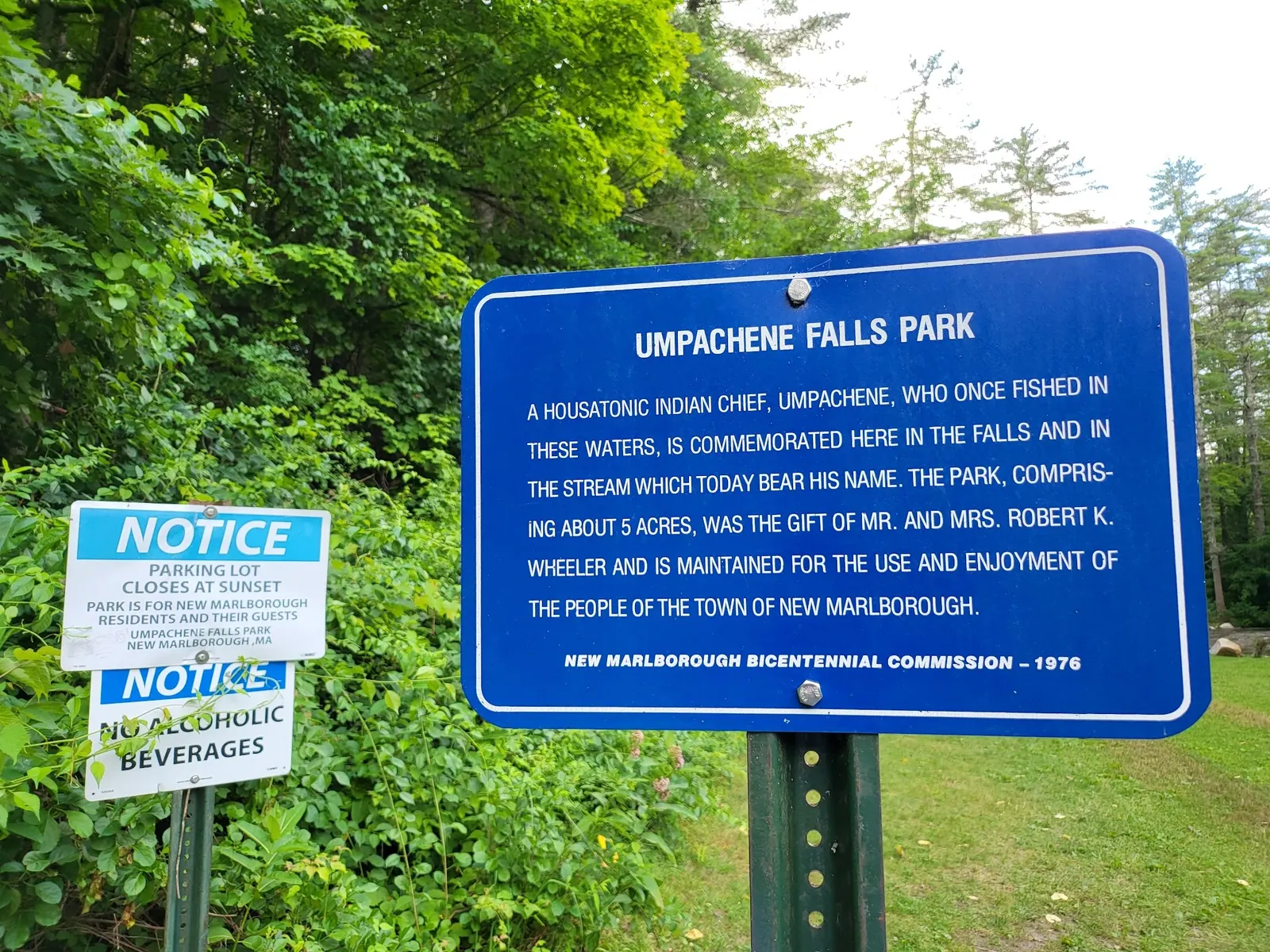
Berkshires Outside identifies this town park as restricted to New Marlborough residents and their guests, with permission needed for other visitors. A saved park notice photograph corroborates the resident-and-guest wording. This is not an unrestricted public swimming recommendation.
The falls are on the Umpachene River near its meeting with the Konkapot, not on the Mill River as earlier text claimed. The town commission is the contact for present access arrangements. Its office address should not be mistaken for the park entrance.
The regional profile identifies Umpachene Falls Road near Hadsell Street. Ask the commission about the current approach and legal parking. Old bridge closures and exact-mileage directions were not reverified, and the retained historical point is not a surveyed water entrance.
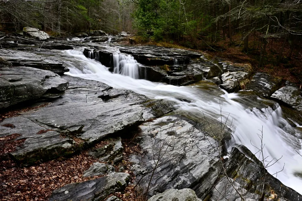
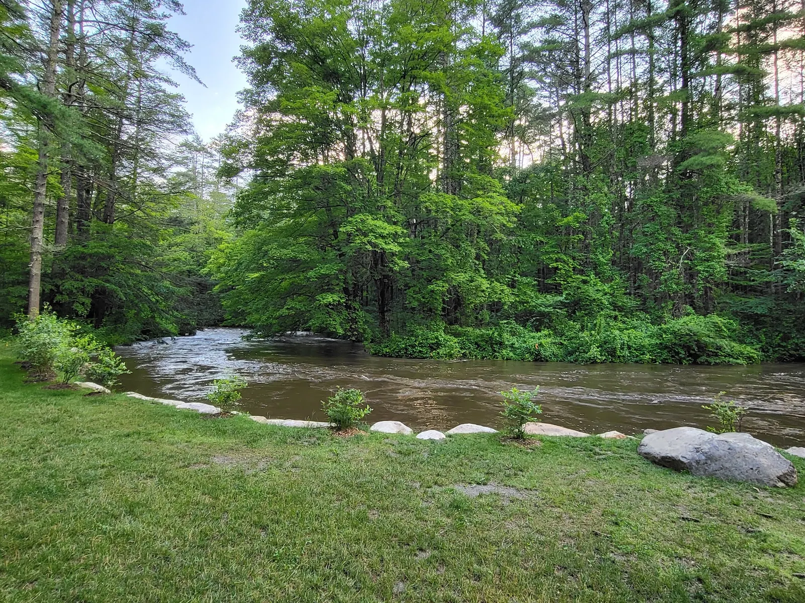
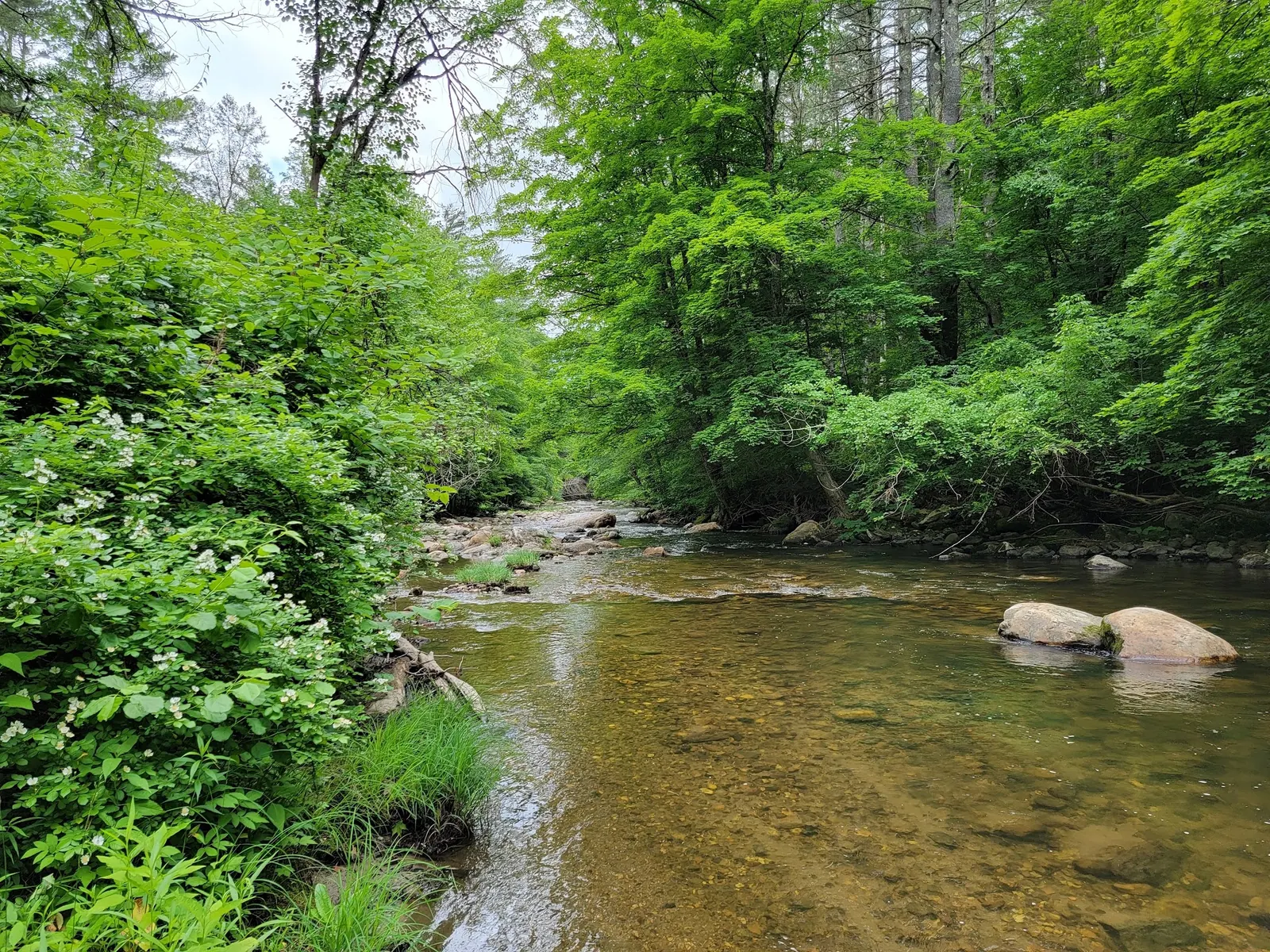
The town lists picnic tables and a swing. Confirm restroom operation separately. Current lifeguard staffing, water quality and accessible falls entry were not established. Historical cascade and river photographs show setting, not safe conditions or authorization to enter the water.
First confirm that you qualify for park access or obtain the required permission. The regional park profile identifies parking on Umpachene Falls Road near Hadsell Street. Confirm the current legal approach and parking with the commission. Old bridge-closure and exact-mileage directions have not been reverified. The commission's town-office address is not the falls entrance; the retained historical point is about two miles from the saved named falls point.
Resident/guest restriction appears in the regional park profile and a saved park notice photograph. The photo also shows a sunset parking closure; confirm current signs rather than relying on an old image.
Confirm the entrance, parking arrangements, and legal access with the land manager. A map pin does not establish a public right of access. Follow posted routes and never block gates or driveways.
Park access is described as limited to New Marlborough residents and their guests, with other visitors needing groundskeeper permission. Do not treat this as an unrestricted public swimming stop. Confirm current water-entry rules and conditions before entering. Public park access does not necessarily include permission to swim. Respect private property and posted restrictions.
Water conditions can change quickly. This listing does not provide a current safety or water-quality assessment. Check official alerts and avoid entering water when conditions or permission are uncertain.
Bring sturdy water shoes to protect your feet on rocks and slippery surfaces. A waterproof dry bag keeps your phone, keys, and valuables safe. Pack a quick-dry towel, sun protection, and drinking water - never drink from the natural water source.
Nearby places from saved public map data, not necessarily facilities at the swimming spot. Confirm access, hours, fees, and amenities with the operator before you drive.
Map data retrieved 2026-06-15
Waterfall
New Marlborough, MA 01259
Park
Umpachene Falls Rd, Southfield, MA 01259
Hiking area
442 Mill River Southfield Rd, New Marlborough, MA 01230
Hiking area
New Marlborough, MA 01230
State park
69 Blue Hill Rd, Monterey, MA 01245
Scenic park with a fishing pond, wildlife viewing, wintertime snow sports & all-year hiking trails.
Campground
MA-8, Otis, MA 01253
Campground
9 Camp Half-Moon Rd, Monterey, MA 01245
City Hall
807 Mill River Southfield Rd, Mill River, MA 01244
Checking nearby USGS water conditions…
The regional park profile limits access to New Marlborough residents and their guests, with other visitors needing groundskeeper permission. Ask the town commission before travel.
No. They are on the Umpachene River near its meeting with the Konkapot River. The commission office in Mill River is not the falls entrance.
No. The resident-and-guest restriction still matters, and historical images do not establish current permission or conditions.
They were not reverified. Confirm the legal approach and parking with the commission rather than relying on archived bridge-closure instructions.
The saved park sign documents local commemoration and the park's town identity; protect the site and leave rocks undisturbed.
Four reviewed historical photos show the cascade, park identity and access notices, a riverside lawn and a wooded river reach. They are not present-condition reports or permission for a particular water entry.
Use authorized paths, protect shoreline vegetation and pack out waste.
Browse every listed natural swimming spot in Massachusetts.
Find similar waterfalls destinations across the directory.
See under-the-radar places and local favorites in the same state.
Compare easier-access destinations and safer planning options.
Explore waterfall-focused swimming destinations in Massachusetts.
Use this safety guide before entering any natural water.
Safety & Access Notice
This information is for general planning only and may be incomplete, outdated, or inaccurate. Access rules, closures, water levels, currents, hazards, and legal restrictions can change at any time. Always verify current rules with the land manager or official source before visiting.
You are responsible for your own safety and for following all posted signs, laws, and local regulations. Read the full disclaimer.
No overnight permission verified. Treat this as a day-use planning lead and ask the commission before any overnight proposal.
Loading weather data…
Safety & Access Notice
This information is for general planning only and may be incomplete, outdated, or inaccurate. Access rules, closures, water levels, currents, hazards, and legal restrictions can change at any time. Always verify current rules with the land manager or official source before visiting.
You are responsible for your own safety and for following all posted signs, laws, and local regulations. Read the full disclaimer.
Joshua Havens created Hidden Swimming Holes to make it easier for people to find — and safely visit — natural freshwater swimming destinations across the United States. He researches access conditions, water quality resources, and land management rules so you don't have to start from scratch. He holds a strong belief that good outdoor recreation information should be accurate, honest about its limitations, and freely available.
Discover other amazing natural swimming destinations across America