Appalachian Trail Parking
Hiking area
4.9 (12)
2120 Cape St, Lee, MA 01238

Background: generated illustration, not a photograph of this location.
Plan Upper Goose Pond with the Appalachian Trail side-trail approach, seasonal cabin information, designated camping rules and reviewed trail and pond photos.
Swimming restriction
Check present signs and conditions before entering. Do not jump from the dock or assume photographed rocks are safe diving platforms. No current lifeguard service or water-quality clearance verified.
Official sources checked:
Location
A closer look
Photos show past visits, not current water levels or swimming conditions. Select a photo to view it larger.
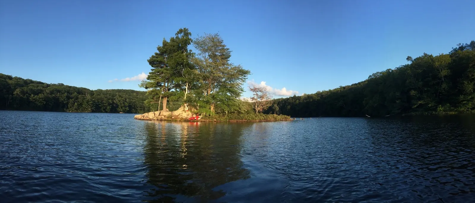
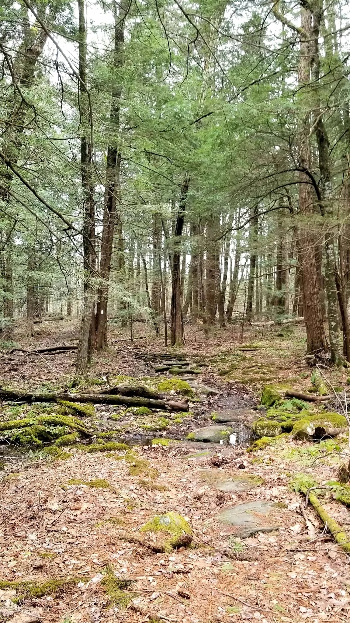
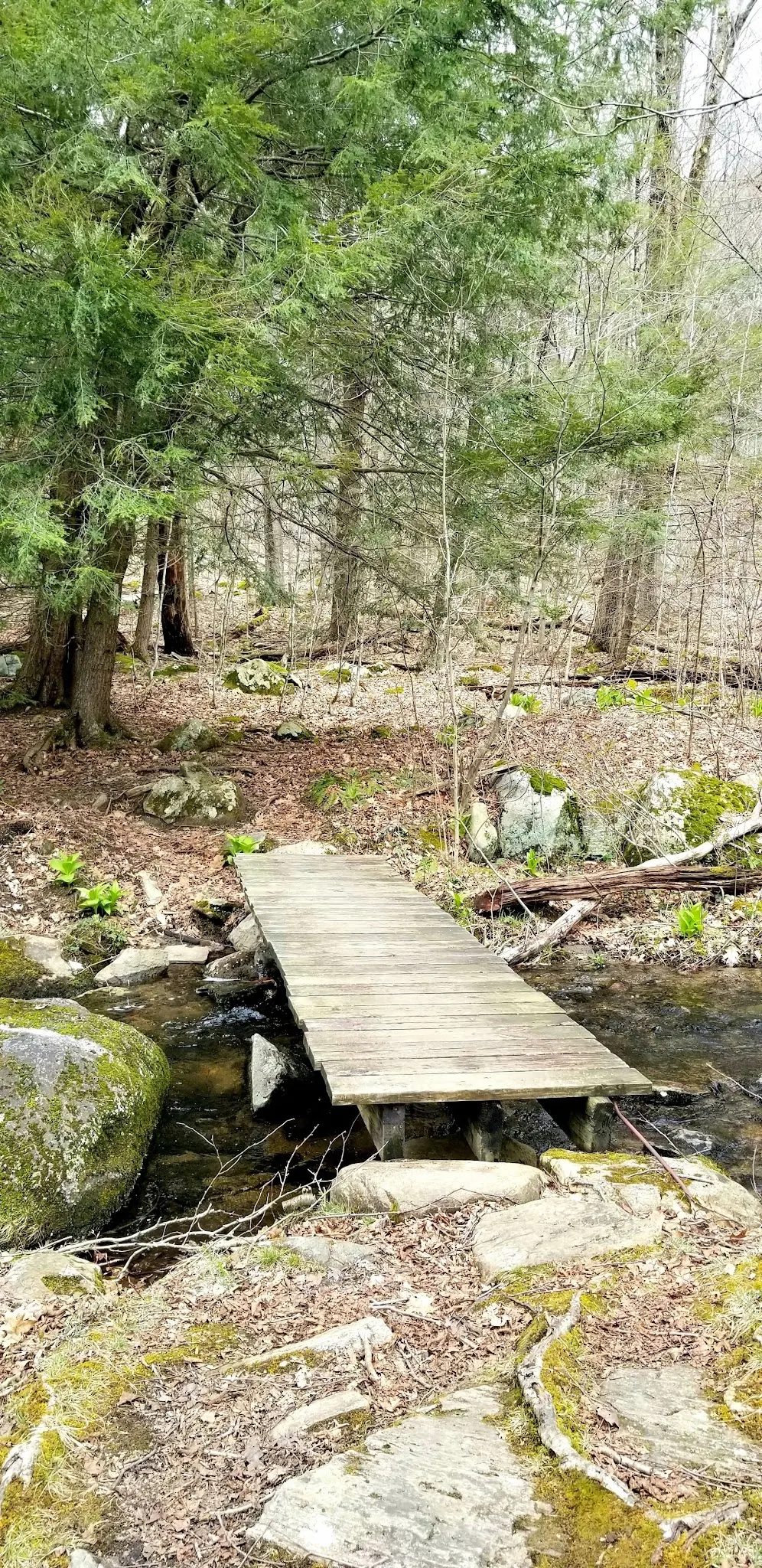
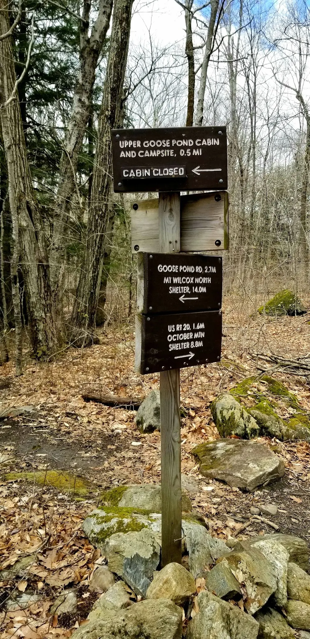
This is a desk-researched listing. A record update or map check does not confirm current swimming permission or water conditions.
Found an error? Send a correction with the location and a source. How we research listings.
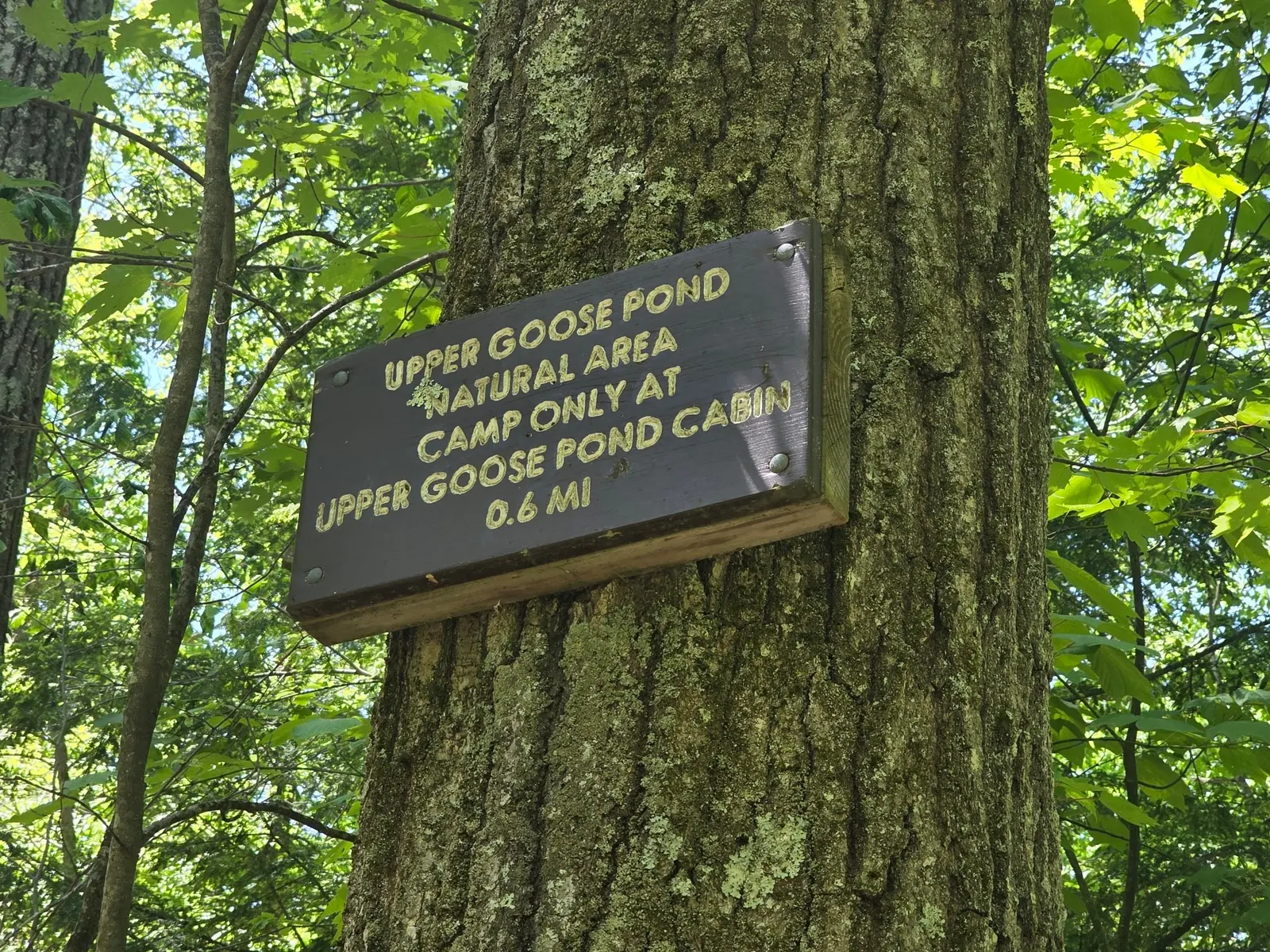
AMC's shelter list places the junction 1.6 miles south of US 20, then adds a half-mile side trail. Plan with a current map, not the former 1.7-mile total or the unverified historical town pin. The gallery junction sign helps explain the distinction without guaranteeing present sign condition.
The Trustees reservation offers a separate ridge walk and explicitly states there is no trail access down to the pond. Do not turn its parking directions into instructions for a swim.
The visitor FAQ describes first-come overnight use for A.T. hikers, not reservable holiday lodging. Groups cannot treat ATCamp registration as a reservation. Day visitors should be self-sufficient and leave shared access clear.
The management calendar lists October 11, 2026 closing work. Do not assume a dock, canoe or open cabin from a summer photo. The historical cabin-closed sign in this gallery is not today's status.
Official visitor guidance describes swimming, but this review did not establish present water-quality clearance or supervision. Avoid jumping, respect restrictions and make water entry a separate conditions-based decision. The selected images illustrate scenery and trail terrain, not measured swimming depths.
Use an up-to-date Appalachian Trail map and permitted parking at the US 20 access. AMC locates the cabin side-trail junction about 1.6 miles south along the A.T., followed by a half-mile side trail, rather than the old 1.7-mile total. Follow current blazes and cabin signs; this is not a surveyed route length. The retained historical town pin is about 4.1 miles from the saved named pond record and is not a verified trailhead. Do not use the Trustees Goose Pond Reservation viewpoint trail as a water-access shortcut.
The Trustees Goose Pond Reservation is a separate ridge outing: its page explicitly says there is no trail access down to the pond. The selected trail and bridge photos do not establish a wheelchair-accessible route.
Confirm the entrance, parking arrangements, and legal access with the land manager. A map pin does not establish a public right of access. Follow posted routes and never block gates or driveways.
Check present signs and conditions before entering. Do not jump from the dock or assume photographed rocks are safe diving platforms. No current lifeguard service or water-quality clearance verified. Public park access does not necessarily include permission to swim. Respect private property and posted restrictions.
Water conditions can change quickly. This listing does not provide a current safety or water-quality assessment. Check official alerts and avoid entering water when conditions or permission are uncertain.
Bring sturdy water shoes to protect your feet on rocks and slippery surfaces. A waterproof dry bag keeps your phone, keys, and valuables safe. Pack a quick-dry towel, sun protection, and drinking water - never drink from the natural water source.
Nearby places from saved public map data, not necessarily facilities at the swimming spot. Confirm access, hours, fees, and amenities with the operator before you drive.
Map data retrieved 2026-06-15
Hiking area
2120 Cape St, Lee, MA 01238
Hiking area
Appalachian Trl, Lee, MA 01238
Hiking area
42° 21.026 N 73° 20.895' W, Lenox Rd, West Stockbridge, MA 01266
Campground
256 Woodland Rd, Lee, MA 01238
Campground
317 Woodland Rd, Lee, MA 01238
Home to the famed Appalachian Trail, this expansive forest offers camping, hiking & a fishing lake.
Campground
350 Longview Ave, Hinsdale, MA 01235
Public bathroom
8 Center St, West Stockbridge, MA 01266
Public bathroom
West Stockbridge, MA 01266
Checking nearby USGS water conditions…
No. AMC describes 1.6 miles along the A.T. from US 20 to a junction, plus a half-mile side trail. Use a current map and allow time for the return.
No. It is seasonal and caretaker-dependent. Confirm arrangements with AMC; nearby designated tent platforms are listed for year-round use.
The Trustees specifically says its Goose Pond Reservation trail does not provide access down to the pond. Use appropriate A.T. planning instead.
No. Massachusetts A.T. camping is restricted to designated overnight sites. A shoreline photo or a cabin closure does not allow dispersed camping.
The cabin supports Appalachian Trail visitors. It is not a bookable lakeside vacation rental or a general-purpose serviced campground.
Historical photos show a wooded pond island, rocky trail, small footbridge and named cabin/camping signs. The sign marked cabin closed is historical, not a live status report; no island swim or diving route is recommended.
Stay on designated paths and use designated overnight sites. AMC sources conflict about fire permission; follow the shelter list's stricter no-fire instruction and confirm current rules rather than treating the FAQ fireplace reference as permission.
Browse every listed natural swimming spot in Massachusetts.
Find similar pool destinations across the directory.
See under-the-radar places and local favorites in the same state.
Compare easier-access destinations and safer planning options.
Use this safety guide before entering any natural water.
Safety & Access Notice
This information is for general planning only and may be incomplete, outdated, or inaccurate. Access rules, closures, water levels, currents, hazards, and legal restrictions can change at any time. Always verify current rules with the land manager or official source before visiting.
You are responsible for your own safety and for following all posted signs, laws, and local regulations. Read the full disclaimer.
Use designated overnight sites only, not an arbitrary shore campsite. The cabin is caretaker-dependent and seasonal; nearby tent platforms are listed year-round. Consult current site guidance before an overnight trip.
Loading weather data…
Safety & Access Notice
This information is for general planning only and may be incomplete, outdated, or inaccurate. Access rules, closures, water levels, currents, hazards, and legal restrictions can change at any time. Always verify current rules with the land manager or official source before visiting.
You are responsible for your own safety and for following all posted signs, laws, and local regulations. Read the full disclaimer.
Joshua Havens created Hidden Swimming Holes to make it easier for people to find — and safely visit — natural freshwater swimming destinations across the United States. He researches access conditions, water quality resources, and land management rules so you don't have to start from scratch. He holds a strong belief that good outdoor recreation information should be accurate, honest about its limitations, and freely available.
Discover other amazing natural swimming destinations across America