
River
Fees unconfirmed
Benton
Little Rock
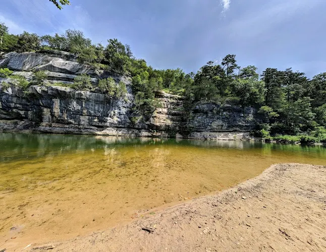
Plan a Saline River outing near Benton with named access points, current closure checks, river-level resources and clear limits on bridge-entry information.
Saline River
View Details
Discover 19 amazing natural swimming destinations across Arkansas. From pristine lakes to refreshing rivers, find your perfect swimming spot.
Do not treat historical swimming descriptions or photos of another Blue Hole as permission. Confirm current access with the land manager before entering. Do not jump, dive or use rope swings.
Read the correction and official sourcesNPS identifies a swimming beach at Buffalo Point. River levels, currents and visibility change. Check current park alerts and conditions with rangers before entering. Wear a life jacket, swim with a companion and do not jump or dive from cliffs.
Read the correction and official sourcesHighway 65 and Highway 285 are distinct historical references. AGFC's Highway 124 North Fork boat slide near Quitman is a different location, not confirmation of either swimming entry.
Read the correction and official sourcesSwim only in the open designated area and follow staff instructions. Park opening is not beach opening.
Read the correction and official sourcesUse the posted swimming area when open and obey local closures. The official swimming-area listing does not authorize cliff jumping or swimming beside the dam, boat ramp or marina.
Read the correction and official sourcesUse the named destination's current rules and condition notices. No unverified jumping, diving, slides or rope swings recommended.
Read the correction and official sourcesUse the named destination's current rules and condition notices. No unverified jumping, diving, slides or rope swings recommended.
Read the correction and official sourcesSwimming is prohibited in the pool below Cedar Falls and in Cedar Creek, including the historic Blue Hole area. This correction concerns the natural creek locations previously recommended here, not the park's separate swimming pools. Check the park for pool opening, eligibility and fees.
Read the correction and official sourcesJack Creek Recreation Area is closed for the season. The Forest Service page checked October 21, 2026 lists March 1, 2027 as the planned reopening, not a guarantee. Do not plan a swim there before confirmed reopening. This notice applies to the mapped Jack Creek destination and does not establish closure or opening of separate Knoppers Ford.
Read the correction and official sourcesThe municipal homepage identifies Riverside Park, but the reviewed parks page does not publish readable swimming-entry rules. Riverside Park context does not prove Wreck Hole ownership, railway access or bathing permission.
Read the correction and official sources Plan a Saline River outing near Benton with named access points, current closure checks, river-level resources and clear limits on bridge-entry information.

Find Big Spring Park's city-listed swimming hole in Cotter, with the official entrance location, park facilities and cautions for White River conditions.

Plan Bluff Hole Park on the Mulberry River with the city's $5 vehicle parking charge, US-64 entrance directions, picnic facilities and swimming cautions.

Plan Buffalo Point beach access between campground loops A and B. See reviewed photos, ranger contact details and Buffalo River safety considerations.

Find Brushy Creek at Highway 246, separate from Cossatot Falls and the visitor center. Compare viewing access, camping locations and river safety guidance.

Plan a Dam Site visit near Heber Springs with official swim-area guidance, SR-25 directions, park facilities and separate camping arrangements.
Compare Eureka Springs-area water outings with Lake Leatherwood's park map, camping and contact details, plus clear limits on legacy cliff and river access.

Plan a Haw Creek Falls visit with low-water bridge cautions, free primitive camping, vault toilets and the distinction from Fort Douglas on Big Piney Creek.

Compare Hot Springs bathhouse soaking with Lake Ouachita's swim beach. Find correct contacts, separate destinations and campground reservation guidance.
Compare Buffalo River access near Jasper without confusing Pruitt Landing with a verified swim beach. Check current conditions, camping and park guidance.

Plan the two-mile Kings River Falls hike with official trail directions, swimming-condition cautions and natural-area rules against camping and campfires.

Plan a Little Missouri River outing with Albert Pike day-use rules, separate waterfall destinations, flood cautions and no directions to the closed private quarry.

Visit Long Pool on Big Piney Creek with corrected recreation-area coordinates, day-use fees, first-come camping information and river safety advice.

Compare Redding and Wolf Pen on the Mulberry River with corrected destination coordinates, day-use fees, camping facilities and river-condition cautions.

Compare Gunner Pool, Blanchard Springs and Barkshed with current-source cautions, creek-access planning, campground details and facility-specific opening checks.

Plan distinct Ponca and Steel Creek river stops with official campground information, reservation guidance and realistic swimming-condition checks.
Plan Richland Creek with corrected campground coordinates, rough-road advice, first-come camping and the distinction from Falling Water Falls and wilderness hikes.

Plan Woolum river access near St. Joe with NPS primitive-camping rules, limited facilities and river-condition checks. No cliff-jumping recommendation.
Plan a Spring River visit around Buford Beach in Hardy, with documented public access, facility questions, river-level resources and separate camping options.
Safety & Access Notice
This information is for general planning only and may be incomplete, outdated, or inaccurate. Access rules, closures, water levels, currents, hazards, and legal restrictions can change at any time. Always verify current rules with the land manager or official source before visiting.
You are responsible for your own safety and for following all posted signs, laws, and local regulations. Read the full disclaimer.
Arkansas features 19 natural swimming spots across 8 water types. Expect varying access and conditions by season; arrive early on weekends, pack out trash, and always verify current rules and water levels before you go.
Arkansas, the Natural State, is a paradise for freshwater swimmers, offering a stunning array of swimming holes carved by rivers, creeks, and springs. From the dramatic waterfalls of the Ozarks to the serene, spring-fed pools of the Ouachitas, these natural retreats provide a cool escape and a direct connection to the state's rugged beauty. This guide covers the essential information for planning your adventure, from top destinations to vital safety tips.
Arkansas is renowned for its natural swimming holes, primarily found in the Ozark and Ouachita National Forests and along scenic rivers like the Buffalo and Cossatot. Most spots are free, undeveloped, and require self-sufficiency. The best time to visit is from late May through September. Always prioritize safety: check water levels, never dive into unknown water, and practice Leave No Trace principles.
Here are twelve standout destinations to anchor your Arkansas swimming hole exploration.
Arkansas's swimming holes are concentrated in its two major mountain regions and river corridors.
Swimming in natural water bodies requires caution and preparation.
Base yourself in Jasper or Harrison for a classic north Arkansas swimming adventure.
Q: Are Arkansas swimming holes safe for kids?
A: No natural-water destination is certified child-safe by this guide. Tanyard Creek Falls is a Bella Vista walking destination with unresolved swimming permission, not a controlled pool. Check the exact manager's rules, route and current notices for any intended outing, and closely supervise children near water. A personal depth check or clear appearance is not a safety guarantee.
Q: Can I bring my dog to swimming holes?
A: In general, yes, but they must be leashed in developed recreation areas and state parks. In national forests, leash rules may vary. Always clean up after your pet and ensure they do not disturb wildlife or other visitors.
Q: What should I bring for a day at a swimming hole?
A: Essentials include water shoes, sunscreen, insect repellent, plenty of drinking water, a trash bag, a first-aid kit, a towel, and a life jacket for weaker swimmers. For remote spots, add a map, compass, and basic survival gear.
Q: Is cliff jumping allowed?
A: No current cliff-jumping permission or surveyed landing zone was verified for Half Bushel. Do not jump or dive from its bluff, and do not stop on the bridge to locate it. Old visitor practices and a personal depth check are not permission or a safety guarantee. Check other destinations, including Bluff Hole, under their own current rules.
Q: Where can I find water level information?
A: Check the USGS Water Data website for stream gauges on major rivers. For the Buffalo River, the National Park Service provides flow information. Local outfitters are also an excellent source for current conditions.
Help preserve these natural treasures for future visitors.
Ready to discover more? Check out swimming holes in other states or browse our complete directory.