Westons Beach
Beach
4.6 (142)
River St, Fryeburg, ME 04037

Background: generated illustration, not a photograph of this location.
Plan Weston's Beach in Fryeburg with River Street arrival guidance, day-parking information, town beach rules, river-safety caveats and reviewed scenic photos.
Swimming restriction
Check posted restrictions. The town-linked ordinance reserves the roped area for swim-program participants during that program and prohibits jumping or diving from the bridge. It does not establish today's program schedule or water-quality clearance.
Official sources checked:
Location
A closer look
Photos show past visits, not current water levels or swimming conditions. Select a photo to view it larger.
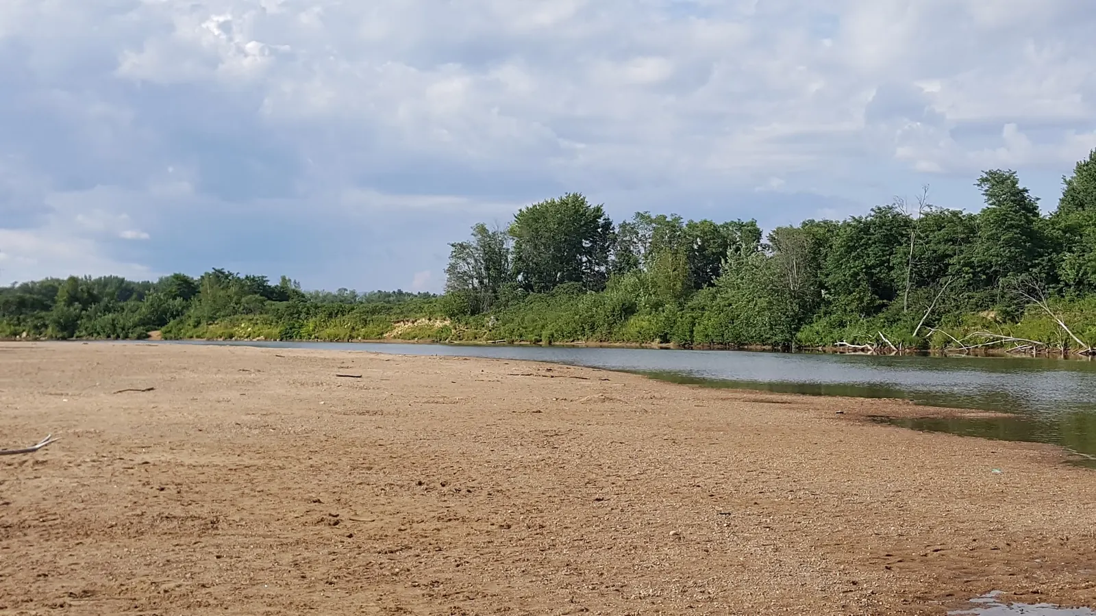
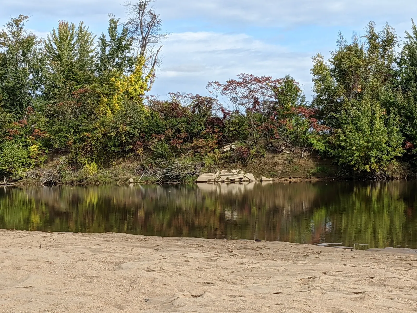
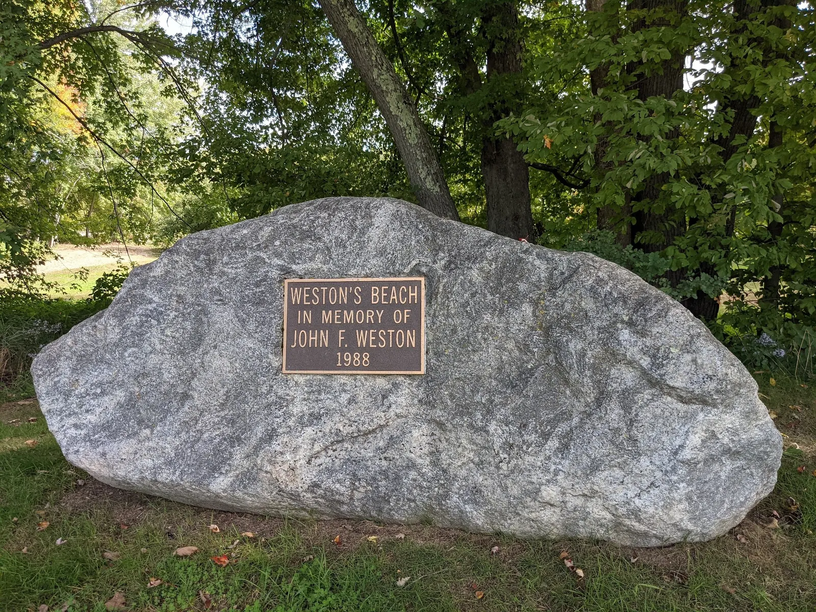
This is a desk-researched listing. A record update or map check does not confirm current swimming permission or water conditions.
Found an error? Send a correction with the location and a source. How we research listings.
The town-managed paddling guide places Weston's Beach on River Street, about half a mile north of downtown Fryeburg along ME 113. It describes free day parking, not overnight storage. The old map pin is unverified and differs substantially from the saved named beach record.
Read the town-linked ordinance and current signs. The document dates to 1983, so its presence online does not prove today's hours or staffing. Its swim-program restriction is conditional, not evidence that a program is currently running.
Do not use the old woodland detour or wade to a sandbar as arrival instructions. Saco River depth and current change, and water-quality clearance has not been verified. A viewing-only visit is appropriate when conditions or restrictions make water entry unsuitable.
Swan's Falls is a different put-in/take-out with its own parking and facilities. Those details are not amenities at Weston's Beach. For a longer paddle, arrange your return transport before launching.
Reviewed historical photos show the sandy riverbank and a named memorial marker without identifiable visitors. They illustrate the setting, not present water depth, supervision or an accessible route.
Town-managed trail guidance places the beach on River Street, reached from downtown Fryeburg by taking ME 113 north from US 302 for about half a mile, with the beach on the right. Follow current entrance and parking signs. The retained historical pin is about 4.2 miles from the saved named beach record and is not a verified entrance. Do not follow the old unmarked woodland detour or wade across the river to reach a sandbar.
The town-managed paddling guide describes hand-carry boat access and a 10 mph maximum at put-ins and take-outs. A longer paddle to Swan's Falls requires its own take-out and transport planning.
Confirm the entrance, parking arrangements, and legal access with the land manager. A map pin does not establish a public right of access. Follow posted routes and never block gates or driveways.
Check posted restrictions. The town-linked ordinance reserves the roped area for swim-program participants during that program and prohibits jumping or diving from the bridge. It does not establish today's program schedule or water-quality clearance. Public park access does not necessarily include permission to swim. Respect private property and posted restrictions.
Water conditions can change quickly. This listing does not provide a current safety or water-quality assessment. Check official alerts and avoid entering water when conditions or permission are uncertain.
Bring sturdy water shoes to protect your feet on rocks and slippery surfaces. A waterproof dry bag keeps your phone, keys, and valuables safe. Pack a quick-dry towel, sun protection, and drinking water - never drink from the natural water source.
Nearby places from saved public map data, not necessarily facilities at the swimming spot. Confirm access, hours, fees, and amenities with the operator before you drive.
Map data retrieved 2026-06-15
Beach
River St, Fryeburg, ME 04037
Outlet mall
2 Common Ct, North Conway, NH 03860
State park
68 Echo Lake Rd, North Conway, NH 03860
118-acre park with a scenic trail circling a lake plus picnicking & swimming options & a bathhouse.
Hiking area
44°04'06.5"N 71°04'18.5"W, Center Conway, NH 03813
Hiking area
North Conway, NH 03860
Hiking area
North Conway, NH 03860
Campground
03818 584 White Mountain Hwy, North Conway, NH 03860
Campground
776 White Mountain Hwy, North Conway, NH 03860
Checking nearby USGS water conditions…
The town-managed trail guide describes free day parking by the River Street beach, with no overnight parking. Follow current signs rather than treating the unverified historical pin as an entrance.
The town-linked ordinance prohibits camping on town land at Weston's Bridge and open fires. Book accommodation elsewhere and check present signs.
Current staffing and facilities have not been verified. Swan's Falls amenities belong to that separate access point, not this beach.
This listing does not recommend river crossings. Changing current and depth can make a crossing hazardous even if an older account or photo looks shallow.
The selected memorial-marker photo identifies Weston's Beach and commemorates John F. Weston. It is not proof of current access arrangements.
Three historical photos show the sandy Saco River shoreline, a quieter riverbank view and the Weston's Beach memorial marker. Camera positions, river depth and current beach conditions have not been surveyed.
Respect town land, posted restrictions and other river users. Use provided waste containers and pack out waste if they are unavailable.
Browse every listed natural swimming spot in Maine.
Find similar river destinations across the directory.
See under-the-radar places and local favorites in the same state.
Compare easier-access destinations and safer planning options.
Use this safety guide before entering any natural water.
Safety & Access Notice
This information is for general planning only and may be incomplete, outdated, or inaccurate. Access rules, closures, water levels, currents, hazards, and legal restrictions can change at any time. Always verify current rules with the land manager or official source before visiting.
You are responsible for your own safety and for following all posted signs, laws, and local regulations. Read the full disclaimer.
The town-linked ordinance prohibits camping on town land at Weston's Bridge and bans open fires. Arrange overnight accommodation elsewhere.
Loading weather data…
Safety & Access Notice
This information is for general planning only and may be incomplete, outdated, or inaccurate. Access rules, closures, water levels, currents, hazards, and legal restrictions can change at any time. Always verify current rules with the land manager or official source before visiting.
You are responsible for your own safety and for following all posted signs, laws, and local regulations. Read the full disclaimer.
Joshua Havens created Hidden Swimming Holes to make it easier for people to find — and safely visit — natural freshwater swimming destinations across the United States. He researches access conditions, water quality resources, and land management rules so you don't have to start from scratch. He holds a strong belief that good outdoor recreation information should be accurate, honest about its limitations, and freely available.
Discover other amazing natural swimming destinations across America