Smalls Falls
Waterfall
04.8 (146)
West Central Franklin, ME 04970
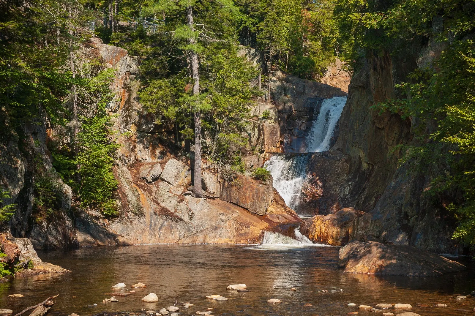
Background photo from a past visit, not current conditions. View photos and source links
Plan Smalls Falls on Route 4 near Rangeley with reviewed access information, five photos, uneven-trail context and qualified facilities and swimming guidance.
Swimming restriction
Follow current posted restrictions and closures. The local Chamber warns against dangerous jumps. No current swimming clearance or lifeguard service verified.
Location
A closer look
Photos show past visits, not current water levels or swimming conditions. Select a photo to view it larger.

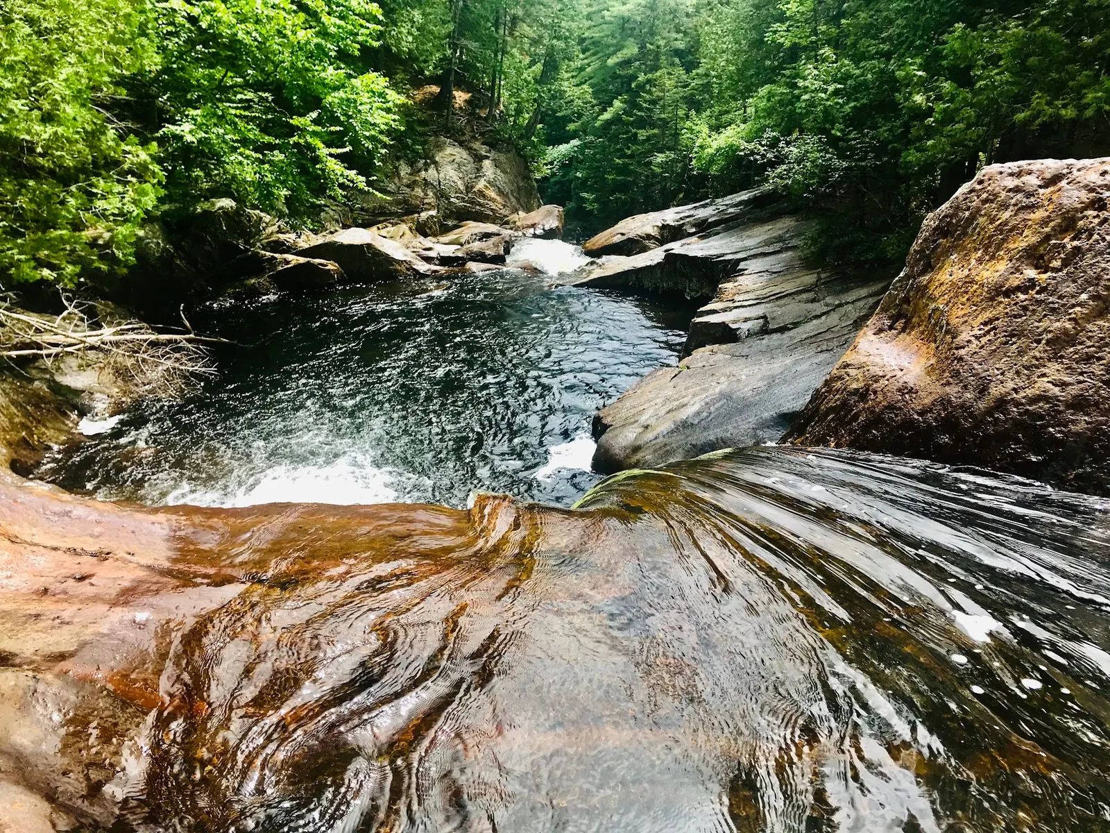
This is a desk-researched listing. A record update or map check does not confirm current swimming permission or water conditions.
Found an error? Send a correction with the location and a source. How we research listings.
This Route 4 stop combines waterfall scenery with a more demanding approach than the old all-ages description suggests. Five reviewed photographs help show both the water and the terrain.
The Heritage Trust profile identifies Maine DOT ownership and describes bedrock beside the gorge. Its generic conservation-area policies are not a substitute for this property's posted rules.
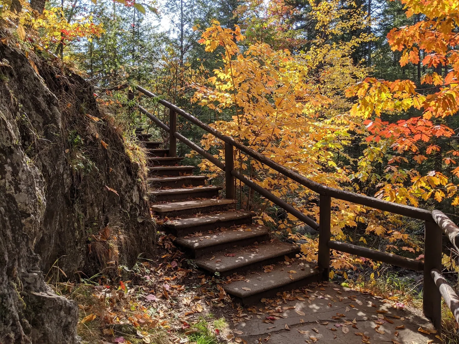
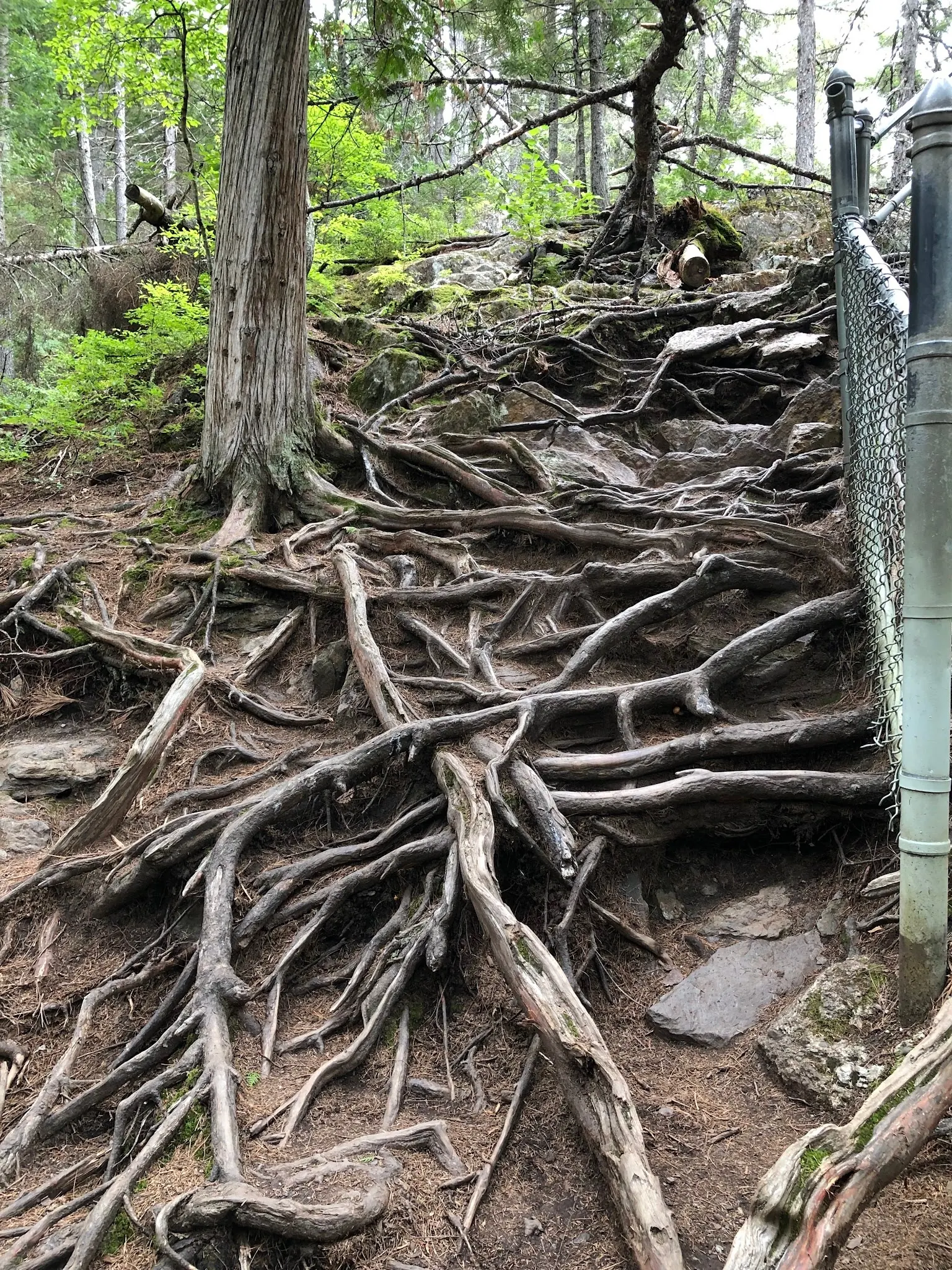
The added images show steps and exposed roots. Stay within barriers and turn back if footing does not suit your group. The local trail profile reports a footbridge, picnic facilities and restrooms, but current availability and potable water have not been confirmed.
The Chamber guide describes swimming holes and warns against jumping. That is not a real-time conditions report. Use Maine IFW's water-safety guidance when planning, and follow current notices rather than assuming a pool is safe for children.
Look for the signed Smalls Falls rest area on Maine Route 4 south of Rangeley. Use the designated entrance and parking, not an arbitrary gorge coordinate or highway shoulder. The independent trail guide describes a footbridge and streamside trail. Check signs before proceeding; the retained coordinate is not a surveyed water entry.
The Trust describes a short trail with bedrock sections beside the gorge. Reviewed photos show steps, exposed roots and fencing. Short distance does not mean step-free or suitable for every visitor.
Confirm the entrance, parking arrangements, and legal access with the land manager. A map pin does not establish a public right of access. Follow posted routes and never block gates or driveways.
Follow current posted restrictions and closures. The local Chamber warns against dangerous jumps. No current swimming clearance or lifeguard service verified. Public park access does not necessarily include permission to swim. Respect private property and posted restrictions.
Water conditions can change quickly. This listing does not provide a current safety or water-quality assessment. Check official alerts and avoid entering water when conditions or permission are uncertain.
Bring sturdy water shoes to protect your feet on rocks and slippery surfaces. A waterproof dry bag keeps your phone, keys, and valuables safe. Pack a quick-dry towel, sun protection, and drinking water - never drink from the natural water source.
Nearby places from saved public map data, not necessarily facilities at the swimming spot. Confirm access, hours, fees, and amenities with the operator before you drive.
Map data retrieved 2026-06-15
Waterfall
West Central Franklin, ME 04970
Tourist information center
6 Bridge St, Rumford, ME 04276
Campground
121 Troll Hagen Ln, Farmington, ME 04938
Public bathroom
507 Wilton Rd, Farmington, ME 04938
Visitor center
300 Glen Rd, Gorham, NH 03581
Government office
18 Elkins Ln, Augusta, ME 04333
Checking nearby USGS water conditions…
Use the signed Route 4 rest-area entrance south of Rangeley. Do not route straight to an assumed gorge entry or park on the highway shoulder.
A step-free route has not been verified. Photos show steps, roots and uneven ground; assess the approach for your group's mobility.
No. Current potable water has not been confirmed, so bring your own. Local facilities descriptions are not a check of today's service.
Do not jump or dive. Current depth and underwater hazards are not established by photographs or tourism descriptions.
The regional Heritage Trust lists the rest area as Maine DOT-owned; it is not automatically a Trust conservation area or a staffed state-park beach.
Three existing falls/pool images plus two approach-context photos. Views do not establish present depth, water quality or a universally easy route. Visitor scenes withheld.
Use existing paths, respect barriers and take litter home. Confirm current pet and fire policies rather than assuming permission from generic regional advice.
Browse every listed natural swimming spot in Maine.
Find similar falls and gorge pools destinations across the directory.
See under-the-radar places and local favorites in the same state.
Compare easier-access destinations and safer planning options.
Explore waterfall-focused swimming destinations in Maine.
Use this safety guide before entering any natural water.
Safety & Access Notice
This information is for general planning only and may be incomplete, outdated, or inaccurate. Access rules, closures, water levels, currents, hazards, and legal restrictions can change at any time. Always verify current rules with the land manager or official source before visiting.
You are responsible for your own safety and for following all posted signs, laws, and local regulations. Read the full disclaimer.
No overnight permission verified at the rest area. Book camping separately; do not transfer Trust conservation-area campfire rules to this DOT property.
Loading weather data…
Safety & Access Notice
This information is for general planning only and may be incomplete, outdated, or inaccurate. Access rules, closures, water levels, currents, hazards, and legal restrictions can change at any time. Always verify current rules with the land manager or official source before visiting.
You are responsible for your own safety and for following all posted signs, laws, and local regulations. Read the full disclaimer.
Joshua Havens created Hidden Swimming Holes to make it easier for people to find — and safely visit — natural freshwater swimming destinations across the United States. He researches access conditions, water quality resources, and land management rules so you don't have to start from scratch. He holds a strong belief that good outdoor recreation information should be accurate, honest about its limitations, and freely available.
Discover other amazing natural swimming destinations across America