Ozone Falls State Natural Area
Nature preserve
0.1 mi
4.8 (2505)
14563 TN-1, Ozone, TN 37854
Dramatic waterfall backed by a weather-carved rock amphitheater, plus a hiking trail.
Public restroom

Background: generated illustration, not a photograph of this location.
Plan Ozone Falls with rugged gorge-trail guidance, daylight access, parking directions and a reviewed gallery. Check water-entry rules before swimming.
Location
A closer look
Photos show past visits, not current water levels or swimming conditions. Select a photo to view it larger.
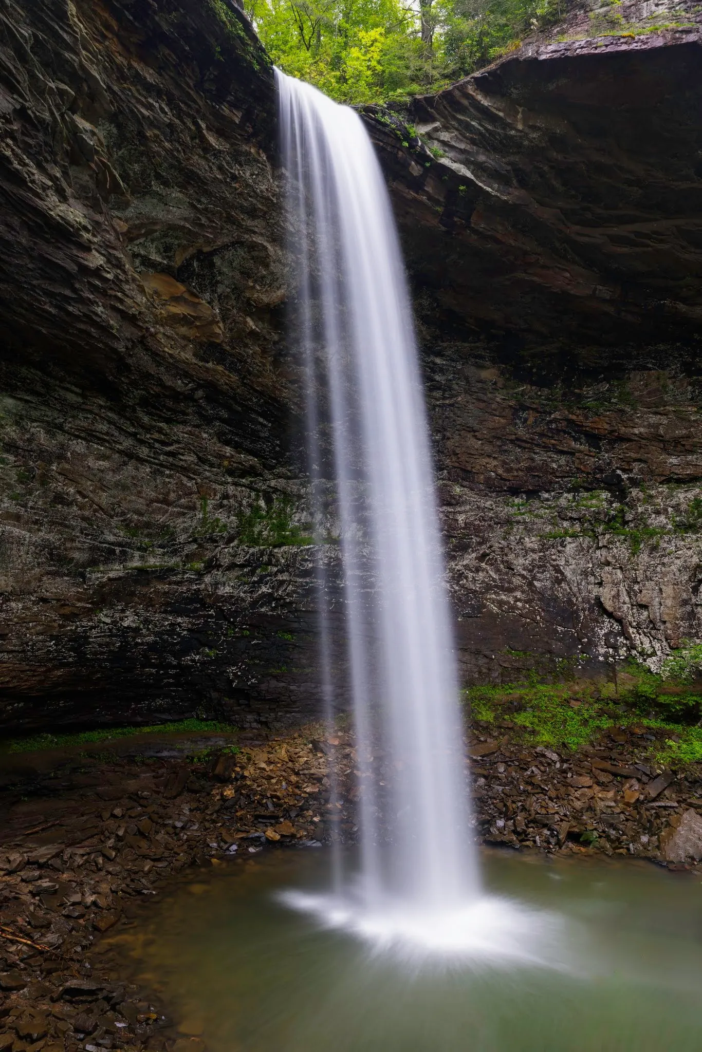
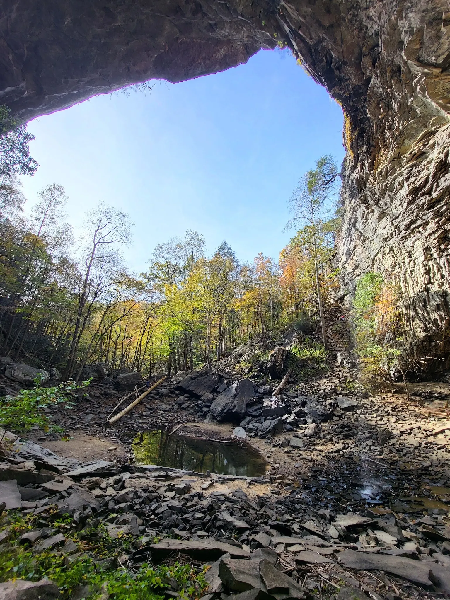
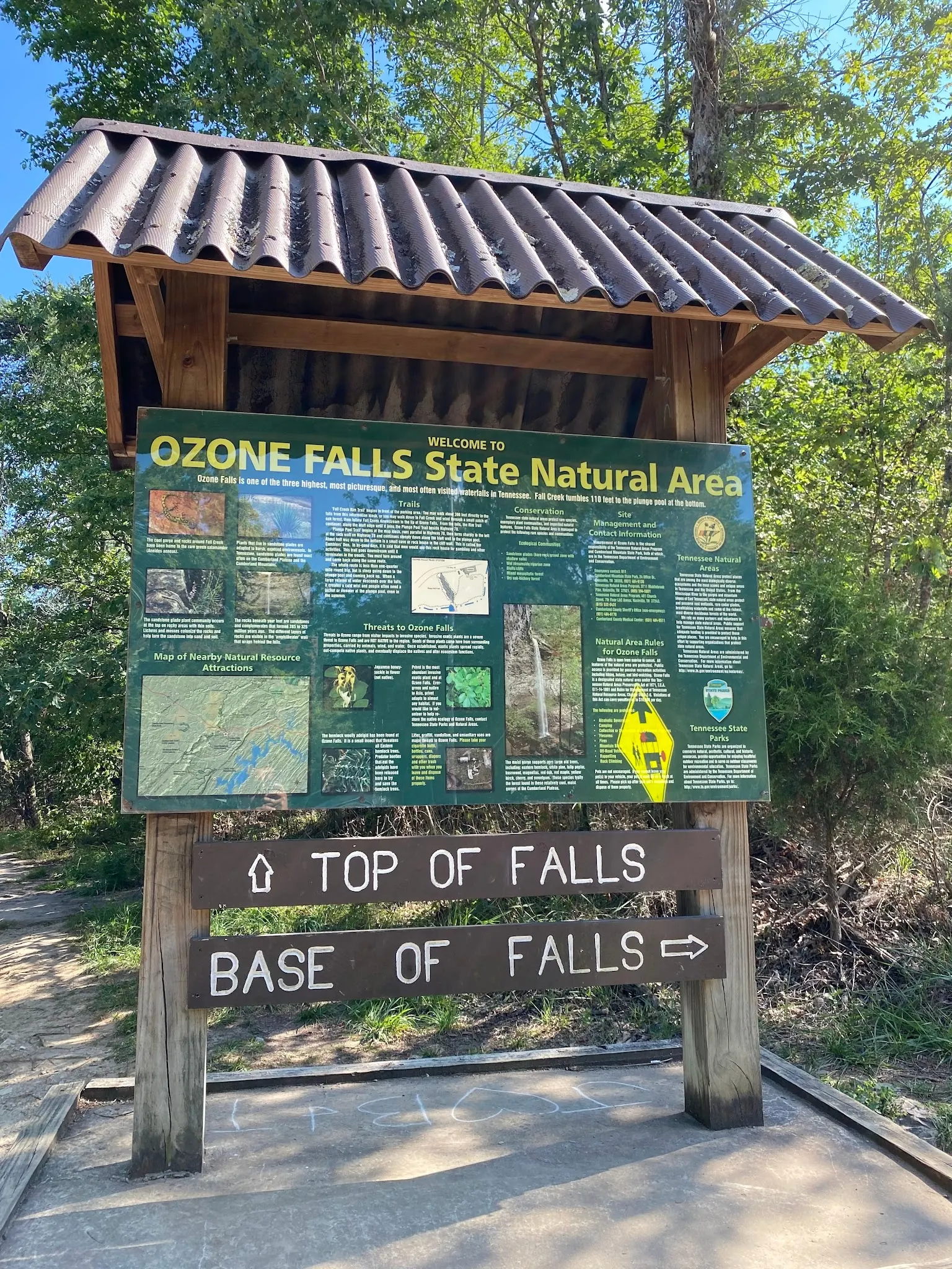
This is a desk-researched listing. A record update or map check does not confirm current swimming permission or water conditions.
Found an error? Send a correction with the location and a source. How we research listings.
Ozone Falls is a state natural area beside US70. Its gorge visit and the long Black Mountain connection are different trips, not interchangeable mileage estimates.
The TDEC profile describes a rugged three-quarter-mile trail, with an out-and-back return required. It does not label that figure a round-trip distance. The descent should not be presented as easy for all visitors. Do not jump or dive into the rock-strewn pool.
The Conservancy section guide describes 6.7 strenuous miles between Black Mountain and Ozone Falls, with its main mileages measured from Black Mountain. For the shorter visit, use the named Ozone Falls trailhead beside US70 and current signs. The map point is a published trailhead reference, not an independently verified water entry.
The Conservancy lists swimming among section features, but the state's natural-area profile does not expressly confirm pool-entry permission. Ask management and obey posted restrictions. Photographs establish neither authorization nor safe depth, and this guide removes the old encouragement to jump after testing the water.
TDEC specifies sunrise-to-sunset visits, prohibits rappelling and camping, and lists leashed dogs as allowed but not recommended. Parking and a trail are confirmed; current fees and water-side services are not. Bring the supplies needed for a self-sufficient hike. Three reviewed historical photos show the falls, amphitheater and trailhead sign. Reviewed October 9, 2026.
Use the official US70 approach from the Crab Orchard exit and signs for Ozone Falls. Use designated parking beside US70. The published trailhead reference is not a surveyed entrance or swimming pin.
Public visits are sunrise to sunset. Rappelling is prohibited. Leashed dogs are listed as allowed but not recommended.
Confirm the entrance, parking arrangements, and legal access with the land manager. A map pin does not establish a public right of access. Follow posted routes and never block gates or driveways.
Current swimming permission has not been independently confirmed for this listing. Check official rules, fees, hours, and closures before visiting. Public park access does not necessarily include permission to swim. Respect private property and posted restrictions.
Water conditions can change quickly. This listing does not provide a current safety or water-quality assessment. Check official alerts and avoid entering water when conditions or permission are uncertain.
Bring sturdy water shoes to protect your feet on rocks and slippery surfaces. A waterproof dry bag keeps your phone, keys, and valuables safe. Pack a quick-dry towel, sun protection, and drinking water - never drink from the natural water source.
Nearby places from saved public map data, not necessarily facilities at the swimming spot. Confirm access, hours, fees, and amenities with the operator before you drive.
Map data retrieved 2026-06-15
Nature preserve
14563 TN-1, Ozone, TN 37854
Dramatic waterfall backed by a weather-carved rock amphitheater, plus a hiking trail.
Waterfall
Tennessee 37854
Parking lot
I-40, Crab Orchard, TN 37723
Campground
Crab Orchard, TN 37723
Visitor center
208 Maiden St, Wartburg, TN 37887
Visitor center in a river park with natural history exhibits, a bookstore & tips from rangers.
Public bathroom
35G8+X55, Silver Point, TN 38582
Checking nearby USGS water conditions…
TDEC calls it rugged. Short distance does not make the steep, rocky descent suitable for every visitor.
That is the Conservancy's separate strenuous Black Mountain connection. Do not transfer its mileage to the shorter trailhead visit.
The Conservancy lists swimming as a section feature, but the state profile does not expressly confirm current pool access. Check management guidance and posted restrictions.
This guide does not recommend jumping or diving. A photograph or depth check cannot establish a safe jump.
TDEC lists dogs on leash as allowed but not recommended for this natural area.
No. The official natural-area profile prohibits both camping and rappelling.
The state lists sunrise-to-sunset public access, subject to current notices and posted restrictions.
No. It is the Conservancy's published trailhead reference, not surveyed parking or accessible swimming entry.
TDEC mentions Jungle Book filming but does not specify the year. Conflicting film-year claims are not repeated.
Three historical gallery views show the waterfall, rocky amphitheater and named trailhead sign. They do not establish current flow, safe footing or water permission.
Carry out everything brought in. Hunting, fishing and camping are not permitted; protect the natural area and remain on authorized routes.
Browse every listed natural swimming spot in Tennessee.
Find similar waterfall and gorge destinations across the directory.
See under-the-radar places and local favorites in the same state.
Compare easier-access destinations and safer planning options.
Explore waterfall-focused swimming destinations in Tennessee.
Use this safety guide before entering any natural water.
Safety & Access Notice
This information is for general planning only and may be incomplete, outdated, or inaccurate. Access rules, closures, water levels, currents, hazards, and legal restrictions can change at any time. Always verify current rules with the land manager or official source before visiting.
You are responsible for your own safety and for following all posted signs, laws, and local regulations. Read the full disclaimer.
Camping is not permitted in the natural area.
Loading weather data…
Safety & Access Notice
This information is for general planning only and may be incomplete, outdated, or inaccurate. Access rules, closures, water levels, currents, hazards, and legal restrictions can change at any time. Always verify current rules with the land manager or official source before visiting.
You are responsible for your own safety and for following all posted signs, laws, and local regulations. Read the full disclaimer.
Joshua Havens created Hidden Swimming Holes to make it easier for people to find — and safely visit — natural freshwater swimming destinations across the United States. He researches access conditions, water quality resources, and land management rules so you don't have to start from scratch. He holds a strong belief that good outdoor recreation information should be accurate, honest about its limitations, and freely available.
Discover other amazing natural swimming destinations across America