Mill Creek Trailhead
Hiking area
04.8 (43)
Mill Creek Trail Rd, Hamilton, MT 59840

Background: generated illustration, not a photograph of this location.
Plan the Mill Creek Falls hike near Hamilton with trailhead details, hiking-distance estimates and reviewed photos. Swimming permission and water entry are unverified.
Swimming permission unconfirmed
Trail access is not swimming authorization. Do not jump, dive or enter the waterfall's forceful flow based on photographs.
Official sources checked:
Status summarizes our reviewed record, not today's opening or safety. Check current rules, swimming boundaries and notices before visiting.
Location
A closer look
Photos show past visits, not current water levels or swimming conditions. Select a photo to view it larger.
This is a desk-researched listing. A record update or map check does not confirm current swimming permission or water conditions.
Found an error? Send a correction with the location and a source. How we research listings.
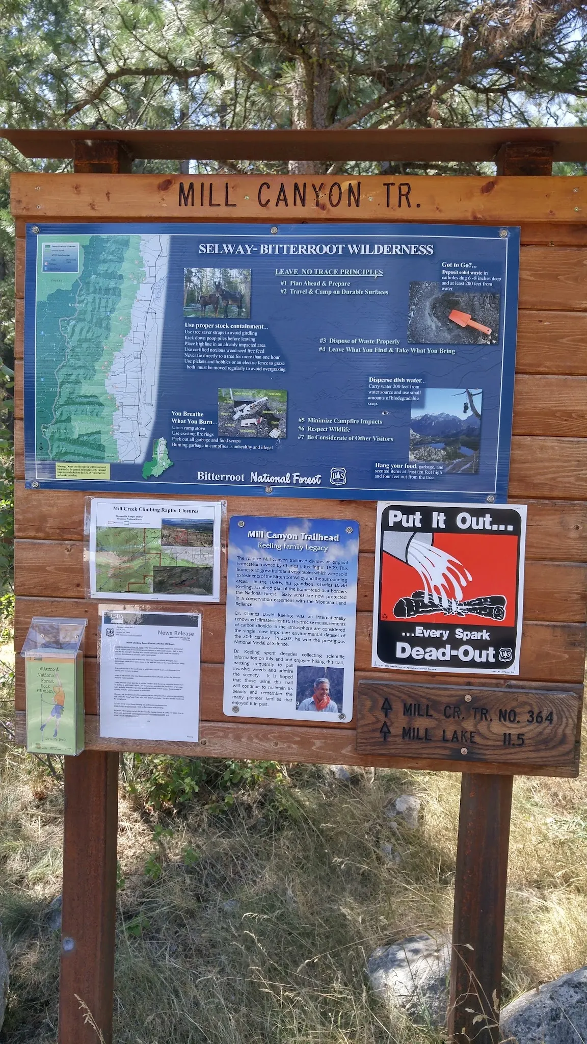
Mill Creek Falls is a hiking destination near Hamilton in the Bitterroot Mountains. The Forest Service trailhead page identifies Mill Creek Trail #364 and access toward the Selway-Bitterroot Wilderness. That supports a hiking plan, not the old listing's claim of comfortable extended summer swimming.
The independent Outbound account places the falls about three miles along the trail and lists a six-mile round trip with roughly 650 feet of gain. Treat those as planning estimates, not a surveyed entry route. Its author's suggestion that the pool might be good for swimming is speculation, not a manager's permission or a water-safety assessment.
The official site lists no trailhead fee and no overnight camping. Its restroom information conflicts internally: a vault toilet in the description, but none in the amenities section. Ask the Stevensville Ranger District at 406-777-5461 about present facilities and route conditions. Pack drinking water and arrange any overnight plan separately.
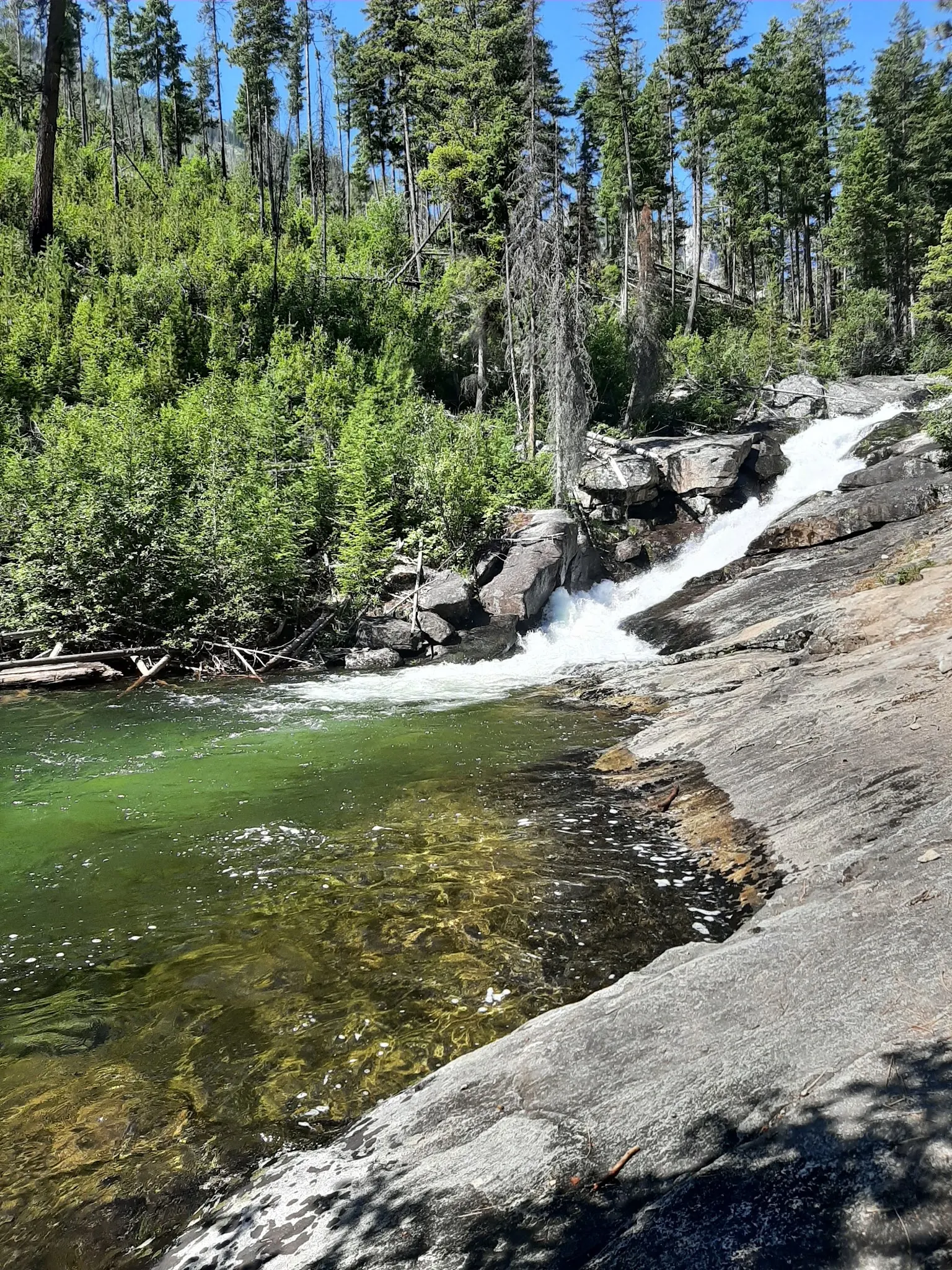
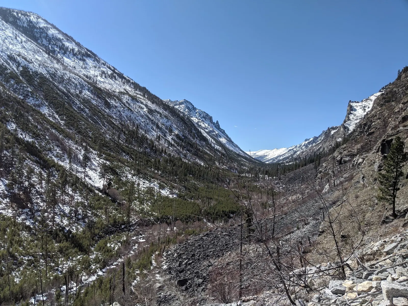
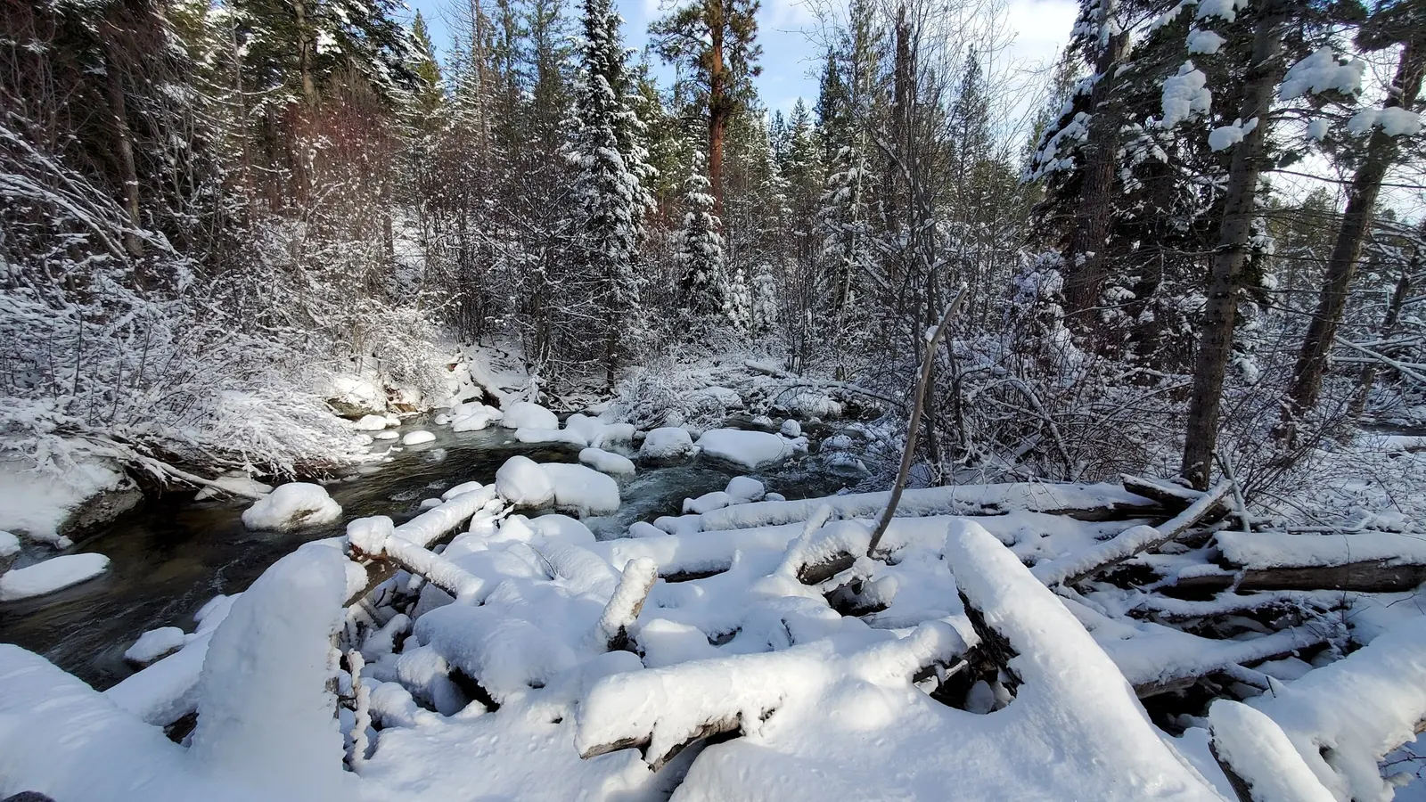
Reviewed images show canyon terrain, a cascade, winter creek scenery and a named trailhead kiosk. Seasonal photographs do not describe today's conditions, and the kiosk's longer Mill Lake mileage is not the distance to the falls. No water quality, safe depth, supervision or accessible swim entry was verified. Do not jump from rocks or approach the waterfall as though it were a maintained pool.
Use Mill Creek Trailhead in the Bitterroot National Forest, reached via Dutch Hill Road, Bowman Road and Mill Creek Trail Road. Confirm road and trail status with the Stevensville district. Do not rely on the former 45-mile-from-Missoula estimate or treat the retained historical pin as a falls pool or exact parking point.
Check road access, weather and forest restrictions before leaving. Published general trailhead availability is not a live report that the full route is passable.
Confirm the entrance, parking arrangements, and legal access with the land manager. A map pin does not establish a public right of access. Follow posted routes and never block gates or driveways.
Trail access is not swimming authorization. Do not jump, dive or enter the waterfall's forceful flow based on photographs. Public park access does not necessarily include permission to swim. Respect private property and posted restrictions.
Water conditions can change quickly. This listing does not provide a current safety or water-quality assessment. Check official alerts and avoid entering water when conditions or permission are uncertain.
Nearby places from saved public map data, not necessarily facilities at the swimming spot. Confirm access, hours, fees, and amenities with the operator before you drive.
Map data retrieved 2026-06-15
Hiking area
Mill Creek Trail Rd, Hamilton, MT 59840
Campground
Blodgett Camp Rd, Hamilton, MT 59840
Public bathroom
660 Blodgett Camp Rd, Hamilton, MT 59840
RV park
2101 N 1st St, Hamilton, MT 59840
Campground
815 US-93, Hamilton, MT 59840
Government office
712 N Main St, Darby, MT 59829
The independent Outbound account estimates about three miles each way, or six miles return. Confirm the route and current conditions before using that estimate for your party.
The Forest Service site information prohibits overnight camping at Mill Creek Trailhead. Confirm separate backcountry or campground requirements for an overnight stay.
The official page conflicts between its description and amenities section. Verify current availability before relying on a toilet.
Current swimming permission, safe depth and water quality were not verified. A photo of a pool or a visitor's suggestion is not a safety assessment; do not jump or dive.
Use Bitterroot National Forest information for this Hamilton-area route, not similarly named Mill Creek destinations in other forests or states.
Four reviewed historical images show a cascade along the Mill Creek route, a snowy canyon, a snow-covered creek and the Mill Canyon trailhead kiosk. Context photographs are not today's trail or swimming conditions.
Stay on authorized routes, pack out litter and follow current wilderness, fire and overnight-use restrictions.
Browse every listed natural swimming spot in Montana.
Compare nearby options around Missoula before you choose a route.
Find similar creek destinations across the directory.
See under-the-radar places and local favorites in the same state.
Compare easier-access destinations and safer planning options.
Explore waterfall-focused swimming destinations in Montana.
Safety & Access Notice
This information is for general planning only and may be incomplete, outdated, or inaccurate. Access rules, closures, water levels, currents, hazards, and legal restrictions can change at any time. Always verify current rules with the land manager or official source before visiting.
You are responsible for your own safety and for following all posted signs, laws, and local regulations. Read the full disclaimer.
No overnight camping at the trailhead under the published site information. Confirm applicable backcountry or separate campground rules before an overnight trip.
Loading weather data…
Safety & Access Notice
This information is for general planning only and may be incomplete, outdated, or inaccurate. Access rules, closures, water levels, currents, hazards, and legal restrictions can change at any time. Always verify current rules with the land manager or official source before visiting.
You are responsible for your own safety and for following all posted signs, laws, and local regulations. Read the full disclaimer.
Joshua Havens created Hidden Swimming Holes to make it easier for people to find — and safely visit — natural freshwater swimming destinations across the United States. He researches access conditions, water quality resources, and land management rules so you don't have to start from scratch. He holds a strong belief that good outdoor recreation information should be accurate, honest about its limitations, and freely available.
Discover other amazing natural swimming destinations across America