Houston Brook Falls
Hiking area
4.8 (184)
Bingham, ME 04920

Background: generated illustration, not a photograph of this location.
Plan Houston Brook Falls near Bingham with signed trailhead guidance, parking caveats, exposed-root and high-water hazards, practical FAQs and reviewed photos.
Swimming permission unconfirmed
Confirm current access and water-entry permission on site or with the responsible landowner before entering. Visitor accounts of swimming do not establish a managed bathing area. Do not jump, dive or enter turbulent water near the cascade.
Location
A closer look
Photos show past visits, not current water levels or swimming conditions. Select a photo to view it larger.
This is a desk-researched listing. A record update or map check does not confirm current swimming permission or water conditions.
Found an error? Send a correction with the location and a source. How we research listings.
The regional visitor guide describes crossing the Kennebec River from Bingham on Route 16 and turning north on Ridge Road toward signed falls parking. The scenic-byway guide uses Pleasant Ridge Road and the transfer station as its reference. Follow current signs and parking rules; do not obstruct a working gate. The old historical pin has not been verified as a trailhead.
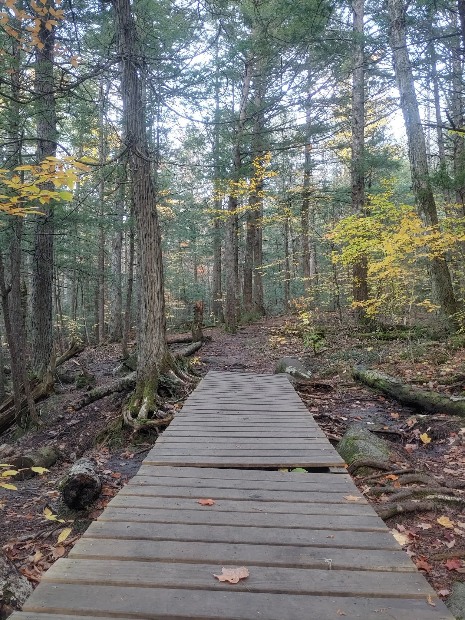
The original Northern Outdoors hiking account notes exposed roots and slippery rocks. Published distance estimates differ, so this listing does not promise a precise walk time. The gallery boardwalk photo shows one historical section, not a continuous accessible route.
Visitor guides describe swimming, but this review did not establish current landowner permission, a managed beach, lifeguard services or water-quality clearance. Read present signs before entering and choose a viewing-only visit if permission is unclear. High water can make walking and swimming dangerous.
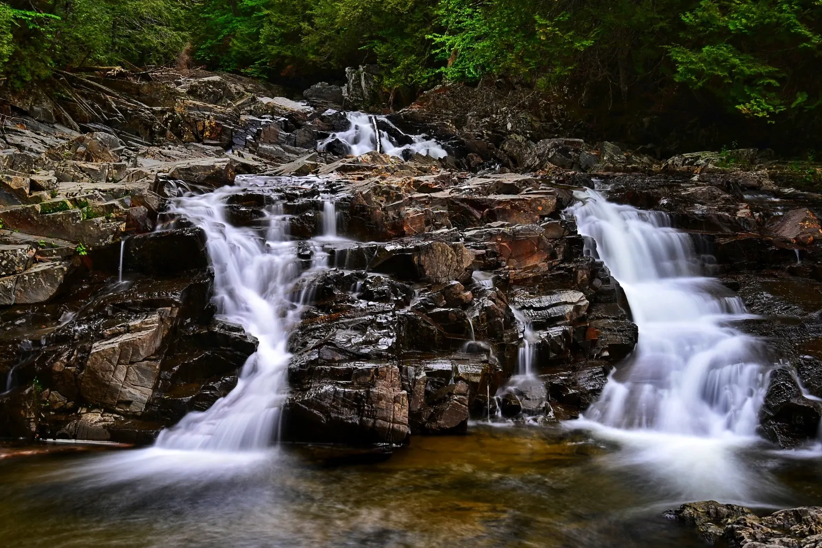
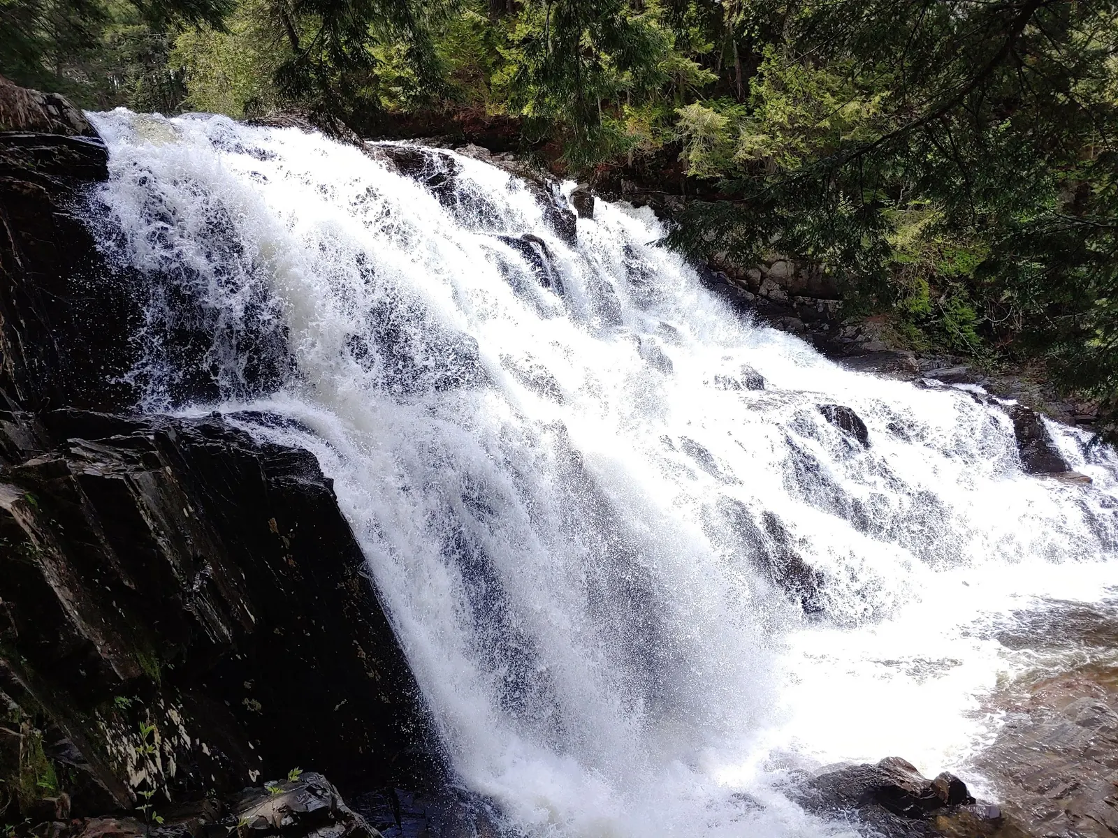
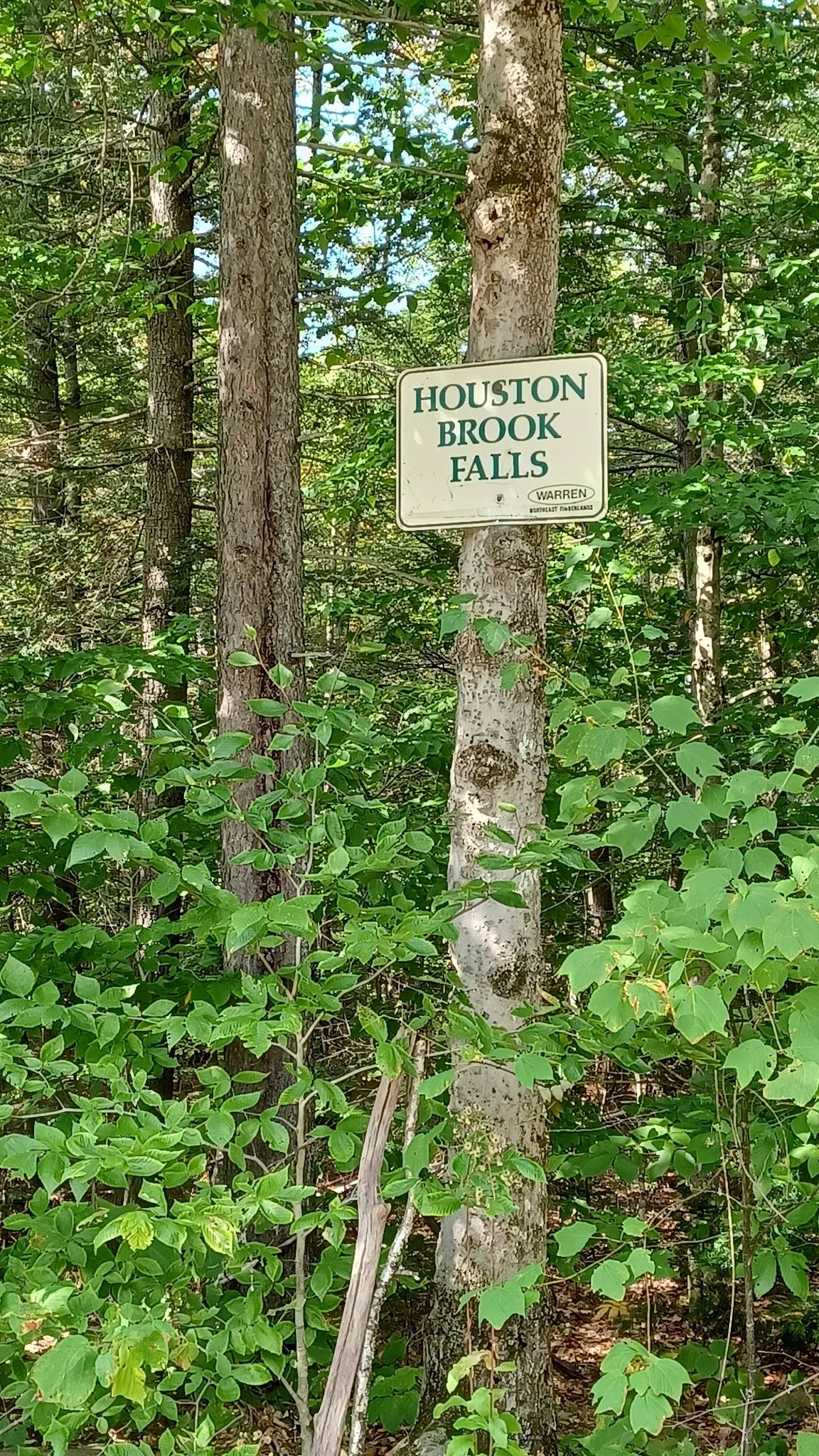
The selected waterfall, boardwalk and named-sign photos provide historical context. A stronger-flow view illustrates why conditions matter; it is not a measurement of today's flow. Stay on permitted paths and do not climb wet ledges to recreate photographed angles.
Regional visitor guidance starts from US 201 in Bingham, crosses the Kennebec River on Route 16/Bridge Street and turns north on Ridge Road. It describes about 3.5 miles to signed falls parking on the right. The scenic-byway guide calls the road Pleasant Ridge Road and references the transfer station. Use current signs to resolve the approach; do not block the transfer-station gate or invent roadside spaces. The retained historical pin is about 2.8 miles from the saved named falls record and is not a verified trailhead.
Guides describe a signed short trail, but their distance estimates differ. Verify the present approach and parking rules rather than treating an exact walking time or mileage as guaranteed.
Confirm the entrance, parking arrangements, and legal access with the land manager. A map pin does not establish a public right of access. Follow posted routes and never block gates or driveways.
Confirm current access and water-entry permission on site or with the responsible landowner before entering. Visitor accounts of swimming do not establish a managed bathing area. Do not jump, dive or enter turbulent water near the cascade. Public park access does not necessarily include permission to swim. Respect private property and posted restrictions.
Water conditions can change quickly. This listing does not provide a current safety or water-quality assessment. Check official alerts and avoid entering water when conditions or permission are uncertain.
Nearby places from saved public map data, not necessarily facilities at the swimming spot. Confirm access, hours, fees, and amenities with the operator before you drive.
Map data retrieved 2026-06-15
Hiking area
Bingham, ME 04920
Park
Parking lot, 503 Lake Moxie Rd, West Forks, ME 04985
Hiking & snow-shoeing through a landscape of woods & bogs, plus swims under a 90-ft high waterfall.
Campground
327 Canaan Rd, Skowhegan, ME 04976
Campground
18 Cabin Rd, Canaan, ME 04924
Campground
942 Waterville Rd, Skowhegan, ME 04976
Public bathroom
Los Angeles, CA 90047
Public bathroom
Inglewood, CA 90302
Public bathroom
374 Madison Ave, Skowhegan, ME 04976
Visitor guides describe Ridge or Pleasant Ridge Road near the transfer station after crossing the Kennebec River from Bingham on Route 16. Use current falls signs and permitted parking, not the unverified historical map pin.
That has not been established. A boardwalk photo does not prove a continuous accessible route, and the original hiking account notes exposed roots and slippery rocks.
Current permission has not been verified. Visitor guides describing swims are not land-manager rules or water-quality clearance. Check posted restrictions before water entry.
No current lifeguard, restroom or changing service has been verified. Plan drinking water and restroom stops separately.
High water can make the rocks and approach hazardous. Avoid water entry and do not approach wet waterfall edges; turn back if the route is unsafe.
Regional visitor guides place Houston Brook Falls in the Bingham and Pleasant Ridge area. Road naming and trail-distance descriptions differ, so current signs matter more than a rigid old itinerary.
Four historical images show the cascade, a stronger-flow waterfall view, a woodland boardwalk and the Houston Brook Falls sign. They do not verify current trail maintenance, water safety or permission to reproduce a camera position.
Respect landowner signs, keep gates and working access clear, stay on permitted paths and pack out waste. A named trail sign is not blanket permission for camping or water entry.
Browse every listed natural swimming spot in Maine.
Find similar waterfalls destinations across the directory.
See under-the-radar places and local favorites in the same state.
Compare easier-access destinations and safer planning options.
Explore waterfall-focused swimming destinations in Maine.
Use this safety guide before entering any natural water.
Safety & Access Notice
This information is for general planning only and may be incomplete, outdated, or inaccurate. Access rules, closures, water levels, currents, hazards, and legal restrictions can change at any time. Always verify current rules with the land manager or official source before visiting.
You are responsible for your own safety and for following all posted signs, laws, and local regulations. Read the full disclaimer.
No campsite or overnight permission established at the falls. Arrange lodging separately and do not camp at the trailhead.
Loading weather data…
Safety & Access Notice
This information is for general planning only and may be incomplete, outdated, or inaccurate. Access rules, closures, water levels, currents, hazards, and legal restrictions can change at any time. Always verify current rules with the land manager or official source before visiting.
You are responsible for your own safety and for following all posted signs, laws, and local regulations. Read the full disclaimer.
Joshua Havens created Hidden Swimming Holes to make it easier for people to find — and safely visit — natural freshwater swimming destinations across the United States. He researches access conditions, water quality resources, and land management rules so you don't have to start from scratch. He holds a strong belief that good outdoor recreation information should be accurate, honest about its limitations, and freely available.
Discover other amazing natural swimming destinations across America