Swimming Hole Green Ridge State Forest
Park
4.7 (22)
15 Mile Creek Rd SE, Flintstone, MD 21530

Background: generated illustration, not a photograph of this location.
Plan Green Ridge with current camping fees, headquarters directions, flood-related road checks and creek photos. Confirm permission for your intended water access.
Status summarizes our reviewed record, not today's opening or safety. Check current rules, swimming boundaries and notices before visiting.
Location
A closer look
Photos show past visits, not current water levels or swimming conditions. Select a photo to view it larger.
This is a desk-researched listing. A record update or map check does not confirm current swimming permission or water conditions.
Found an error? Send a correction with the location and a source. How we research listings.
The archived listing combined multiple informal water spots without complete directions. Today's official guidance supports forest recreation, but it does not establish swimming permission for each old creek reference. Call 301-478-3124 about your intended reach before water entry.
The DNR forest profile gives 28700 Headquarters Drive NE, Flintstone, reached from I-68 Exit 64 and M.V. Smith Road. Its office hours are 7 a.m. to 3 p.m. daily, not swimming hours. Flood damage may affect roads and campsites, so check your route before leaving. The old town point is withheld; headquarters directions are not a verified swimming approach.
The current recreation guide lists standard sites at $10 per night and group sites at $20. Forest campsites have tables and fire rings, correcting the old price and facilities description. Obtain required camping permits, confirm availability and bring cash or check for the headquarters kiosk. Roads can require four-wheel drive depending on conditions. Pine Lick is a six-mile moderate trail and Long Pond a nine-mile difficult trail; neither length describes a confirmed swim approach. Keep dogs leashed, and do not import firewood.
The federal Fifteen Mile Creek campground is near Little Orleans at towpath mile 140, beside the creek's Potomac confluence. Its camping rules, toilets and seasonal hand-pump water belong to that facility, not every forest creek spot. Confirm federal camping arrangements separately. The DNR Potomac paddling route from Bond's Landing is also not a creek-swimming itinerary. River currents can be hazardous; use appropriate paddling equipment and current conditions information.
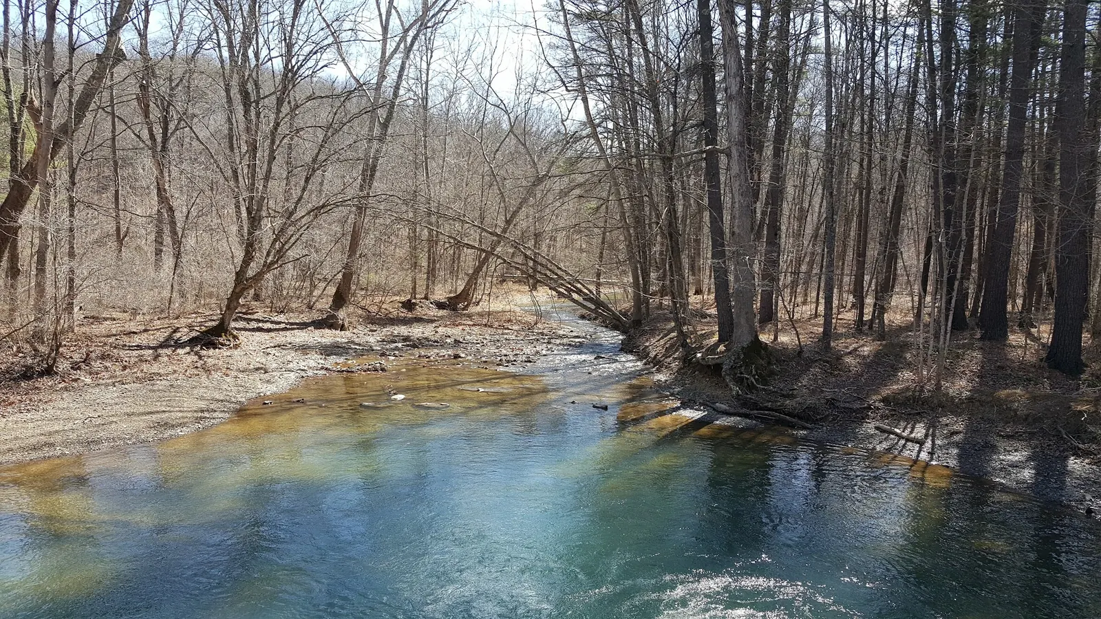
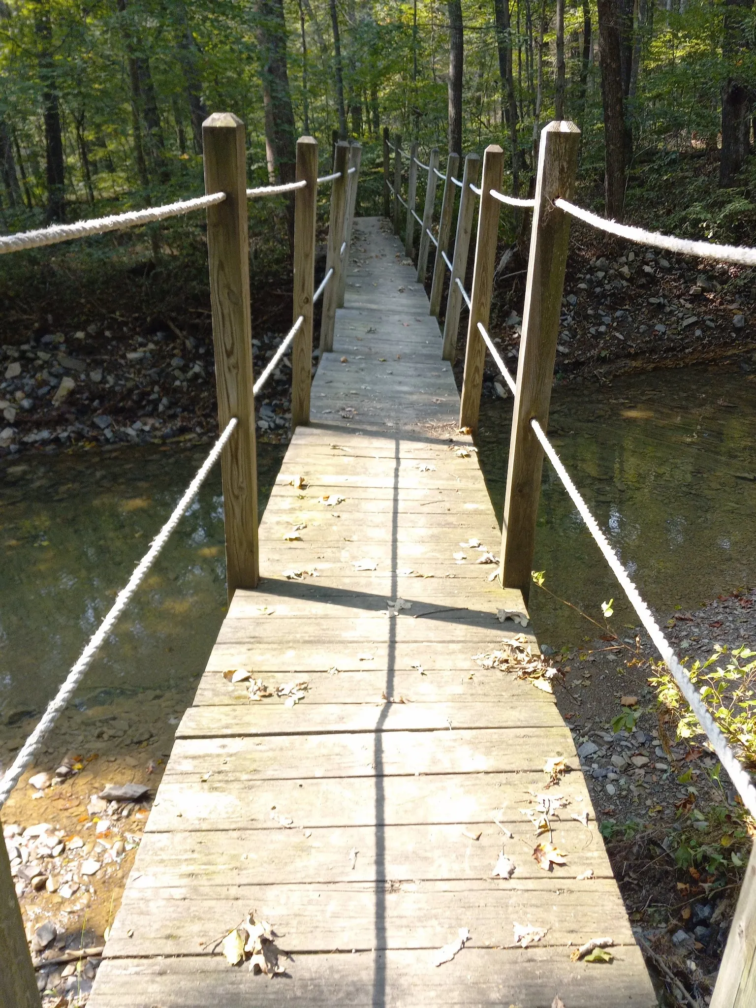
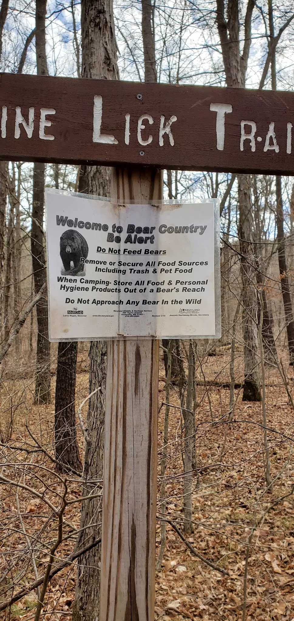
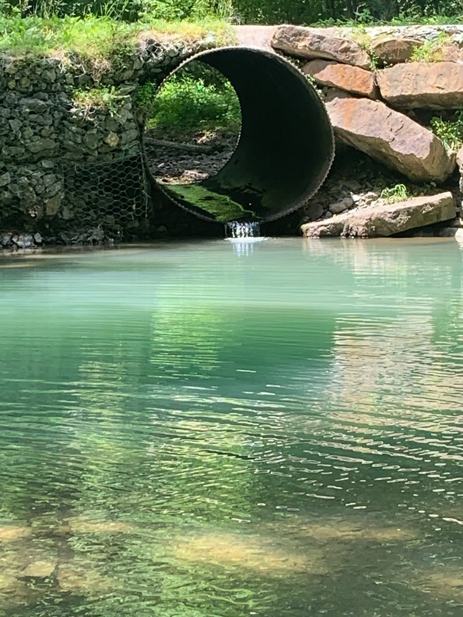
Four historical collection photos show creek scenery, a narrow wooden footbridge, a Pine Lick trail sign and a culvert. The named trail sign corroborates forest context, but no image independently fixes a camera location or proves current permission, safe depth or clean water. Do not jump from bridges, use rope swings or enter culverts. Ask about the precise route and accessibility you need rather than transferring an accessible-overlook claim to the creek. Reviewed October 9, 2026.
For forest headquarters, DNR directs I-68 Exit 64 onto M.V. Smith Road, then Headquarters Drive immediately on the right. Headquarters is 28700 Headquarters Drive NE, Flintstone. Obtain current forest maps and route-specific road advice; this is not an exact creek-swimming approach.
DNR warns some roads and campsites may be temporarily closed after flooding. Call headquarters before travel. Office hours are 7 a.m. to 3 p.m. daily, not verified water-access hours. Dogs must remain leashed.
Confirm the entrance, parking arrangements, and legal access with the land manager. A map pin does not establish a public right of access. Follow posted routes and never block gates or driveways.
Current swimming permission has not been independently confirmed for this listing. Check official rules, fees, hours, and closures before visiting. Public park access does not necessarily include permission to swim. Respect private property and posted restrictions.
Water conditions can change quickly. This listing does not provide a current safety or water-quality assessment. Check official alerts and avoid entering water when conditions or permission are uncertain.
Nearby places from saved public map data, not necessarily facilities at the swimming spot. Confirm access, hours, fees, and amenities with the operator before you drive.
Map data retrieved 2026-06-15
Park
15 Mile Creek Rd SE, Flintstone, MD 21530
Hiking area
Old Hancock Rd NE, Cumberland, MD 21502
Campground
31661 Green Forest Dr, Little Orleans, MD 21766
State park
12900 Lake Shore Dr, Flintstone, MD 21530
Recreation area has a lake with a sandy beach, hiking trails & a popular campground with facilities.
Hiking area
La Vale, MD 21502
Campground
Campground 1, 10410B Hillcrest Drive, 1 Elizabeth St Campground 2, Cumberland, MD 21502
Campground
10408 Hillcrest Dr, Cumberland, MD 21502
Public bathroom
Marine Dr NW, Boardman, OR 97818
That was not established. Confirm the exact reach with forest headquarters; unresolved access is not a blanket prohibition.
Use the official headquarters at 28700 Headquarters Drive NE, Flintstone, and current maps. I-68 Exit 64 leads to M.V. Smith Road and Headquarters Drive.
The current recreation page lists $10 nightly for standard sites and $20 for group sites. Obtain required permits and confirm current availability.
Do not assume so. DNR warns roads and campsites may be affected by flooding. Ask headquarters about your exact route and vehicle needs.
No. The federal campground is near Little Orleans at the Potomac confluence, with separate arrangements and facilities.
No. The published 7 a.m. to 3 p.m. hours refer to the headquarters office.
That was not verified. DNR's accessible Scenic Overlook Trail does not establish an accessible creek entry.
DNR permits pets throughout the forest on a leash at all times. Confirm any route-specific restrictions.
Green Ridge is a western Maryland forest in the Ridge and Valley region; use operator interpretation for historical detail.
Four historical collection views show a leafless-season creek, narrow wooden footbridge, Pine Lick sign with bear guidance and culvert context. Culvert imagery is not a recommended water entry.
Carry out litter, keep pets leashed and follow firewood restrictions. Do not transport firewood into the forest from outside.
Browse every listed natural swimming spot in Maryland.
See under-the-radar places and local favorites in the same state.
Compare easier-access destinations and safer planning options.
Use this safety guide before entering any natural water.
Safety & Access Notice
This information is for general planning only and may be incomplete, outdated, or inaccurate. Access rules, closures, water levels, currents, hazards, and legal restrictions can change at any time. Always verify current rules with the land manager or official source before visiting.
You are responsible for your own safety and for following all posted signs, laws, and local regulations. Read the full disclaimer.
Around 100 primitive forest sites and three group sites are listed by the current recreation page. Obtain required permits and check site availability and flood closures. Federal C&O campground arrangements are separate.
Loading weather data…
Safety & Access Notice
This information is for general planning only and may be incomplete, outdated, or inaccurate. Access rules, closures, water levels, currents, hazards, and legal restrictions can change at any time. Always verify current rules with the land manager or official source before visiting.
You are responsible for your own safety and for following all posted signs, laws, and local regulations. Read the full disclaimer.
Joshua Havens created Hidden Swimming Holes to make it easier for people to find — and safely visit — natural freshwater swimming destinations across the United States. He researches access conditions, water quality resources, and land management rules so you don't have to start from scratch. He holds a strong belief that good outdoor recreation information should be accurate, honest about its limitations, and freely available.
Discover other amazing natural swimming destinations across America