North Chickamauga Creek Gorge State Park
State park
0.2 mi
4.5 (14)
345 Montlake Rd, Soddy-Daisy, TN 37379

Background: generated illustration, not a photograph of this location.
North Chickamauga Blue Hole access is temporarily closed for construction. Check the park's reopening notice before using the historical Montlake Road approach.
Swimming temporarily closed
Do not use the closed Montlake Road entrance or Blue Hole access. Check the park's current reopening and creek-status notices before planning any later swim. Do not jump, dive or use rope swings.
Location
A closer look
Photos show past visits, not current water levels or swimming conditions. Select a photo to view it larger.
This is a desk-researched listing. A record update or map check does not confirm current swimming permission or water conditions.
Found an error? Send a correction with the location and a source. How we research listings.
The state-operated reservation notice lists a construction closure affecting the Montlake Road entrance, trailhead and Blue Hole access beginning in March 2026, with an approximate one-year duration. Chattanooga tourism gives March 23, 2026 as the start. No confirmed reopening date was established in this review.
The old Montlake Road directions refer to North Chickamauga Creek Gorge Blue Hole. They do not describe South Chickamauga Creek or Chickamauga Lake. The historical route is not usable guidance during the closure.
Check the park safety page for the latest notice before travel. Do not cross barriers or assume another trailhead permits access to the closed Blue Hole. Camping availability is a separate question.
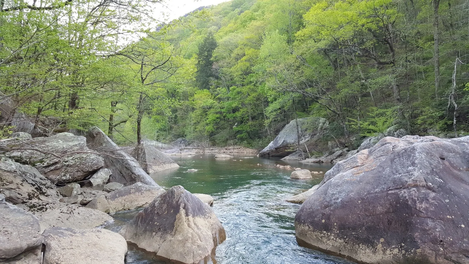
The reviewed photograph shows water among large boulders. It is not proof of open access, present water depth or water quality. Following reopening, any visit still depends on the park's current water-status restrictions.
This listing's historical Montlake Road directions identify the North Chickamauga Creek Gorge Blue Hole, not South Chickamauga Creek or Chickamauga Lake. The Montlake Road entrance and Blue Hole access are temporarily closed for construction. Do not follow the old approach or seek a bypass. The retained map point is not a verified entrance; check the official park reopening notice before travel.
State-operated booking information says the improvement closure begins in March 2026 and lasts approximately one year. Chattanooga tourism identifies March 23, 2026 as the start. This is an estimate, not a guaranteed March 2027 reopening.
Confirm the entrance, parking arrangements, and legal access with the land manager. A map pin does not establish a public right of access. Follow posted routes and never block gates or driveways.
Do not use the closed Montlake Road entrance or Blue Hole access. Check the park's current reopening and creek-status notices before planning any later swim. Do not jump, dive or use rope swings. Public park access does not necessarily include permission to swim. Respect private property and posted restrictions.
Water conditions can change quickly. This listing does not provide a current safety or water-quality assessment. Check official alerts and avoid entering water when conditions or permission are uncertain.
Nearby places from saved public map data, not necessarily facilities at the swimming spot. Confirm access, hours, fees, and amenities with the operator before you drive.
Map data retrieved 2026-06-15
State park
345 Montlake Rd, Soddy-Daisy, TN 37379
Parking lot
8399 Gulf View Dr, Soddy-Daisy, TN 37379
Hiking area
Co Hwy 1126, Soddy-Daisy, TN 37379
Public library
9619 Dayton Pike Ste C, Soddy-Daisy, TN 37379
RV park
171 Ducktown St, Soddy-Daisy, TN 37379
Campground
2525 Igou Ferry Rd, Soddy-Daisy, TN 37379
Hiking area
5058 Gann Store Rd, Hixson, TN 37343
RV park
1845 Lee Pike, Soddy-Daisy, TN 37379
The checked notices describe a temporary construction closure affecting Montlake Road and Blue Hole access. Check the park for a confirmed reopening before travel.
The state booking notice estimates approximately one year from March 2026. That is not a guaranteed reopening date.
No. The historical Montlake Road approach identifies North Chickamauga Creek Gorge Blue Hole, not South Chickamauga Creek or Chickamauga Lake.
Do not seek a bypass. A camping or hiking access notice does not authorize entry into the closed Blue Hole area.
The historical directions establish the Montlake Road Blue Hole destination on North Chickamauga Creek, separate from South Chickamauga Creek and Chickamauga Lake.
One reviewed conventional photo shows the boulder-lined creek before this review. It does not establish open access or current water conditions. Two spherical panorama frames were withheld as distorted gallery views.
Do not bypass barriers or park on roadsides to reach closed areas. Follow current park instructions.
Browse every listed natural swimming spot in Tennessee.
Compare nearby options around Chattanooga before you choose a route.
Find similar creeks destinations across the directory.
See under-the-radar places and local favorites in the same state.
Compare easier-access destinations and safer planning options.
Use this safety guide before entering any natural water.
Safety & Access Notice
This information is for general planning only and may be incomplete, outdated, or inaccurate. Access rules, closures, water levels, currents, hazards, and legal restrictions can change at any time. Always verify current rules with the land manager or official source before visiting.
You are responsible for your own safety and for following all posted signs, laws, and local regulations. Read the full disclaimer.
Camping rules and availability are separate from Blue Hole access. The indexed booking notice mentions another trailhead, but current access there is not independently verified and is not offered as a bypass.
Loading weather data…
Safety & Access Notice
This information is for general planning only and may be incomplete, outdated, or inaccurate. Access rules, closures, water levels, currents, hazards, and legal restrictions can change at any time. Always verify current rules with the land manager or official source before visiting.
You are responsible for your own safety and for following all posted signs, laws, and local regulations. Read the full disclaimer.
Joshua Havens created Hidden Swimming Holes to make it easier for people to find — and safely visit — natural freshwater swimming destinations across the United States. He researches access conditions, water quality resources, and land management rules so you don't have to start from scratch. He holds a strong belief that good outdoor recreation information should be accurate, honest about its limitations, and freely available.
Discover other amazing natural swimming destinations across America