Kent Square Parking Garage
Parking garage
3.7 (43)
207 Draper Rd SW, Blacksburg, VA 24060

Background: generated illustration, not a photograph of this location.
Plan the four-mile Cascades hike near Pembroke with current parking fees, daylight access, facilities, trail restrictions and reviewed waterfall photos.
Swimming permission unconfirmed
Do not assume older tourism swimming recommendations override current orders. The designated-site order prohibits swimming outside designated swimming areas in developed recreation areas; no designated waterfall swim zone was verified here. Confirm permitted water access with the ranger district. Climbing around or under the waterfall is restricted to the designated trail.
Official sources checked:
Location
A closer look
Photos show past visits, not current water levels or swimming conditions. Select a photo to view it larger.
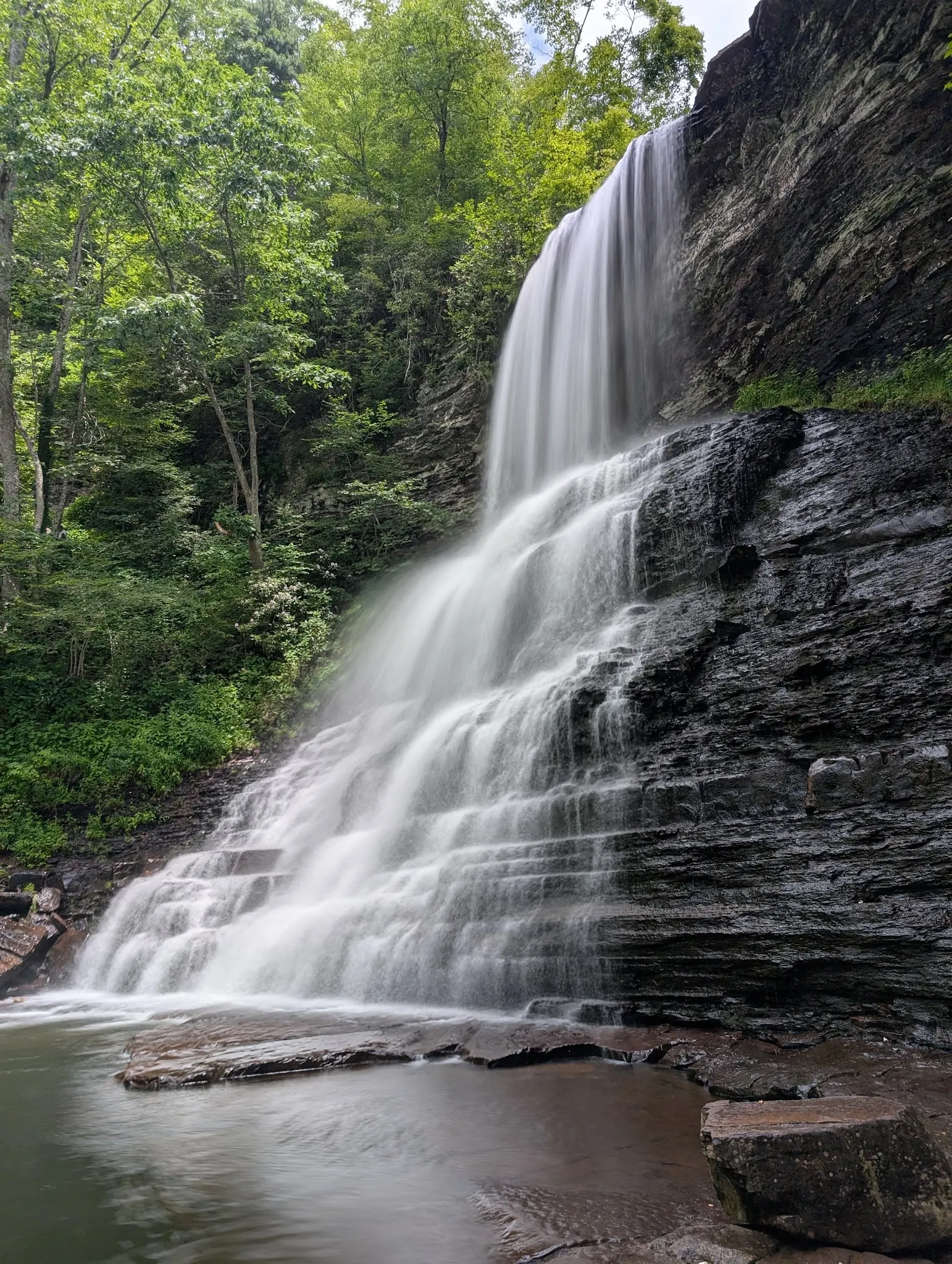
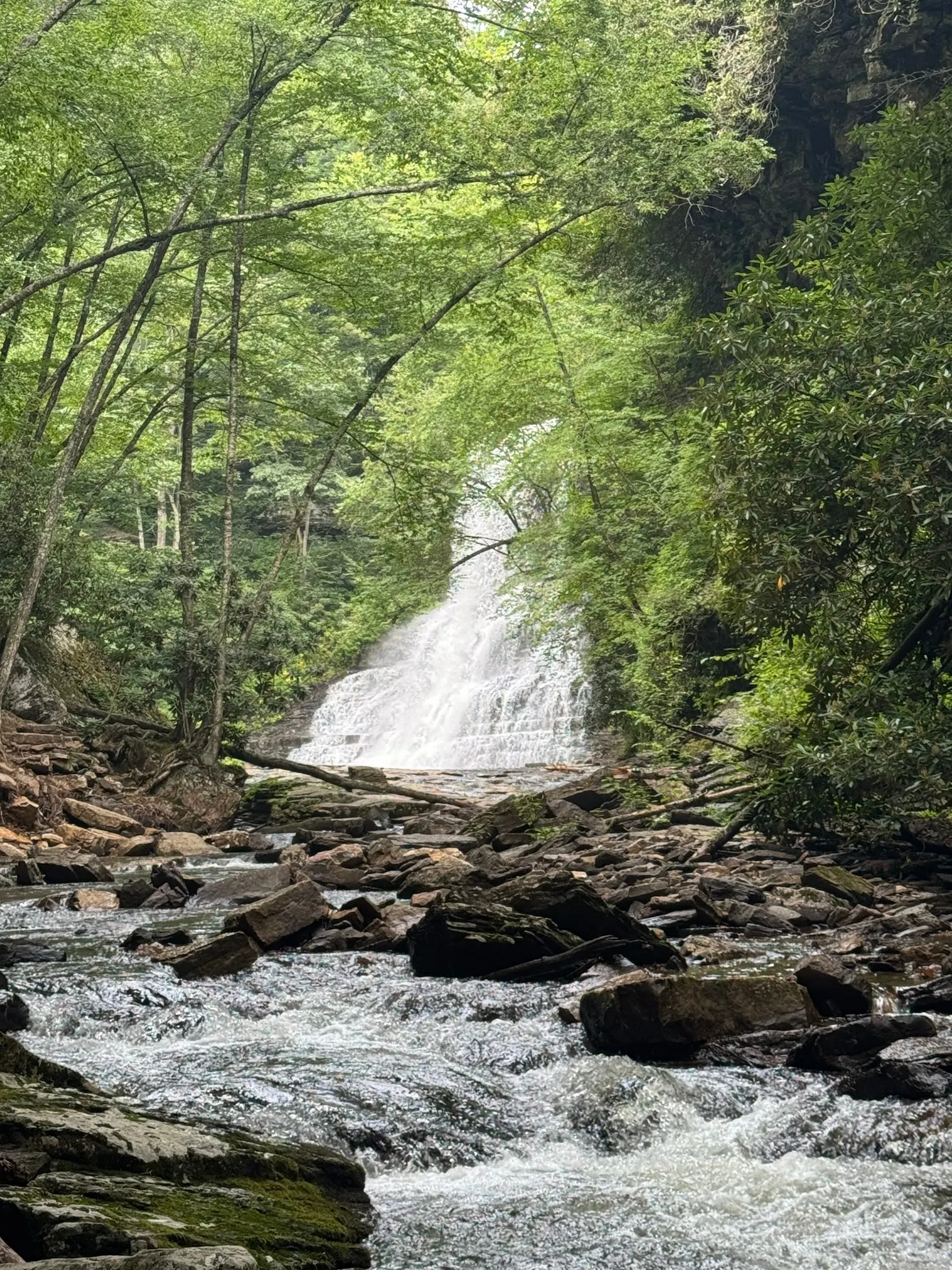
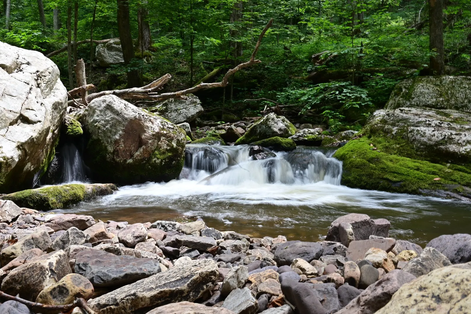
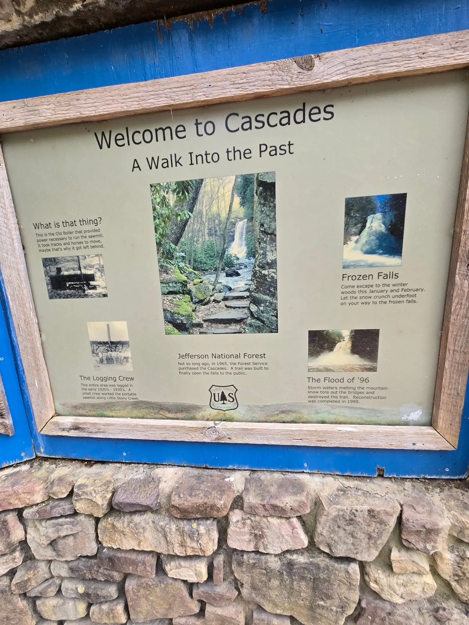
This is a desk-researched listing. A record update or map check does not confirm current swimming permission or water conditions.
Found an error? Send a correction with the location and a source. How we research listings.
The Cascades trail follows Little Stony Creek through a wooded gorge to the main waterfall. The Forest Service profile places the falls two miles from parking, making this a four-mile round-trip outing. The gallery shows the waterfall and creek setting, not a current conditions report.
Day use costs $3 per vehicle per day. Accepted passes include the America the Beautiful Interagency Pass series and the forest Seasonal Day Use Pass, not Virginia State Parks passes. Toilets, drinking water and picnic tables are listed at the day-use site. Accessible restrooms do not imply an accessible hike to the falls.
Follow US460 to Pembroke and SR623/Cascades Drive about four miles to parking. Plan enough daylight for both directions. The Cascades-specific order restricts night access, climbing around the falls, camping, wheeled trail use and alcohol. Use designated paths rather than climbing cliff faces for a photo.
Older tourism descriptions mention swimming, but the operator profile does not identify a designated waterfall swimming zone. The designated recreation-site order restricts swimming outside designated areas. Confirm permitted water access with the ranger district; do not treat a photo, old recommendation or paid parking receipt as permission or water-quality clearance.
The Virginia Tourism trail listing supplies the Pembroke street address and trailhead information. Our older coordinates are retained but unverified. Use official directions, not the historical pin, to plan parking.
From Blacksburg follow US460 west to Pembroke, then SR623/Cascades Drive about four miles to the Cascades parking lot. Forest Service directions give 13 miles on US460, replacing the older18-mile estimate. Virginia Tourism lists2068CascadesDrive, PembrokeVA24136. Pay the posted vehicle fee or display an accepted pass. The retained historical pin differs from published day-use coordinates and is not a verified trailhead or swim entry.
The Forest Service profile lists the site open year-round, sunrise to sunset. The site-specific order applies to the trail and parking area too; do not plan a night hike or overnight parking. Check alerts before departure.
Confirm the entrance, parking arrangements, and legal access with the land manager. A map pin does not establish a public right of access. Follow posted routes and never block gates or driveways.
Do not assume older tourism swimming recommendations override current orders. The designated-site order prohibits swimming outside designated swimming areas in developed recreation areas; no designated waterfall swim zone was verified here. Confirm permitted water access with the ranger district. Climbing around or under the waterfall is restricted to the designated trail. Public park access does not necessarily include permission to swim. Respect private property and posted restrictions.
Water conditions can change quickly. This listing does not provide a current safety or water-quality assessment. Check official alerts and avoid entering water when conditions or permission are uncertain.
Nearby places from saved public map data, not necessarily facilities at the swimming spot. Confirm access, hours, fees, and amenities with the operator before you drive.
Map data retrieved 2026-06-15
Parking garage
207 Draper Rd SW, Blacksburg, VA 24060
Parking garage
206 Barger St, Blacksburg, VA 24060
Parking lot
Oak Ln, Blacksburg, VA 24061
Park
2068 Cascade Dr, Pembroke, VA 24136
This 4-mile hiking trail traverses rocky streams to a striking 69-ft. waterfall.
Hiking area
805 Merrimac Rd, Blacksburg, VA 24060
Hiking area
2842 Crockett Springs Road a, Shawsville, VA 24162
Visitors can access this dramatic, 40-foot waterfall via a marked trail from a parking area.
Campground
4554 Straley Valley, Blacksburg, VA 24060
Campground
Craig Creek Rd, Blacksburg, VA 24060
The Forest Service lists the waterfall about two miles from parking and the scenic outing as four miles round trip. Allow time for uneven terrain and return before sunset.
No. The posted day-use fee is $3 per vehicle per day. Listed accepted federal and forest passes differ from Virginia State Parks passes.
No. The site-specific order restricts access to the day-use area, parking lot and Cascades Trail between sunset and sunrise.
No designated waterfall swimming zone was established from the reviewed operator information. Confirm permitted water access with the ranger district rather than relying on older tourism recommendations.
Stay on the designated trail. The site-specific order restricts climbing slopes and rock cliffs around, beneath or within the waterfall area outside that trail.
The Forest Service lists flush toilets, potable water and picnic tables at the day-use site. Check availability before travel and carry water for the hike.
The named Cascades interpretive kiosk documents the recreation area's trail and forest history.
Four reviewed historical views show the main waterfall, rocky creek foreground, mossy stream cascade and named Cascades interpretive kiosk. They do not establish present trail or water conditions.
Stay on designated paths, carry out litter and keep dogs leashed no longer than six feet. Alcohol is prohibited in the day-use area, parking lot, trail and waterfall surroundings under the site-specific order.
Browse every listed natural swimming spot in Virginia.
Compare nearby options around Roanoke before you choose a route.
Find similar waterfalls destinations across the directory.
See under-the-radar places and local favorites in the same state.
Compare easier-access destinations and safer planning options.
Explore waterfall-focused swimming destinations in Virginia.
Safety & Access Notice
This information is for general planning only and may be incomplete, outdated, or inaccurate. Access rules, closures, water levels, currents, hazards, and legal restrictions can change at any time. Always verify current rules with the land manager or official source before visiting.
You are responsible for your own safety and for following all posted signs, laws, and local regulations. Read the full disclaimer.
This is a day-use destination. The Cascades-specific order restricts camping within 300 feet of the day-use area, parking lot, trail and waterfall. No overnight parking; arrange an authorized campground separately.
Loading weather data…
Safety & Access Notice
This information is for general planning only and may be incomplete, outdated, or inaccurate. Access rules, closures, water levels, currents, hazards, and legal restrictions can change at any time. Always verify current rules with the land manager or official source before visiting.
You are responsible for your own safety and for following all posted signs, laws, and local regulations. Read the full disclaimer.
Joshua Havens created Hidden Swimming Holes to make it easier for people to find — and safely visit — natural freshwater swimming destinations across the United States. He researches access conditions, water quality resources, and land management rules so you don't have to start from scratch. He holds a strong belief that good outdoor recreation information should be accurate, honest about its limitations, and freely available.
Discover other amazing natural swimming destinations across America