Hightop Summit Trailhead parking
Parking lot
5 (1)
Elkton, VA 22827

Background: generated illustration, not a photograph of this location.
Plan Big Rock Falls from Milam Gap with corrected trail directions, stream-crossing advice and the distinction between the falls and full Rapidan Camp hike.
Swimming restriction
NPS allows swimming in park streams generally, but warns of shallow, rocky and cold water. Never climb on or around waterfalls. Permission does not establish safe conditions at Big Rock Falls.
Location
A closer look
Photos show past visits, not current water levels or swimming conditions. Select a photo to view it larger.
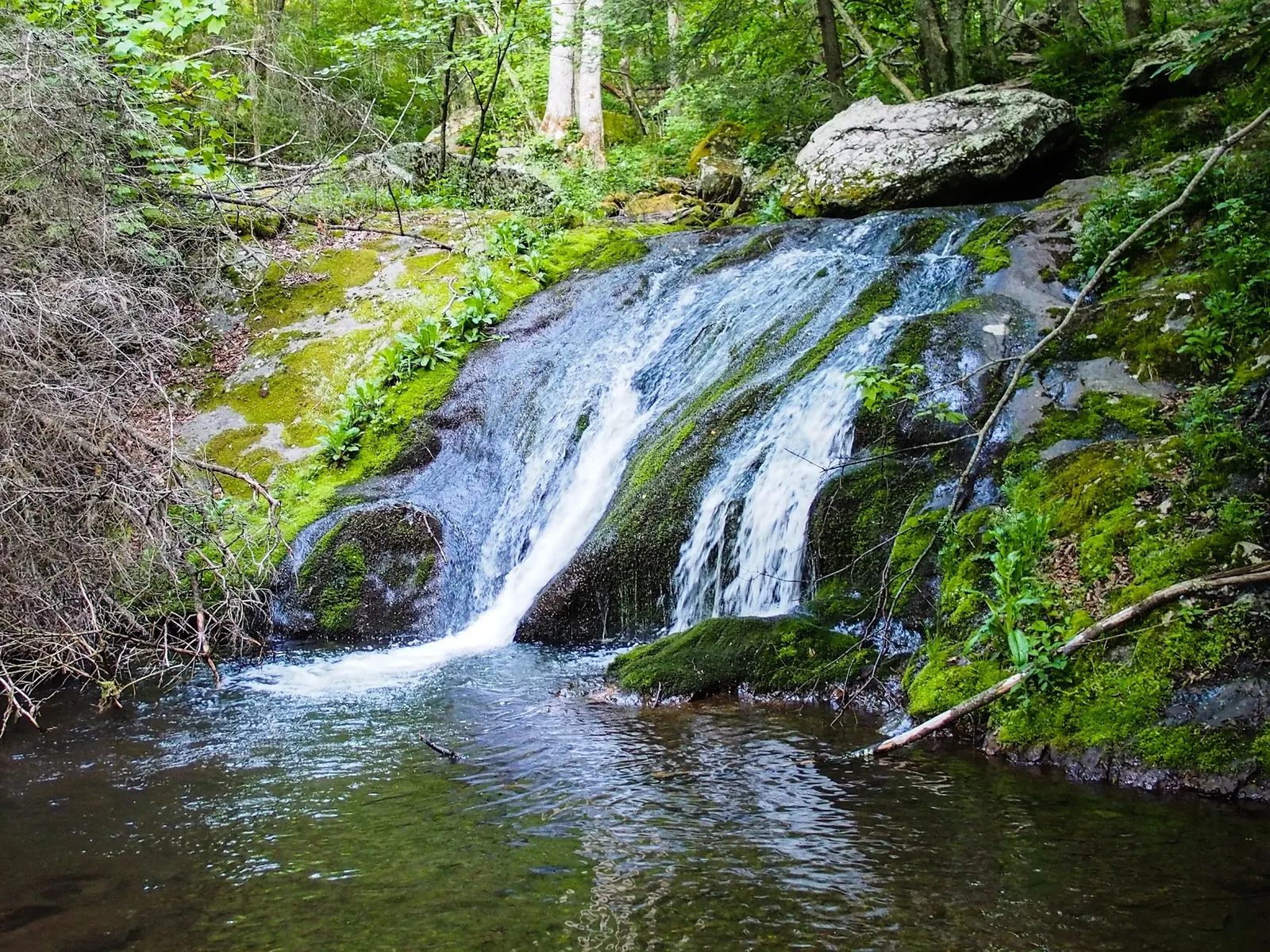
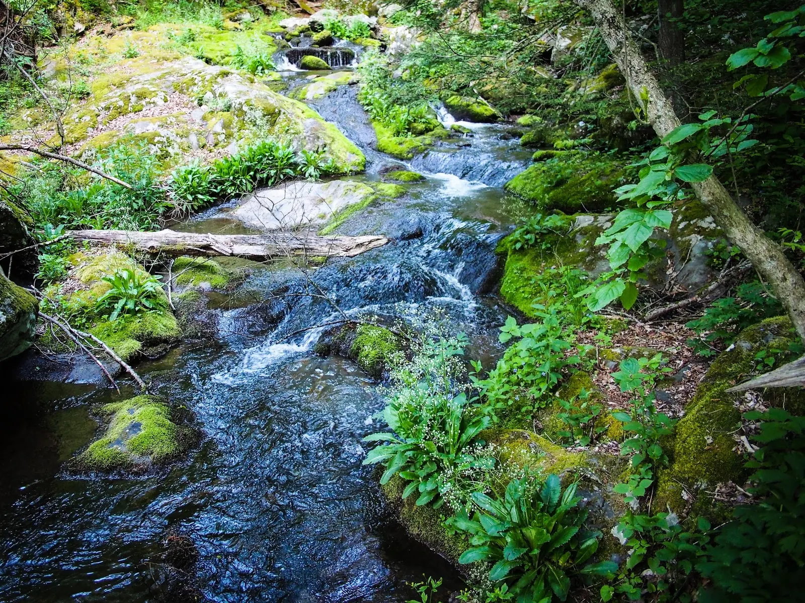
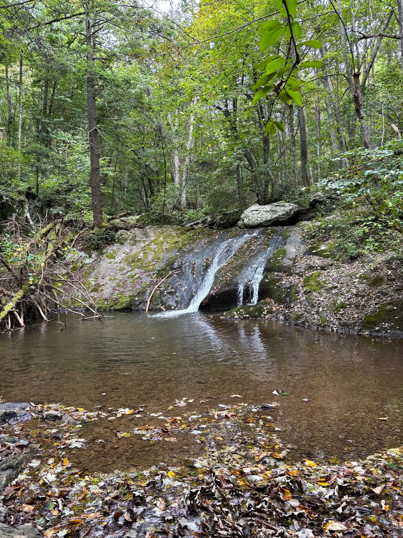
This is a desk-researched listing. A record update or map check does not confirm current swimming permission or water conditions.
Found an error? Send a correction with the location and a source. How we research listings.
Big Rock Falls is a wooded cascade on Mill Prong in Shenandoah National Park. Plan a waterfall hike rather than assuming the pool will be deep, clear or suitable for swimming when you arrive. Mossy rock, forest and the nearby Rapidan Camp route are the main reasons to explore this area.
Use Milam Gap parking at Skyline Drive mile 52.8. Cross the road, briefly follow the Appalachian Trail, then turn left onto blue-blazed Mill Prong Trail. At the second stream crossing, stay right onto the yellow-blazed Mill Prong Horse Trail toward Rapidan Camp. Follow current trailposts and carry a park map.
NPS rates the full Rapidan Camp out-and-back as moderate: four miles round trip with 870 feet of elevation gain. Those figures describe the camp outing, not a measured waterfall-only trip. Stream crossings may become difficult after rain. Turn around if crossing conditions are beyond your ability, and allow time for the uphill return.
NPS permits swimming in park streams generally, but warns that many are rocky, shallow and cold even in summer. This does not certify a particular pool as safe or establish its water quality. Never climb on or around waterfalls. Avoid jumping, diving and fast-moving water; changing flow can make a previous visit or photograph a poor guide to present conditions.
A park entrance fee applies. Bring drinking water and footwear with traction; do not depend on unconfirmed amenities at the trailhead or falls. Check park alerts before driving Skyline Drive. Rapidan Camp adds a history stop, but allow for the full hike if continuing there.
Sources: NPS Rapidan Camp hike and Shenandoah visitor FAQ. Reviewed September 26, 2026.
Start at Milam Gap parking, Skyline Drive mile 52.8. Cross Skyline Drive and briefly follow the Appalachian Trail to the trailpost. Turn left onto blue-blazed Mill Prong Trail. At the second stream crossing, stay right onto the yellow-blazed Mill Prong Horse Trail toward Rapidan Camp. Follow current trailposts and the NPS map. Stream crossings can be difficult after rain; turn around if unsafe. The four-mile round-trip distance published by NPS is for the full Rapidan Camp hike, not a waterfall-only measurement.
Access is via the Milam Gap trailhead, not a drive-up waterfall. Follow current park alerts and trail signs. Stream crossings can become difficult after rain.
Confirm the entrance, parking arrangements, and legal access with the land manager. A map pin does not establish a public right of access. Follow posted routes and never block gates or driveways.
NPS allows swimming in park streams generally, but warns of shallow, rocky and cold water. Never climb on or around waterfalls. Permission does not establish safe conditions at Big Rock Falls. Public park access does not necessarily include permission to swim. Respect private property and posted restrictions.
Water conditions can change quickly. This listing does not provide a current safety or water-quality assessment. Check official alerts and avoid entering water when conditions or permission are uncertain.
Bring sturdy water shoes to protect your feet on rocks and slippery surfaces. A waterproof dry bag keeps your phone, keys, and valuables safe. Pack a quick-dry towel, sun protection, and drinking water - never drink from the natural water source.
Nearby places from saved public map data, not necessarily facilities at the swimming spot. Confirm access, hours, fees, and amenities with the operator before you drive.
Map data retrieved 2026-06-15
Parking lot
Elkton, VA 22827
Hiking area
Elkton, VA 22827
Moderate 6-mile round-trip route with stream crossings to backcountry camping & fishing sites.
Camping cabin
19540 Spotswood Trail, Elkton, VA 22827
Public bathroom
501 E Chandler St, Culpeper, VA 22701
Public bathroom
Stanardsville, VA 22973
Visitor center
Skyline Drive Milepost 51, Stanley, VA 22851
Skyline Drive resource for info, maps, exhibits & ranger programs plus restrooms & first aid.
Public safety office
Skyline Drive Milepost 51, Stanley, VA 22851
Forestry office
Dyke, VA 22935
Checking nearby USGS water conditions…
Reported fee information: National Park entrance fee applies. Verify current pricing with the managing agency before your visit.
NPS allows swimming in park streams generally, but warns of shallow, rocky and cold water. Never climb on or around waterfalls. Permission does not establish safe conditions at Big Rock Falls.
Big Rock Falls is a waterfall on Mill Prong Creek located in Virginia, near Luray. Plan Big Rock Falls from Milam Gap with corrected trail directions, stream-crossing advice and the distinction between the falls and full Rapidan Camp hike.
Seasonal planning notes: Choose suitable weather and stream-crossing conditions. Summer does not guarantee safe flow or swimming depth. Water levels, clarity, and temperature vary with recent weather. Check current conditions before going, especially after rain or snowmelt.
Reported facilities at Big Rock Falls include: Bring drinking water and supplies. Amenities at Milam Gap and the falls were not confirmed in this review. Amenities can change - contact the managing agency or check recent visitor reports to confirm current availability.
None at site.
Historical ties to President Herbert Hoover, whose nearby retreat adds a layer of historical intrigue to the area.
Capture the waterfall in golden hour light, vibrant fall foliage, or misty morning atmospheres.
Follow Leave No Trace principles to preserve the ecosystem; avoid littering and respect wildlife habitats.
Browse every listed natural swimming spot in Virginia.
Find similar waterfalls destinations across the directory.
See under-the-radar places and local favorites in the same state.
Compare easier-access destinations and safer planning options.
Explore waterfall-focused swimming destinations in Virginia.
Use this safety guide before entering any natural water.
Safety & Access Notice
This information is for general planning only and may be incomplete, outdated, or inaccurate. Access rules, closures, water levels, currents, hazards, and legal restrictions can change at any time. Always verify current rules with the land manager or official source before visiting.
You are responsible for your own safety and for following all posted signs, laws, and local regulations. Read the full disclaimer.
None at site.
Loading weather data…
Safety & Access Notice
This information is for general planning only and may be incomplete, outdated, or inaccurate. Access rules, closures, water levels, currents, hazards, and legal restrictions can change at any time. Always verify current rules with the land manager or official source before visiting.
You are responsible for your own safety and for following all posted signs, laws, and local regulations. Read the full disclaimer.
Joshua Havens created Hidden Swimming Holes to make it easier for people to find — and safely visit — natural freshwater swimming destinations across the United States. He researches access conditions, water quality resources, and land management rules so you don't have to start from scratch. He holds a strong belief that good outdoor recreation information should be accurate, honest about its limitations, and freely available.
Discover other amazing natural swimming destinations across America