Explore swimming-hole listings in Utah and plan beyond the familiar stops.
"Hidden gem" is a browsing theme, not a promise of solitude, clear water or public access.
4
Planning candidates
4
Total in Utah
0
No entry fee listed
Use this collection to research places in Utah, then check each listing's sources and access notes.
Descriptive detail is not evidence that a site is uncrowded or that its water is suitable for swimming.
By Hidden Swimming Holes Team-
How We Selected These Hidden Gems
This shortlist uses discoverable records, whether free or fee-based. Records with a dated rules-source field come first, followed by records with source links, then a stable alphabetical order. Read the fee notes for each place; the separate budget guide focuses on records reporting no entry fee.
Description length, legacy confidence labels and photo counts do not affect placement. A recorded source date is not a current water-quality or access clearance.
We show up to ten candidates, not a ranking of safety or seclusion.
Confirm permission and any permit or reservation requirements
Check the actual route and parking location with the land manager
Read current closure and water-quality notices
Keep an alternative plan if the site is closed or crowded
Pro Tip
Download offline maps and save each stop before you drive - signal can vanish when you're closest to the good stuff.
Timing and Advisories in Utah
Check current conditions and local advisories for the exact waterbody before travelling.
Do not assume water is suitable simply because a day or two has passed since rain, or because it looks clear.
Follow posted closures and the land manager's guidance instead of a fixed waiting period.
See the CDC's natural-water swimming guidance for advisory checks, especially after heavy rain.
Access, Parking, and Navigation
Save the official entrance, permitted parking area and return route before leaving. A map pin can describe a broad
recreation area rather than the route to the water; read the pin note and approach details in each full listing.
Ask the operator about reservations, road access and the actual route surface and distance. Do not treat a photograph,
a turnout or a path worn by other visitors as permission to enter. Never block gates or use unauthorized parking.
Respect the Place
If authorized parking is full, use a separately checked backup plan. Do not create new paths or park in vegetation
to reach the water. A backup destination needs its own access and condition checks.
Pack for the Confirmed Route
Footwear appropriate to the confirmed approach, plus a towel and dry layers
Sun protection, drinking water and food matched to your trip
Saved maps, operator contacts and a way to carry out your waste
Any required permit or reservation confirmation; check equipment rules with the operator
Before You Go
Check the named destination's current rules and advisories before deciding whether to swim.
A quiet location or calm-looking surface does not establish suitable conditions. If permission or conditions
remain uncertain, keep the outing on land instead of looking for an unverified water entry.
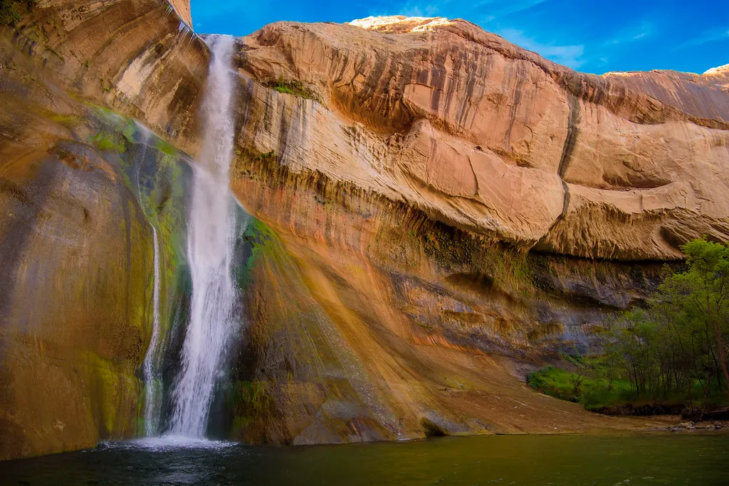
Calf Creek Recreation Area lies along UT-12 between Escalante and Boulder. Do not confuse creek access near the developed recreation area with the waterfall farther up the canyon. Use the trailhead restroom before starting, and carry a portable human-waste containment bag for the canyon walk. The BLM trail guide…
Listing Planning Notes
Campground/day-use creek access
Six-mile round-trip Lower Falls hike
BLM rockfall warning at the waterfall
Developed-area toilets and picnic facilities
Water Body:Calf Creek
Recorded Timing:Choose weather suitable for the full return hike. Summer heat and sandy trail sections require extra planning; consult current BLM notices before setting out.
Fee Notes:BLM lists $5 per vehicle for day use; confirm current fees and pass eligibility before visiting.
Homestead Crater is a paid geothermal swimming experience in Midway, Utah, not a free river swimming hole. The operator's arrival instructions say to arrive at your booked time: guests cannot enter the Crater before their slot. Pack a towel, water bottle and sandals or other water-friendly footwear with your…
Listing Planning Notes
Geothermal spring within a limestone dome
Paid, timed swim sessions
Life vests provided and required
Announced April and May 2027 renovation closure
Water Body:Homestead Crater Hot Spring
Recorded Timing:Reserve an available session before traveling. Do not assume year-round access during the announced April and May 2027 renovation closure.
Fee Notes:Operator lists $30 per one-hour swim session as of October 5, 2026; confirm current price when booking.
Lake Powell spans Utah and Arizona. This regional listing is not a single swimming hole or a short-trip promise from Las Vegas. For the southern-lake option at Wahweap Swim Beach, NPS places the beach across from the campground and lists car and bus/RV parking plus vault toilets. The buoyed boundary excludes…
Listing Planning Notes
Separate northern and southern lake access
NPS-listed shoreline swimming options
Entrance pass or park fee required
No swimming in marinas or launch areas
Water Body:Lake Powell (Colorado River)
Recorded Timing:Choose conditions suitable for your group and check lake levels, access and water-quality notices. Weather and water conditions can change in any season.
Fee Notes:NPS lists $30 per private passenger vehicle for seven days; eligible passes may cover entrance. Camping and vessel fees are separate. Cashless payment.
Burraston Ponds near Mona is a Utah Division of Wildlife Resources management area. This listing retains the historic name Mona Rope Swings so older links remain useful, but it should not be read as a promise of working swings. Mona City lists swimming, fishing, canoeing and kayaking at the ponds. That is not a daily…
Listing Planning Notes
Day-use ponds near Mona
Swimming listed by Mona City
No overnight camping
Historic rope-swing claims require caution
Water Body:Burraston Ponds
Recorded Timing:Choose suitable weather and check current pond and access conditions. No season guarantees safe swimming.
Fee Notes:Confirm current access requirements with Utah DWR; fishing licensing is separate.