Turner Falls Overlook
Park
0.2 mi
4.6 (660)
5085 US-77, Davis, OK 73030
Picnic tablesPublic restroom

Background: generated illustration, not a photograph of this location.
Check Turner Falls' winter swimming closure, admission, camping and parking arrangements. View reviewed waterfall photos and prepare life jackets for a future operating season.
Swimming temporarily closed
Operator currently announces winter swimming closure. Winter season is October 1 through April 30. During an operating swim season, children 12 and under must wear a Coast Guard-certified flotation device. No swimming after dark; follow posted boundaries and staff instructions.
Official sources checked:
Location
A closer look
Photos show past visits, not current water levels or swimming conditions. Select a photo to view it larger.
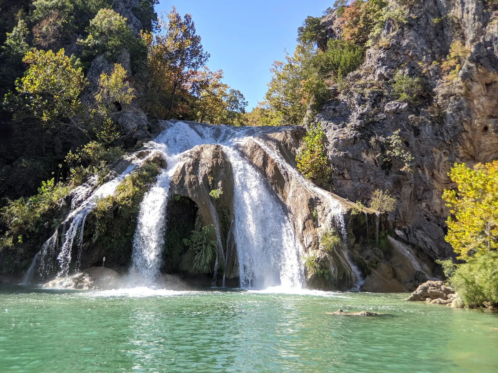
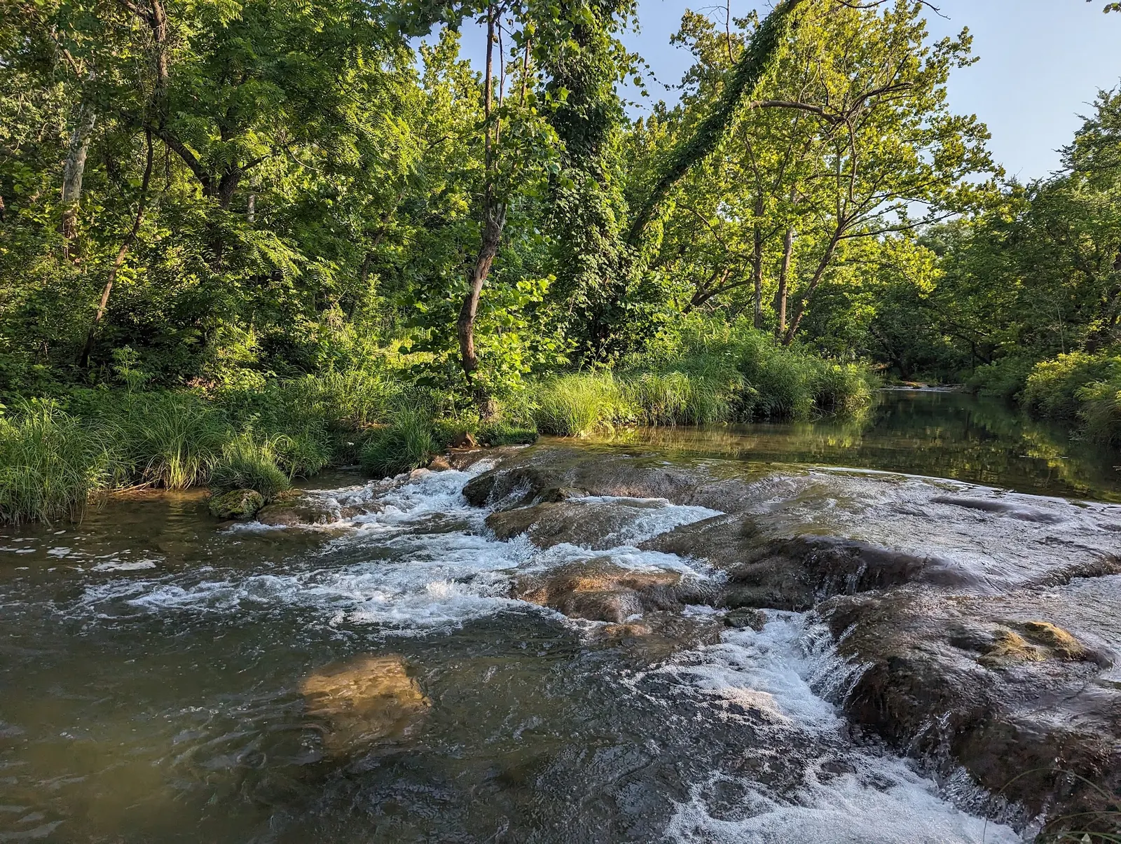
This is a desk-researched listing. A record update or map check does not confirm current swimming permission or water conditions.
Found an error? Send a correction with the location and a source. How we research listings.
The operator homepage currently announces a winter swimming closure. Plan a dry-land visit or wait for confirmed swimming operation; buying admission is not an exception to the closure.
Use the pricing page and live booking total. Distinguish admission, overnight accommodation and your chosen parking arrangement instead of treating them as one ticket.
Read the operator FAQ before packing. Fit equipment before leaving home and check your group's needs rather than assuming a rental will be available.
The gallery helps explain the waterfall and creek setting. Read the park rules for flood warnings and restricted activities. Remain on permitted routes, including during a scenery-only visit.
Use the operator's Turner Falls Park location at I-35 and US Highway 77, Davis, and follow current entrance signs. Confirm the parking level before arrival; the historical water point is not a verified gate or parking entrance.
Reviewed October 8, 2026: homepage announces winter swim closure. FAQ distinguishes free parking from weekend paid Level 1 and Level 2 parking, with a park tram described. A close-parking permit is not required simply to enter. Confirm current tram service and parking availability.
Confirm the entrance, parking arrangements, and legal access with the land manager. A map pin does not establish a public right of access. Follow posted routes and never block gates or driveways.
Operator currently announces winter swimming closure. Winter season is October 1 through April 30. During an operating swim season, children 12 and under must wear a Coast Guard-certified flotation device. No swimming after dark; follow posted boundaries and staff instructions. Public park access does not necessarily include permission to swim. Respect private property and posted restrictions.
Water conditions can change quickly. This listing does not provide a current safety or water-quality assessment. Check official alerts and avoid entering water when conditions or permission are uncertain.
Nearby places from saved public map data, not necessarily facilities at the swimming spot. Confirm access, hours, fees, and amenities with the operator before you drive.
Map data retrieved 2026-06-15
Park
5085 US-77, Davis, OK 73030
Park
I-35 &, US-77, Davis, OK 73030
Beaches & a natural swimming hole with waterfalls plus a rock castle, caves & geological formations.
Parking lot
CRGM+55, Davis, OK 73030
National reserve
901 W 1st St, Sulphur, OK 73086
This lakefront park with trails & camping sites is popular for swimming, boating & fishing.
Campground
662-898 E 1st St, Sulphur, OK 73086
Visitor center
901 W 1st St, Sulphur, OK 73086
Many water sports in springs & streams, plus waterfalls, a lake, forested trails & diverse wildlife.
Campground
Cold Springs Campground, 25 Cold Spgs Rd, Sulphur, OK 73086
Park
Sulphur, OK 73086
No. The operator's current swim closure applies even when other park visits are available.
Not simply to enter. Compare the parking options and confirm the walking or transport arrangement that fits your group.
No. Prepare suitable equipment before a future operating swimming visit.
Historic gathering place for native peoples and settlers, now a cherished Oklahoma landmark.
Reviewed empty waterfall and creek-cascade views show historical scenery, not an open swim season or permission to climb the rocks.
Use authorized routes and parking, leave wildlife undisturbed and carry out rubbish.
Browse every listed natural swimming spot in Oklahoma.
Compare nearby options around Oklahoma City before you choose a route.
Find similar waterfalls destinations across the directory.
See under-the-radar places and local favorites in the same state.
Compare easier-access destinations and safer planning options.
Use this safety guide before entering any natural water.
Safety & Access Notice
This information is for general planning only and may be incomplete, outdated, or inaccurate. Access rules, closures, water levels, currents, hazards, and legal restrictions can change at any time. Always verify current rules with the land manager or official source before visiting.
You are responsible for your own safety and for following all posted signs, laws, and local regulations. Read the full disclaimer.
Operator offers overnight reservations separately from admission. Verify the full booking total and check-in instructions for your selected accommodation.
Loading weather data…
Safety & Access Notice
This information is for general planning only and may be incomplete, outdated, or inaccurate. Access rules, closures, water levels, currents, hazards, and legal restrictions can change at any time. Always verify current rules with the land manager or official source before visiting.
You are responsible for your own safety and for following all posted signs, laws, and local regulations. Read the full disclaimer.
Joshua Havens created Hidden Swimming Holes to make it easier for people to find — and safely visit — natural freshwater swimming destinations across the United States. He researches access conditions, water quality resources, and land management rules so you don't have to start from scratch. He holds a strong belief that good outdoor recreation information should be accurate, honest about its limitations, and freely available.
Discover other amazing natural swimming destinations across America