Todd Creek Falls Trailhead
Hiking area
0.5 mi
4.3 (19)
Q53M+HQW, Central, SC 29630
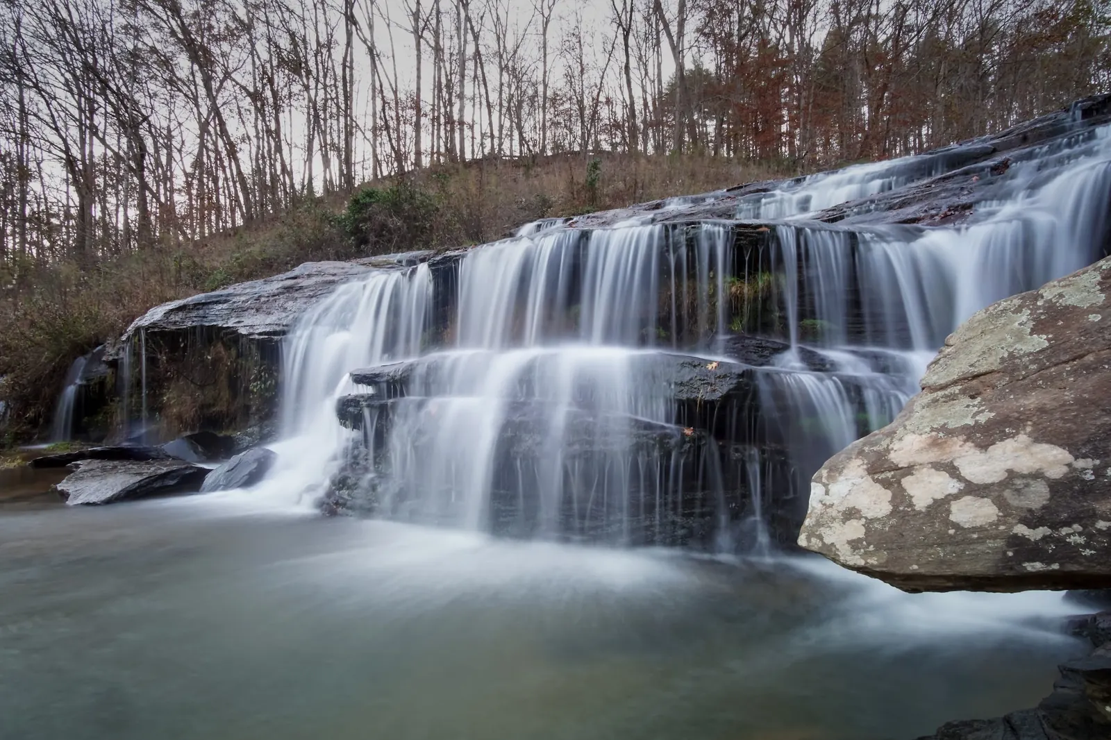
Background photo from a past visit, not current conditions. View photos and source links
Preview Todd Creek Falls near Clemson with reviewed cascade and landscape photos. Compare published trail details and check access before planning a waterfall outing.
Swimming permission unconfirmed
A trail-directory description of a swimming hole is not current landowner approval. Confirm access and water-use rules with the listed Clemson contact before swimming. Do not jump or climb wet ledges.
Location
A closer look
Photos show past visits, not current water levels or swimming conditions. Select a photo to view it larger.
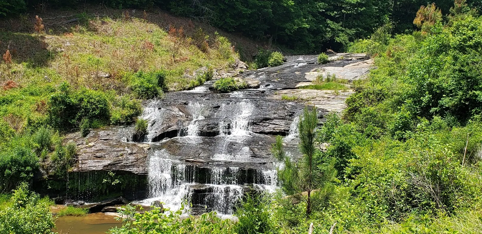
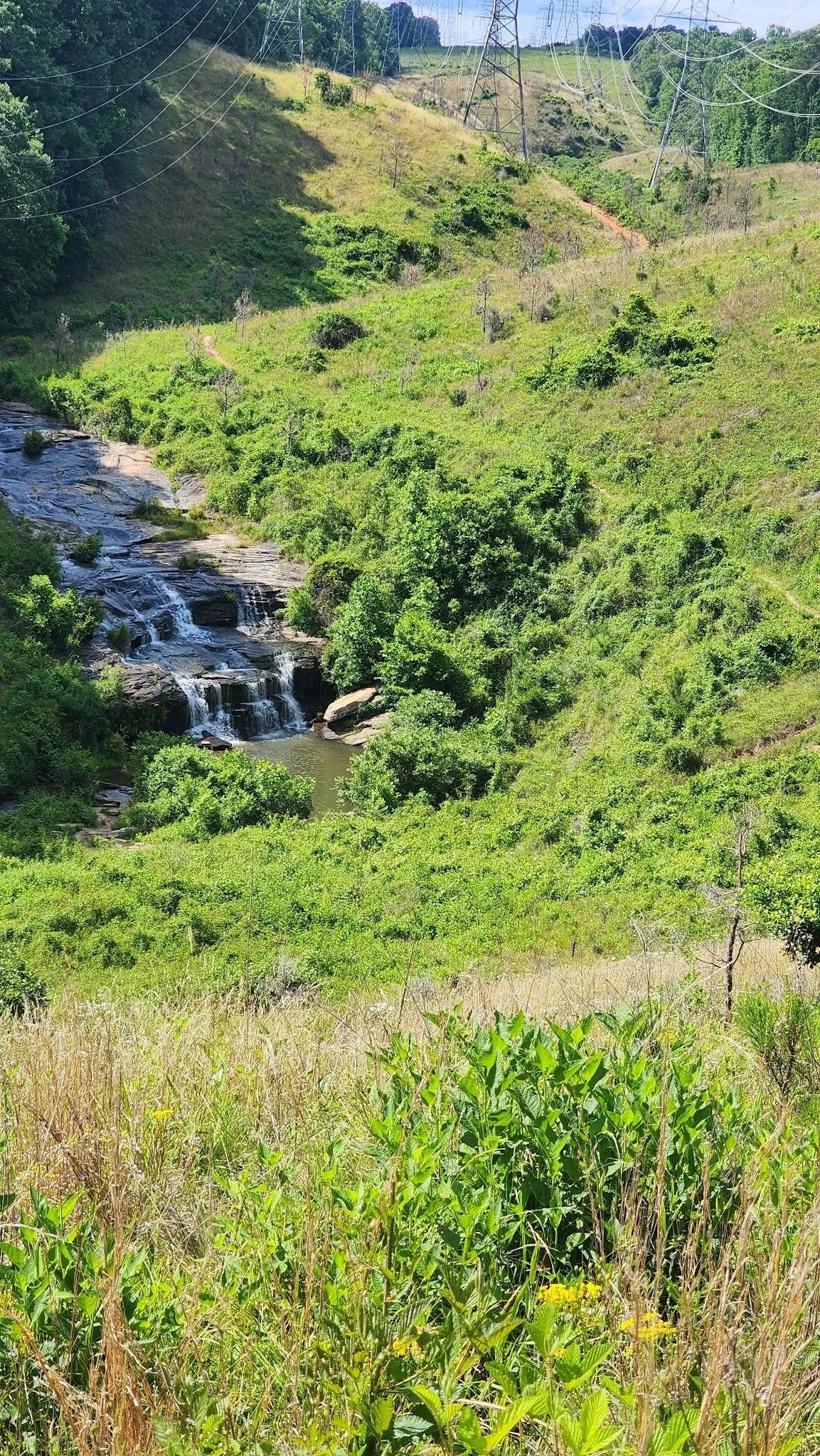
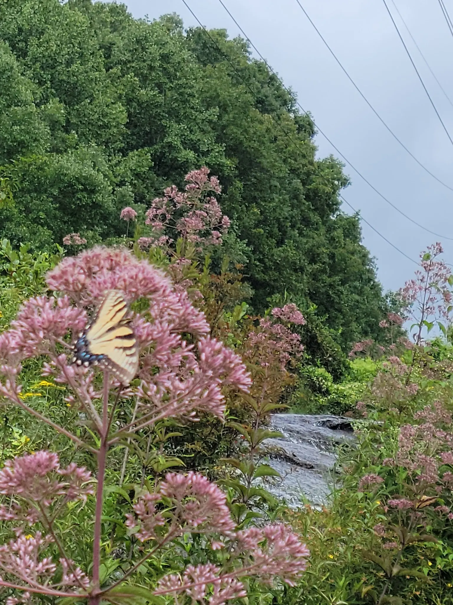
This is a desk-researched listing. A record update or map check does not confirm current swimming permission or water conditions.
Found an error? Send a correction with the location and a source. How we research listings.
Todd Creek Falls has a distinctive stepped cascade and a setting that mixes creek-side vegetation with a utility corridor. The gallery includes waterfall details, a broader landscape and a nature close-up, giving a more useful preview than a single image of the pool.
The SC Trails entry identifies a Brookbend Road approach. Its distance figures are inconsistent, and its description distinguishes the general walk from a steep final descent. Ask the listed contact about the current authorized route and parking before deciding how much time to allow.
Think about the return climb as well as the descent. Choose footwear with grip, carry water and leave daylight for the walk back. The old instruction to wade across the creek is no longer offered as a required route. If the path or water level makes an outing uncomfortable, turn back rather than improvising a crossing.
SC Trails mentions a pool, but that does not establish present-day landowner swimming approval. This state-administered directory draws on several information sources. Confirm water-use rules directly, and do not treat visitor photos as proof of safe depth, unrestricted access or a clothing-optional designation.
No toilets, changing rooms or lifeguards were verified at the falls. Plan those needs elsewhere, take your litter home and avoid climbing waterfall ledges or utility structures. The images show past conditions, not a forecast of the flow or footing you will find on arrival.
SC Trails identifies the Brookbend Road bridge over Todd Creek as the approach. Confirm legal parking and the currently authorized path with the listed contact. Do not use the old instruction to wade across the creek; a crossing requirement was not verified.
SC Trails is a state-administered trail directory drawing on owners, research and users. Its header lists 0.70 miles one way, while the narrative describes a shorter approach and steep final descent. Confirm the segment rather than promising a single exact distance.
Confirm the entrance, parking arrangements, and legal access with the land manager. A map pin does not establish a public right of access. Follow posted routes and never block gates or driveways.
A trail-directory description of a swimming hole is not current landowner approval. Confirm access and water-use rules with the listed Clemson contact before swimming. Do not jump or climb wet ledges. Public park access does not necessarily include permission to swim. Respect private property and posted restrictions.
Water conditions can change quickly. This listing does not provide a current safety or water-quality assessment. Check official alerts and avoid entering water when conditions or permission are uncertain.
Nearby places from saved public map data, not necessarily facilities at the swimming spot. Confirm access, hours, fees, and amenities with the operator before you drive.
Map data retrieved 2026-06-15
Hiking area
Q53M+HQW, Central, SC 29630
Hiking area
Central, SC 29630
City Hall
106 S Main St, Six Mile, SC 29682
Park
225 Ponderosa Dr, Six Mile, SC 29682
Campground
671 High Falls Rd, Seneca, SC 29672
4-acre lakefront park providing water sports, a campground, fishing pier, mini-golf & sports courts.
Park
V448+G2, 757 Keowee Baptist Church Rd, Six Mile, SC 29682
Boat ramp
757 Keowee Baptist Church Rd, Six Mile, SC 29682
Campground
757 Keowee Baptist Church Rd, Six Mile, SC 29682
SC Trails gives conflicting distance details. Confirm your intended segment with its listed contact rather than relying on one exact mileage.
A crossing requirement was not verified. Do not use the old wading instruction as current route advice.
No. A trail description mentioning a pool is not current landowner approval.
No facilities or lifeguards were verified at the waterfall.
Todd Creek Falls is situated near Clemson, a town rich in history and deeply connected to Clemson University. The area blends academic vibrancy with natural splendor, reflecting South Carolina’s diverse cultural and environmental heritage.
Four reviewed photos show the tiered cascade, a wider waterfall view, its utility-corridor setting and flowers with a butterfly beside the creek. Visible tracks are not route authorization.
Visitors are encouraged to practice Leave No Trace principles, including packing out trash, staying on designated trails, and respecting local wildlife. Protecting the creek’s ecosystem ensures its beauty for future generations.
Browse every listed natural swimming spot in South Carolina.
Find similar waterfalls destinations across the directory.
See under-the-radar places and local favorites in the same state.
Compare easier-access destinations and safer planning options.
Explore waterfall-focused swimming destinations in South Carolina.
Use this safety guide before entering any natural water.
Safety & Access Notice
This information is for general planning only and may be incomplete, outdated, or inaccurate. Access rules, closures, water levels, currents, hazards, and legal restrictions can change at any time. Always verify current rules with the land manager or official source before visiting.
You are responsible for your own safety and for following all posted signs, laws, and local regulations. Read the full disclaimer.
SC Trails marks no camping. Arrange overnight accommodation elsewhere.
Loading weather data…
Safety & Access Notice
This information is for general planning only and may be incomplete, outdated, or inaccurate. Access rules, closures, water levels, currents, hazards, and legal restrictions can change at any time. Always verify current rules with the land manager or official source before visiting.
You are responsible for your own safety and for following all posted signs, laws, and local regulations. Read the full disclaimer.
Joshua Havens created Hidden Swimming Holes to make it easier for people to find — and safely visit — natural freshwater swimming destinations across the United States. He researches access conditions, water quality resources, and land management rules so you don't have to start from scratch. He holds a strong belief that good outdoor recreation information should be accurate, honest about its limitations, and freely available.
Discover other amazing natural swimming destinations across America