Parking
Parking lot
0.1 mi
4 (3)
California

Background: generated illustration, not a photograph of this location.
Preview Switzer Falls and canyon scenery with reviewed photos. Check today's route, parking and closures before a hike; swimming permission remains unverified.
Swimming permission unconfirmed
Confirm water recreation with the Forest Service. A waterfall photograph and a picnic-area description do not establish swimming permission. Do not scramble beside the falls to reach an upper pool, jump or dive.
Status summarizes our reviewed record, not today's opening or safety. Check current rules, swimming boundaries and notices before visiting.
Location
A closer look
Photos show past visits, not current water levels or swimming conditions. Select a photo to view it larger.
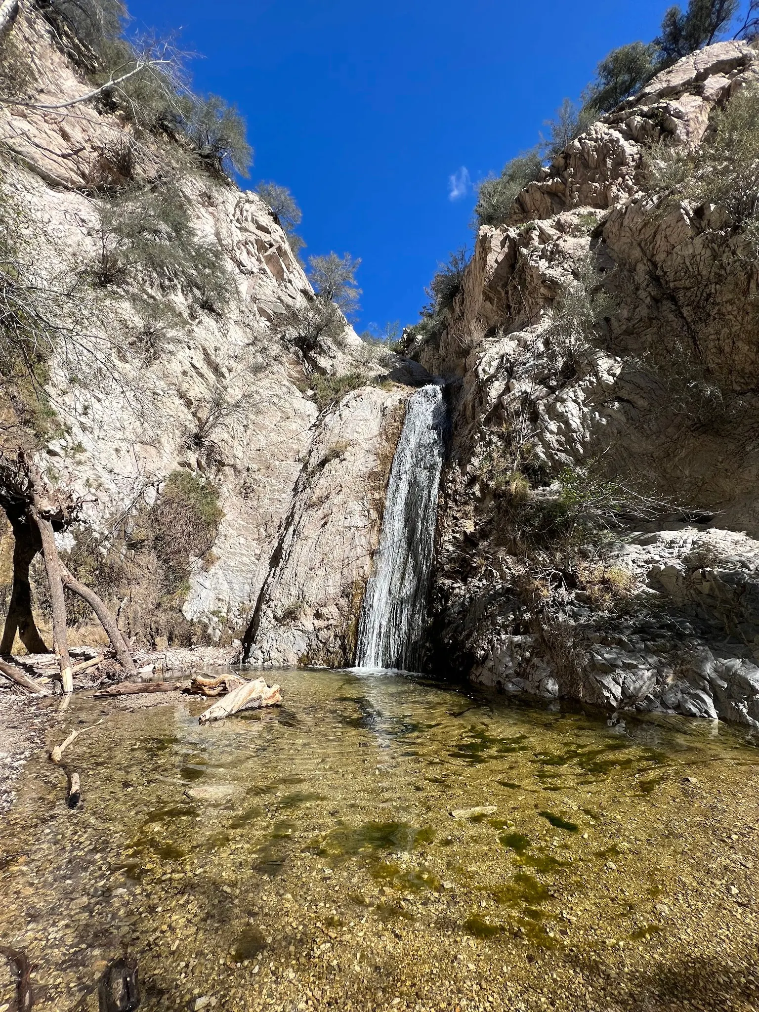
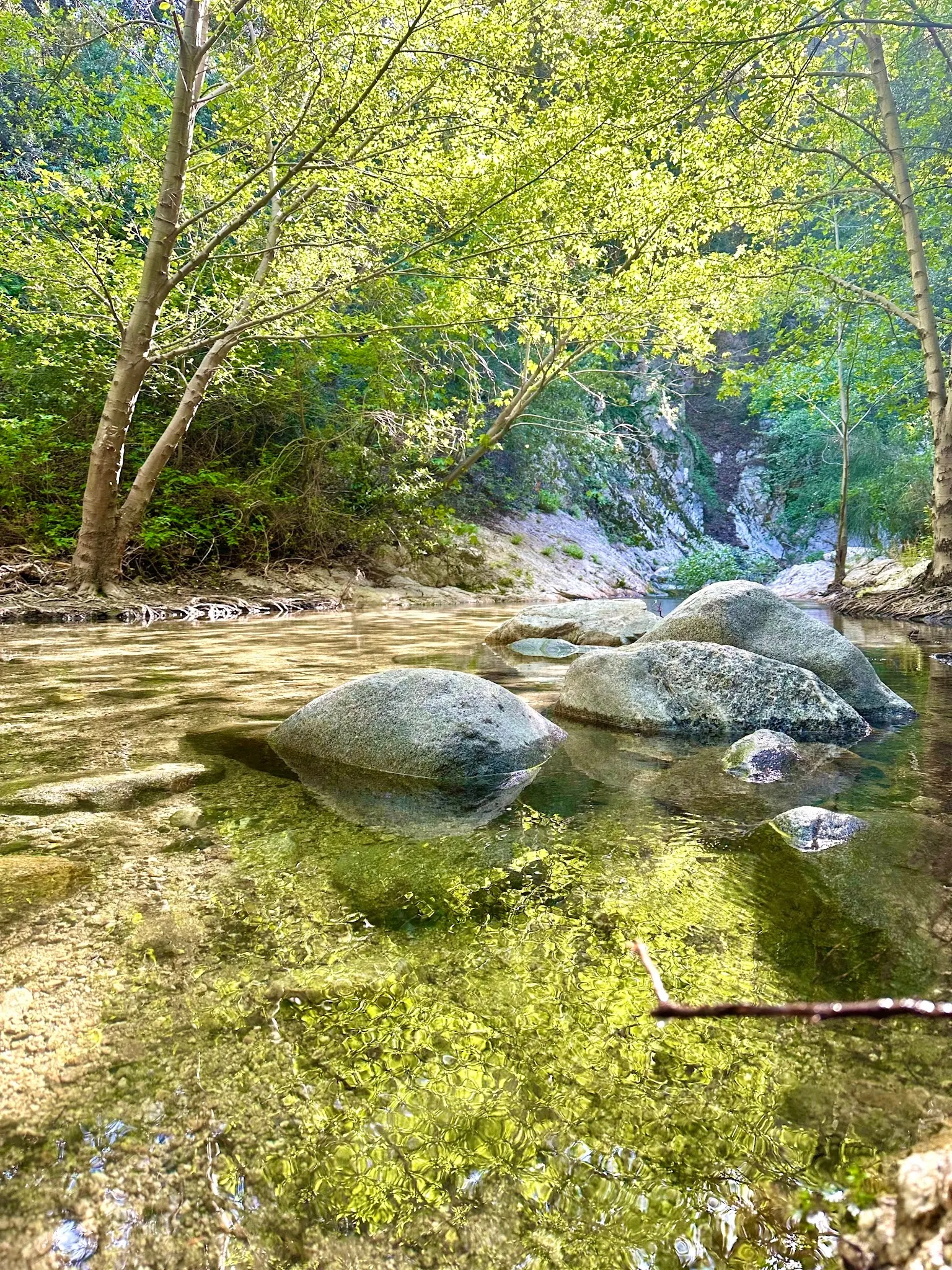
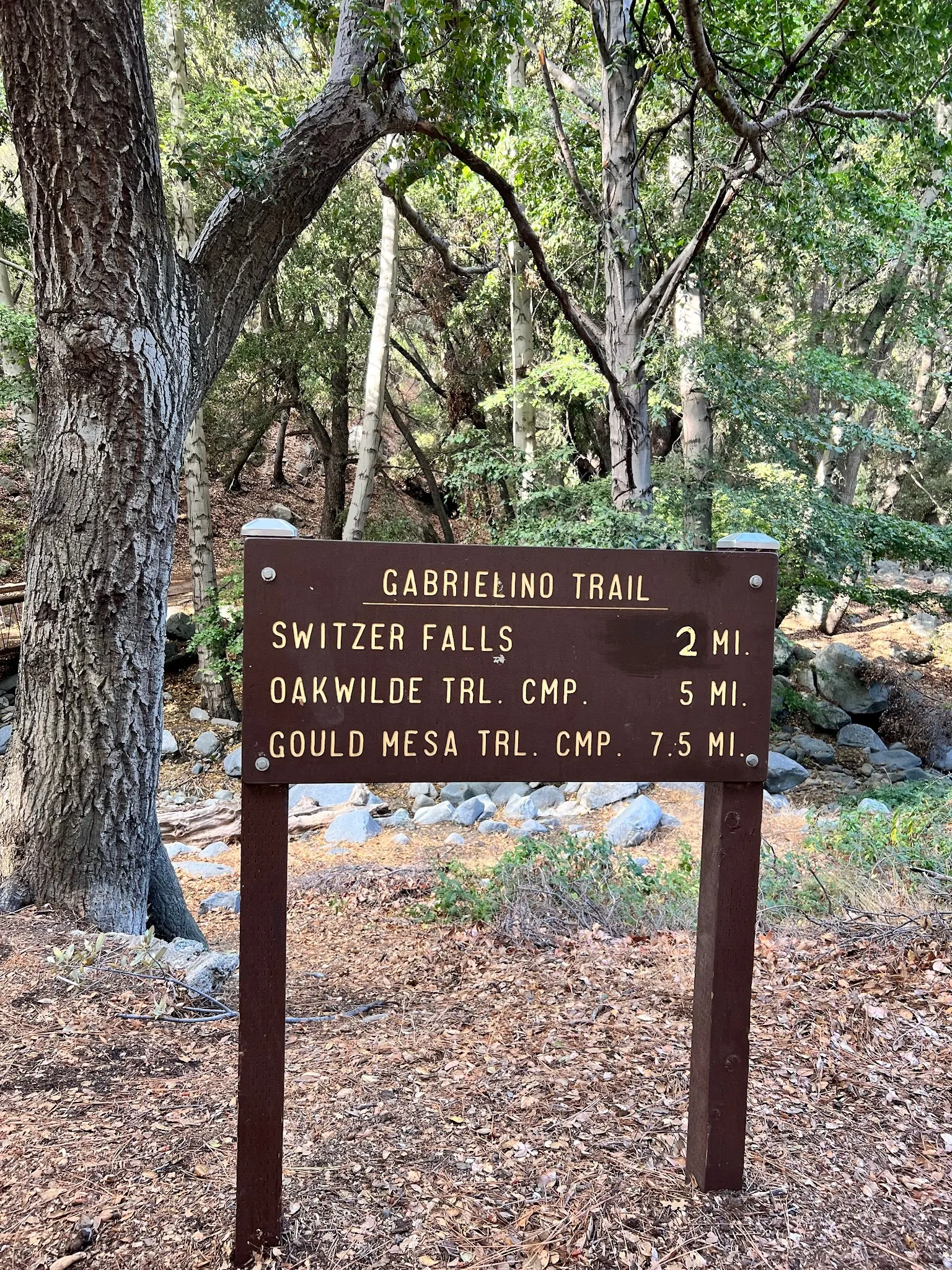
This is a desk-researched listing. A record update or map check does not confirm current swimming permission or water conditions.
Found an error? Send a correction with the location and a source. How we research listings.
Switzer Falls can be considered as a canyon-walking and photography destination, but the visit needs current access checks. The gallery shows the landscape without pretending to establish today's trail status or swimming permission.
Ask the Forest Service about the starting area, parking and the exact onward trail section. Permission to use one facility does not confirm that the whole waterfall route is available. Current site and closure documents were unavailable to this review, so no reopening claim is made.
The Arroyo Seco Foundation hosts an older canyon-walking account. Treat it as background, not a current itinerary. The photographed trail sign is useful visual context, but do not turn its mileage into a guaranteed trip length without checking your actual route.
A historical account specifically cautions against climbing down to the falls. Do not follow the previous guide's suggestion of scrambling to an upper pool or jumping from rocks. Choose permitted viewpoints and turn around when a crossing or trail section is unsuitable.
Carry drinking water, suitable footwear and enough daylight for the walk back. Confirm services at the starting area instead of assuming toilets or water are available at the falls. Keep food secured, take rubbish home and plan another authorized activity if access cannot be confirmed.
Ask the Forest Service for current Switzer picnic-area access and the authorized route to your chosen canyon destination. Confirm Angeles Crest Highway conditions and gate operation before departure. The retained coordinate is not independently verified as parking or a waterfall entrance.
Reviewed October 8, 2026: current Forest Service site and closure documents could not be fetched in this session. Neither an open-route claim nor a current blanket closure was verified. Confirm the picnic area and onward waterfall route separately before traveling.
Confirm the entrance, parking arrangements, and legal access with the land manager. A map pin does not establish a public right of access. Follow posted routes and never block gates or driveways.
Confirm water recreation with the Forest Service. A waterfall photograph and a picnic-area description do not establish swimming permission. Do not scramble beside the falls to reach an upper pool, jump or dive. Public park access does not necessarily include permission to swim. Respect private property and posted restrictions.
Water conditions can change quickly. This listing does not provide a current safety or water-quality assessment. Check official alerts and avoid entering water when conditions or permission are uncertain.
Nearby places from saved public map data, not necessarily facilities at the swimming spot. Confirm access, hours, fees, and amenities with the operator before you drive.
Map data retrieved 2026-06-15
Parking lot
California
Tourist attraction
701 Angeles Crest Hwy, Tujunga, CA 91042
Popular path through a national forest & ruined wilderness resort to a waterfall at a a deep gorge.
Campground
Bear Canyon Campground, Altadena, CA 91001
Hiking area
Brown Mountain Fire Rd, Altadena, CA 91001
Campground
Gould Mesa, Arroyo Blvd, La Cañada Flintridge, CA 91011
Unfussy, hike-in tent campsite offering basic facilities, including a vault toilet & picnic tables.
Hiking area
915 Ventura St, Altadena, CA 91001
Public bathroom
578-676 N Arroyo Blvd, Pasadena, CA 91103
National forest
12371 Little Tujunga Canyon Rd, Sylmar, CA 91342
Mountainous national forest covering 700,000-acres with chaparral, pine & fir trees & hiking trails.
Not by this review. Confirm current picnic-area and onward trail access with the Forest Service before departure.
No. Ask the Forest Service about water recreation and current restrictions.
No. Do not use waterfall-edge shortcuts or jump from rocks. Stay on authorized routes.
No. Confirm your actual starting point, destination and available trail sections.
Historically significant due to its connection to the Tongva people and Gaspar de Portolà’s exploration.
Three reviewed photos show a waterfall, a wooded creek with boulders and a Gabrielino Trail sign. The sign is historical visual context, not a current trail-status or distance guarantee.
Follow Leave No Trace principles to protect local wildlife and habitats. Adventure Pass required for parking.
Browse every listed natural swimming spot in California.
Find similar waterfalls destinations across the directory.
See under-the-radar places and local favorites in the same state.
Compare easier-access destinations and safer planning options.
Explore waterfall-focused swimming destinations in California.
Use this safety guide before entering any natural water.
Safety & Access Notice
This information is for general planning only and may be incomplete, outdated, or inaccurate. Access rules, closures, water levels, currents, hazards, and legal restrictions can change at any time. Always verify current rules with the land manager or official source before visiting.
You are responsible for your own safety and for following all posted signs, laws, and local regulations. Read the full disclaimer.
The falls are not a verified campsite. Choose an authorized campground and confirm its access and any permit separately; trail-camp names on a sign do not establish current operation.
Loading weather data…
Safety & Access Notice
This information is for general planning only and may be incomplete, outdated, or inaccurate. Access rules, closures, water levels, currents, hazards, and legal restrictions can change at any time. Always verify current rules with the land manager or official source before visiting.
You are responsible for your own safety and for following all posted signs, laws, and local regulations. Read the full disclaimer.
Joshua Havens created Hidden Swimming Holes to make it easier for people to find — and safely visit — natural freshwater swimming destinations across the United States. He researches access conditions, water quality resources, and land management rules so you don't have to start from scratch. He holds a strong belief that good outdoor recreation information should be accurate, honest about its limitations, and freely available.
Discover other amazing natural swimming destinations across America