Standish-Hickey State Recreation Area
State park
4.6 (458)
Leggett, CA 95585
State preserve in an inland river canyon offering year-round camping, hiking & swimming.
Barbecue grillPicnic tablesPublic restroom

Background: generated illustration, not a photograph of this location.
State Parks supports South Fork Eel swimming at Standish-Hickey. Check algae notices, seasonal bridge access and actual campground services before a river visit.
Swimming restriction
Use current manager notices and authorized entrances; no jumping, diving, natural-slide or rope-swing itinerary.
Official sources checked:
Location
A closer look
Photos show past visits, not current water levels or swimming conditions. Select a photo to view it larger.
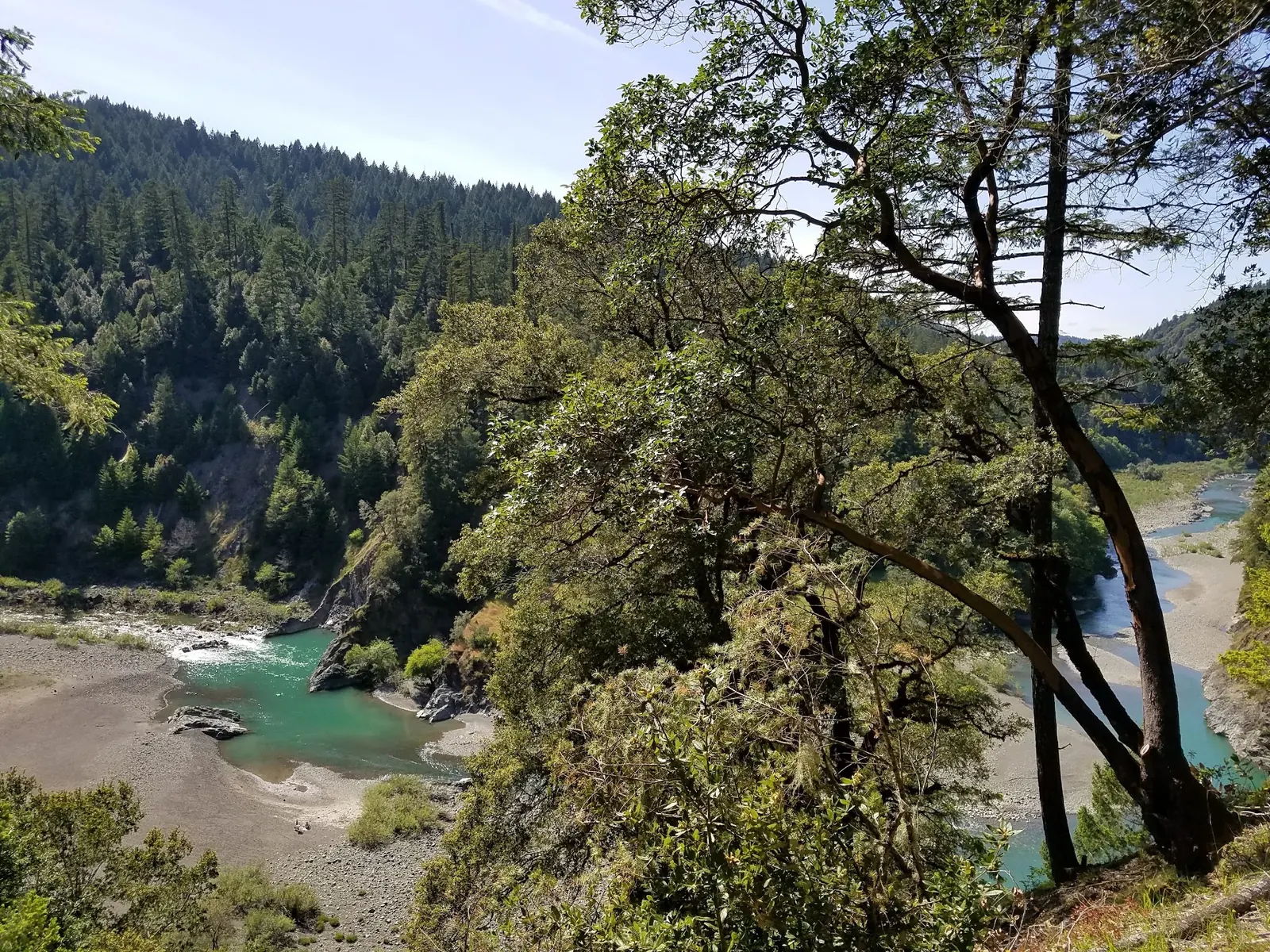
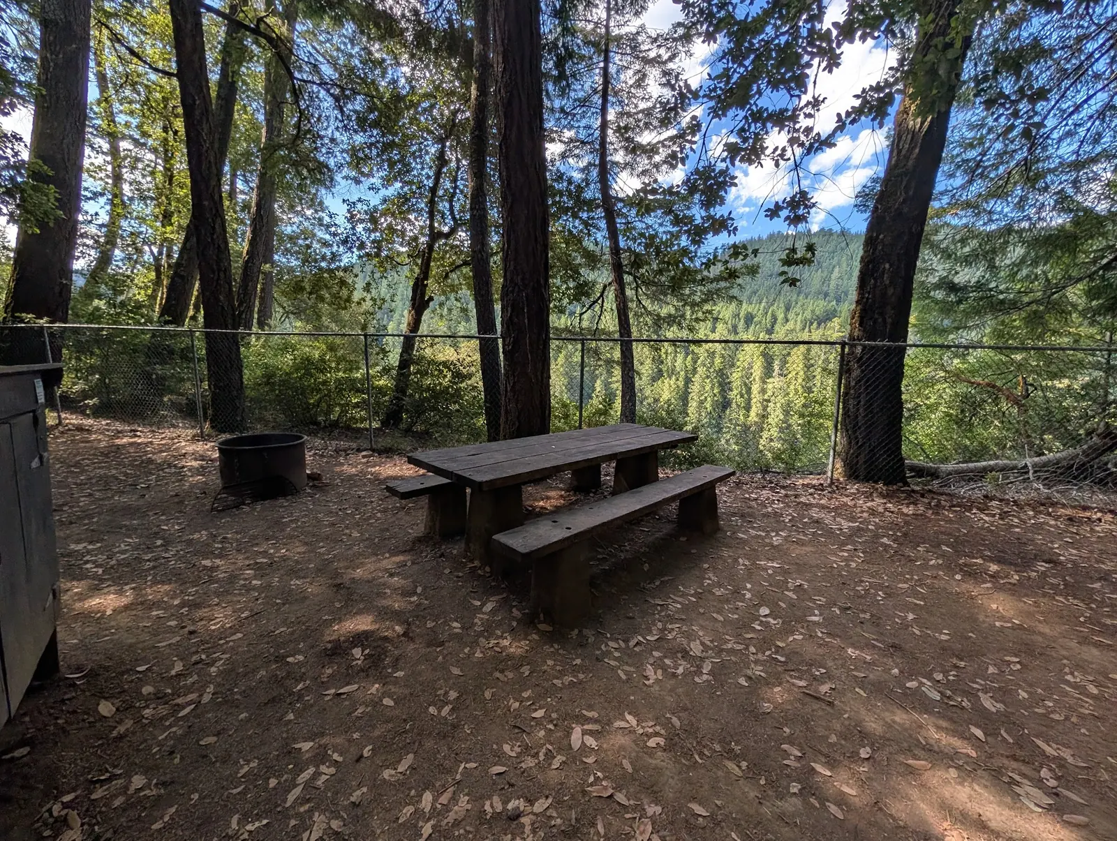
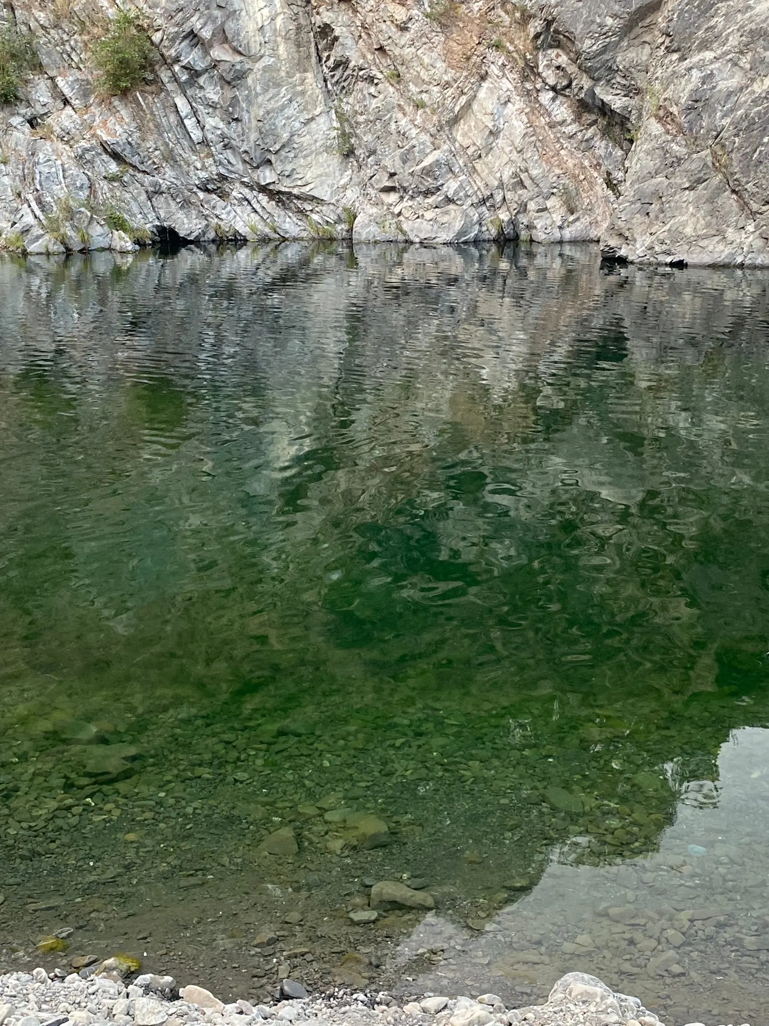
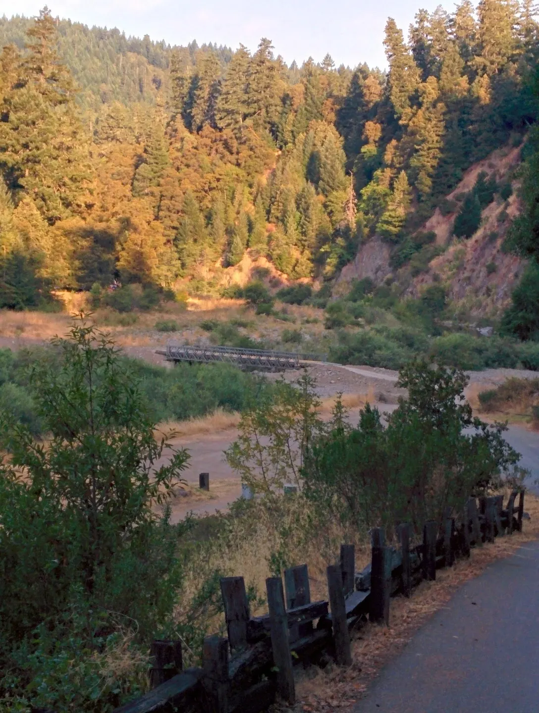
This is a desk-researched listing. A record update or map check does not confirm current swimming permission or water conditions.
Found an error? Send a correction with the location and a source. How we research listings.
California State Parks supports swimming, camping and other recreation on the South Fork Eel River at Standish-Hickey. The park is along Highway 101, about one and a half miles north of Leggett. This is a managed river destination, not an invitation to search for two unmarked pools.
The park's visitor activity page directs visitors to check at the entrance for dangerous blue-green algae levels. Do that before water entry and follow current notices. A sunny day or clear-looking water cannot rule out harmful conditions. Do not jump or dive from the rocky outcrops.
State Parks explains that high water and removal of seasonal bridges make much of the park inaccessible in winter. At least one campground remains open, but that does not mean every river trail or bank can be reached. Ask which route is currently available and plan for the return climb; no step-free water descent is established.
The manager lists parking, restrooms, showers, drinking water and picnic facilities. Confirm the particular campground's operation and charges. Follow required bear-food storage and fire rules; dogs are not allowed on trails except service animals. Managed services do not establish lifeguards, constant water depth or a child-safe bathing area.
The historical gallery shows a river bend, a closer rock-wall view, a campsite table and a low seasonal bridge. It illustrates the park setting, not a specific reserved campsite or surveyed water-entry route. Water appearance cannot establish depth or current quality. State Parks warns that winter high water and removal of seasonal bridges can limit access; the photographed bridge is not proof of a crossing today. A pictured fire ring does not override current fire restrictions.
Use the signed park entrance along Highway 101 about 1.5 miles north of Leggett. Ask at the entrance about current river access and algae notices rather than assuming the old downhill path or both pools are available.
High water and seasonal bridge removal can affect much of the park independently of campground operation. Check the named river route before entering.
Confirm the entrance, parking arrangements, and legal access with the land manager. A map pin does not establish a public right of access. Follow posted routes and never block gates or driveways.
Use current manager notices and authorized entrances; no jumping, diving, natural-slide or rope-swing itinerary. Public park access does not necessarily include permission to swim. Respect private property and posted restrictions.
Water conditions can change quickly. This listing does not provide a current safety or water-quality assessment. Check official alerts and avoid entering water when conditions or permission are uncertain.
Bring sturdy water shoes to protect your feet on rocks and slippery surfaces. A waterproof dry bag keeps your phone, keys, and valuables safe. Pack a quick-dry towel, sun protection, and drinking water - never drink from the natural water source.
Nearby places from saved public map data, not necessarily facilities at the swimming spot. Confirm access, hours, fees, and amenities with the operator before you drive.
Map data retrieved 2026-06-15
State park
Leggett, CA 95585
State preserve in an inland river canyon offering year-round camping, hiking & swimming.
Campground
69350 US-101, Leggett, CA 95585
Campground
Leggett, CA 95585
Hiking area
903 Beach Rd, Whitethorn, CA 95589
Campground
75000 US-101, Leggett, CA 95585
Cozy rooms & private cabins in a rustic resort with river access & a heated outdoor pool.
Public bathroom
Lafayette, CA 94549
Public bathroom
Walnut Creek, CA 94596
Public bathroom
2698 Oak Rd, Walnut Creek, CA 94597
Yes. State Parks lists swimming on the South Fork Eel River, subject to current conditions and notices.
No. The retained approach names the park, not two independently verified water-entry routes.
The park activity page says to ask at the entrance about dangerous algae levels. Follow current instructions before entering the river.
No. Seasonal bridge removal and high water can make much of the park inaccessible even while a campground remains open.
Parking, restrooms, showers, drinking water and picnic facilities are listed for the park. Confirm availability at the campground or area you use.
State Parks says dogs are not allowed on trails except service animals. Confirm applicable areas and follow posted rules.
Respect protected landscapes and community access rules; do not infer cultural claims from scenery.
Reviewed gallery views show the river landscape, campsite setting and a historical seasonal bridge. Use authorized viewpoints; bridge installation, campsite availability, fires and water conditions need current checks.
Respect land boundaries and closed areas, use authorized routes and carry out waste.
Browse every listed natural swimming spot in California.
Find similar managed river recreation and camping destinations across the directory.
See under-the-radar places and local favorites in the same state.
Compare easier-access destinations and safer planning options.
Use this safety guide before entering any natural water.
Safety & Access Notice
This information is for general planning only and may be incomplete, outdated, or inaccurate. Access rules, closures, water levels, currents, hazards, and legal restrictions can change at any time. Always verify current rules with the land manager or official source before visiting.
You are responsible for your own safety and for following all posted signs, laws, and local regulations. Read the full disclaimer.
State Parks says at least one campground is open year-round; seasonal bridges affect other areas. Confirm the actual campground's current operation and charges.
Loading weather data…
Safety & Access Notice
This information is for general planning only and may be incomplete, outdated, or inaccurate. Access rules, closures, water levels, currents, hazards, and legal restrictions can change at any time. Always verify current rules with the land manager or official source before visiting.
You are responsible for your own safety and for following all posted signs, laws, and local regulations. Read the full disclaimer.
Joshua Havens created Hidden Swimming Holes to make it easier for people to find — and safely visit — natural freshwater swimming destinations across the United States. He researches access conditions, water quality resources, and land management rules so you don't have to start from scratch. He holds a strong belief that good outdoor recreation information should be accurate, honest about its limitations, and freely available.
Discover other amazing natural swimming destinations across America