St. Anthony Sandbar
Park
04.5 (221)
139 S 3rd E, St Anthony, ID 83445
Picnic tablesPublic restroomSlides

Background: generated illustration, not a photograph of this location.
Explore St. Anthony Sand Bar shoreline photos and plan a Henrys Fork visit. Review dated city safety guidance, dam hazards, and what to confirm before swimming.
Swimming restriction
Follow current signs and any closure instructions. The June 2022 city notice warns of swift currents, debris and the dam and states there is no lifeguard. That notice is not today's swimming clearance. Do not jump, dive or approach the dam.
Location
A closer look
Photos show past visits, not current water levels or swimming conditions. Select a photo to view it larger.
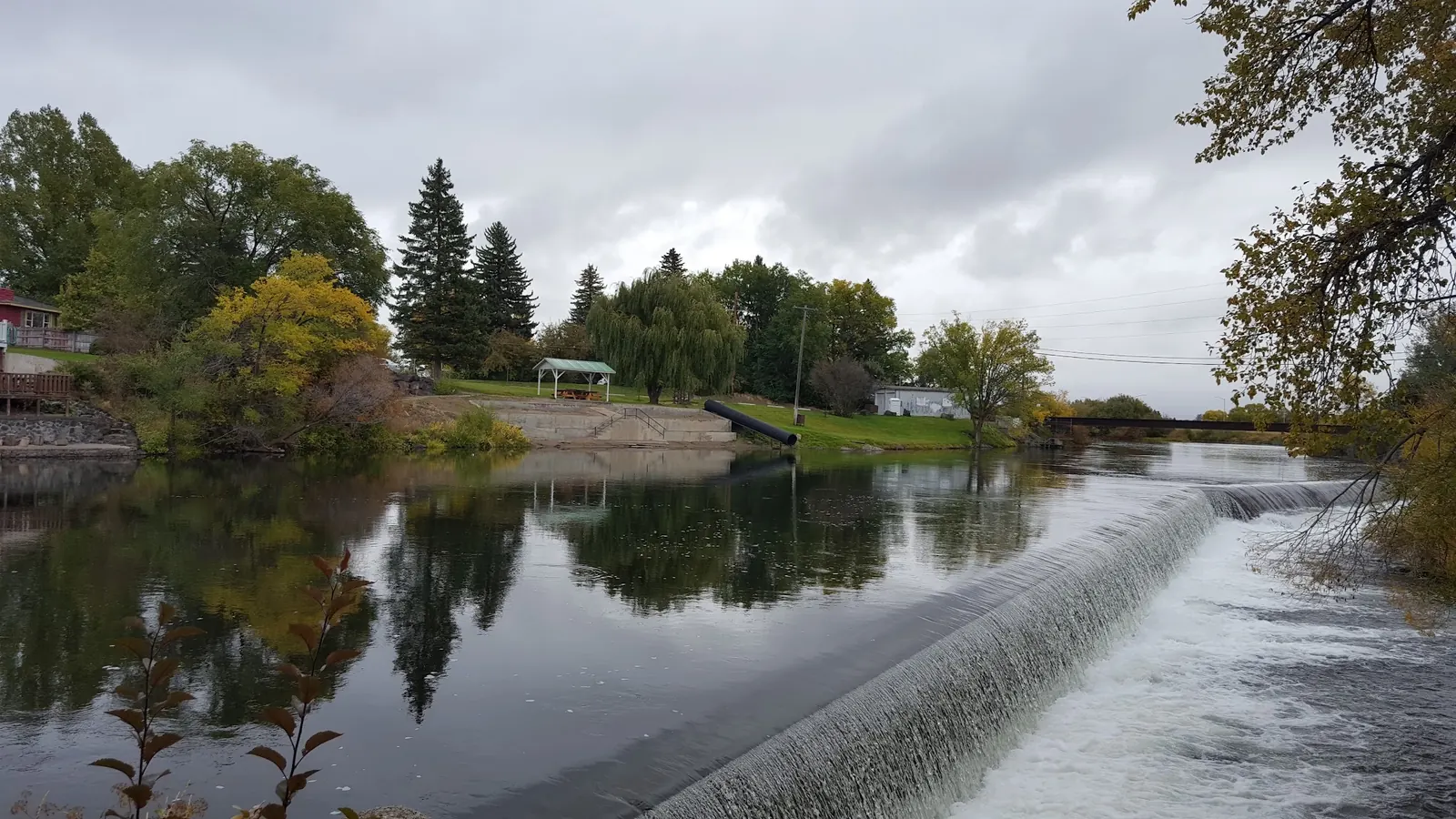
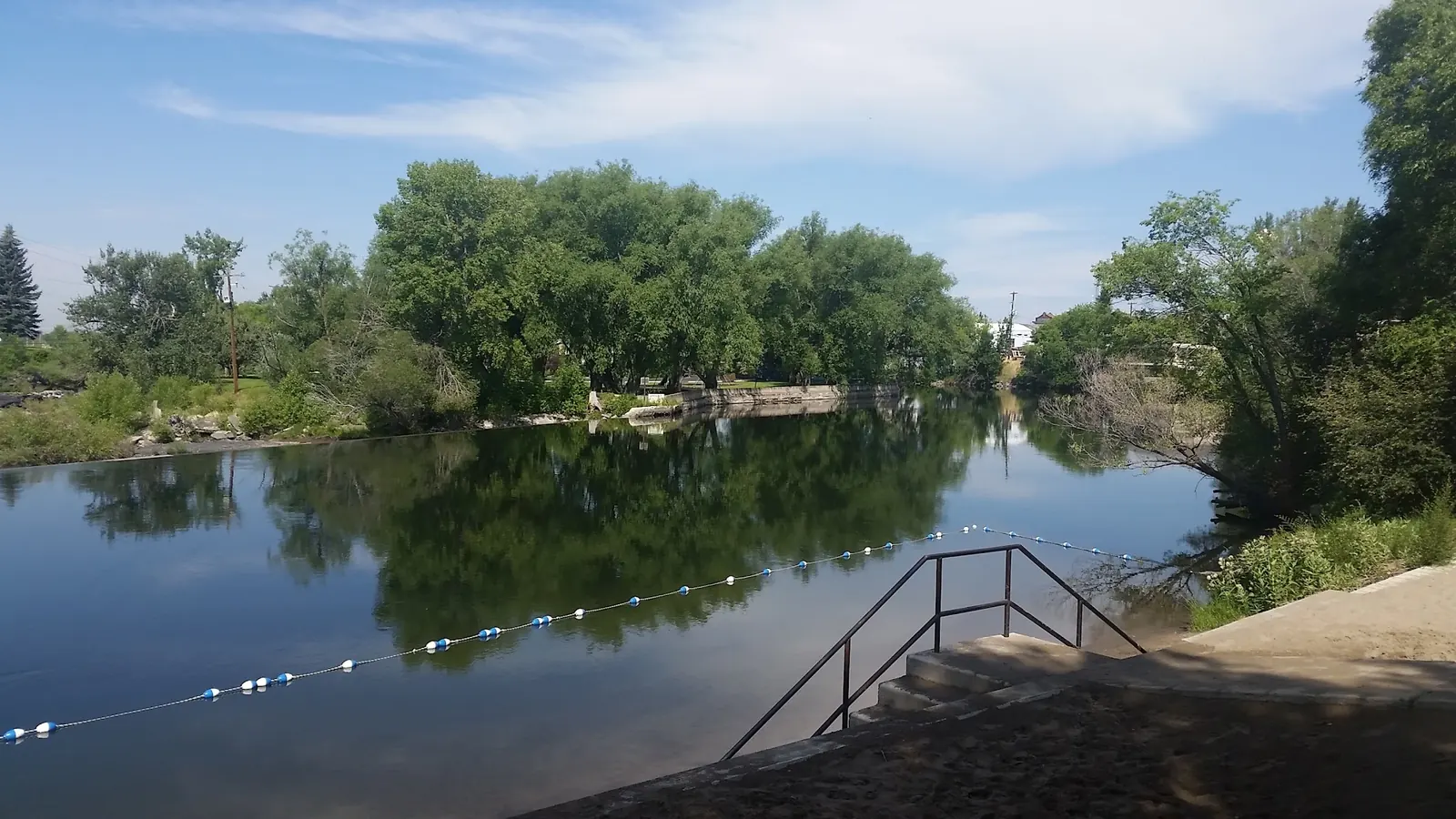
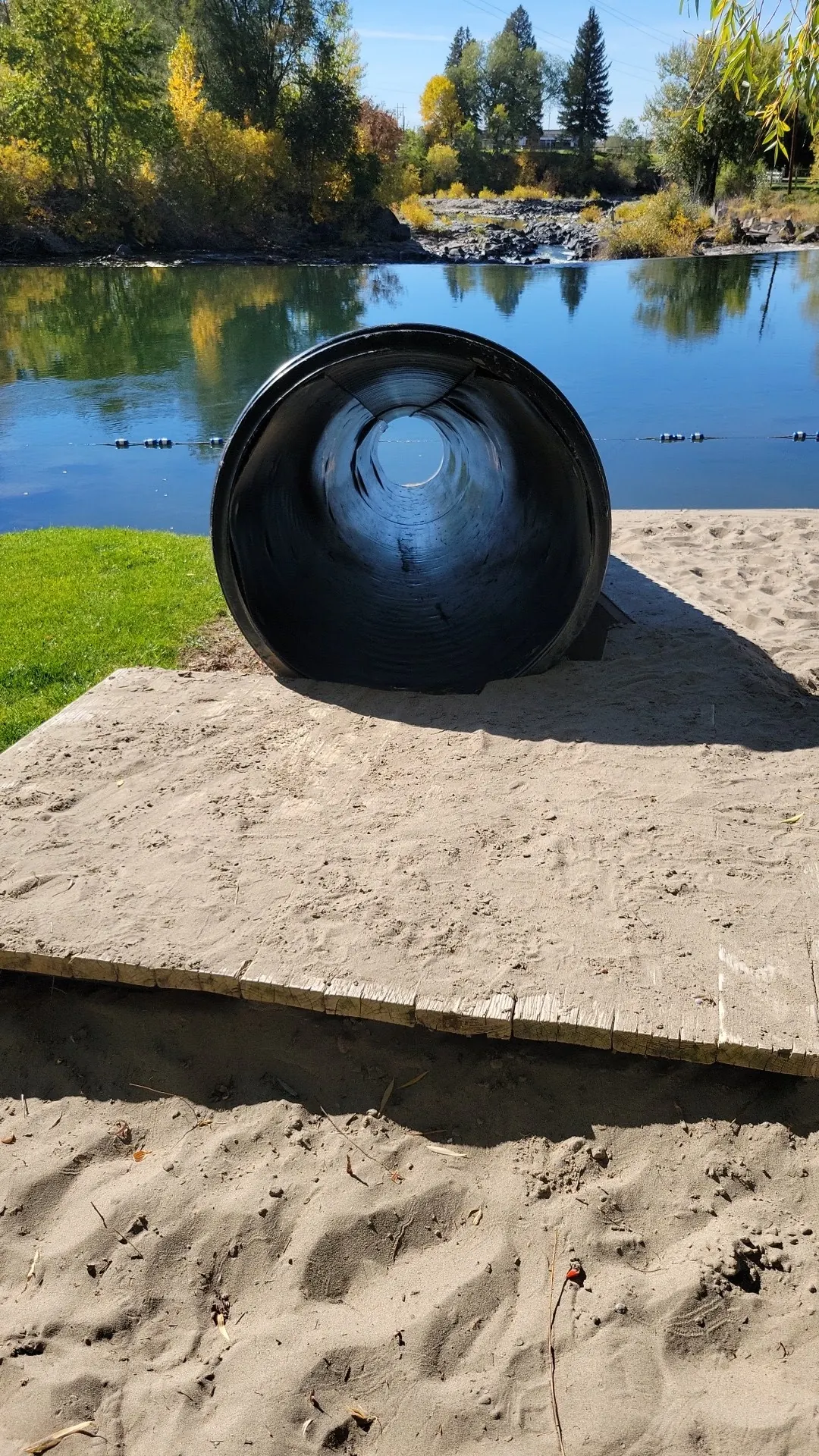
This is a desk-researched listing. A record update or map check does not confirm current swimming permission or water conditions.
Found an error? Send a correction with the location and a source. How we research listings.
The city lists St. Anthony Sand Bar as a park. It is distinct from St. Anthony Sand Dunes and Egin Lakes. A developed shoreline and swimming equipment in a historical photograph do not guarantee today's water access or conditions.
The June 2022 city newsletter warns about current, debris and the nearby dam and states that no lifeguard is provided. Treat it as dated safety context, not a current opening notice. Stay away from the dam and follow today's signs.
Confirm access and advisories with the city at 208-624-3494. No current hours, fees, water-quality clearance or equipment inspection were established. Keep children closely supervised and do not jump or dive.
Three reviewed, people-free photos show shoreline steps, a slide structure and dam context. The dam view illustrates a hazard, not a recommended entry. Photos are not current-condition reports, and the retained map point is a recreation-area reference rather than a verified swimming entrance.
Locate the city-listed St. Anthony Sand Bar near the southern end of 3rd East and confirm current parking and access with the city. The retained map point is a recreation-area reference, not a verified water-entry location. Use posted access areas, not river structures or the dam.
The city currently lists this park by name. Its accessible web page does not establish today's swim conditions, opening hours or equipment operation. The saved shoreline images and historical notice do not replace posted instructions.
Confirm the entrance, parking arrangements, and legal access with the land manager. A map pin does not establish a public right of access. Follow posted routes and never block gates or driveways.
Follow current signs and any closure instructions. The June 2022 city notice warns of swift currents, debris and the dam and states there is no lifeguard. That notice is not today's swimming clearance. Do not jump, dive or approach the dam. Public park access does not necessarily include permission to swim. Respect private property and posted restrictions.
Water conditions can change quickly. This listing does not provide a current safety or water-quality assessment. Check official alerts and avoid entering water when conditions or permission are uncertain.
Bring sturdy water shoes to protect your feet on rocks and slippery surfaces. A waterproof dry bag keeps your phone, keys, and valuables safe. Pack a quick-dry towel, sun protection, and drinking water - never drink from the natural water source.
Nearby places from saved public map data, not necessarily facilities at the swimming spot. Confirm access, hours, fees, and amenities with the operator before you drive.
Map data retrieved 2026-06-15
Park
139 S 3rd E, St Anthony, ID 83445
Campground
4 Eagle Pk Dr, Rexburg, ID 83440
This nature space along the Teton River has 24 sites for tent camping, restrooms & potable water.
Public male bathroom
W Main St, Rexburg, ID 83440
Public female bathroom
W Main St, Rexburg, ID 83440
Park
S 2nd W & 3rd W, Rexburg, ID 83440
Leafy green space featuring an open field, playground & spray park, plus an old carousel.
Campground
2125 W 2000 S, Rexburg, ID 83440
Campground
2245 S Frontage Rd, Rexburg, ID 83440
Hiking area
11760-11894 S Snake River Rd, Rexburg, ID 83440
Checking nearby USGS water conditions…
No. This listing concerns the city-listed riverside Sand Bar Park, not the dunes or Egin Lakes.
No. The reviewed notice is from June 2022. Follow current signs and confirm advisories with the city before entering water.
No. The city's dated safety notice specifically warns visitors to stay away from the dam. This directory does not recommend entering there.
No. A saved photo shows its appearance, not a current inspection or operating status. Confirm with the city and follow posted restrictions.
Sand Bar Park is a city-listed riverside destination, separate from the region's sand dunes and Egin Lakes.
Three reviewed views show shoreline steps, a slide structure and the nearby dam context. They are not current-condition reports or recommendations to enter near the dam.
Use established park access and dispose of waste properly. Do not enter closed areas or cross river structures.
Browse every listed natural swimming spot in Idaho.
Find similar river beach destinations across the directory.
See under-the-radar places and local favorites in the same state.
Compare easier-access destinations and safer planning options.
Use this safety guide before entering any natural water.
Safety & Access Notice
This information is for general planning only and may be incomplete, outdated, or inaccurate. Access rules, closures, water levels, currents, hazards, and legal restrictions can change at any time. Always verify current rules with the land manager or official source before visiting.
You are responsible for your own safety and for following all posted signs, laws, and local regulations. Read the full disclaimer.
No authorized campsite at Sand Bar Park verified; arrange overnight accommodation separately.
Loading weather data…
Safety & Access Notice
This information is for general planning only and may be incomplete, outdated, or inaccurate. Access rules, closures, water levels, currents, hazards, and legal restrictions can change at any time. Always verify current rules with the land manager or official source before visiting.
You are responsible for your own safety and for following all posted signs, laws, and local regulations. Read the full disclaimer.
Joshua Havens created Hidden Swimming Holes to make it easier for people to find — and safely visit — natural freshwater swimming destinations across the United States. He researches access conditions, water quality resources, and land management rules so you don't have to start from scratch. He holds a strong belief that good outdoor recreation information should be accurate, honest about its limitations, and freely available.
Discover other amazing natural swimming destinations across America