Point Au Roche State Park
State park
0.8 mi
4.8 (874)
19 Camp Red Cloud Rd, Plattsburgh, NY 12901
Barbecue grillCycling lanesPicnic tablesPublic restroom

Background: generated illustration, not a photograph of this location.
Plan a Point Au Roche visit with dated beach-season information, entrance guidance and reviewed Lake Champlain photos. Check current opening notices before swimming.
Swimming restriction
Use only the designated beach when officially operating. Check the current park notice; this review does not confirm swimming is open today.
Official sources checked:
Location
A closer look
Photos show past visits, not current water levels or swimming conditions. Select a photo to view it larger.
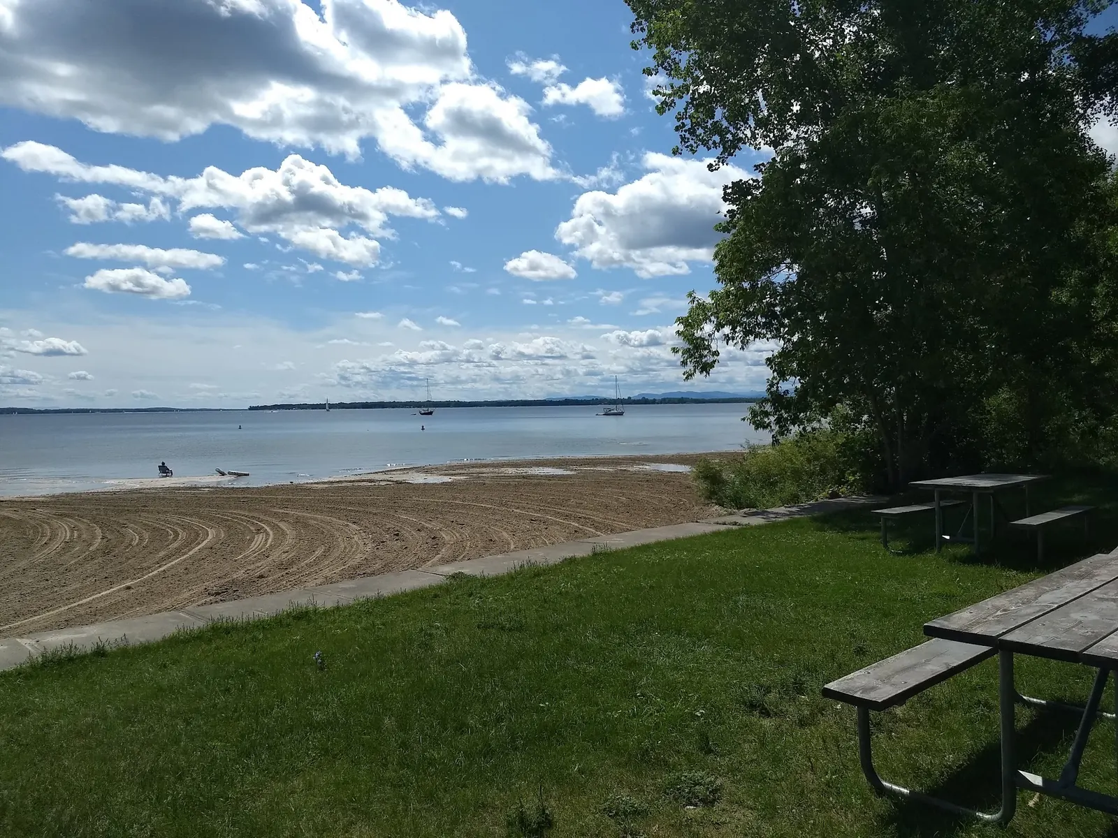
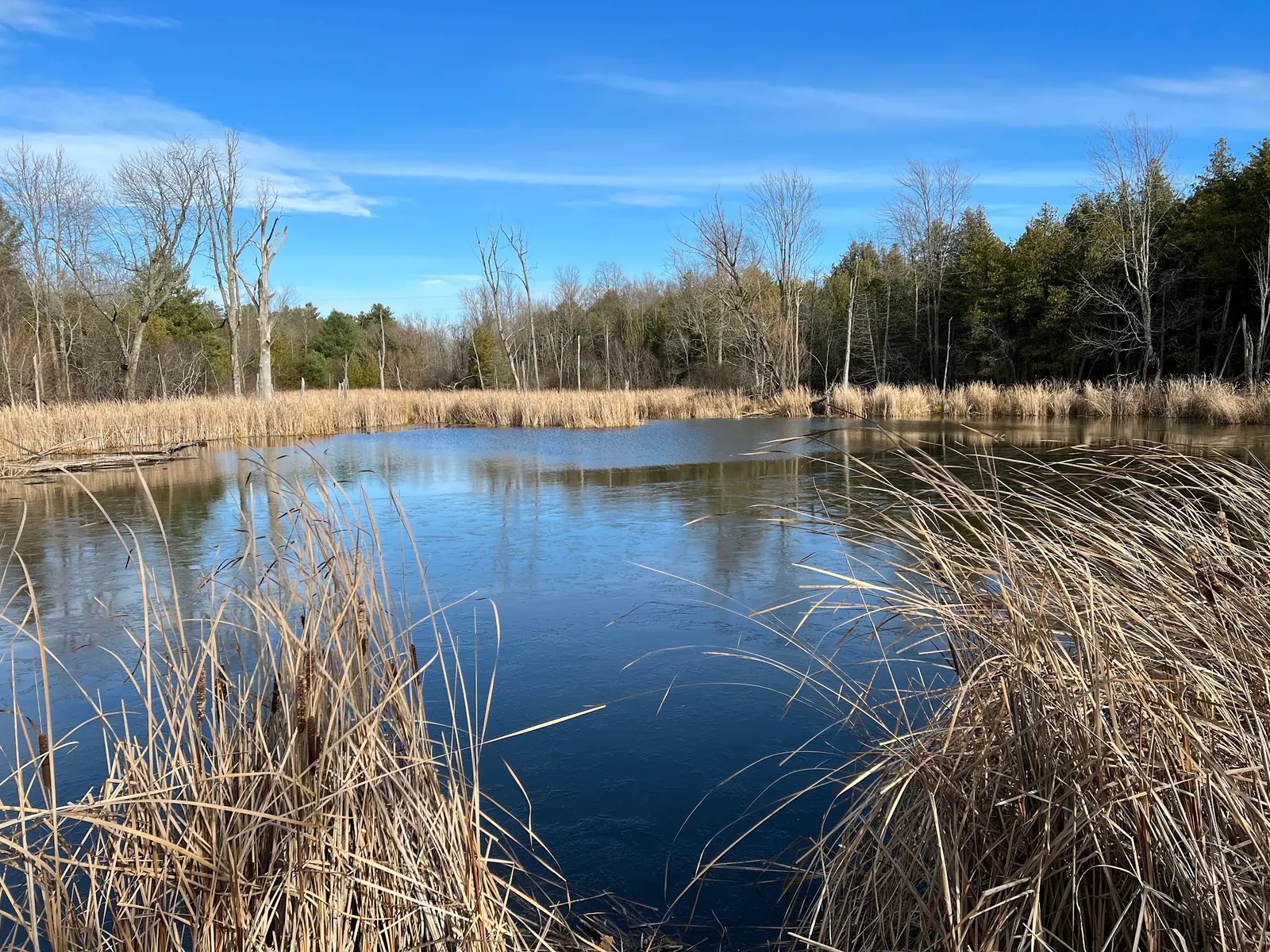
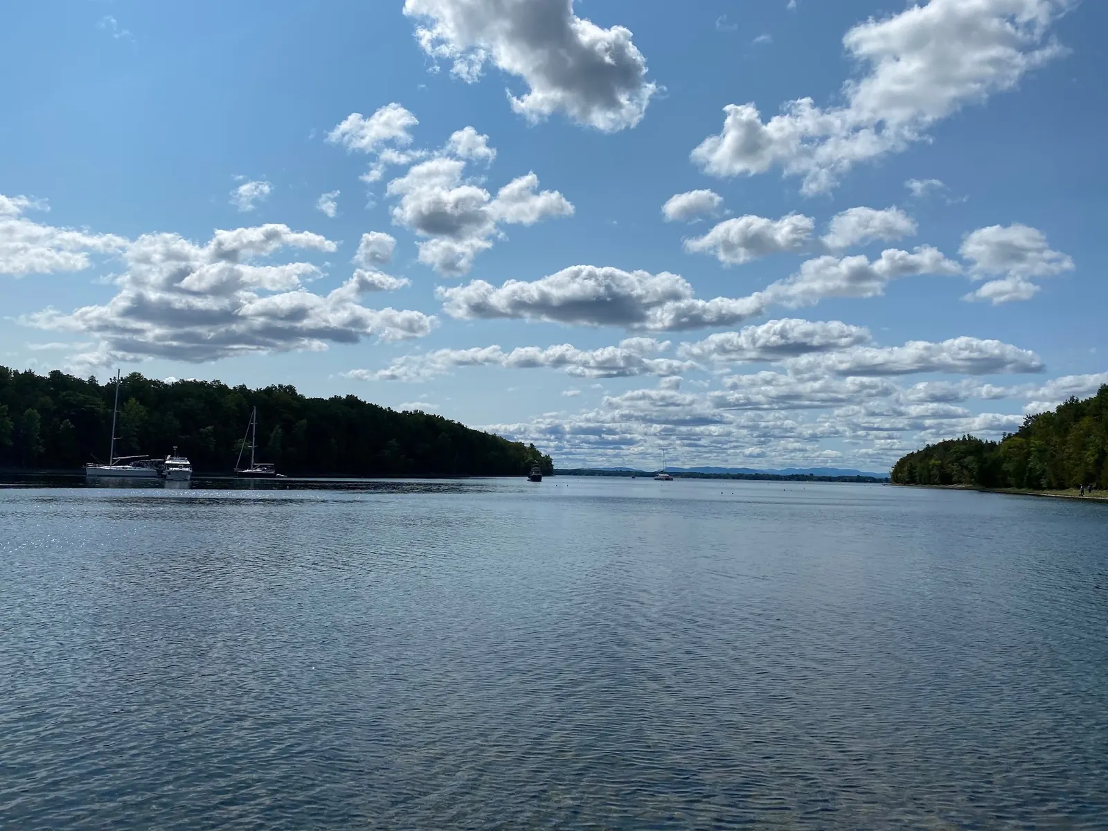
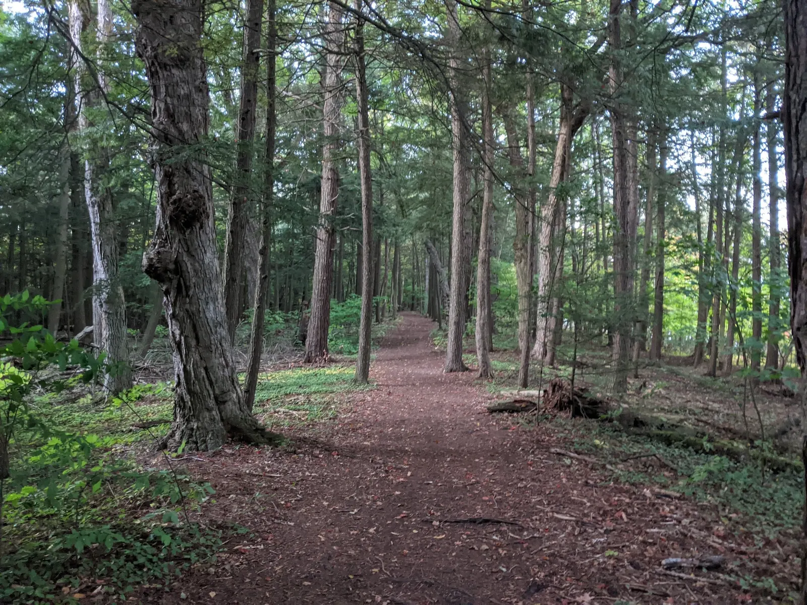
This is a desk-researched listing. A record update or map check does not confirm current swimming permission or water conditions.
Found an error? Send a correction with the location and a source. How we research listings.
Point Au Roche offers a lakeside day out, but a park being open is not proof that its swimming area is operating. Use the official park page to check the swimming notice and beach results before making a swim-focused trip.
Use the manager's entrance links rather than routing to a shoreline photo. Decide whether you want beach time, a picnic or nature exploration, then confirm the appropriate arrival instructions. Leave time to read the signs after parking.
The gallery includes different parts of the park. A marsh scene is not a substitute beach, and a boat scene is not a promise of available moorings. These historical views help describe the setting without claiming current conditions.
Build flexibility into the day if weather or a posted notice changes your plans. Do not move to an unmarked shore simply because the designated beach is unavailable.
The additional wooded-path photograph shows a dirt surface and forest setting. Its exact trail segment is not established, so it is not a beach approach map or an accessible-route promise. Follow the park's current entrance and trail information rather than reconstructing the archived shortcut from photographs.
Use the manager's Main Entrance link for the day-use area at 19 Camp Red Cloud Road, Plattsburgh. The Nature Center entrance is separate. The retained historical map point is not a verified beach entry.
Park and trails: sunrise to sunset year-round. Mooring lines were unavailable for the 2026 season; historical bay photos do not establish current mooring availability.
Confirm the entrance, parking arrangements, and legal access with the land manager. A map pin does not establish a public right of access. Follow posted routes and never block gates or driveways.
Use only the designated beach when officially operating. Check the current park notice; this review does not confirm swimming is open today. Public park access does not necessarily include permission to swim. Respect private property and posted restrictions.
Water conditions can change quickly. This listing does not provide a current safety or water-quality assessment. Check official alerts and avoid entering water when conditions or permission are uncertain.
Bring sturdy water shoes to protect your feet on rocks and slippery surfaces. A waterproof dry bag keeps your phone, keys, and valuables safe. Pack a quick-dry towel, sun protection, and drinking water - never drink from the natural water source.
Nearby places from saved public map data, not necessarily facilities at the swimming spot. Confirm access, hours, fees, and amenities with the operator before you drive.
Map data retrieved 2026-06-15
State park
19 Camp Red Cloud Rd, Plattsburgh, NY 12901
Park
137 St Armands Rd, Plattsburgh, NY 12901
Campground
7182 US-9, Plattsburgh, NY 12901
Public bathroom
24 Calbi Way, Plattsburgh, NY 12901
State park
152 Cumberland Head Rd, Plattsburgh, NY 12901
Popular destination for beach swimming & scenic picnics on the shore of Lake Champlain.
Public bathroom
51 Beach Rd, Plattsburgh, NY 12901
Parking lot
2 Dock St, Plattsburgh, NY 12901
Public bathroom
19 Cornelia St, Plattsburgh, NY 12901
Checking nearby USGS water conditions…
No. Check the separate swimming notice on the official park page before planning to enter the water.
No. They illustrate the wider landscape and do not identify an approved water-entry route.
No. Verify boat services directly with the park before arriving.
Point Au Roche State Park reflects the region’s historical significance as part of early French settlements and its proximity to Plattsburgh, a key location during the War of 1812.
Three reviewed historical views show the sandy shore, a marsh and boats in a bay. The marsh and bay are context images, not swimming-entry directions. No identifiable visitor faces are used.
Pack out litter, stay on authorized paths and leave plants and rocks in place. Keep photography separate from advice about legal water access.
Browse every listed natural swimming spot in New York.
Find similar lakes destinations across the directory.
See under-the-radar places and local favorites in the same state.
Compare easier-access destinations and safer planning options.
Use this safety guide before entering any natural water.
Safety & Access Notice
This information is for general planning only and may be incomplete, outdated, or inaccurate. Access rules, closures, water levels, currents, hazards, and legal restrictions can change at any time. Always verify current rules with the land manager or official source before visiting.
You are responsible for your own safety and for following all posted signs, laws, and local regulations. Read the full disclaimer.
No campground arrangement verified for this listing. Do not turn a boat photograph into overnight accommodation advice.
Loading weather data…
Safety & Access Notice
This information is for general planning only and may be incomplete, outdated, or inaccurate. Access rules, closures, water levels, currents, hazards, and legal restrictions can change at any time. Always verify current rules with the land manager or official source before visiting.
You are responsible for your own safety and for following all posted signs, laws, and local regulations. Read the full disclaimer.
Joshua Havens created Hidden Swimming Holes to make it easier for people to find — and safely visit — natural freshwater swimming destinations across the United States. He researches access conditions, water quality resources, and land management rules so you don't have to start from scratch. He holds a strong belief that good outdoor recreation information should be accurate, honest about its limitations, and freely available.
Discover other amazing natural swimming destinations across America