Ocqueoc Falls
Waterfall
04.8 (680)
Ocqueoc Township, MI 49759

Background: generated illustration, not a photograph of this location.
Plan Ocqueoc Falls with DNR access information, Recreation Passport guidance, qualified accessible-route details, nearby camping and five reviewed photos.
Swimming restriction
Follow current signs and closures. Lifeguards and current water quality unverified. Do not jump or dive.
Official sources checked:
Location
A closer look
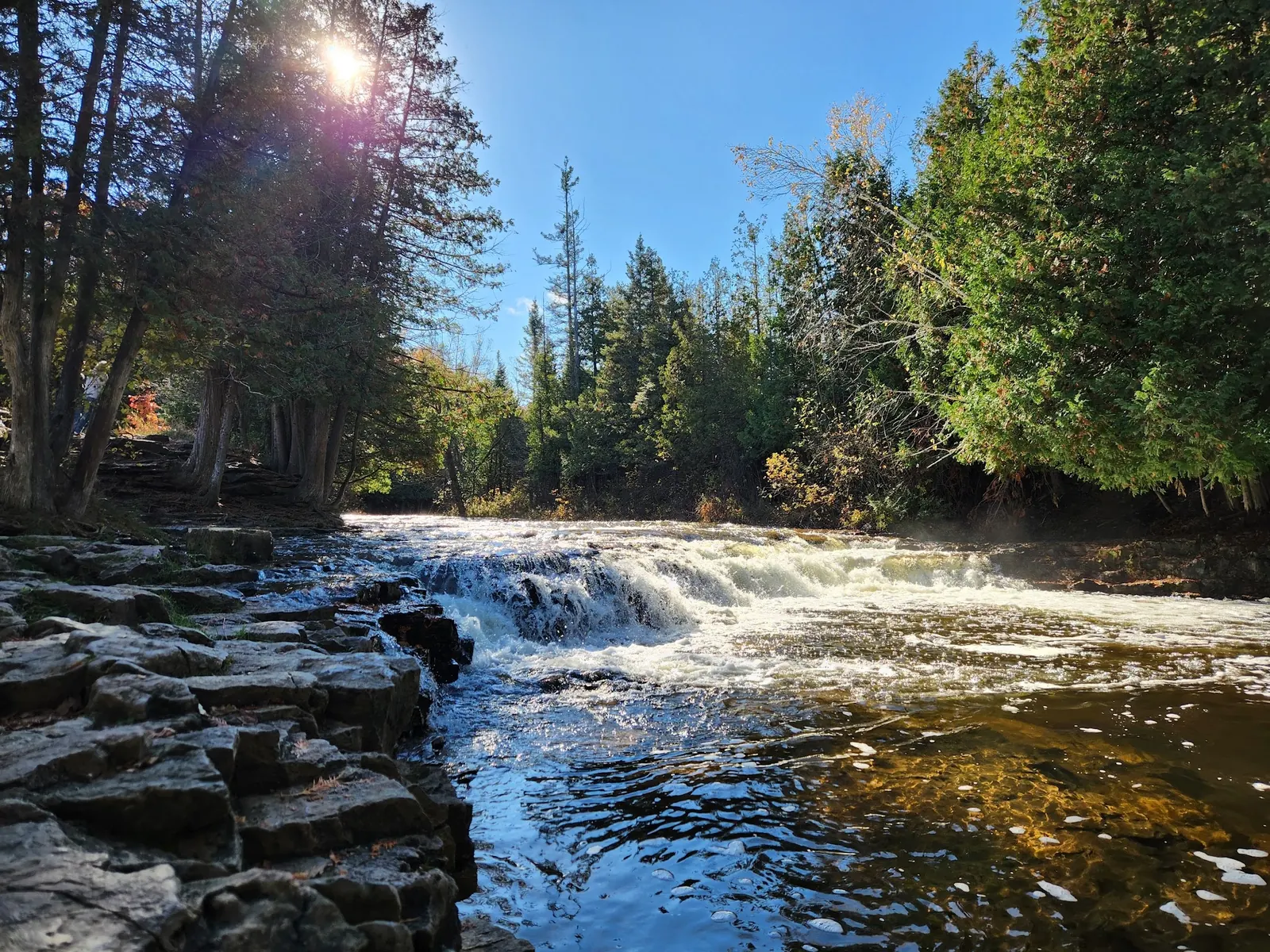
Photos show past visits, not current water levels or swimming conditions. Select a photo to view it larger.
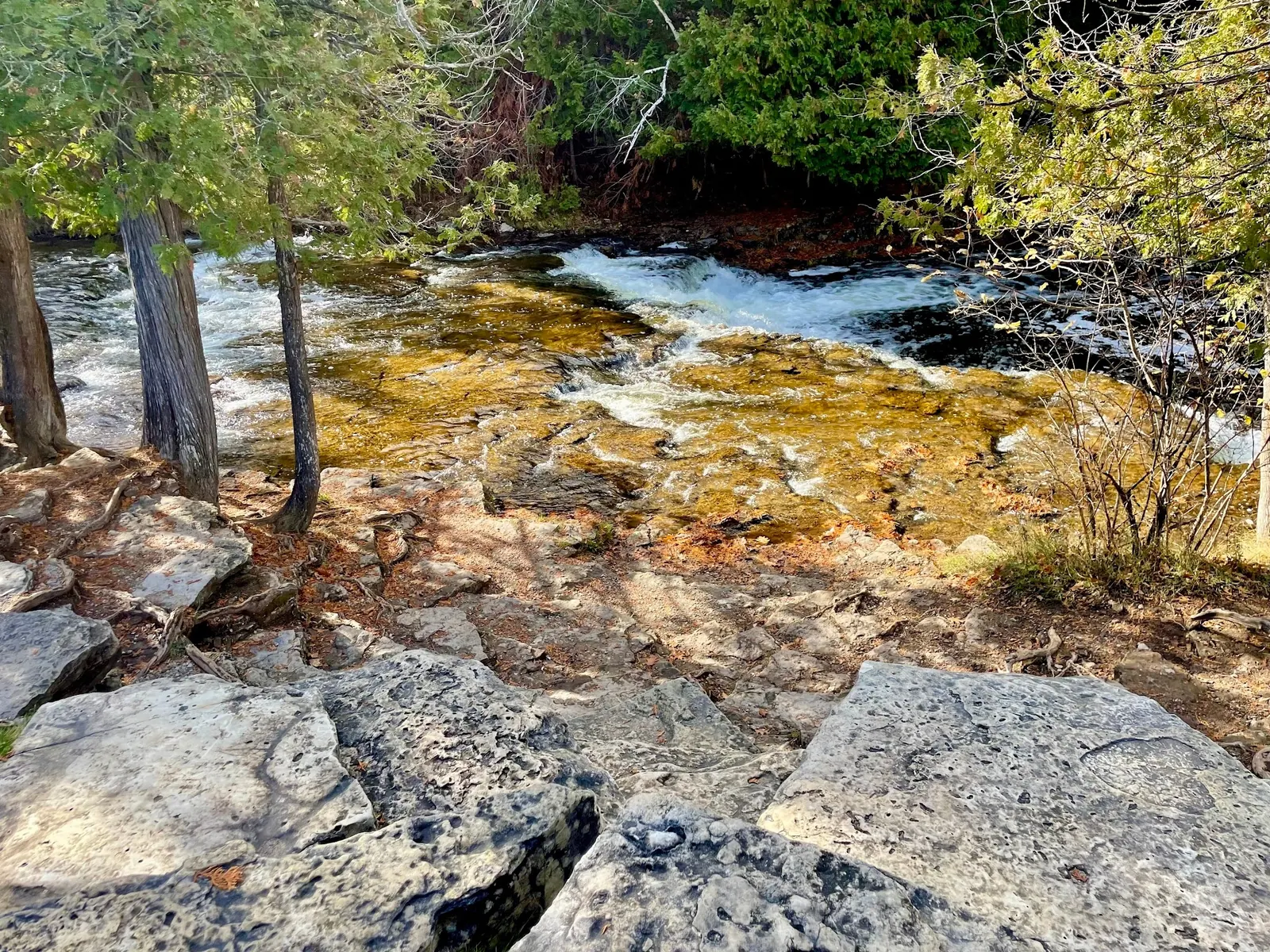
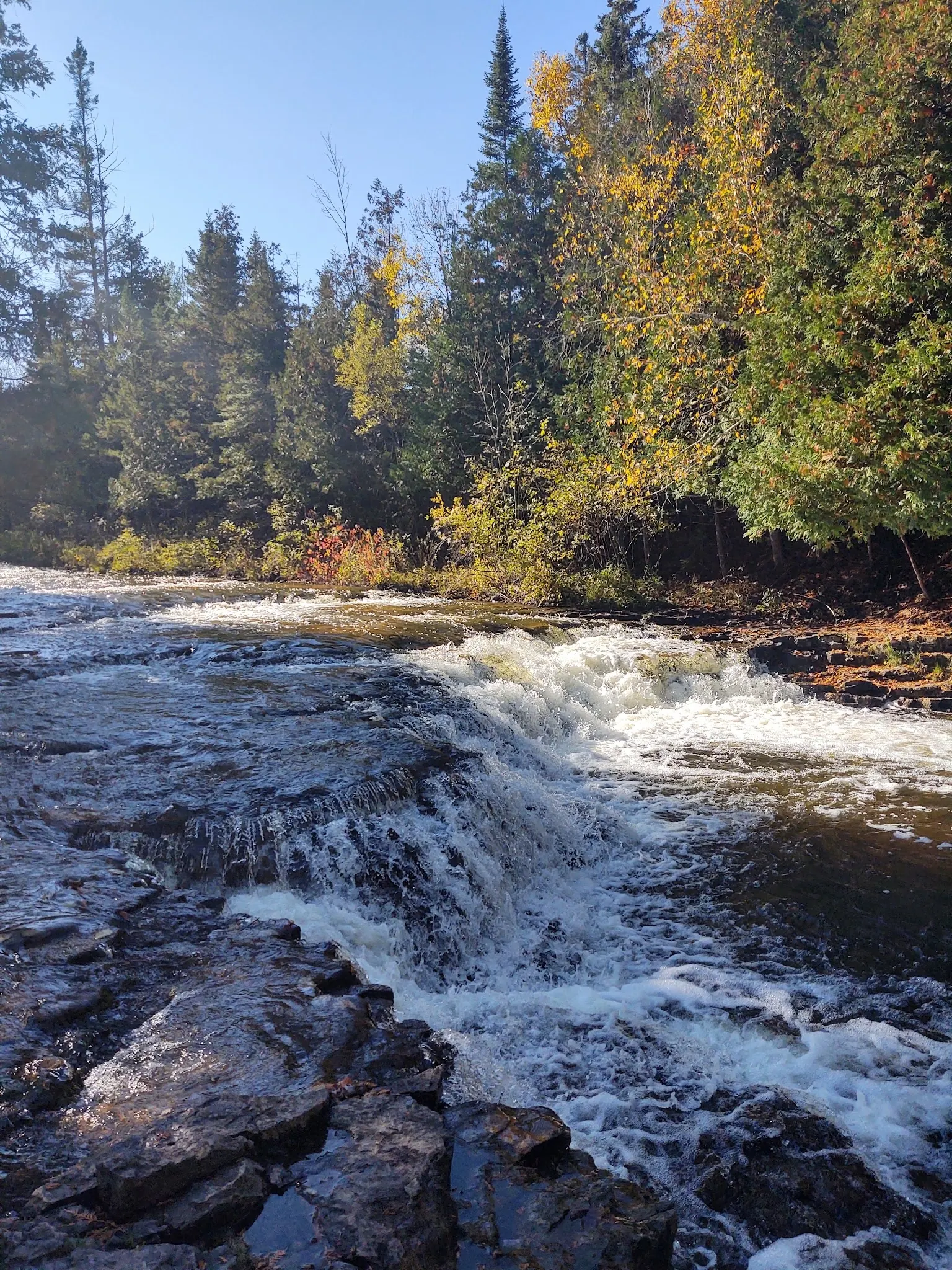
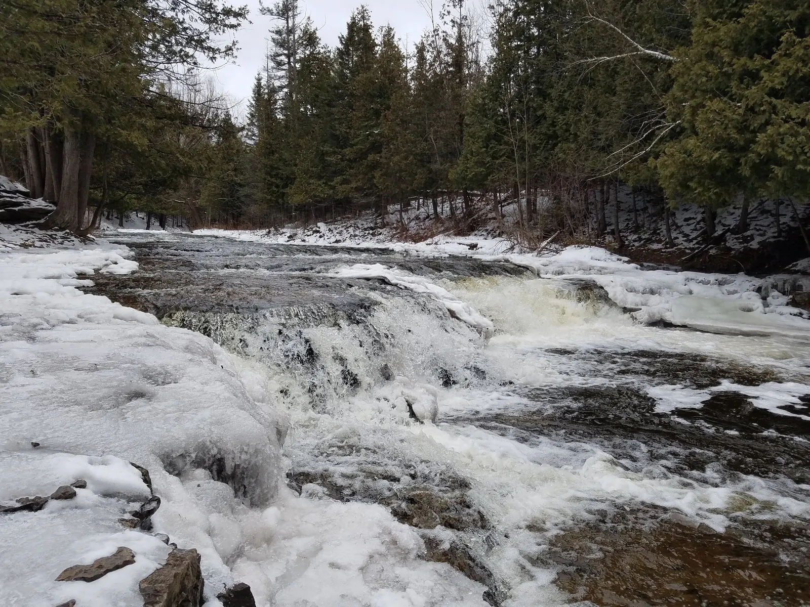
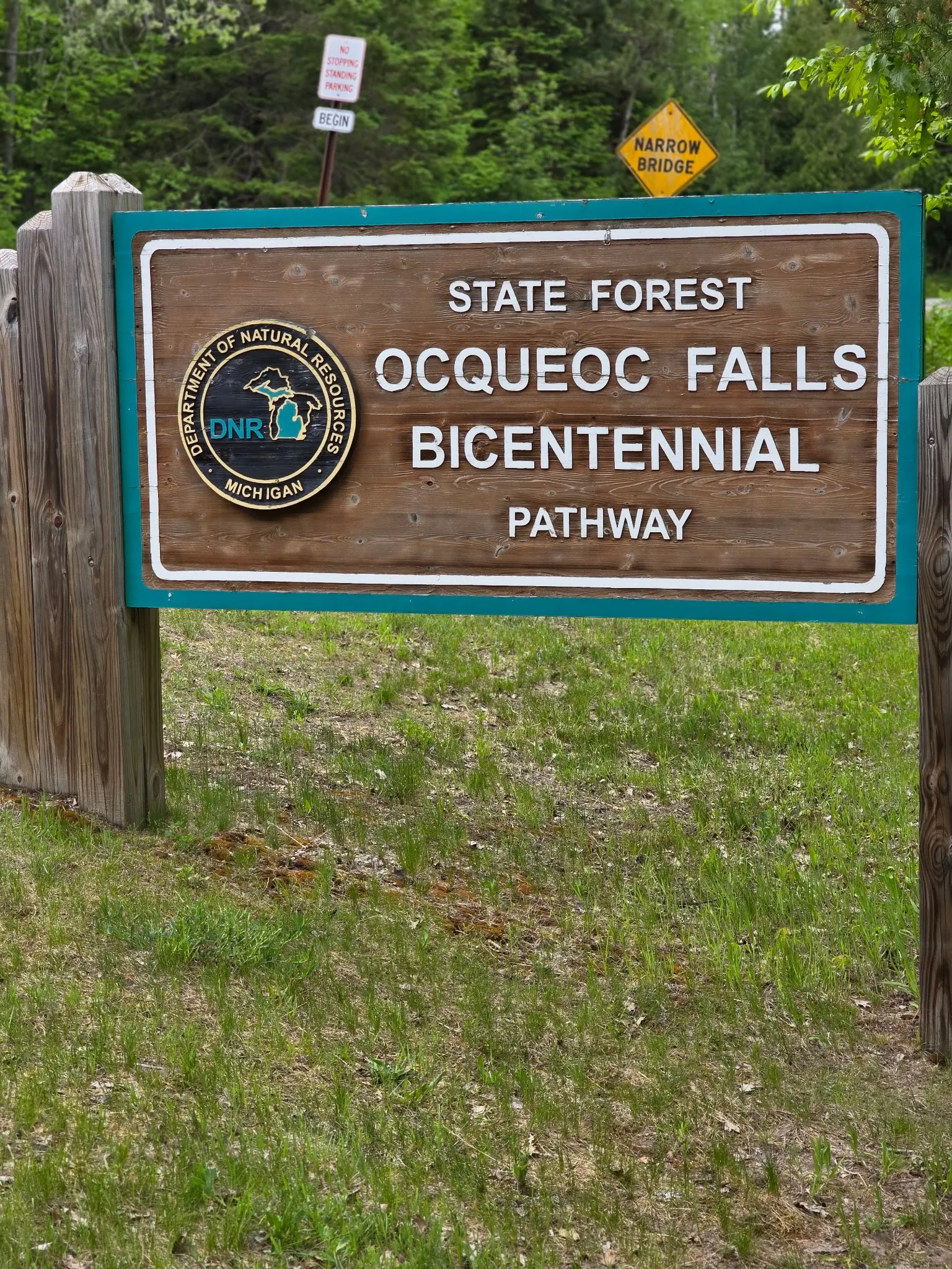
This is a desk-researched listing. A record update or map check does not confirm current swimming permission or water conditions.
Found an error? Send a correction with the location and a source. How we research listings.
This is a managed destination with documented accessibility work, not an unofficial roadside stop.
The current Recreation Passport guidance distinguishes vehicle registration categories and exemptions, including entry on foot or bicycle. Do not use an old price or assume camping is included.
The current DNR listing distinguishes falls picnic facilities from the campground. Its 2012 accessibility bulletin explains the earlier river-access design. Ask about maintenance and assistance your group may need. Infrastructure is not a promise of safe swimming.
The four existing photographs are preserved with a wider falls view added. Seasonal images illustrate variability, not present depth or water quality. Rough banks pictured are not evidence of the accessible route.
Find signed Bicentennial Pathway and falls parking off Ocqueoc Falls Road near M-68. Use the designated lot, not roadside or bridge parking. Arrange your vehicle pass and follow marked routes; the retained coordinate is not a surveyed water entry.
Current DNR information confirms a paved parking-to-falls trail. Its 2012 bulletin describes ramp and transfer features; confirm their present condition before relying on them. Unpaved bank paths are not equivalent alternatives.
Confirm the entrance, parking arrangements, and legal access with the land manager. A map pin does not establish a public right of access. Follow posted routes and never block gates or driveways.
Follow current signs and closures. Lifeguards and current water quality unverified. Do not jump or dive. Public park access does not necessarily include permission to swim. Respect private property and posted restrictions.
Water conditions can change quickly. This listing does not provide a current safety or water-quality assessment. Check official alerts and avoid entering water when conditions or permission are uncertain.
Bring sturdy water shoes to protect your feet on rocks and slippery surfaces. A waterproof dry bag keeps your phone, keys, and valuables safe. Pack a quick-dry towel, sun protection, and drinking water - never drink from the natural water source.
Nearby places from saved public map data, not necessarily facilities at the swimming spot. Confirm access, hours, fees, and amenities with the operator before you drive.
Map data retrieved 2026-06-15
Waterfall
Ocqueoc Township, MI 49759
Hiking area
Ocqueoc Falls Bicentennial Pathway, Millersburg, MI 49759
Campground
Millersburg, MI 49759
Park
7148 N Silver Creek Rd, Rogers City, MI 49779
State park
5001 US-23, Rogers City, MI 49779
Forested park includes hiking, biking & skiing terrain, plus 1 mile of shoreline along Lake Huron.
Public bathroom
Hoeft State Park, Rogers City, MI 49779
Park
1242 Forest Ave, Rogers City, MI 49779
Checking nearby USGS water conditions…
Motor-vehicle access requires a Recreation Passport. Check current rates and exemptions; overnight camping is separate.
DNR documents a paved approach. Its ramp and transfer description dates to 2012; confirm current conditions and suitability for your needs.
Do not assume that. DNR places the picnic area across the road from the campground. Confirm current toilet and water availability.
No such guarantee is supported. Assess flow and warnings; low falls do not establish safe swimming.
DNR's 2012 bulletin documents accessibility improvements; design history is not a maintenance inspection.
Five selected images show falls, banks, snow/ice and the named DNR sign. They neither establish current conditions nor illustrate the confirmed accessible route.
Use marked routes, respect restrictions and take litter home. Do not make shoreline shortcuts.
Browse every listed natural swimming spot in Michigan.
Find similar low falls and river pools destinations across the directory.
See under-the-radar places and local favorites in the same state.
Compare easier-access destinations and safer planning options.
Explore waterfall-focused swimming destinations in Michigan.
Use this safety guide before entering any natural water.
Safety & Access Notice
This information is for general planning only and may be incomplete, outdated, or inaccurate. Access rules, closures, water levels, currents, hazards, and legal restrictions can change at any time. Always verify current rules with the land manager or official source before visiting.
You are responsible for your own safety and for following all posted signs, laws, and local regulations. Read the full disclaimer.
Ocqueoc Falls State Forest Campground is across the road. Sites are first-come, first-served; check operating dates and separate overnight fees.
Loading weather data…
Safety & Access Notice
This information is for general planning only and may be incomplete, outdated, or inaccurate. Access rules, closures, water levels, currents, hazards, and legal restrictions can change at any time. Always verify current rules with the land manager or official source before visiting.
You are responsible for your own safety and for following all posted signs, laws, and local regulations. Read the full disclaimer.
Joshua Havens created Hidden Swimming Holes to make it easier for people to find — and safely visit — natural freshwater swimming destinations across the United States. He researches access conditions, water quality resources, and land management rules so you don't have to start from scratch. He holds a strong belief that good outdoor recreation information should be accurate, honest about its limitations, and freely available.
Discover other amazing natural swimming destinations across America