Alfred A. Loeb State Park
State park
04.7 (643)
N Bank Chetco River Rd, Brookings, OR 97415
Park known for its myrtlewood trees, with fishing, swimming & rafting on the Chetco river.
Barbecue grillPicnic tablesPublic restroom

Background: generated illustration, not a photograph of this location.
Explore Loeb State Park near Brookings with Chetco River photos, swimming precautions, camping reservations and practical access information for your visit.
Swimming restriction
Follow posted restrictions and ask staff about river access before entering. State Parks lists swimming here, but does not provide a current depth or water-quality clearance in the reviewed profile.
Official sources checked:
Location
A closer look
Photos show past visits, not current water levels or swimming conditions. Select a photo to view it larger.
This is a desk-researched listing. A record update or map check does not confirm current swimming permission or water conditions.
Found an error? Send a correction with the location and a source. How we research listings.
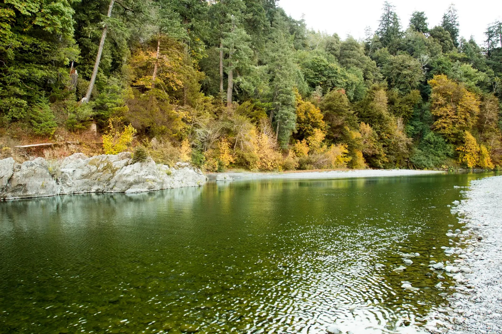
The riverbank and wooded setting give this southern Oregon park a different feel from an ocean beach. Our old description incorrectly placed it between Brookings and Grants Pass and promised easy, child-friendly shallows. Those claims are retired.
The official Loeb page includes swimming. That is not a current water test or a guarantee of suitable depth. State Parks' statewide advice describes unsupervised swimming and calls for a life jacket because cold water, currents and underwater hazards can be deceptive. Choose a riverside walk if conditions do not suit your group.
Route to the named park on North Bank Chetco River Road near Brookings. Use current signs and ask staff for the usable river approach. We have not verified the old turn-by-turn distances or an exact water-entry pin. Park accessibility does not establish an accessible route into the river.
The park lists year-round day use and camping, reservable sites and three rustic cabins. Check current availability and prices before traveling. Flush toilets and hot showers are listed, but there is no dump station and generators are not allowed. Ask which facilities day visitors may use.
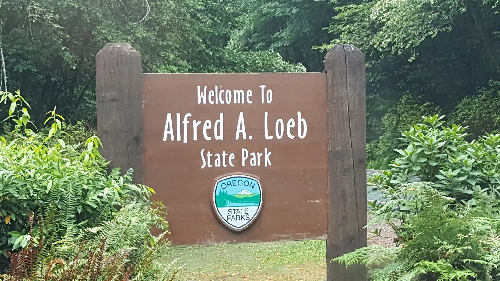
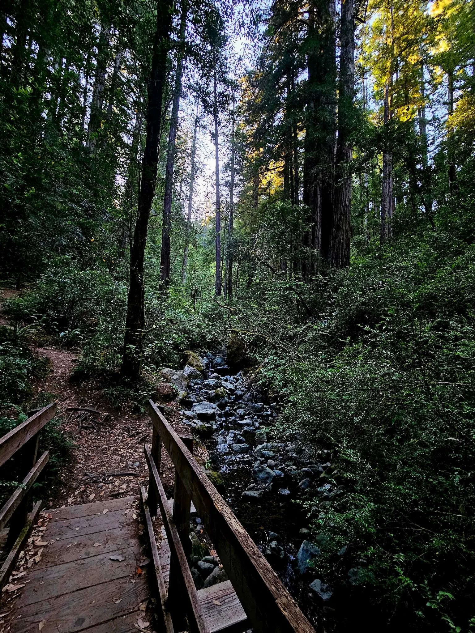
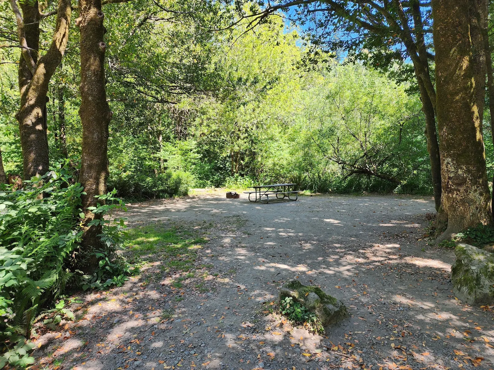
The reviewed photos show riverbank scenery, the park sign, a woodland footbridge and an empty campsite. They do not prove today's water quality, identify a safe swimming depth or make the pictured footbridge an approved river-entry route. Stay on established paths and respect occupied campsites.
Use Alfred A. Loeb State Park on North Bank Chetco River Road near Brookings as the destination and follow current park signs and official routing. The old route's precise US-101 turn distance, ten-mile approach and left-side entrance were not independently verified and are retired. Park only in authorized areas and ask staff for the currently usable river approach. The historical coordinates are retained as an unverified reference, not a confirmed parking stall, trail junction or water-entry location.
The official page lists year-round day use. Check notices before departure; opening does not certify river conditions. Do not assume every trail, gravel bar or water approach is accessible to every visitor.
Confirm the entrance, parking arrangements, and legal access with the land manager. A map pin does not establish a public right of access. Follow posted routes and never block gates or driveways.
Follow posted restrictions and ask staff about river access before entering. State Parks lists swimming here, but does not provide a current depth or water-quality clearance in the reviewed profile. Public park access does not necessarily include permission to swim. Respect private property and posted restrictions.
Water conditions can change quickly. This listing does not provide a current safety or water-quality assessment. Check official alerts and avoid entering water when conditions or permission are uncertain.
Bring sturdy water shoes to protect your feet on rocks and slippery surfaces. A waterproof dry bag keeps your phone, keys, and valuables safe. Pack a quick-dry towel, sun protection, and drinking water - never drink from the natural water source.
Nearby places from saved public map data, not necessarily facilities at the swimming spot. Confirm access, hours, fees, and amenities with the operator before you drive.
Map data retrieved 2026-06-15
State park
N Bank Chetco River Rd, Brookings, OR 97415
Park known for its myrtlewood trees, with fishing, swimming & rafting on the Chetco river.
Hiking area
N Bank Chetco River Rd, Brookings, OR 97415
Public bathroom
Harbor, OR 97415
Public parking space
630 Chetco Ave, Brookings, OR 97415
RV park
16035 Boat Basin Rd, Brookings, OR 97415
Tourist attraction
541 Chetco Ave #1, Brookings, OR 97415
Free parking lot
Central Building, 703 Chetco Ave, Brookings, OR 97415
Visitor center
898 Elk Dr, Brookings, OR 97415
Checking nearby USGS water conditions…
The manager lists swimming as an activity, subject to conditions and posted rules. That does not guarantee safe water, measured depths or lifeguard supervision.
The official page lists year-round day use and camping. Check current notices before departure; year-round opening does not make river conditions suitable year round.
Yes, use the official reservation service for current availability and prices. A saved Google operating-status flag is not a reservation.
Do not assume that. Visible stones or clear-looking water do not establish depth, current strength or bacterial quality. Supervise children closely and follow State Parks' life-jacket guidance.
No. The historical coordinates are retained, but the precise water approach and its accessibility have not been verified. Ask park staff for a route suited to your needs.
Use the full Alfred A. Loeb State Park name when planning or booking; this is the Brookings-area Chetco River park, not a destination between Brookings and Grants Pass.
Historical riverbank, named park sign, woodland footbridge and empty campsite views. The trail image does not identify the exact route to a swimming entry, and visible water clarity is not a bacterial test.
Use established paths, respect campsite boundaries and carry out litter. Do not create riverbank shortcuts or remove vegetation to reach a photo viewpoint.
Browse every listed natural swimming spot in Oregon.
Find similar river destinations across the directory.
See under-the-radar places and local favorites in the same state.
Compare easier-access destinations and safer planning options.
Use this safety guide before entering any natural water.
Safety & Access Notice
This information is for general planning only and may be incomplete, outdated, or inaccurate. Access rules, closures, water levels, currents, hazards, and legal restrictions can change at any time. Always verify current rules with the land manager or official source before visiting.
You are responsible for your own safety and for following all posted signs, laws, and local regulations. Read the full disclaimer.
Reservable campsites and three rustic cabins; camping is listed year round. Check availability and prices through the official booking service. Generators are prohibited.
Loading weather data…
Safety & Access Notice
This information is for general planning only and may be incomplete, outdated, or inaccurate. Access rules, closures, water levels, currents, hazards, and legal restrictions can change at any time. Always verify current rules with the land manager or official source before visiting.
You are responsible for your own safety and for following all posted signs, laws, and local regulations. Read the full disclaimer.
Joshua Havens created Hidden Swimming Holes to make it easier for people to find — and safely visit — natural freshwater swimming destinations across the United States. He researches access conditions, water quality resources, and land management rules so you don't have to start from scratch. He holds a strong belief that good outdoor recreation information should be accurate, honest about its limitations, and freely available.
Discover other amazing natural swimming destinations across America