Little Stony Falls
Hiking area
4.8 (314)
Forest Rd 701, Dungannon, VA 24245

Background: generated illustration, not a photograph of this location.
Plan Little Stony Falls with partial-closure guidance, distinct trail approaches, swimming-status limits and five reviewed waterfall, creek and trail photos.
Swimming permission unconfirmed
Waterfall viewing does not establish swimming permission. Partial trail closure is not proof of a site-wide swimming ban.
Official sources checked:
Location
A closer look
Photos show past visits, not current water levels or swimming conditions. Select a photo to view it larger.
This is a desk-researched listing. A record update or map check does not confirm current swimming permission or water conditions.
Found an error? Send a correction with the location and a source. How we research listings.
This is the Little Stony Creek waterfall area in Scott County near Dungannon and Coeburn, not Cascades Falls near Pembroke. Upper and Hanging Rock approaches are distinct. No verified swimming-entry pin is published.
The City of Norton's hiking page reports a two-mile section closed by landslides. This does not establish today's status of every approach. The National Recreation Trails record also reports partial closure and warns that its historical application details may be outdated. The linked Forest Service status page could not be retrieved during this review. Confirm current sections with the Clinch Ranger District and obey onsite closures.
Whole-trail length is not a verified open itinerary or an automatic round-trip distance to the falls. The NRT profile describes a former narrow-gauge railroad corridor with rocky sections and boulders. Ask about your chosen approach, including present bridge condition, parking and services. A separate picnic area's amenities are not automatically facilities at the waterfall. No accessible water entry or overnight permission is confirmed here.
Hiking profiles and photographs do not establish swimming permission, suitable depth or water quality. Do not jump or dive. The partial trail notice also does not establish a site-wide swimming ban. Follow current land-manager guidance for your activity.
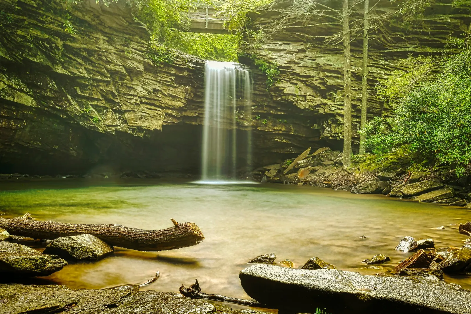
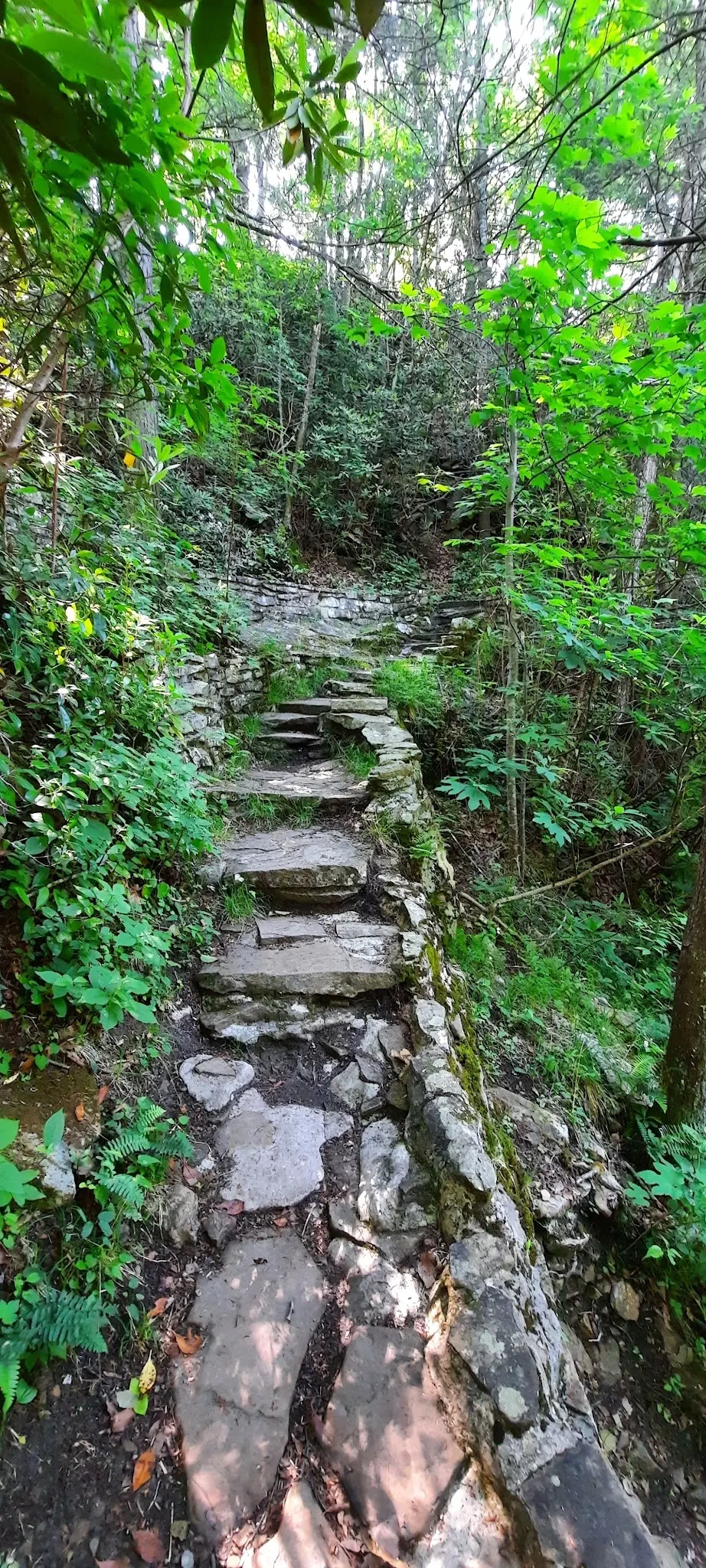
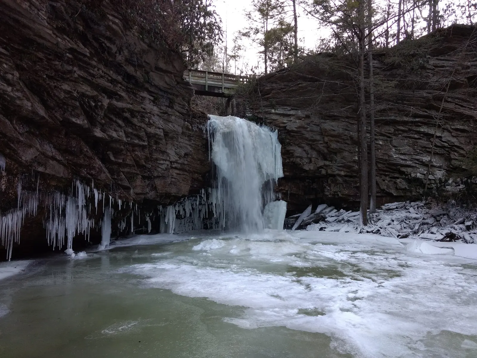
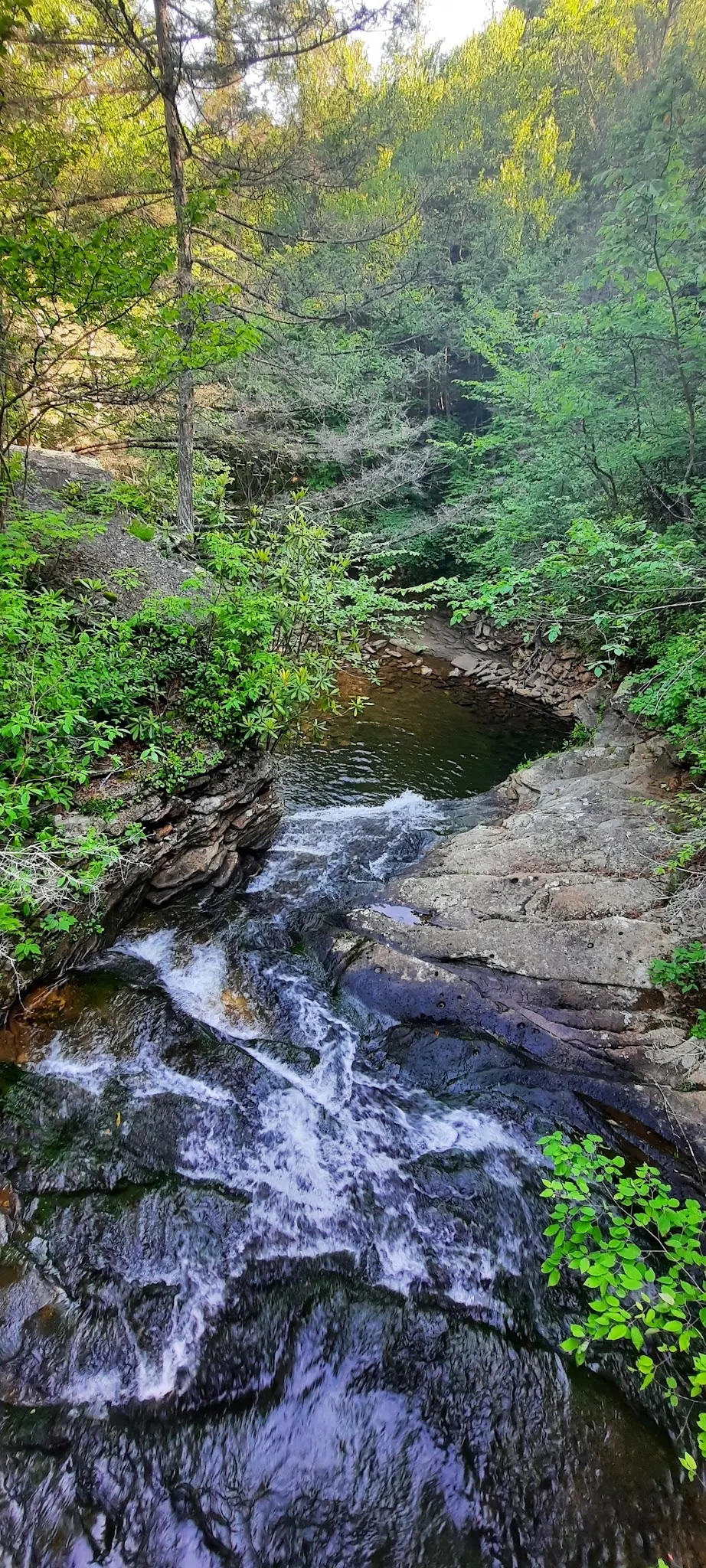
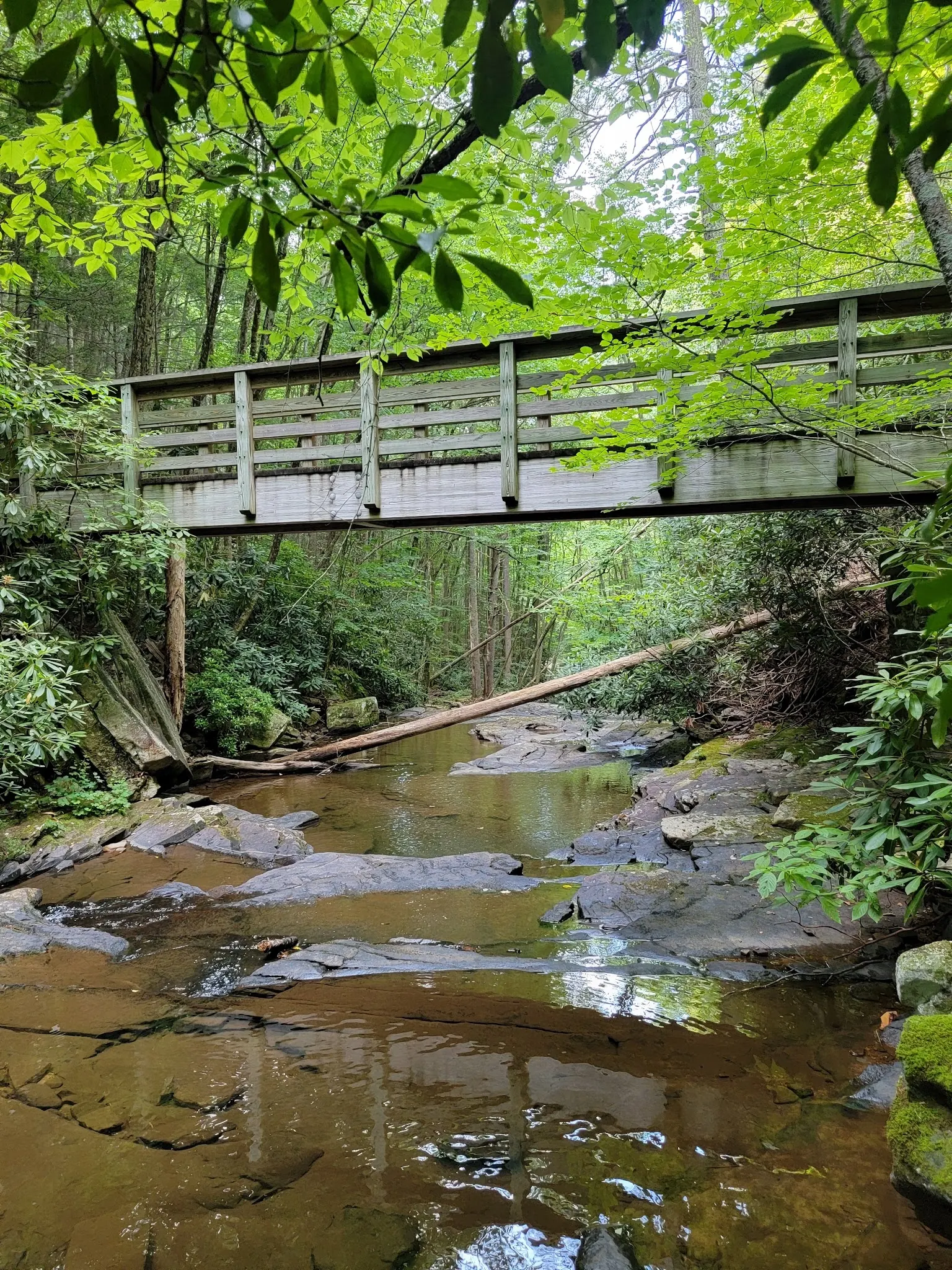
Waterfall scenery, winter ice, uneven stone steps, a cascading creek channel and a wooden footbridge describe the setting. These historical photographs do not establish open access, present bridge condition or a verified swimming entrance.
Confirm the currently open approach with the Clinch Ranger District before travel. Upper and Hanging Rock approaches are distinct. Do not use full trail length as an open-route recommendation, follow withdrawn town-pin navigation or cross a posted closure.
Norton reports a two-mile partial landslide closure. Historical NRT record also reports closure. Exact current open sections remain unconfirmed.
Confirm the entrance, parking arrangements, and legal access with the land manager. A map pin does not establish a public right of access. Follow posted routes and never block gates or driveways.
Waterfall viewing does not establish swimming permission. Partial trail closure is not proof of a site-wide swimming ban. Public park access does not necessarily include permission to swim. Respect private property and posted restrictions.
Water conditions can change quickly. This listing does not provide a current safety or water-quality assessment. Check official alerts and avoid entering water when conditions or permission are uncertain.
Nearby places from saved public map data, not necessarily facilities at the swimming spot. Confirm access, hours, fees, and amenities with the operator before you drive.
Map data retrieved 2026-06-15
Hiking area
Forest Rd 701, Dungannon, VA 24245
Campground
425 Rocky Branch Rd, Blountville, TN 37617
Campground
Colonial Heights, TN 37663
Public bathroom
406 Bays Mountain Park Rd, Kingsport, TN 37660
Public bathroom
2000 Harrell Rd, Kingsport, TN 37660
Public bathroom
Colonial Beach, VA 22443
Visitor center
Interstate 26 Mile Marker, 5, Kingsport, TN 37664
Tourist information center
280 Jennie Moore Rd, Flag Pond, TN 37657
Norton reports a two-mile partial closure, not today's status of every approach. Confirm current sections with the Clinch Ranger District.
Not without confirming the approach. It is not automatically a round-trip falls itinerary, especially with closed sections.
No. Hiking access and waterfall views do not establish permission, safe depth or water quality. Do not jump or dive.
No such guarantee is established. Confirm services for your specific open approach.
No. They show historical setting and terrain, not current access or bridge condition.
NRT profile describes an old narrow-gauge railroad corridor; historic context does not establish present usable distance.
Five historical views show waterfall, winter ice, stone steps, cascading creek and footbridge; none proves open access or swimming permission.
Remain on open designated routes and take your litter home.
Browse every listed natural swimming spot in Virginia.
Find similar waterfalls destinations across the directory.
See under-the-radar places and local favorites in the same state.
Compare easier-access destinations and safer planning options.
Explore waterfall-focused swimming destinations in Virginia.
Use this safety guide before entering any natural water.
Safety & Access Notice
This information is for general planning only and may be incomplete, outdated, or inaccurate. Access rules, closures, water levels, currents, hazards, and legal restrictions can change at any time. Always verify current rules with the land manager or official source before visiting.
You are responsible for your own safety and for following all posted signs, laws, and local regulations. Read the full disclaimer.
Confirm overnight rules and permitted locations with the district.
Loading weather data…
Safety & Access Notice
This information is for general planning only and may be incomplete, outdated, or inaccurate. Access rules, closures, water levels, currents, hazards, and legal restrictions can change at any time. Always verify current rules with the land manager or official source before visiting.
You are responsible for your own safety and for following all posted signs, laws, and local regulations. Read the full disclaimer.
Joshua Havens created Hidden Swimming Holes to make it easier for people to find — and safely visit — natural freshwater swimming destinations across the United States. He researches access conditions, water quality resources, and land management rules so you don't have to start from scratch. He holds a strong belief that good outdoor recreation information should be accurate, honest about its limitations, and freely available.
Discover other amazing natural swimming destinations across America