Kinkaid Lake Trail
Hiking area
0.2 mi
3.8 (16)
Gorham, IL 62940

Background: generated illustration, not a photograph of this location.
View Kinkaid Lake Spillway photos and distinguish its access from lake recreation areas, camping and facilities. Current swimming permission remains unverified.
Swimming permission unconfirmed
Confirm the exact location's rules with the manager and follow posted restrictions. Visitor photos and informal use do not establish permission.
Official sources checked:
Status summarizes our reviewed record, not today's opening or safety. Check current rules, swimming boundaries and notices before visiting.
Location
A closer look
Photos show past visits, not current water levels or swimming conditions. Select a photo to view it larger.
This is a desk-researched listing. A record update or map check does not confirm current swimming permission or water conditions.
Found an error? Send a correction with the location and a source. How we research listings.
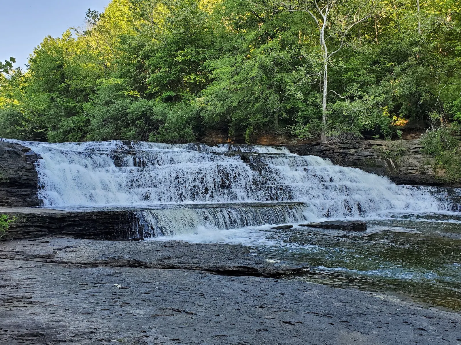
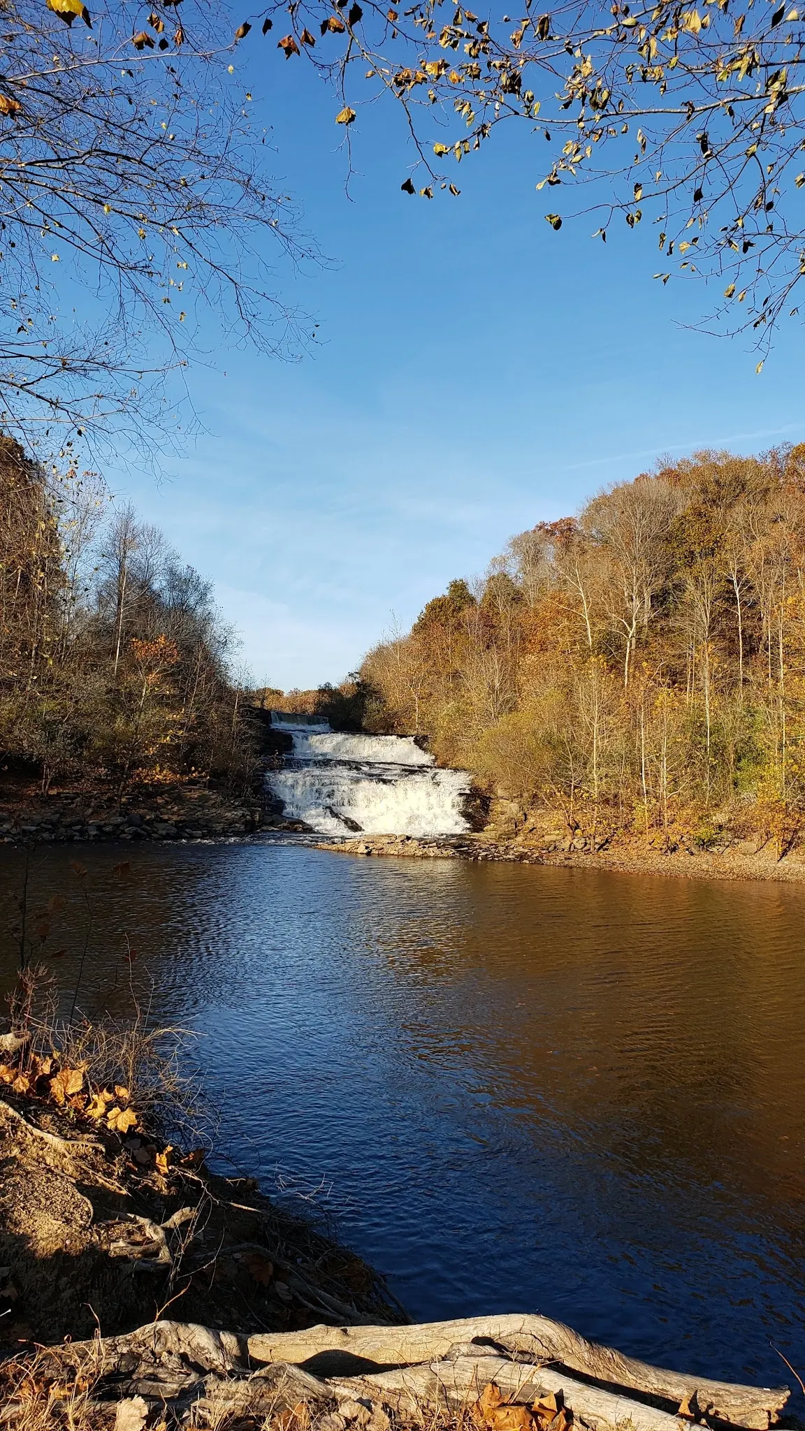
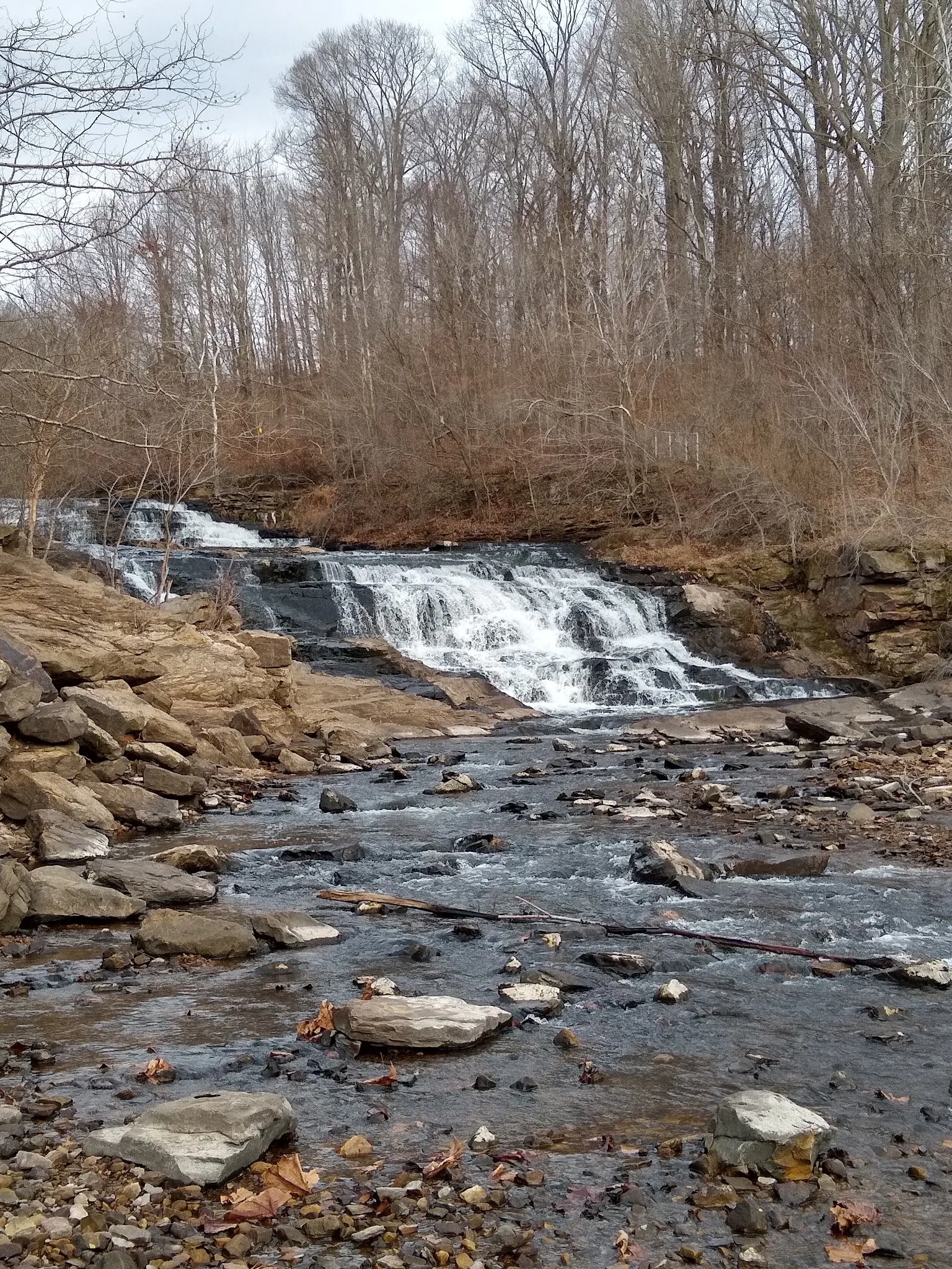
The saved photographs show water descending tiered rock into a wooded pool and channel. This is a scenic setting, but the pictures cannot establish safe depth, water quality or permission to enter. We have not verified a designated swimming area at the spillway.
Illinois DNR lists the dam and spillway as water-resource facilities. Its lake overview describes land managed by several organizations. Ask about the specific spillway approach and posted restrictions rather than assuming one lake-wide rule.
The DNR activity page places picnic and restroom amenities at named recreation areas and prohibits camping on DNR property. Those services are not promises about the spillway bank. Choose an authorized campground separately.
Three reviewed views show the cascade, autumn surroundings and rock-filled downstream channel. The water looks different between photographs. Neither a quiet-looking pool nor a visitor's camera position is evidence of a legal or suitable water entry. Do not follow an assumed route over barriers or onto dam structures.
The historical directions approach via Illinois 149 and Spillway Road near Murphysboro. Confirm the signed spillway entrance, legal parking and road status before travel. DNR's general park entrance and Cinder Hill office address are not verified spillway arrival points. The retained historical coordinates are not a verified parking or water-entry pin.
Land around Kinkaid Lake has several managers. A campground booking, marina visit or forest recreation rule does not establish access to the dam or spillway.
Confirm the entrance, parking arrangements, and legal access with the land manager. A map pin does not establish a public right of access. Follow posted routes and never block gates or driveways.
Confirm the exact location's rules with the manager and follow posted restrictions. Visitor photos and informal use do not establish permission. Public park access does not necessarily include permission to swim. Respect private property and posted restrictions.
Water conditions can change quickly. This listing does not provide a current safety or water-quality assessment. Check official alerts and avoid entering water when conditions or permission are uncertain.
Nearby places from saved public map data, not necessarily facilities at the swimming spot. Confirm access, hours, fees, and amenities with the operator before you drive.
Map data retrieved 2026-06-15
Hiking area
Gorham, IL 62940
Marina
2063 Marina Rd, Murphysboro, IL 62966
Campground
2-110 Big Oak, Murphysboro, IL 62966
Park
Murphysboro, IL 62966
Hiking area
768 C Forest Service Rd, Ava, IL 62907
State park
52 Cinder Hill Dr, Murphysboro, IL 62966
Hiking area
236 Cove Hollow Rd, Carbondale, IL 62903
Public bathroom
727 Playport Rd, Carbondale, IL 62902
Current spillway swimming permission was not verified. Check with the manager and obey posted restrictions; informal use and photographs are not permission.
No. The earlier shallow-water and family-suitability assurances were unsupported. The photographs do not establish safe depth or conditions.
Do not assume so. Named lake recreation areas and managed campgrounds are separate destinations, and spillway-specific services were not verified.
DNR uses Kinkaid Lake. The existing directory identity and URL retain the older Kincaid spelling so established links continue to work.
Official DNR pages use Kinkaid Lake. The established directory route retains the historical Kincaid spelling.
The gallery shows a close cascade, a wider autumn pool setting and a rocky downstream channel. These historical views are not a depth measurement or current access report.
Respect signed boundaries and leave rocks, plants and water undisturbed. Carry out litter.
Browse every listed natural swimming spot in Illinois.
See under-the-radar places and local favorites in the same state.
Compare easier-access destinations and safer planning options.
Use this safety guide before entering any natural water.
Safety & Access Notice
This information is for general planning only and may be incomplete, outdated, or inaccurate. Access rules, closures, water levels, currents, hazards, and legal restrictions can change at any time. Always verify current rules with the land manager or official source before visiting.
You are responsible for your own safety and for following all posted signs, laws, and local regulations. Read the full disclaimer.
DNR prohibits camping on its property. Managed camping elsewhere around the lake is separate from spillway access; reserve with the relevant operator.
Loading weather data…
Safety & Access Notice
This information is for general planning only and may be incomplete, outdated, or inaccurate. Access rules, closures, water levels, currents, hazards, and legal restrictions can change at any time. Always verify current rules with the land manager or official source before visiting.
You are responsible for your own safety and for following all posted signs, laws, and local regulations. Read the full disclaimer.
Joshua Havens created Hidden Swimming Holes to make it easier for people to find — and safely visit — natural freshwater swimming destinations across the United States. He researches access conditions, water quality resources, and land management rules so you don't have to start from scratch. He holds a strong belief that good outdoor recreation information should be accurate, honest about its limitations, and freely available.
Discover other amazing natural swimming destinations across America