Difficult Campground
Campground
3.8 mi
4.6 (176)
665 Difficult Campground, Aspen, CO 81611
Public restroomRestroomRunning waterTent sites

Background: generated illustration, not a photograph of this location.
Explore the Aspen Devil's Punchbowl with three reviewed gorge photos, Independence Pass travel checks and guidance distinguishing it from the Schofield Pass namesake.
Swimming permission unconfirmed
Water-entry permission was not established by the reviewed sources. A historical cliff-jumping description is not an operating rule or a safety assessment. Do not jump or dive into the gorge.
Location
A closer look
Photos show past visits, not current water levels or swimming conditions. Select a photo to view it larger.
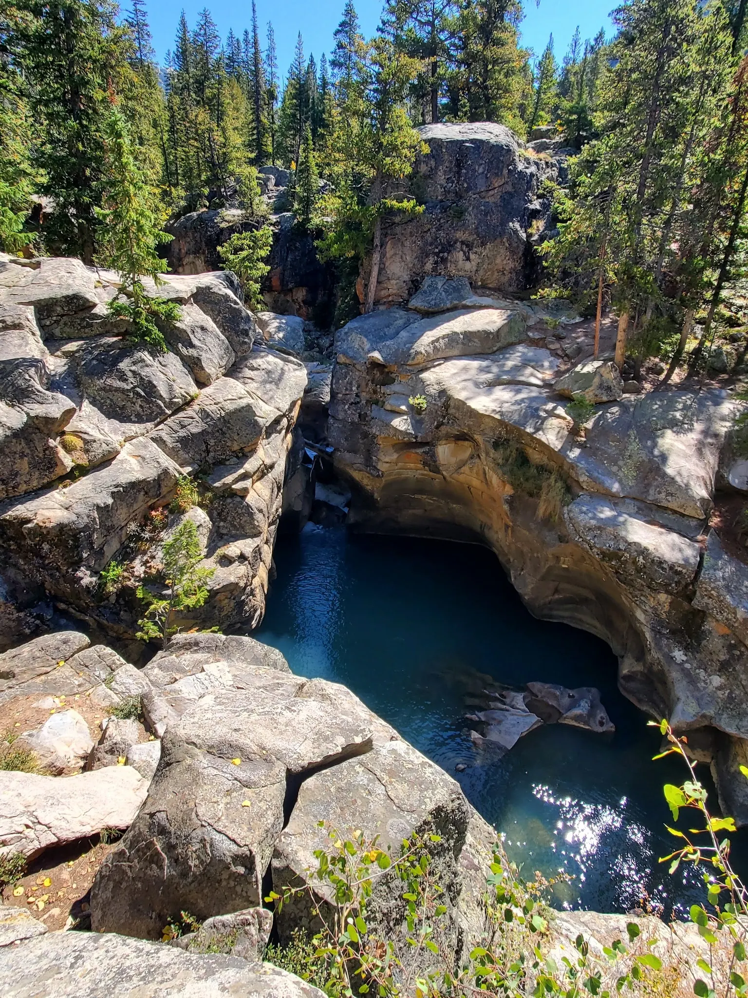
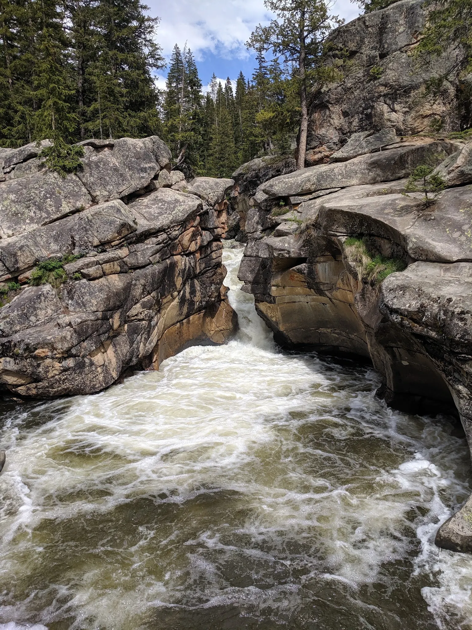
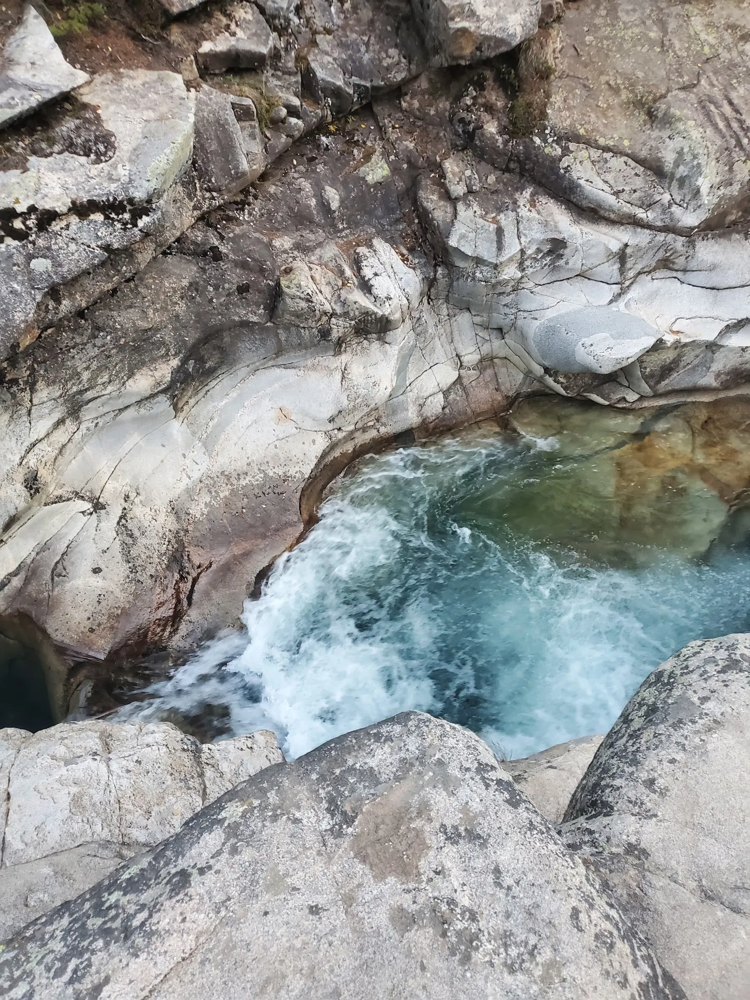
This is a desk-researched listing. A record update or map check does not confirm current swimming permission or water conditions.
Found an error? Send a correction with the location and a source. How we research listings.
The 2014 Aspen Trail Finder account distinguishes this Roaring Fork corridor location from another Devil's Punchbowl near Schofield Pass. Check that your route and images refer to the Aspen destination before planning the outing.
Read CDOT's Independence Pass travel information and follow its link to COtrip before departure. Typical seasonal opening dates are not a live road report. Check the published vehicle restrictions if traveling with a trailer, and confirm parking separately from whether the highway is open.
The selected gallery focuses on rounded gorge walls and flowing water. Contrasting mountain-gorge photos were withheld rather than silently mixed into the Aspen gallery. Choose an authorized dry-land viewpoint without moving onto slick edges to recreate a camera angle.
A dramatic pool image cannot reveal submerged obstacles, current water quality or a reliable way out. Neither the historical jumping description nor the reviewed travel page establishes current swimming permission. Do not jump or dive, and choose a confirmed managed swimming location if a swim is the purpose of your trip.
Confirm the Aspen destination along Highway 82, not the same-name gorge near Schofield Pass. Check COtrip for route status and confirm designated parking and the authorized pedestrian approach locally. The retained coordinate is not a verified parking space or water entrance; roadside parked cars do not establish permission.
Reviewed October 8, 2026: the location account is dated September 2014. CDOT describes recurring winter closure of Independence Pass and directs travelers to COtrip for current status. Its typical seasonal dates are not confirmation of today's road opening or of a 2026 closure date.
Confirm the entrance, parking arrangements, and legal access with the land manager. A map pin does not establish a public right of access. Follow posted routes and never block gates or driveways.
Water-entry permission was not established by the reviewed sources. A historical cliff-jumping description is not an operating rule or a safety assessment. Do not jump or dive into the gorge. Public park access does not necessarily include permission to swim. Respect private property and posted restrictions.
Water conditions can change quickly. This listing does not provide a current safety or water-quality assessment. Check official alerts and avoid entering water when conditions or permission are uncertain.
Nearby places from saved public map data, not necessarily facilities at the swimming spot. Confirm access, hours, fees, and amenities with the operator before you drive.
Map data retrieved 2026-06-15
Campground
665 Difficult Campground, Aspen, CO 81611
Hiking area
401 Co Rd 21, Aspen, CO 81611
Parking garage
Aspen, CO 81611
Public bathroom
419 S Mill St, Aspen, CO 81611
Park
Rio Grande Trl, Aspen, CO 81611
Hiking area
255 S Hunter St, Aspen, CO 81611
Forestry office
806 W Hallam St, Aspen, CO 81611
Government office
199 Prospector Rd, Aspen, CO 81611
No. This listing concerns the Aspen and Independence Pass corridor destination. Check the full location name when planning a route.
No current official swimming permission was established by this review. A historical jumping description is not authorization or safety guidance.
No. Check road status and confirm the exact permitted approach separately.
No. Candidates with unresolved destination identity were withheld; three visually consistent gorge views were selected.
A wild retreat that showcases the enduring beauty of Colorado’s wilderness, contrasting the luxury of nearby Aspen and Glenwood Springs.
Three reviewed photos show rounded gorge rocks, a cascade and a closer water channel. Several contrasting mountain-gorge candidates were withheld because their destination identity was unresolved. No selected image verifies water depth, a usable exit or permission at the camera position.
Stay on permitted routes, avoid disturbing stream banks, leave rock surfaces unmarked and carry out rubbish.
Browse every listed natural swimming spot in Colorado.
See under-the-radar places and local favorites in the same state.
Compare easier-access destinations and safer planning options.
Explore waterfall-focused swimming destinations in Colorado.
Use this safety guide before entering any natural water.
Safety & Access Notice
This information is for general planning only and may be incomplete, outdated, or inaccurate. Access rules, closures, water levels, currents, hazards, and legal restrictions can change at any time. Always verify current rules with the land manager or official source before visiting.
You are responsible for your own safety and for following all posted signs, laws, and local regulations. Read the full disclaimer.
No overnight permission verified at this point. Reserve an authorized campsite separately.
Loading weather data…
Safety & Access Notice
This information is for general planning only and may be incomplete, outdated, or inaccurate. Access rules, closures, water levels, currents, hazards, and legal restrictions can change at any time. Always verify current rules with the land manager or official source before visiting.
You are responsible for your own safety and for following all posted signs, laws, and local regulations. Read the full disclaimer.
Joshua Havens created Hidden Swimming Holes to make it easier for people to find — and safely visit — natural freshwater swimming destinations across the United States. He researches access conditions, water quality resources, and land management rules so you don't have to start from scratch. He holds a strong belief that good outdoor recreation information should be accurate, honest about its limitations, and freely available.
Discover other amazing natural swimming destinations across America