Watoga State Park
State park
4.7 (687)
4800 Watoga Park Rd, Marlinton, WV 24954
Natural area with more than 10,000 acres of mountains featuring hiking trails, campgrounds & cabins.
Barbecue grillBasketball courtCycling lanesHas a tennis court

Background: generated illustration, not a photograph of this location.
Plan Watoga with clear river-versus-lake guidance, seasonal camping, official contact information and four reviewed park-context photos.
Swimming permission unconfirmed
Confirm permitted river access and current notices. Lake boating, campground facilities and older pool references do not establish river swimming permission.
Official sources checked:
Status summarizes our reviewed record, not today's opening or safety. Check current rules, swimming boundaries and notices before visiting.
Location
A closer look
Photos show past visits, not current water levels or swimming conditions. Select a photo to view it larger.
This is a desk-researched listing. A record update or map check does not confirm current swimming permission or water conditions.
Found an error? Send a correction with the location and a source. How we research listings.
This historical listing concerns the Greenbrier River behind Riverside Campground. The current official pages reviewed do not locate that swimming entry or establish its permission. This uncertainty is not evidence of a ban.
The park overview lists 304-799-4087 and 4800 Watoga Park Road, Marlinton, WV 24954. That address is park context, not a water-entry pin. Ask staff about permitted access and day-use parking. Do not cross occupied campsites.
Riverside and Beaver Creek camping is seasonal and weather-dependent. Campground bathhouses are not confirmed river changing facilities. The activities page describes boating and fishing at Watoga Lake, varied hiking trails, and CCC exhibits with a self-guided history tour. Lake recreation is separate from this river listing. Current pool operation was not confirmed.
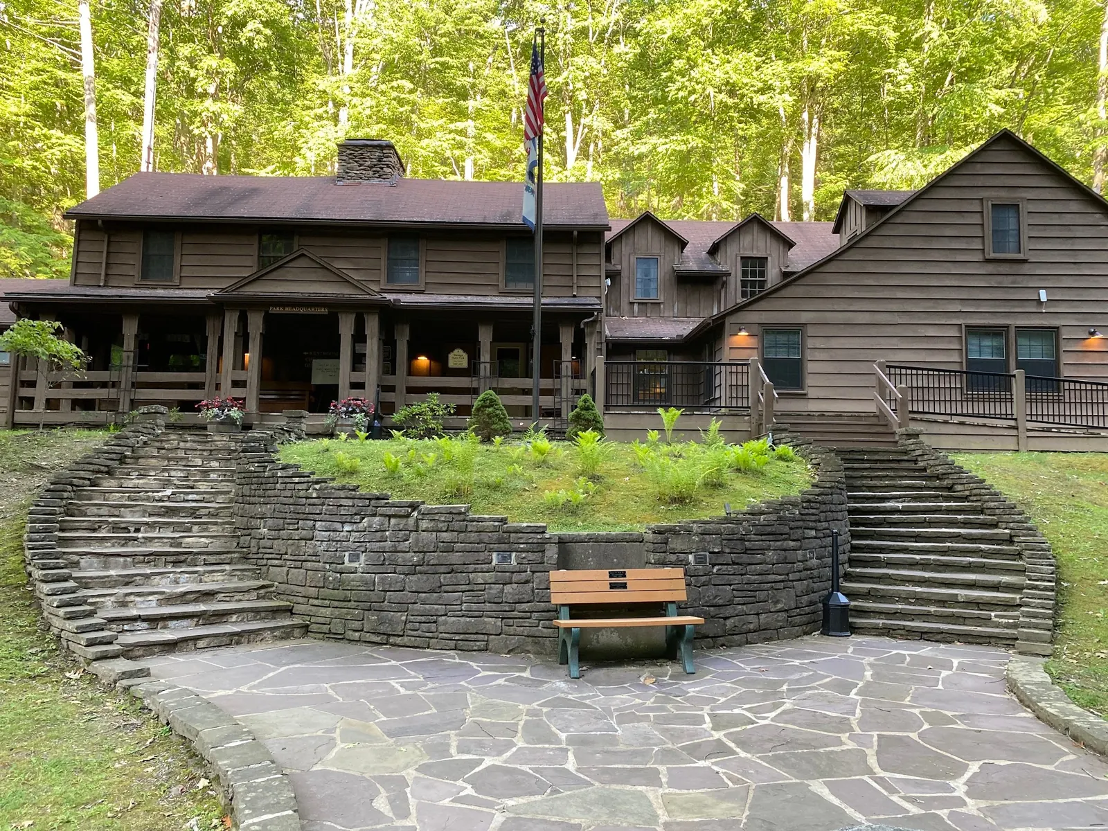
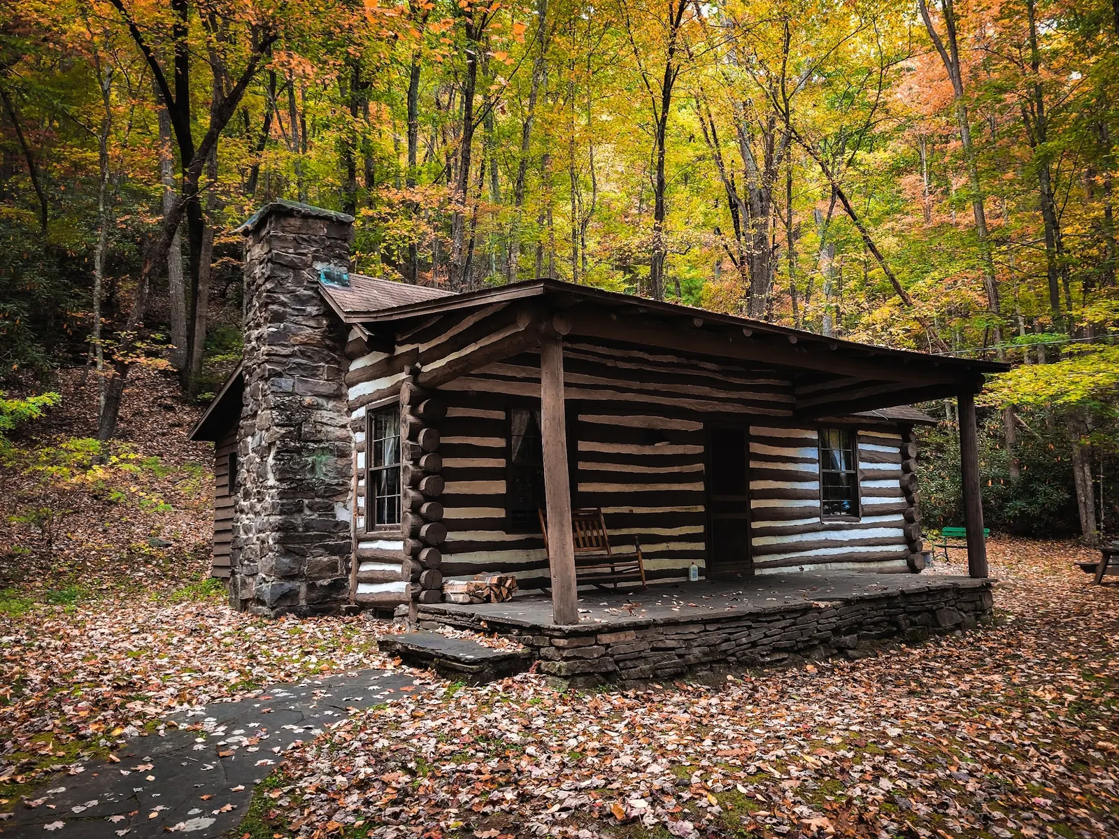
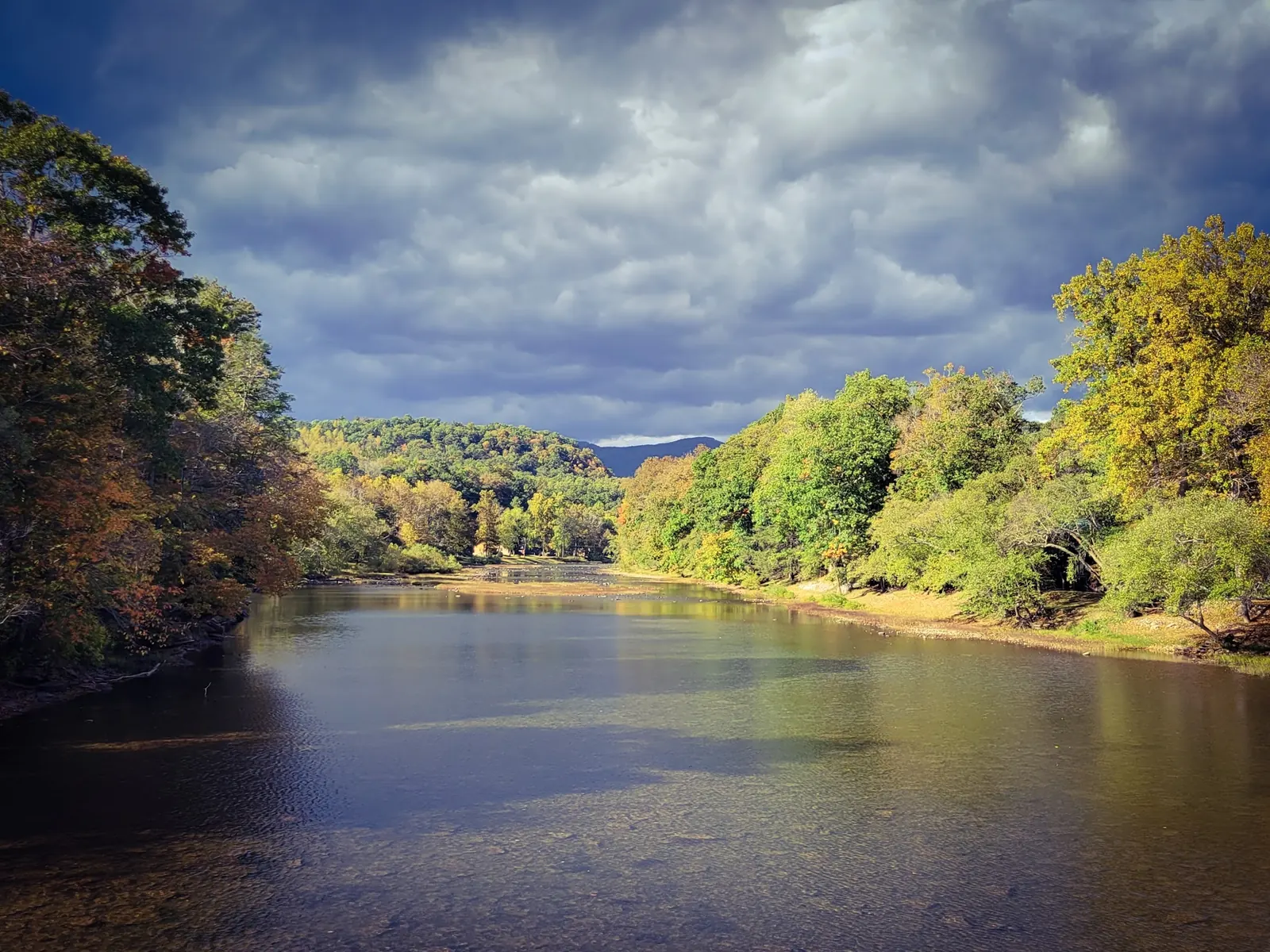
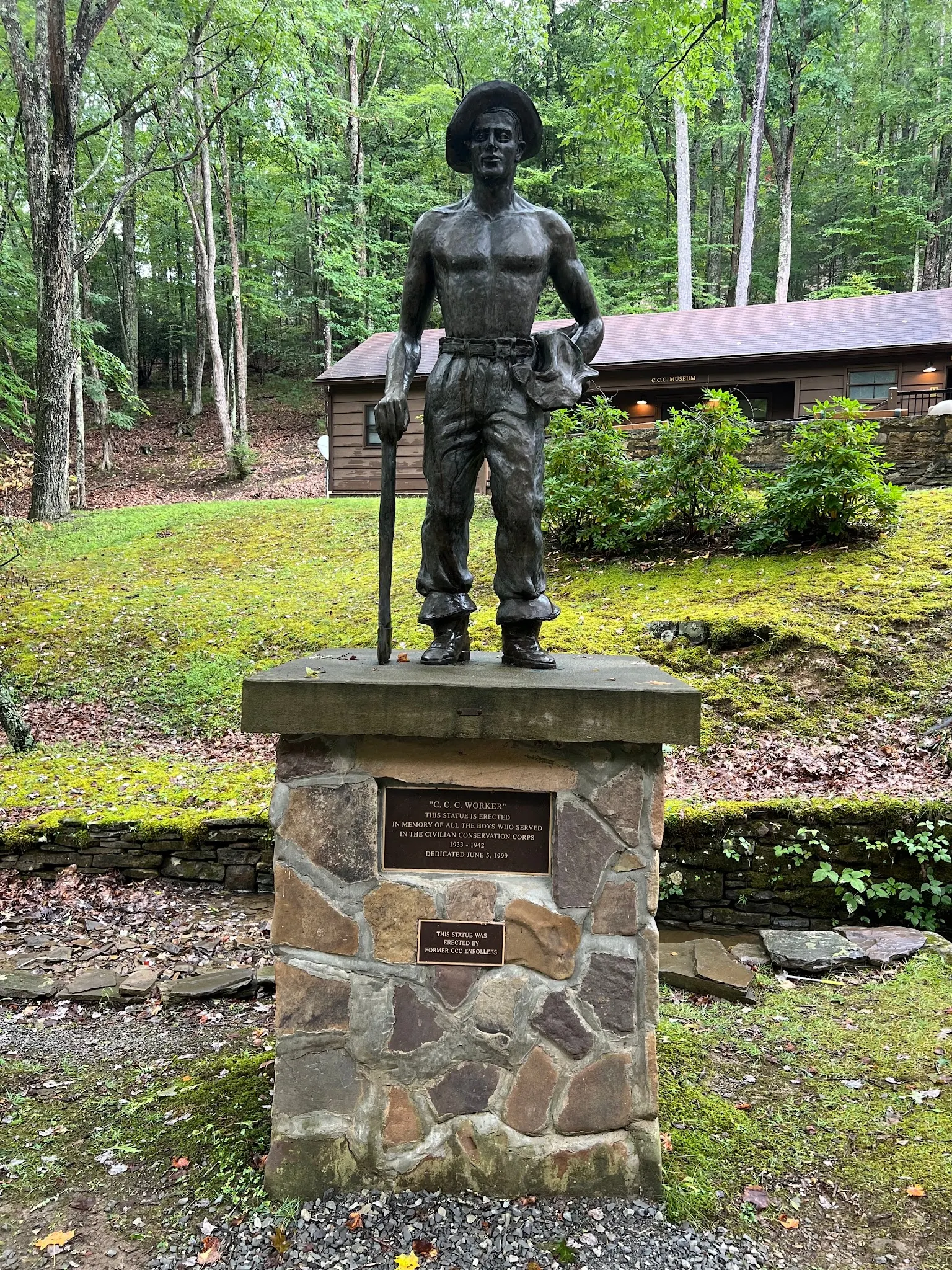
The four-photo gallery shows headquarters, a cabin, regional river scenery and the CCC memorial. The river photograph is not independently located at the historical entry, and none proves present conditions. Check current notices before entering water, avoid high or rapidly changing flows, supervise children and do not jump into unknown depths.
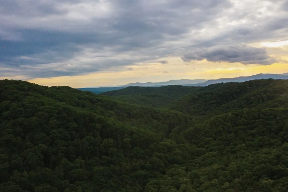
An additional photograph shows forested ridges under evening clouds in the park collection. The viewpoint has not been independently located or surveyed for public access. It adds regional landscape context, not directions to the Greenbrier River, proof of Riverside Campground entry or evidence of current pool operation. Plan the specific activity with park staff rather than treating lake, ridge and river photographs as one arrival point.
Contact staff about permitted Riverside Campground river access. The park address, 4800 Watoga Park Road, Marlinton, WV 24954, is not a verified swimming entry.
Greenbrier River, Watoga Lake and the historical pool are separate destinations; no precise river pin supplied.
Confirm the entrance, parking arrangements, and legal access with the land manager. A map pin does not establish a public right of access. Follow posted routes and never block gates or driveways.
Confirm permitted river access and current notices. Lake boating, campground facilities and older pool references do not establish river swimming permission. Public park access does not necessarily include permission to swim. Respect private property and posted restrictions.
Water conditions can change quickly. This listing does not provide a current safety or water-quality assessment. Check official alerts and avoid entering water when conditions or permission are uncertain.
Nearby places from saved public map data, not necessarily facilities at the swimming spot. Confirm access, hours, fees, and amenities with the operator before you drive.
Map data retrieved 2026-06-15
State park
4800 Watoga Park Rd, Marlinton, WV 24954
Natural area with more than 10,000 acres of mountains featuring hiking trails, campgrounds & cabins.
Hiking area
4800 Watoga Park Rd, Marlinton, WV 24954
Hiking, cycling & horseback riding on a former railway line going over bridges & through tunnels.
State park
Beartown Rd, Renick, WV 24966
Protected mountain forest with a boardwalk for viewing crevices, boulders & overhanging cliffs.
Public bathroom
WMQ5+Q6, Frankford, WV 24938
Tourist information center
Mile, Marker 179, White Sulphur Springs, WV 24986
State park
Greenbrier River Trl, Caldwell, WV 24925
Visitor center
905 Washington St. W, Washington St W, Lewisburg, WV 24901
Park
401 S Court St, Lewisburg, WV 24901
No. Ask staff about permitted Riverside Campground river access and day-use parking; no precise swimming pin is supplied.
No. The historical listing concerns the Greenbrier River. The official lake activities describe boating and fishing, not confirmation of the river entry.
No. Current pool operation was not confirmed from the official pages reviewed. Contact the park before planning a pool visit.
No. They provide park and regional context. The river scenery photo is not independently located at the historical entry.
Check current conditions; avoid high or rapidly changing water, supervise children and do not jump into unknown depths.
Official park information describes CCC exhibits and a self-guided history tour.
An additional photograph shows forested ridges under evening clouds in the park collection. The viewpoint has not been independently located or surveyed for public access. It adds regional landscape context, not directions to the Greenbrier River, proof of Riverside Campground entry or evidence of current pool operation. Plan the specific activity with park staff rather than treating lake, ridge and river photographs as one arrival point.
Stay on permitted routes and pack out litter.
Browse every listed natural swimming spot in West Virginia.
Find similar river destinations across the directory.
See under-the-radar places and local favorites in the same state.
Compare easier-access destinations and safer planning options.
Use this safety guide before entering any natural water.
Safety & Access Notice
This information is for general planning only and may be incomplete, outdated, or inaccurate. Access rules, closures, water levels, currents, hazards, and legal restrictions can change at any time. Always verify current rules with the land manager or official source before visiting.
You are responsible for your own safety and for following all posted signs, laws, and local regulations. Read the full disclaimer.
Riverside and Beaver Creek campgrounds; spring-through-fall operation is weather-dependent.
Loading weather data…
Safety & Access Notice
This information is for general planning only and may be incomplete, outdated, or inaccurate. Access rules, closures, water levels, currents, hazards, and legal restrictions can change at any time. Always verify current rules with the land manager or official source before visiting.
You are responsible for your own safety and for following all posted signs, laws, and local regulations. Read the full disclaimer.
Joshua Havens created Hidden Swimming Holes to make it easier for people to find — and safely visit — natural freshwater swimming destinations across the United States. He researches access conditions, water quality resources, and land management rules so you don't have to start from scratch. He holds a strong belief that good outdoor recreation information should be accurate, honest about its limitations, and freely available.
Discover other amazing natural swimming destinations across America