St. Croix Beach Parking Lot
Parking lot
4.1 (16)
16820 20th St S, Lake St Croix Beach, MN 55043

Background: generated illustration, not a photograph of this location.
Clarify Sunrise, Franconia and Osceola landing identities, federal versus state fees, and why the old regional swimming directions are withdrawn.
Swimming permission unconfirmed
This regional entry does not identify a verified swimming entrance. The old directions mixed landing names and promoted main-channel swimming, rope swings and an unverified slough beach. Those recommendations are withdrawn. This is not a claim that swimming is prohibited throughout the St. Croix River.
Official sources checked:
Status summarizes our reviewed record, not today's opening or safety. Check current rules, swimming boundaries and notices before visiting.
Location
A closer look
Photos show past visits, not current water levels or swimming conditions. Select a photo to view it larger.
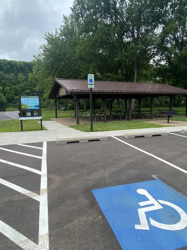
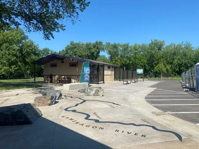
All three photographs show named Osceola Landing facilities, not a verified St. Croix swimming entrance. Marked parking, a paved picnic pad and the interpretive plaza do not establish accessible water entry or today's services. Other landings have different facilities and rules. Historical swimming directions remain withdrawn.
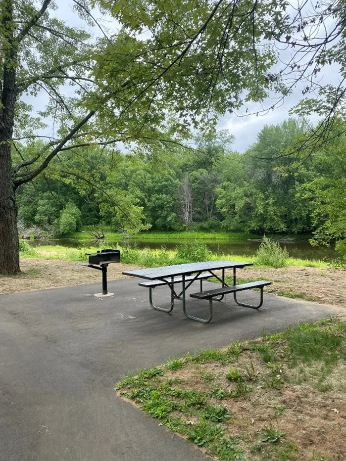
Resized and converted to WebP; embedded metadata removed; scene content unchanged
Resized and converted to WebP; embedded metadata removed; scene content unchanged. No claim to original U.S. Government works.
Resized and converted to WebP; embedded metadata removed; scene content unchanged. No claim to original U.S. Government works.
This is a desk-researched listing. A record update or map check does not confirm current swimming permission or water conditions.
Found an error? Send a correction with the location and a source. How we research listings.
This historical entry combined multiple landings into a swimming recommendation without establishing a specific authorized swimming entrance. The previous swimming directions were withdrawn, along with claims about main-channel swims, rope swings and an official slough beach. This is an access correction, not a river-wide swimming prohibition.
The NPS paddling guide distinguishes Sunrise River Landing in Minnesota from Sunrise Ferry Landing in Wisconsin. It also lists Franconia Landing and Osceola Landing separately. The old name 'Franconia Bridge' and its description of the Osceola crossing should not be treated as precise navigation.
Minnesota DNR identifies Sunrise Landing at Wild River State Park's northern entrance as a boat launch, trailhead and small picnic area. This does not establish the former swimming or tube-rental recommendation.
The NPS fee page says federal Riverway landings and facilities have no use fee, while state parks and private access may charge. The previous statement that parking fees apply at both historical spots was not supported. Identify the exact destination before checking admission.
NPS describes Osceola Landing as having separate boat-launch areas, picnic facilities and upgraded restrooms. These features are specific to Osceola; they should not be copied to other landings or treated as proof of a swimming beach.
For a beach outing, start with the Minneapolis beach guide. For river recreation, check official conditions and confirm the planned activity with the land manager. NPS visitor information is available at 715-483-2274.
This NPS photograph shows the riverside picnic setting at Osceola Landing. It is facility context for that named landing, not Sunrise Landing, Sunrise Ferry or Franconia Landing. The paved picnic pad does not establish an accessible water entry, a designated swimming beach or permission to swim beside a launch. It also does not restore the withdrawn historical swimming directions. Check current destination information for facility availability and choose a separately documented beach for a beach outing. Credit: National Park Service / JAnderson. The image is resized within its original dimensions and converted to WebP; scene content is unchanged.
Additional NPS photographs show marked parking by the Osprey picnic shelter and the interpretive plaza beside the comfort-station building at Osceola Landing. These are historical facility views, not a designated beach, accessible water entrance or confirmation that restrooms, shelters or shuttles operate today. Names etched into the plaza are interpretive displays, not swimming destinations. They do not restore the withdrawn regional swimming directions or describe Sunrise or Franconia. Credit: National Park Service / JAnderson. No claim to original U.S. Government works.
The previous swimming directions were withdrawn. NPS maps distinguish Sunrise River Landing in Minnesota from Sunrise Ferry Landing in Wisconsin and show Franconia and Osceola as separate landings. Select an exact destination and confirm its permitted activities with the manager; no swimming navigation pin is supplied for this broad entry.
A boat landing or picnic area is not a verified swimming entrance. Historical tube-rental-lot directions and the alleged official slough beach have not been confirmed. Do not use this entry to navigate to a swimming spot.
Confirm the entrance, parking arrangements, and legal access with the land manager. A map pin does not establish a public right of access. Follow posted routes and never block gates or driveways.
This regional entry does not identify a verified swimming entrance. The old directions mixed landing names and promoted main-channel swimming, rope swings and an unverified slough beach. Those recommendations are withdrawn. This is not a claim that swimming is prohibited throughout the St. Croix River. Public park access does not necessarily include permission to swim. Respect private property and posted restrictions.
Water conditions can change quickly. This listing does not provide a current safety or water-quality assessment. Check official alerts and avoid entering water when conditions or permission are uncertain.
Nearby places from saved public map data, not necessarily facilities at the swimming spot. Confirm access, hours, fees, and amenities with the operator before you drive.
Map data retrieved 2026-06-15
Parking lot
16820 20th St S, Lake St Croix Beach, MN 55043
Park
39181 Forest Blvd, North Branch, MN 55056
State park
39797 Park Trail, Center City, MN 55012
Venue along the St. Croix River offering hiking, camping, canoeing, cross-country skiing & more.
Hiking area
H48J+G3, Harris, MN 55032
Campground
8620 277th Ave NE, North Branch, MN 55056
Campground
Unnamed Road, North Branch, MN 55056
Campground
39080 Oriole Ave, North Branch, MN 55056
Public bathroom
38780 8th Ave, North Branch, MN 55056
No. It combined multiple landings and old directions without confirming a specific swimming entrance. The historical swimming recommendations are withdrawn, not replaced by a river-wide prohibition.
The NPS paddling guide distinguishes Sunrise River Landing in Minnesota from Sunrise Ferry Landing in Wisconsin. Choose the exact landing and managing agency before planning access.
No. The NPS paddling guide lists them separately. The old bridge-based directions should not be used as precise swimming navigation.
No. NPS says federal Riverway landings and facilities have no use fee, while state parks and private landings may charge. Confirm the rules of the exact destination.
Consult NPS and state park interpretation for river history.
This NPS photograph shows the riverside picnic setting at Osceola Landing. It is facility context for that named landing, not Sunrise Landing, Sunrise Ferry or Franconia Landing. The paved picnic pad does not establish an accessible water entry, a designated swimming beach or permission to swim beside a launch. It also does not restore the withdrawn historical swimming directions. Check current destination information for facility availability and choose a separately documented beach for a beach outing. Credit: National Park Service / JAnderson. The image is resized within its original dimensions and converted to WebP; scene content is unchanged.
Use authorized access points, respect private land and pack out litter.
Browse every listed natural swimming spot in Minnesota.
Compare nearby options around Minneapolis before you choose a route.
Find similar river destinations across the directory.
See under-the-radar places and local favorites in the same state.
Compare easier-access destinations and safer planning options.
Use this safety guide before entering any natural water.
Safety & Access Notice
This information is for general planning only and may be incomplete, outdated, or inaccurate. Access rules, closures, water levels, currents, hazards, and legal restrictions can change at any time. Always verify current rules with the land manager or official source before visiting.
You are responsible for your own safety and for following all posted signs, laws, and local regulations. Read the full disclaimer.
Check official Riverway or state park camping information separately. The older Limestone Park recommendation has not been verified.
Loading weather data…
Safety & Access Notice
This information is for general planning only and may be incomplete, outdated, or inaccurate. Access rules, closures, water levels, currents, hazards, and legal restrictions can change at any time. Always verify current rules with the land manager or official source before visiting.
You are responsible for your own safety and for following all posted signs, laws, and local regulations. Read the full disclaimer.
Joshua Havens created Hidden Swimming Holes to make it easier for people to find — and safely visit — natural freshwater swimming destinations across the United States. He researches access conditions, water quality resources, and land management rules so you don't have to start from scratch. He holds a strong belief that good outdoor recreation information should be accurate, honest about its limitations, and freely available.
Discover other amazing natural swimming destinations across America