Oleno State Park and River Rise Magnolia Campground
Campground
0.3 mi
4.7 (132)
1894 SE Oleno Park Rd, High Springs, FL 32643
Public restroomPublic showerRestroomRunning water

Background: generated illustration, not a photograph of this location.
Plan O'Leno's Santa Fe River swimming area with water-level closure guidance, ranger contact, park admission and camping information. Check trail notices first.
Location
A closer look
Photos show past visits, not current water levels or swimming conditions. Select a photo to view it larger.
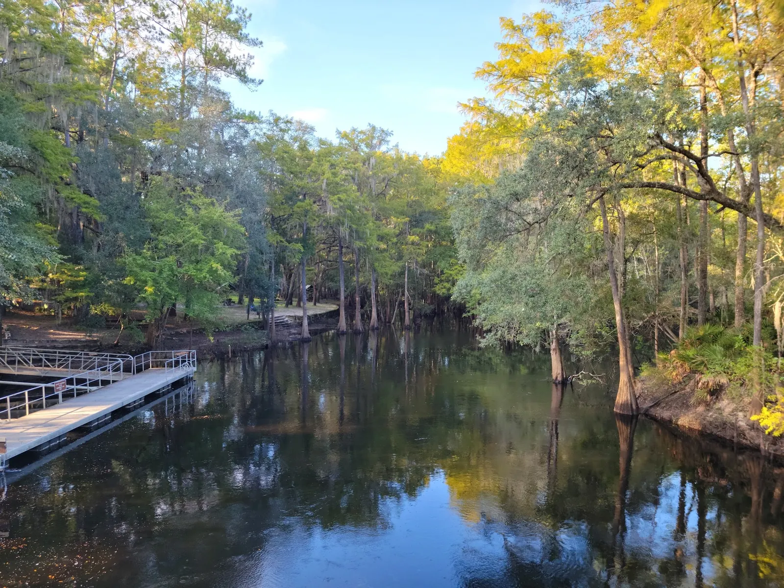
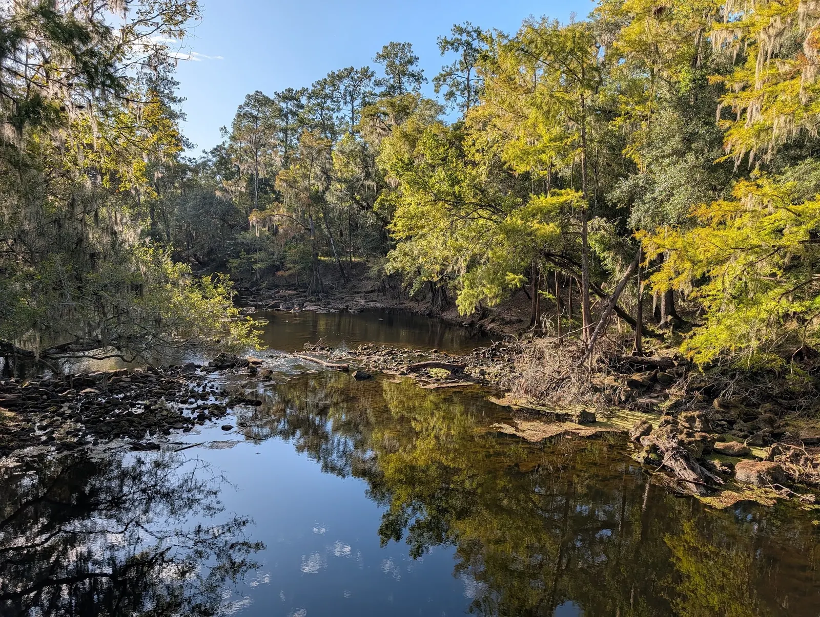
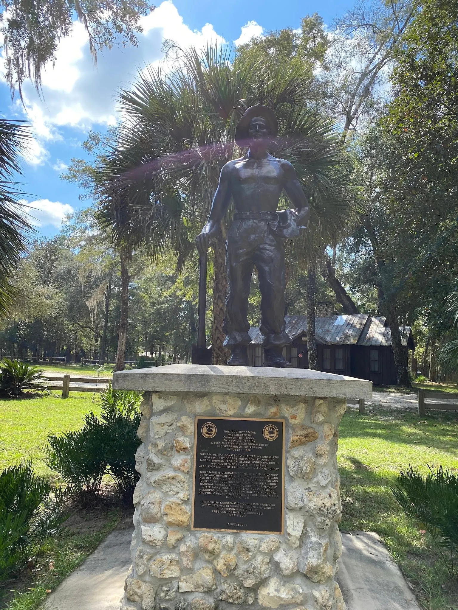
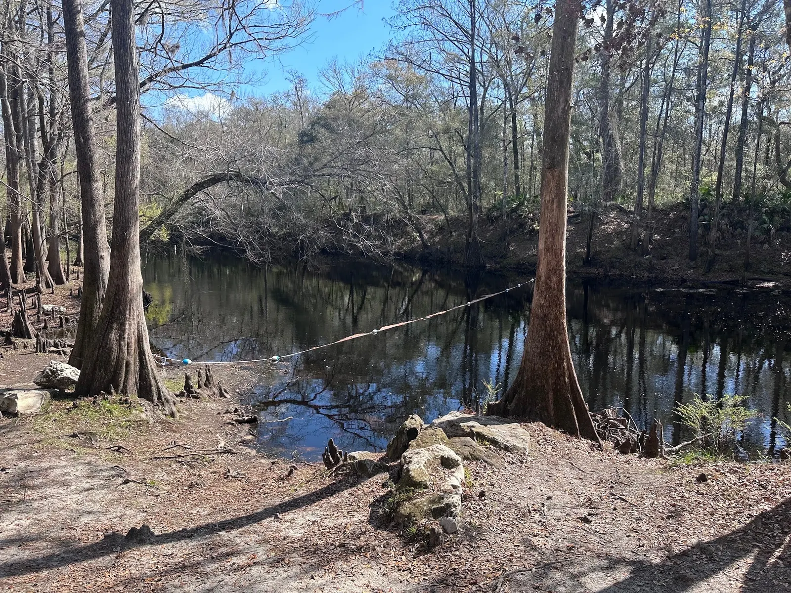
This is a desk-researched listing. A record update or map check does not confirm current swimming permission or water conditions.
Found an error? Send a correction with the location and a source. How we research listings.
O'Leno State Park is a Santa Fe River destination near High Springs with a designated swimming area, riverside picnicking and camping. The manager's swimming guidance says both low and high water can close the swim area and advises calling 386-454-1853 before arrival. No lifeguard is provided. This review used indexed official pages because direct requests were unavailable; it does not confirm that the swim area is open today.
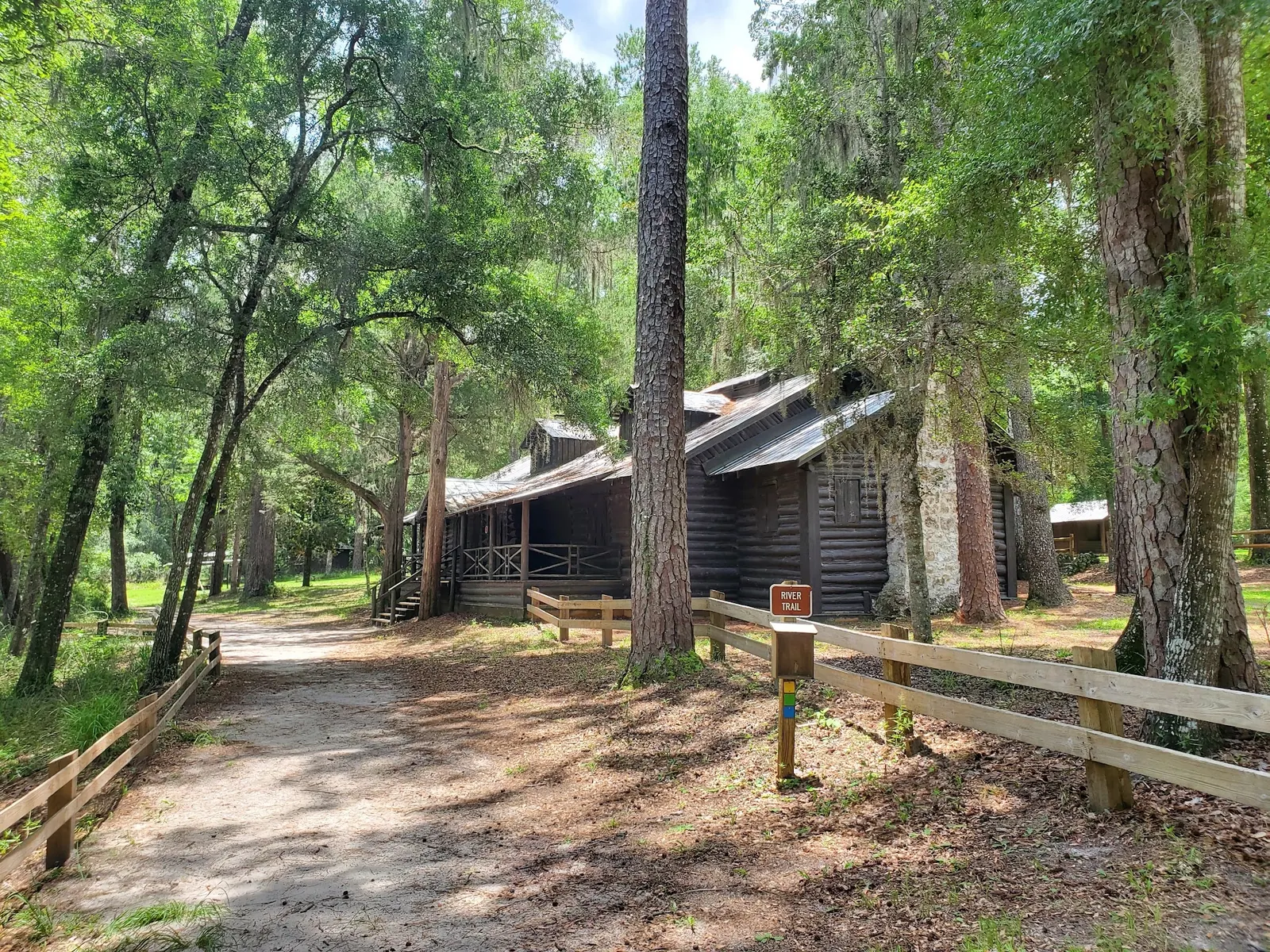
The official homepage publishes a River Trail closure effective May 14, 2026. That notice is not a blanket closure of the park, nor confirmation of swimming access. Ask staff which routes are currently permitted. Gallery photographs show historical river and park context rather than a current trail or water-level report.
The manager lists 410 S.E. O'Leno Park Road, High Springs, and describes the park as six miles north of town on U.S. 441. The retained map point is not a verified swimming entrance. Follow staff instructions instead of treating any trail or riverbank as a permitted water entry.
The homepage lists $5 per vehicle, while the indexed detailed fee page distinguishes vehicle occupancy, pedestrian and bicycle admission. Confirm current rates before travel. The manager lists full-facility, primitive and group camping; check the reservation system for your specific accommodation and total charges.
Restrooms, picnic pavilions, a playground and a canoe/kayak launch are documented park amenities. Ask about mobility requirements and any available day-use wheelchair before visiting. The Santa Fe disappears underground and resurfaces in River Rise Preserve more than three miles away, adding geological interest to a park visit. Neither that setting nor tannin color guarantees suitable swimming conditions.
Use O'Leno State Park, 410 S.E. O'Leno Park Road, High Springs, Florida 32643. The manager describes the park as six miles north of High Springs on U.S. 441. The retained historical map point is not a verified swimming entry. Ask the ranger station for the currently permitted approach rather than navigating along the River Trail without checking its closure notice.
Official indexed park information lists 8 a.m. to sunset, year-round. Its homepage publishes a River Trail closure notice effective May 14, 2026. A trail notice does not by itself establish closure of the entire park or swimming area. Check current manager instructions; direct page fetches were unavailable during this review.
Confirm the entrance, parking arrangements, and legal access with the land manager. A map pin does not establish a public right of access. Follow posted routes and never block gates or driveways.
Current swimming permission has not been independently confirmed for this listing. Check official rules, fees, hours, and closures before visiting. Public park access does not necessarily include permission to swim. Respect private property and posted restrictions.
Water conditions can change quickly. This listing does not provide a current safety or water-quality assessment. Check official alerts and avoid entering water when conditions or permission are uncertain.
Bring sturdy water shoes to protect your feet on rocks and slippery surfaces. A waterproof dry bag keeps your phone, keys, and valuables safe. Pack a quick-dry towel, sun protection, and drinking water - never drink from the natural water source.
Nearby places from saved public map data, not necessarily facilities at the swimming spot. Confirm access, hours, fees, and amenities with the operator before you drive.
Map data retrieved 2026-06-15
Campground
1894 SE Oleno Park Rd, High Springs, FL 32643
Public bathroom
1894 SE Oleno Park Rd, High Springs, FL 32643
State park
410 SE Oleno Park Rd, High Springs, FL 32643
State park on the Santa Fe river featuring a historical suspension bridge, plus camping & hiking.
Hiking area
WC37+5V, High Springs, FL 32643
Park
1656 Old Bellamy Rd, High Springs, FL 32643
Campground
24004 Old Bellamy Rd, High Springs, FL 32643
State park
373 US-27, High Springs, FL 32643
Free parking lot
Santa Fe Canoe Outpost Park, 21410 US-441, High Springs, FL 32643
Checking nearby USGS water conditions…
No. The manager says low or high water can close the designated swim area. Call 386-454-1853 before arrival; this review does not establish today's opening status.
The official swimming guidance says no lifeguard is on duty. Follow current park instructions and supervise children closely.
The official homepage publishes a closure notice effective May 14, 2026. Check with the park for current permitted routes rather than relying on historical gallery photos.
The official homepage lists $5 per vehicle. Indexed detailed fees distinguish occupancy and pedestrian/bicycle entry, so confirm your party's current rate with the park.
The manager lists full-facility, primitive and group camping options. Check reservations, site-specific amenities and current total charges separately from swimming access.
No. It is a retained historical reference. Use the named park entrance and ask staff for a currently permitted approach to the swimming area.
Named after the now-vanished town of Leno, the park’s facilities were built by the Civilian Conservation Corps during the Great Depression, reflecting Florida’s historical legacy.
Historic park context, wooded river banks and limestone exposures. Gallery water levels and the pictured boundary rope are historical observations, not today's access confirmation.
Respect trail closures and site signs, stay in permitted activity areas and remove litter. Do not bypass closed routes to reach a river viewpoint.
Browse every listed natural swimming spot in Florida.
Compare nearby options around Gainesville before you choose a route.
Find similar river destinations across the directory.
See under-the-radar places and local favorites in the same state.
Compare easier-access destinations and safer planning options.
Use this safety guide before entering any natural water.
Safety & Access Notice
This information is for general planning only and may be incomplete, outdated, or inaccurate. Access rules, closures, water levels, currents, hazards, and legal restrictions can change at any time. Always verify current rules with the land manager or official source before visiting.
You are responsible for your own safety and for following all posted signs, laws, and local regulations. Read the full disclaimer.
The manager lists a full-facility campground plus primitive and group camping options. Check the official reservation system for your site type, availability and total charges rather than relying on old campsite prices or assuming every option has the same facilities.
Loading weather data…
Safety & Access Notice
This information is for general planning only and may be incomplete, outdated, or inaccurate. Access rules, closures, water levels, currents, hazards, and legal restrictions can change at any time. Always verify current rules with the land manager or official source before visiting.
You are responsible for your own safety and for following all posted signs, laws, and local regulations. Read the full disclaimer.
Joshua Havens created Hidden Swimming Holes to make it easier for people to find — and safely visit — natural freshwater swimming destinations across the United States. He researches access conditions, water quality resources, and land management rules so you don't have to start from scratch. He holds a strong belief that good outdoor recreation information should be accurate, honest about its limitations, and freely available.
Discover other amazing natural swimming destinations across America