Butler Access Area
Parking lot
4.4 (27)
Pine Creek Rail Trail, Wellsboro, PA 16901

Background: generated illustration, not a photograph of this location.
Plan Ole Bull State Park with beach-season guidance, picnic-area parking, pet rules, camping information and a reviewed Kettle Creek photo gallery.
Location
A closer look
Photos show past visits, not current water levels or swimming conditions. Select a photo to view it larger.
This is a desk-researched listing. A record update or map check does not confirm current swimming permission or water conditions.
Found an error? Send a correction with the location and a source. How we research listings.
For a beach day, start with the park's swimming schedule, not its year-round opening. The old guide incorrectly described this as a creek without a sandy beach.
DCNR's swimming guide identifies a 150-foot sandy beach in Camping Area #1, opposite the picnic area, and directs beach visitors to the picnic-area parking lot. Published swimming hours are 8 a.m. to sunset during the late-May to mid-September season. Swimming is at your own risk. Check current notices before water entry; an October park visit is outside that normal beach season.
Children age ten or younger must be accompanied by someone at least fourteen. That minimum rule does not replace attentive supervision. Pets cannot enter the beach area, and the beach and swimming area are smoke-free, including e-cigarettes. Stay within posted swimming boundaries and away from dam structures. No photo can establish safe depth or current water quality.
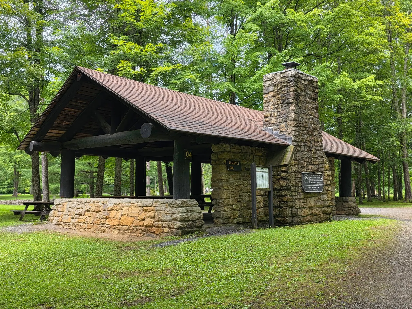
The picnic-area guide lists restrooms, drinking water, tables, playground equipment and four pavilions. Unreserved pavilions are first-come, first-served; reserving one costs extra. Pennsylvania's prices page confirms no park entrance or day-use fee, which does not make camping or reservations free. The overnight guide describes two camping areas and a rental cabin. Check reservation availability and seasonal services separately.
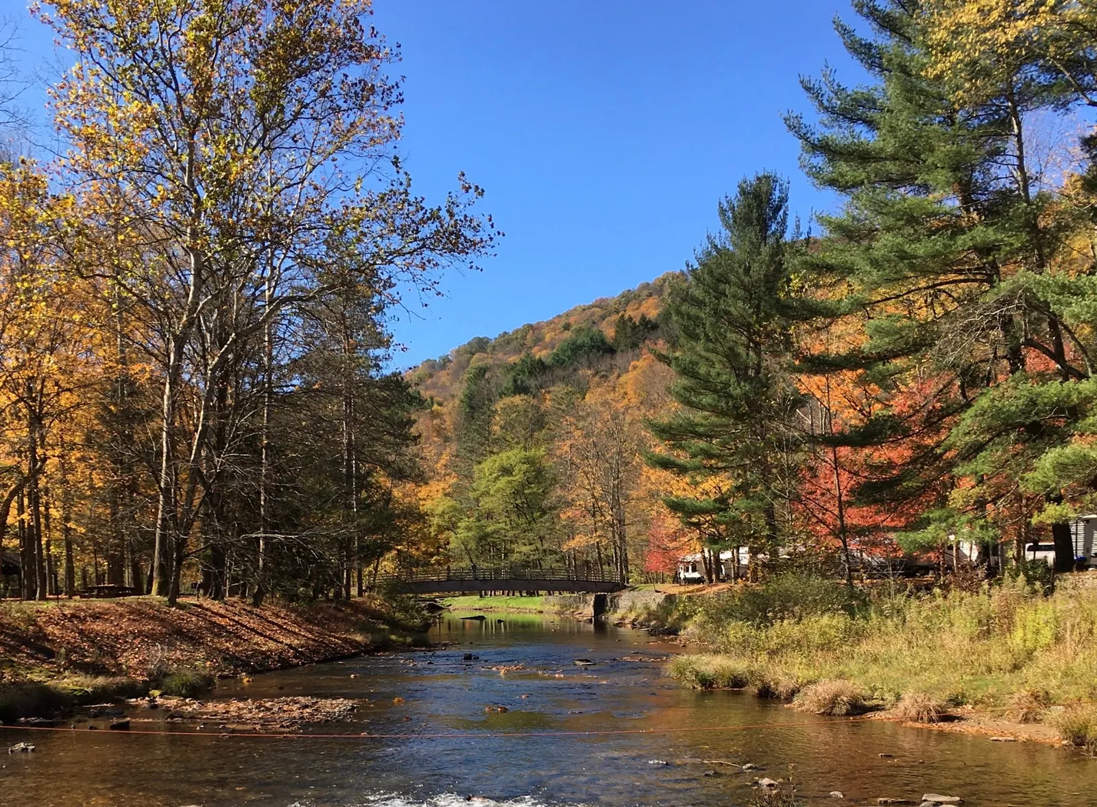
The official park profile gives the Valhalla Lane address and PA144 approach. We replaced an inherited Renovo town point with its published park GPS reference, not an exact beach entry. Download the park map before travel because cell coverage can be unpredictable. Accessible lodging and fishing facilities do not prove an accessible swimming route; ask the office about your specific needs. Five reviewed historical photos add creek scenery, picnic architecture and interpretation without promising today's conditions. Reviewed October 9, 2026.
Follow PA144 to 31 Valhalla Lane, Cross Fork. DCNR places the park 18 miles south of Galeton and 26 miles north of Renovo. For the beach, use the picnic-area parking lot and current park signs.
The beach is seasonal, not year-round. Pets and smoking, including e-cigarettes, are prohibited in its beach/swimming area. Observe posted restrictions.
Confirm the entrance, parking arrangements, and legal access with the land manager. A map pin does not establish a public right of access. Follow posted routes and never block gates or driveways.
Current swimming permission has not been independently confirmed for this listing. Check official rules, fees, hours, and closures before visiting. Public park access does not necessarily include permission to swim. Respect private property and posted restrictions.
Water conditions can change quickly. This listing does not provide a current safety or water-quality assessment. Check official alerts and avoid entering water when conditions or permission are uncertain.
Bring sturdy water shoes to protect your feet on rocks and slippery surfaces. A waterproof dry bag keeps your phone, keys, and valuables safe. Pack a quick-dry towel, sun protection, and drinking water - never drink from the natural water source.
Nearby places from saved public map data, not necessarily facilities at the swimming spot. Confirm access, hours, fees, and amenities with the operator before you drive.
Map data retrieved 2026-06-15
Parking lot
Pine Creek Rail Trail, Wellsboro, PA 16901
Hiking area
Colton Rd, Wellsboro, PA 16901
Hiking area
Wellsboro, PA 16901
Campground
31 Valhalla Ln, Cross Fork, PA 17729
132-acre park with campsites, a sandy swimming beach, picnic areas, fish-filled creeks & trails.
Campground
658 Stony Fork Creek Road, Wellsboro, PA 16901
Campground
130 Wilson Rd, Wellsboro, PA 16901
Campground
863 Sullivan Rd, Wellsboro, PA 16901
Rural motel & campground offering basic rooms with free WiFi, plus on-site dining & a game room.
Public wheelchair-accessible bathroom
2 Chome-4-6 Nozawa, Setagaya City, Tokyo 154-0003, Japan
Checking nearby USGS water conditions…
DCNR publishes late May to mid-September, 8 a.m. to sunset. Check current notices and seasonal opening before travel.
Use the picnic-area lot, opposite Camping Area #1, and follow current park signs.
Entrance and day use have no fee. Camping, cabin rentals and pavilion reservations have separate charges.
No. Beach pets are prohibited even though camping Area #2 offers pet sites for a fee.
The picnic area has restrooms, drinking water, tables, playground equipment and pavilions. A changing room was not verified.
Yes, the official overnight guide describes year-round camping in two areas. Confirm availability, services and booking prices.
That was not established. The accessibility page covers lodging and fishing features; contact the park about your required beach route.
No. It is the operator's published park reference, replacing an unrelated town point.
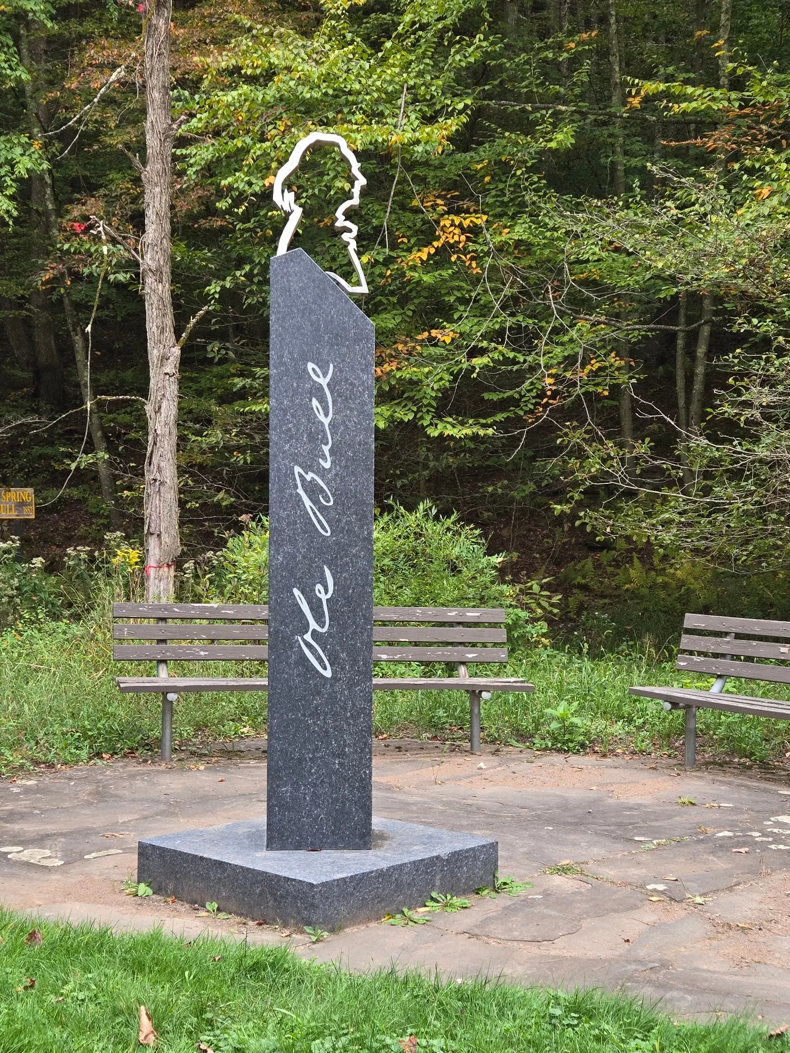
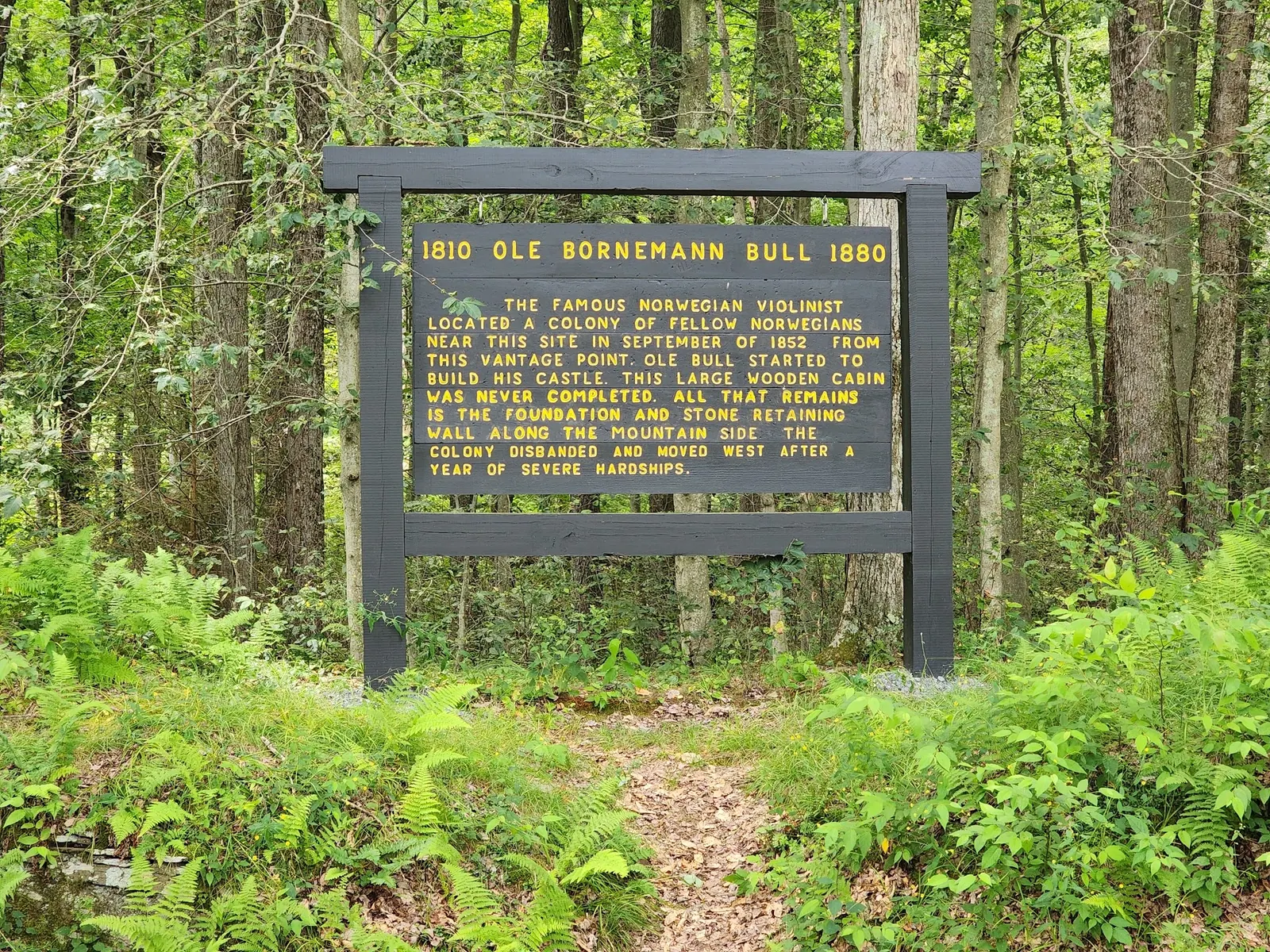
The selected gallery includes Ole Bull memorial and interpretive-sign views; consult park interpretation for historical detail.
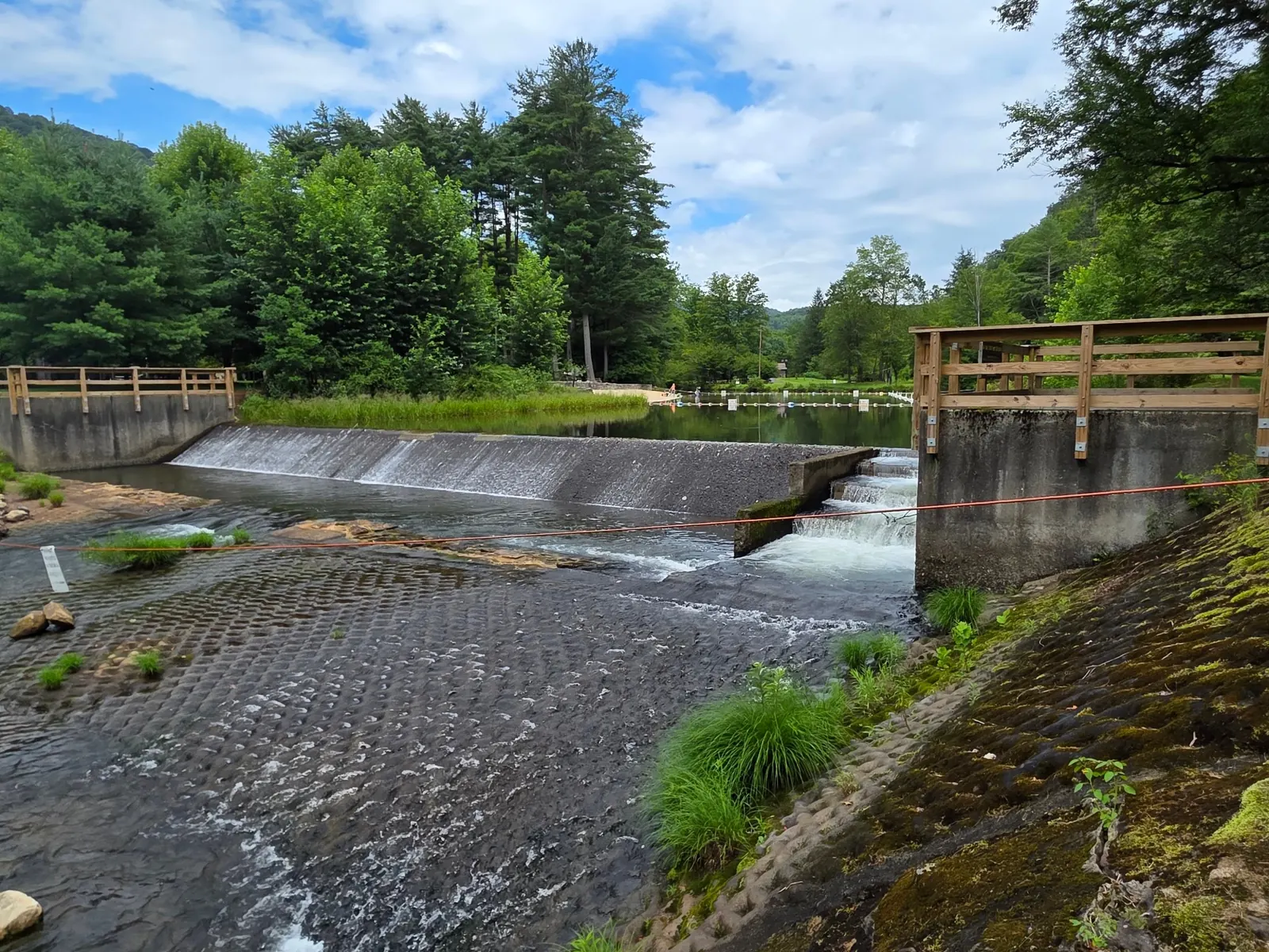
Five historical views show autumn creek scenery, a pavilion, memorial, interpretive board and dam context. The dam view is not a recommended swimming location.
Leave the creek banks and historic features undisturbed, carry out litter and follow park rules.
Browse every listed natural swimming spot in Pennsylvania.
Compare nearby options around Williamsport before you choose a route.
Find similar creek beach destinations across the directory.
See under-the-radar places and local favorites in the same state.
Compare easier-access destinations and safer planning options.
Use this safety guide before entering any natural water.
Safety & Access Notice
This information is for general planning only and may be incomplete, outdated, or inaccurate. Access rules, closures, water levels, currents, hazards, and legal restrictions can change at any time. Always verify current rules with the land manager or official source before visiting.
You are responsible for your own safety and for following all posted signs, laws, and local regulations. Read the full disclaimer.
Two creek-side camping areas accept year-round camping. Book through the official reservation service; seasonal services and availability need confirmation.
Loading weather data…
Safety & Access Notice
This information is for general planning only and may be incomplete, outdated, or inaccurate. Access rules, closures, water levels, currents, hazards, and legal restrictions can change at any time. Always verify current rules with the land manager or official source before visiting.
You are responsible for your own safety and for following all posted signs, laws, and local regulations. Read the full disclaimer.
Joshua Havens created Hidden Swimming Holes to make it easier for people to find — and safely visit — natural freshwater swimming destinations across the United States. He researches access conditions, water quality resources, and land management rules so you don't have to start from scratch. He holds a strong belief that good outdoor recreation information should be accurate, honest about its limitations, and freely available.
Discover other amazing natural swimming destinations across America