Rocky glen water
Park
H537+R8, Factoryville, PA 18419

Background: generated illustration, not a photograph of this location.
Read Little Rocky Glen's indefinite closure update, view historical gorge photos and find Countryside Conservancy contacts. Do not enter the closed preserve.
Swimming temporarily closed
Do not plan a swim while this recorded closure remains in effect. Check the managing authority for reopening; other park activities may have different rules.
Do not enter the closed preserve for swimming, hiking or photography. Reopening, if announced, would not itself establish swimming permission.
Official sources checked:
Status summarizes our reviewed record, not today's opening or safety. Check current rules, swimming boundaries and notices before visiting.
Location
A closer look
Photos show past visits, not current water levels or swimming conditions. Select a photo to view it larger.
This is a desk-researched listing. A record update or map check does not confirm current swimming permission or water conditions.
Found an error? Send a correction with the location and a source. How we research listings.
The Conservancy's closure FAQ states that Little Rocky Glen closed indefinitely on July 2, 2026. No reopening date is published there. Do not enter for a hike, swim or photograph.
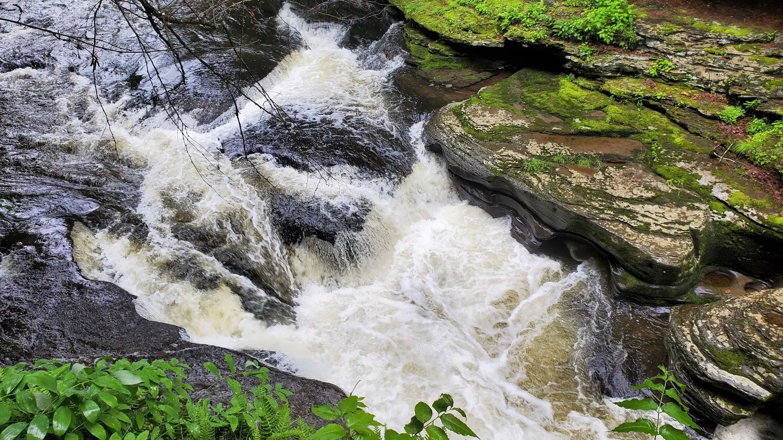
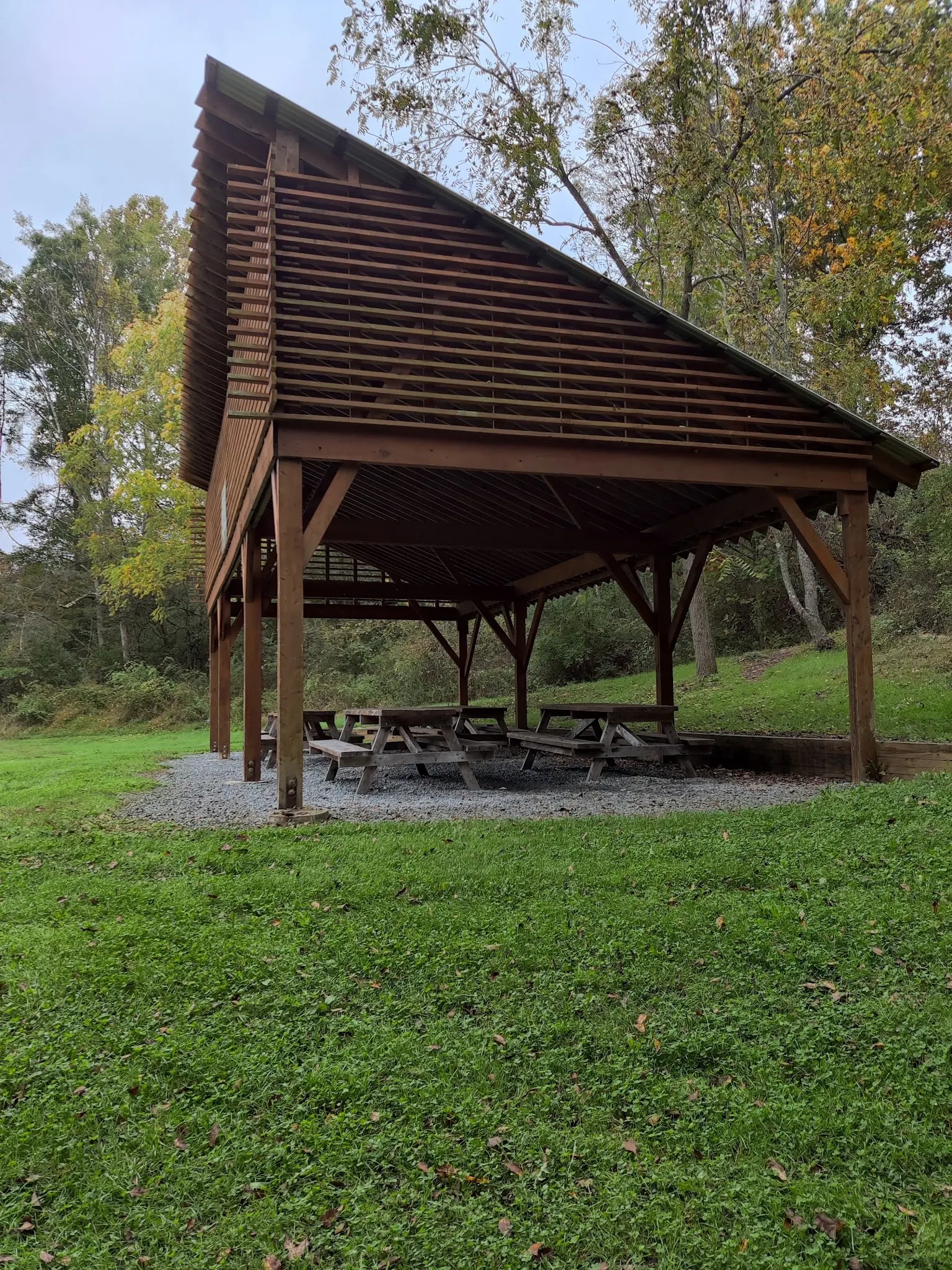
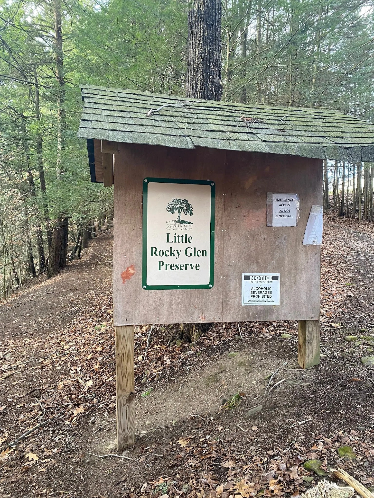
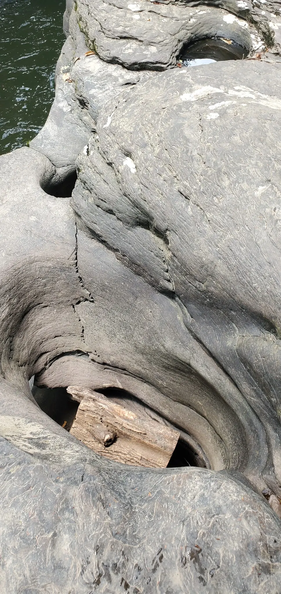
The four reviewed images show white water between rock shelves, a pavilion, the named preserve kiosk and rounded cavities in the creek-side rock. The kiosk anchors the photo collection's identity. These images do not establish current conditions or authorized viewpoints, and none is a reason to cross the closure boundary.
The trail profile locates the preserve along Lithia Valley Road and describes parking before the bridge when coming from US 6. It is background location information, not a reopening announcement. Our old roadside parking and go-around-gate instructions are withdrawn, along with the unverified Spur Road and Fox Road swimming detour.
The retained historical map pin is not a verified trailhead. The contact page gives the Conservancy's office details in La Plume, not an arrival address for this gorge. Call 570-945-6995 for status questions.
Look for a specific operator announcement, not generic dawn-to-dusk preserve hours or an old seasonal schedule. Even a reopening would require new checks of visitor rules and swimming permission. Until then, this page documents a closed destination rather than recommending an outing.
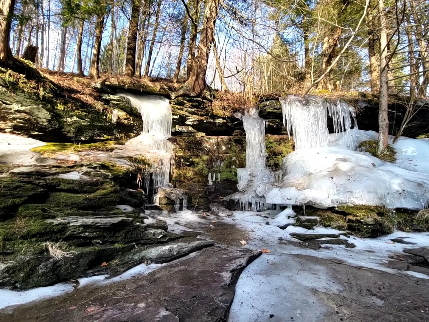
An additional historical winter photograph shows icicles and ice-coated rock shelves. It provides a contrasting season in the archive, not a reason to visit or inspect the ice. The indefinite preserve closure discussed above remains the planning constraint: do not enter to hike, swim or take photographs. Neither the camera position nor an old trail image authorizes access.
Do not travel here to enter the closed preserve. The Conservancy's older trail profile places it on Lithia Valley Road between Factoryville and Tunkhannock, with a lot before the bridge when approaching from US 6. This is location context, not current access permission. Old Route 9 mileage, cross-bridge roadside parking, go-around-gate instructions and the Spur Road/Fox Road swimming detour are retired. The historical pin remains unverified and is not an entrance.
The specific closure overrides generic preserve opening information and older trail directions. Do not go around gates or use another approach to enter.
Confirm the entrance, parking arrangements, and legal access with the land manager. A map pin does not establish a public right of access. Follow posted routes and never block gates or driveways.
Do not enter the closed preserve for swimming, hiking or photography. Reopening, if announced, would not itself establish swimming permission. Public park access does not necessarily include permission to swim. Respect private property and posted restrictions.
Water conditions can change quickly. This listing does not provide a current safety or water-quality assessment. Check official alerts and avoid entering water when conditions or permission are uncertain.
Nearby places from saved public map data, not necessarily facilities at the swimming spot. Confirm access, hours, fees, and amenities with the operator before you drive.
Map data retrieved 2026-06-15
Park
H537+R8, Factoryville, PA 18419
Hiking area
Lower Lake Rd, Greentown, PA 18426
Hiking area
34 Church Hill Rd, Dalton, PA 18414
Campground
105 Whispering Winds Ln, Dalton, PA 18414
Campground
248 Meshoppen Creek Rd, Meshoppen, PA 18630
Campground
Lake View Dr, Dalton, PA 18414
Public bathroom
Lake View Dr, Dalton, PA 18414
Public bathroom
Lake View Dr, Dalton, PA 18414
No. The operator's reviewed notice announces an indefinite closure effective July 2, 2026.
No reopening date was published in the reviewed notice. Check for a specific operator update before planning any visit.
No. Those instructions have been withdrawn. Do not bypass closure boundaries or use the creek as an alternative entrance.
No. They document historical scenery and preserve features, not today's conditions or authorized entry.
Countryside Conservancy at 570-945-6995. Its La Plume office address is not the preserve trailhead.
Privately owned conservation land, not a municipal park. The preserved kiosk identifies the Conservancy and destination.
An additional historical winter photograph shows icicles and ice-coated rock shelves. It provides a contrasting season in the archive, not a reason to visit or inspect the ice. The indefinite preserve closure discussed above remains the planning constraint: do not enter to hike, swim or take photographs. Neither the camera position nor an old trail image authorizes access.
The closure is a reminder that access depends on landowner stewardship decisions. Do not enter for an unauthorized cleanup; use the Conservancy contact to ask about approved volunteering.
Browse every listed natural swimming spot in Pennsylvania.
Find similar creek destinations across the directory.
See under-the-radar places and local favorites in the same state.
Compare easier-access destinations and safer planning options.
Use this safety guide before entering any natural water.
Safety & Access Notice
This information is for general planning only and may be incomplete, outdated, or inaccurate. Access rules, closures, water levels, currents, hazards, and legal restrictions can change at any time. Always verify current rules with the land manager or official source before visiting.
You are responsible for your own safety and for following all posted signs, laws, and local regulations. Read the full disclaimer.
No camping access at the closed preserve. Book a separate authorized overnight destination if visiting the wider region.
Loading weather data…
Safety & Access Notice
This information is for general planning only and may be incomplete, outdated, or inaccurate. Access rules, closures, water levels, currents, hazards, and legal restrictions can change at any time. Always verify current rules with the land manager or official source before visiting.
You are responsible for your own safety and for following all posted signs, laws, and local regulations. Read the full disclaimer.
Joshua Havens created Hidden Swimming Holes to make it easier for people to find — and safely visit — natural freshwater swimming destinations across the United States. He researches access conditions, water quality resources, and land management rules so you don't have to start from scratch. He holds a strong belief that good outdoor recreation information should be accurate, honest about its limitations, and freely available.
Discover other amazing natural swimming destinations across America