Gunpowder Falls State Park Sweet Air Area
Hiking area
4.7 (172)
2791 Dalton Bevard Rd, Baldwin, MD 21013

Background: generated illustration, not a photograph of this location.
Plan Gunpowder Falls Central Area with Belair Road parking, trail rules and river photos. Distinguish informal creek spots from Hammerman's designated beach.
Location
A closer look
Photos show past visits, not current water levels or swimming conditions. Select a photo to view it larger.
This is a desk-researched listing. A record update or map check does not confirm current swimming permission or water conditions.
Found an error? Send a correction with the location and a source. How we research listings.
The Central Area is a network of river trails, not the park's designated Hammerman beach. The archived guide mentions Long Green Creek's informal "Pool" and Pot Rocks, but a current authorized swimming entry for those spots was not established in this review.
The DNR Central profile describes a noncontiguous area along the Big and Little Gunpowder Falls, open sunrise to sunset. Jerusalem Mill is park headquarters. Call 410-592-2897 about the exact reach you intend to visit, current restrictions and water access. An open hiking area does not by itself confirm swimming permission.
DNR's driving directions take US1 north seven miles from I-695 to the Big Gunpowder Falls bridge, with the lot immediately on the right after crossing. The park overview lists 11159 Belair Road for the Big Gunpowder/Sweathouse/Stocksdale area and warns of extremely limited weekend parking. Parking and access there have no fee. Natural-surface trails are rated moderate, so the old easy-access description should not guide a family or accessibility decision. The inherited map point is withheld because it does not verify an individual water entry.
Keep pets leashed and use marked routes. Bicycles are prohibited in Sweathouse Branch wildlands between Harford Road and Belair Road, although many other Central trails allow mountain bikes. Do not assume toilets, drinking water, changing rooms or accessible swimming entry at an informal river spot. Bring what you need for a trail visit and ask the office about your specific route.
Hammerman's beach and swimming guide covers a separate area, with its own lifeguard schedule and rules. Its address is 7200 Graces Quarters, Chase, not the Central Belair Road lot. Check Hammerman's current opening, fees and notices separately rather than transferring beach services to a woodland river reach.
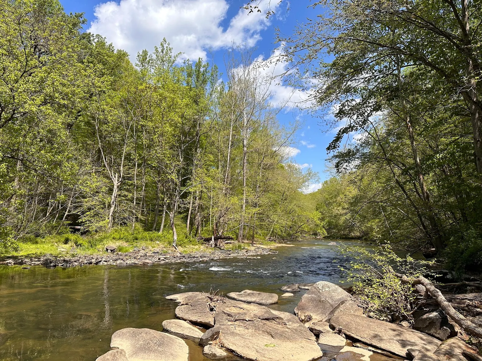
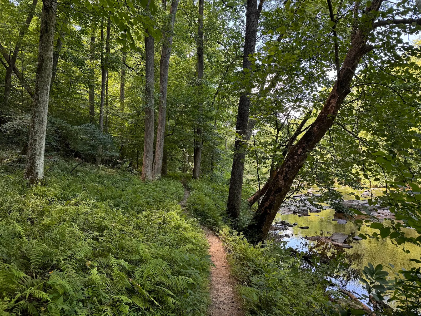
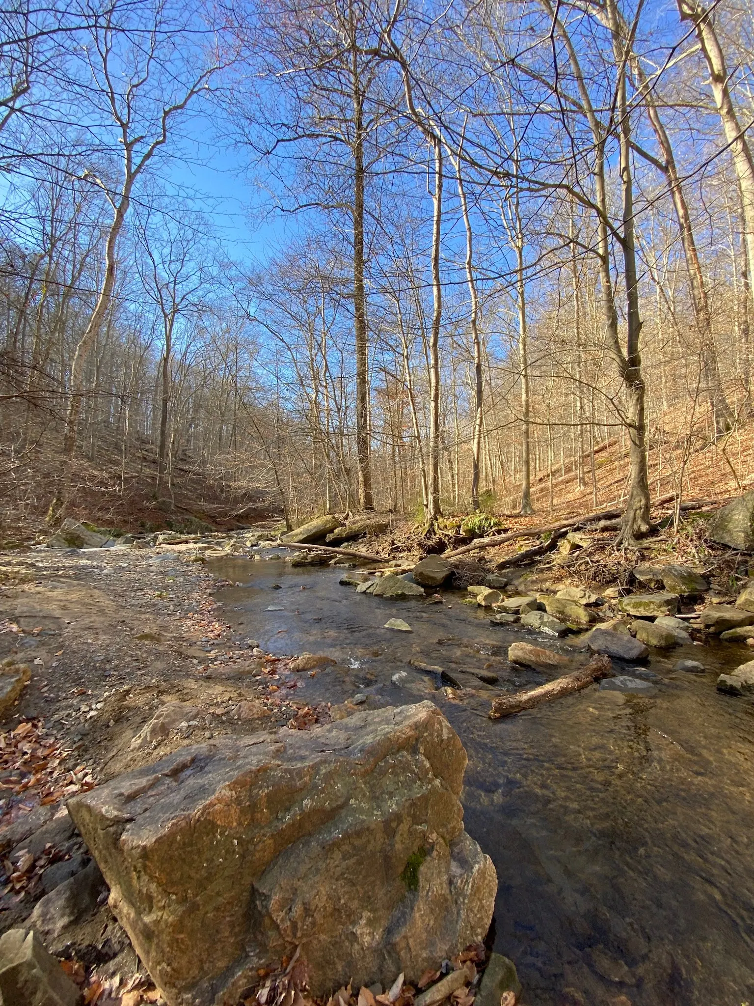
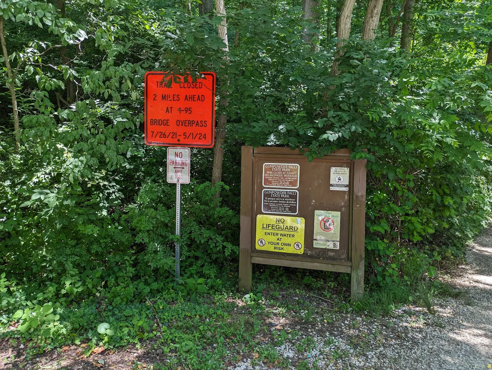
Four reviewed historical photos provide river scenery, bank-path and seasonal context plus a named park rules board. The board includes a closure notice dated 2021-2024; that photograph is neither a current closure notice nor proof that the affected route reopened. No image establishes water depth, quality, safe currents or today's permission. Avoid jumping and diving, and check current park guidance before entering water. Reviewed October 9, 2026.
For the Central Belair Road approach, DNR directs US1 north seven miles from I-695 to the Big Gunpowder Falls bridge, then the parking lot immediately on the right. The park lists 11159 Belair Road, Kingsville, for Big Gunpowder/Sweathouse/Stocksdale parking. Follow current signs; these directions do not verify an individual swimming entry.
Central Area is open sunrise to sunset with multiple noncontiguous access points. Leashed pets are permitted under park policy. Bicycles are prohibited in Sweathouse Branch wildlands between Harford Road and Belair Road; do not generalize this to all Central trails. Exact swimming access needs confirmation.
Confirm the entrance, parking arrangements, and legal access with the land manager. A map pin does not establish a public right of access. Follow posted routes and never block gates or driveways.
Current swimming permission has not been independently confirmed for this listing. Check official rules, fees, hours, and closures before visiting. Public park access does not necessarily include permission to swim. Respect private property and posted restrictions.
Water conditions can change quickly. This listing does not provide a current safety or water-quality assessment. Check official alerts and avoid entering water when conditions or permission are uncertain.
Nearby places from saved public map data, not necessarily facilities at the swimming spot. Confirm access, hours, fees, and amenities with the operator before you drive.
Map data retrieved 2026-06-15
Hiking area
2791 Dalton Bevard Rd, Baldwin, MD 21013
Park
Kingsville, MD 21087
Hiking area
Glen Arm, MD 21057
Campground
1601 Skippers Point Rd, Gunpowder, MD 21010
State park
7200 Graces Quarters Rd, Middle River, MD 21220
Gunpowder River hub for picnics & kayaking, with rentable picnic shelters, fishing & swimming.
Campground
Ellicott City, MD 21043
Campground
4228 Eastern Neck Rd, Rock Hall, MD 21661
Forestry office
Ranger Station, Riverdale, MD 20737
No. Central has multiple river trailheads. Hammerman is the separate designated beach at 7200 Graces Quarters in Chase, with its own swimming guidance.
That was not established by the official pages reviewed. Ask 410-592-2897 about the exact reach and posted restrictions before water entry; unresolved does not mean a blanket prohibition.
DNR lists 11159 Belair Road, Kingsville, and directs US1 north from I-695 to the lot on the right immediately after the Big Gunpowder Falls bridge. Follow current signs.
DNR lists no parking or access fee for Big Gunpowder/Sweathouse/Stocksdale and Little Gunpowder/Jerusalem Mill. Hammerman and reservations must be checked separately.
The official Central profile publishes sunrise to sunset. Confirm current notices before travel.
Keep dogs leashed. Bicycles are prohibited in Sweathouse Branch wildlands between Harford Road and Belair Road; other Central trails have different rules.
That was not verified. DNR rates the Big Gunpowder/Sweathouse/Stocksdale natural-surface trail network moderate. Ask about the specific route and access needs.
No. Its 2021-2024 notice is historical. Check current park notices; the photo proves neither a present closure nor reopening.
Jerusalem Mill is the historic milling village and park headquarters described by DNR.
Four historical collection views show a wooded river, fern-lined bank path, leafless-season stream and named rules board. The board includes a 2021-2024 closure notice, not verified current status; none identifies an authorized swimming entry.
Use marked trails, keep pets leashed, carry out litter and avoid disturbing riverbanks.
Browse every listed natural swimming spot in Maryland.
Compare nearby options around Baltimore before you choose a route.
See under-the-radar places and local favorites in the same state.
Compare easier-access destinations and safer planning options.
Explore waterfall-focused swimming destinations in Maryland.
Use this safety guide before entering any natural water.
Safety & Access Notice
This information is for general planning only and may be incomplete, outdated, or inaccurate. Access rules, closures, water levels, currents, hazards, and legal restrictions can change at any time. Always verify current rules with the land manager or official source before visiting.
You are responsible for your own safety and for following all posted signs, laws, and local regulations. Read the full disclaimer.
Do not plan informal riverbank camping. DNR lists permit-based organized youth camping separately; this is not a public walk-in campground at the archived water spots.
Loading weather data…
Safety & Access Notice
This information is for general planning only and may be incomplete, outdated, or inaccurate. Access rules, closures, water levels, currents, hazards, and legal restrictions can change at any time. Always verify current rules with the land manager or official source before visiting.
You are responsible for your own safety and for following all posted signs, laws, and local regulations. Read the full disclaimer.
Joshua Havens created Hidden Swimming Holes to make it easier for people to find — and safely visit — natural freshwater swimming destinations across the United States. He researches access conditions, water quality resources, and land management rules so you don't have to start from scratch. He holds a strong belief that good outdoor recreation information should be accurate, honest about its limitations, and freely available.
Discover other amazing natural swimming destinations across America