Falls City Falls
Park
4.6 (203)
Little Luckiamute River,, 702 Parry Rd, Falls City, OR 97344

Background: generated illustration, not a photograph of this location.
Visit Falls City Falls on the Little Luckiamute River using the city's Parry Road approach. Check park hours, water conditions and the historical photo gallery.
Location
A closer look
Photos show past visits, not current water levels or swimming conditions. Select a photo to view it larger.
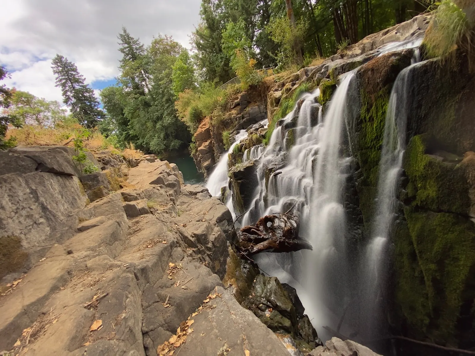
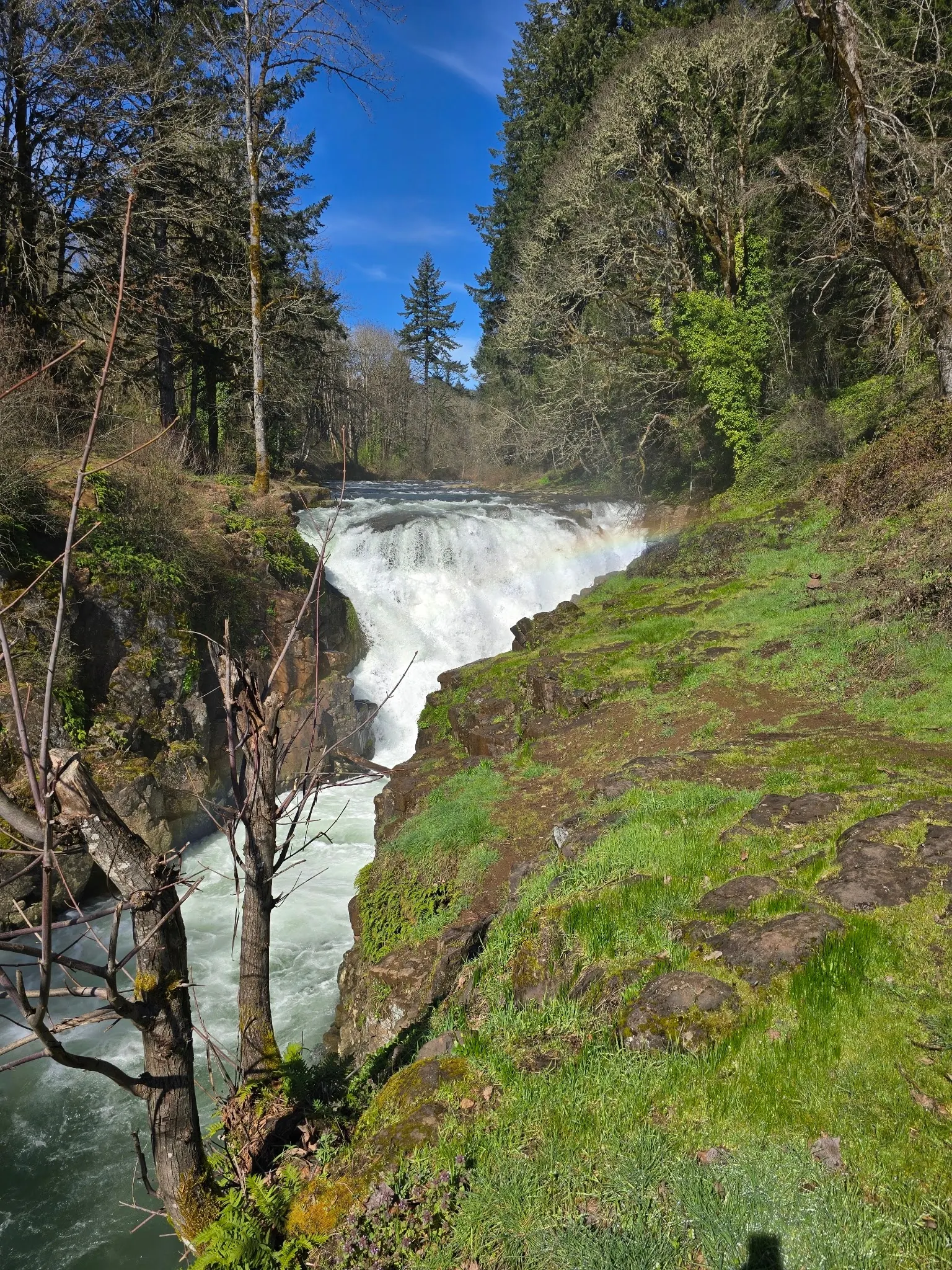
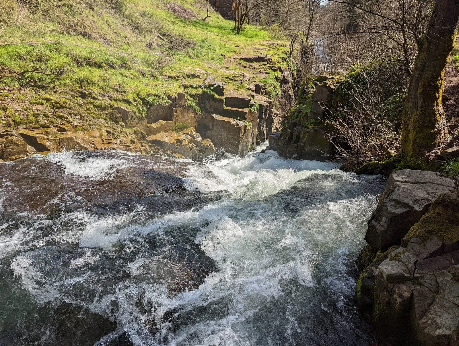
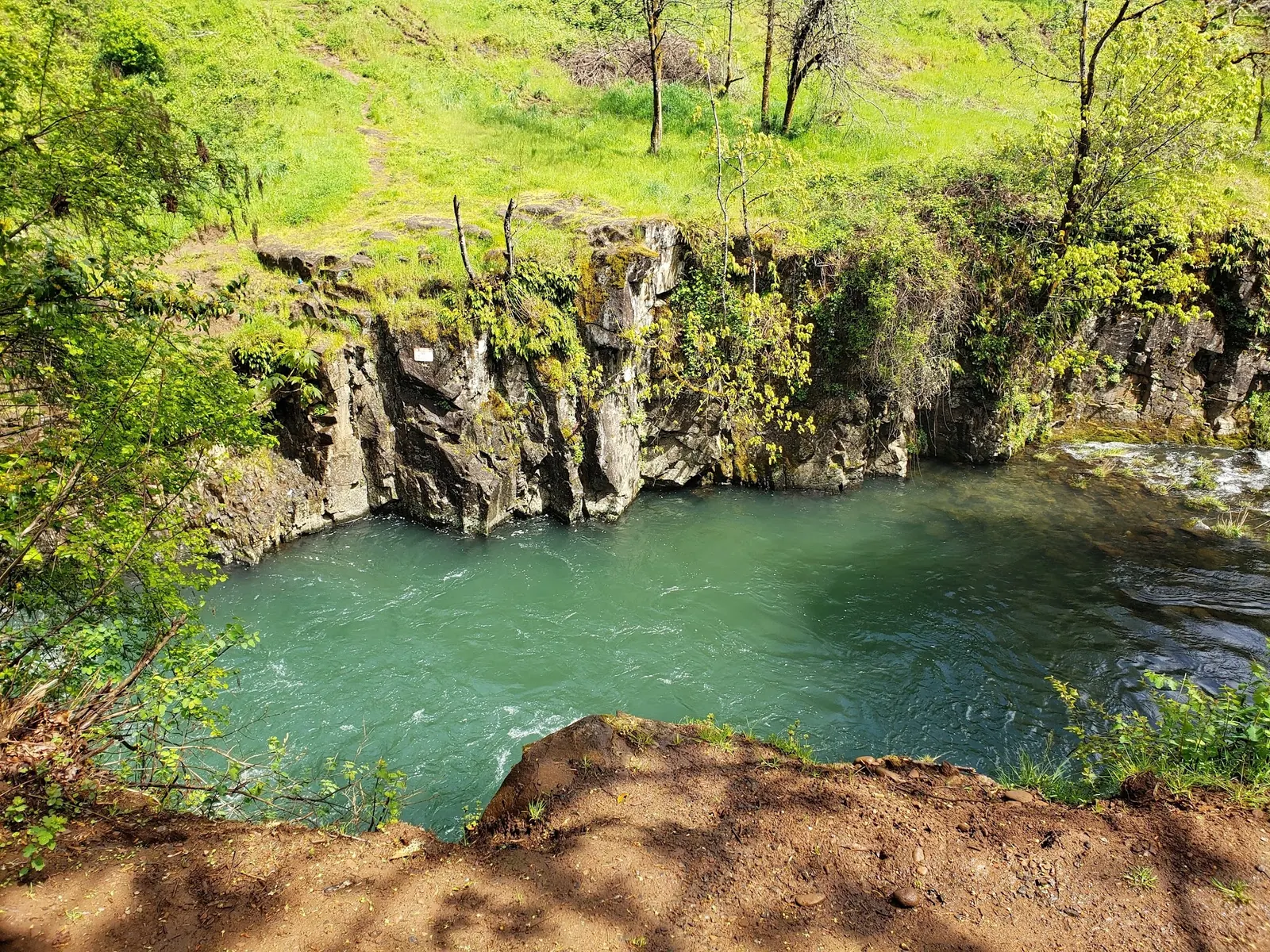
This is a desk-researched listing. A record update or map check does not confirm current swimming permission or water conditions.
Found an error? Send a correction with the location and a source. How we research listings.
Falls City Falls is a town waterfall, not the remote experimental-forest destination described in the old listing. The city parks page lists it with Michael Harding Park and calls it a local swimming hole. That recognition does not guarantee safe depth, supervised swimming or suitable conditions on your visit.
The city's visitor directions place the falls on the south side of town, along Parry Road about 100 yards after the bridge. This is a road-location description, not a measured walk to a water entry. Do not follow the archived Black Rock Road instructions as the current falls route. Black Rock Mountain Bike Area is a separate attraction.
City parks are open sunrise to sundown. Follow current parking signs and do not confuse City Hall's website-footer address with a falls parking lot. Call 503-787-3631 for current park information. Office hours and the Friday public-counter closure do not define park hours. Current entrance or parking charges were not verified.
Water recreation is conditional on current flow, posted restrictions and advisories. Do not jump, dive or enter the waterfall chute. Avoid fast water, wet ledges and unstable banks. The gallery includes historical high- and lower-flow views so visitors can see how differently the river has appeared, not to identify a safe jumping ledge or promise today's conditions.
The city water-quality page discusses bacteria, runoff, temperature and other watershed pollutants. This review did not establish a current recreational sample or swimming clearance for the falls. Drinking-water consumer reports on that page are not river-swimming test results. Clear appearance alone is not evidence of suitable water.
Falls-specific restrooms, changing facilities, drinking water and lifeguard provision were not established. The city lists restrooms at George Kitchen Park up Mitchell Street and a playground and basketball court at Fay Wilson Park; those are separate parks. Bring drinking water and carry out waste. Exact route grades, walking distance and accessible water entry remain unverified. The old remote-hike rating and exact map point have been withdrawn rather than replaced with an assumed swim entrance.
Use the city's Falls City Falls/Michael Harding Park approach on Parry Road on the south side of town, about 100 yards after the bridge. That figure describes the road location, not a measured walk to a swimming entry. The archived Black Rock Road/experimental-forest route is not the current official falls approach. Confirm lawful parking and any signed restrictions; do not park at City Hall merely because its address appears in the website footer.
City parks operate sunrise to sundown. The city's office hours and Friday public-counter closure are not park opening hours. Ask the city about current parking, facilities and river advisories.
Confirm the entrance, parking arrangements, and legal access with the land manager. A map pin does not establish a public right of access. Follow posted routes and never block gates or driveways.
Current swimming permission has not been independently confirmed for this listing. Check official rules, fees, hours, and closures before visiting. Public park access does not necessarily include permission to swim. Respect private property and posted restrictions.
Water conditions can change quickly. This listing does not provide a current safety or water-quality assessment. Check official alerts and avoid entering water when conditions or permission are uncertain.
Bring sturdy water shoes to protect your feet on rocks and slippery surfaces. A waterproof dry bag keeps your phone, keys, and valuables safe. Pack a quick-dry towel, sun protection, and drinking water - never drink from the natural water source.
Nearby places from saved public map data, not necessarily facilities at the swimming spot. Confirm access, hours, fees, and amenities with the operator before you drive.
Map data retrieved 2026-06-15
Park
Little Luckiamute River,, 702 Parry Rd, Falls City, OR 97344
Trailhead
Oregon 97344
Falls City is a city in Polk County, Oregon, United States. The population was 1,051 at the 2020 census. It is part of the Salem Metropolitan Statistical Area.
Non-profit organization
184 SE Oak St, Dallas, OR 97338
Government office
NE Kings Valley Hwy, Dallas, OR 97338
Visitor center
44125 N Santiam Hwy, Detroit, OR 97360
The city directs visitors to Parry Road on the south side of town, about 100 yards after the bridge. Follow current signs and legal parking. That road-location figure is not a verified walking distance to a swimming entrance.
The current city pages identify the falls through town with Michael Harding Park. The old experimental-forest and Black Rock Road approach does not describe the current official falls route.
The city recognizes it as a local swimming hole. Water recreation still depends on current flow, restrictions and advisories; no safe depth, lifeguard arrangement or current recreational water-quality clearance was established.
Do not jump or dive from ledges or enter the waterfall chute. No safe jumping point or depth was verified, and the previous encouragement to scout a jump has been removed.
City parks are open sunrise to sundown. City Hall office hours and its Friday public-counter closure are separate from park hours.
Falls-specific restrooms were not verified. The city lists restroom facilities at George Kitchen Park up Mitchell Street, not at the falls. Do not assume nearby parks' amenities are on site.
Current falls-specific entrance and parking fees and accessible water entry were not established. Check signs or contact the city at 503-787-3631. The old free-access field is not treated as verified.
No. They are historical views with different river conditions. They do not prove today's depth, suitability for swimming or an authorized water entrance. Drinking-water reports are also not recreational river test results.
The falls run through Falls City and are listed with Michael Harding Park. Black Rock Mountain Bike Area is a separate attraction, not the falls approach.
Photograph the falls from permitted stable viewing locations without approaching the brink. Gallery images show historical flows and are not current-condition reports.
Carry out waste, use pet-waste stations and protect streamside vegetation. Keep oil, chemicals, fertilizers and litter out of storm drains and the river.
Browse every listed natural swimming spot in Oregon.
Compare nearby options around Salem before you choose a route.
Find similar river waterfall and city park destinations across the directory.
See under-the-radar places and local favorites in the same state.
Compare easier-access destinations and safer planning options.
Explore waterfall-focused swimming destinations in Oregon.
Safety & Access Notice
This information is for general planning only and may be incomplete, outdated, or inaccurate. Access rules, closures, water levels, currents, hazards, and legal restrictions can change at any time. Always verify current rules with the land manager or official source before visiting.
You are responsible for your own safety and for following all posted signs, laws, and local regulations. Read the full disclaimer.
No falls-specific campsite or permission for overnight stays verified. City parks are open sunrise to sundown.
Loading weather data…
Safety & Access Notice
This information is for general planning only and may be incomplete, outdated, or inaccurate. Access rules, closures, water levels, currents, hazards, and legal restrictions can change at any time. Always verify current rules with the land manager or official source before visiting.
You are responsible for your own safety and for following all posted signs, laws, and local regulations. Read the full disclaimer.
Joshua Havens created Hidden Swimming Holes to make it easier for people to find — and safely visit — natural freshwater swimming destinations across the United States. He researches access conditions, water quality resources, and land management rules so you don't have to start from scratch. He holds a strong belief that good outdoor recreation information should be accurate, honest about its limitations, and freely available.
Discover other amazing natural swimming destinations across America