Gadsden
Parking
Alabama
Gadsden is a city in and the county seat of Etowah County in the U.S. state of Alabama. It is located on the Coosa River about 56 miles northeast of Birmingham, 90 miles southwest of Chattanooga, ...

Background: generated illustration, not a photograph of this location.
DeSoto: River Swimming, Falls Scope and Seasonal Pool. Check exact entrances, current manager rules, facilities and separate camping before visiting.
Swimming restriction
Alabama Parks allows swimming and wading in Laurel Creek and the West Fork through the park, and swimming above A. A. Miller Dam. Natural river areas have no lifeguards and variable water levels. No blanket permission or safety clearance for the main falls basin.
Official sources checked:
Location
A closer look
Photos show past visits, not current water levels or swimming conditions. Select a photo to view it larger.
This is a desk-researched listing. A record update or map check does not confirm current swimming permission or water conditions.
Found an error? Send a correction with the location and a source. How we research listings.
DeSoto has real manager-recognized river swimming, but its main park, falls picnic area and constructed pool are distinct plans. The falls picnic area is seven miles from the main park.
Use the current yellow DeSoto Scout Trail to reach the West Fork Little River rather than assuming old white-trail markings remain a complete route. At the falls follow official signed viewpoint trails; do not invent a scramble to the basin.
Alabama Parks allows swimming and wading in Laurel Creek and the West Fork through the park, and swimming above A. A. Miller Dam. Natural river areas have no lifeguards and variable water levels. No blanket permission or safety clearance for the main falls basin.
Falls picnic area has restrooms, tables, grills and a boat ramp; $5 per vehicle parking, daylight to dusk. Separate pool has changing rooms and lifeguards only while operating, not river supervision.
The constructed pool's posted 2026 season ran Memorial Day weekend through Labor Day, not October operation. The park's lodging and campground are separate bookings; no informal overnight permission inferred at the river.
DeSoto swimming rules; DeSoto Falls picnic access and viewpoints. This review does not certify today's water quality or depth, inspect swings or slides, or authorize jumping. Use current signs and confirm the specific entrance and activity.
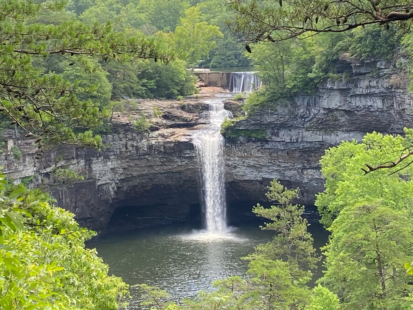
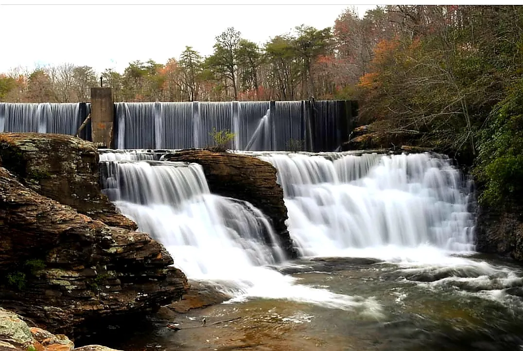
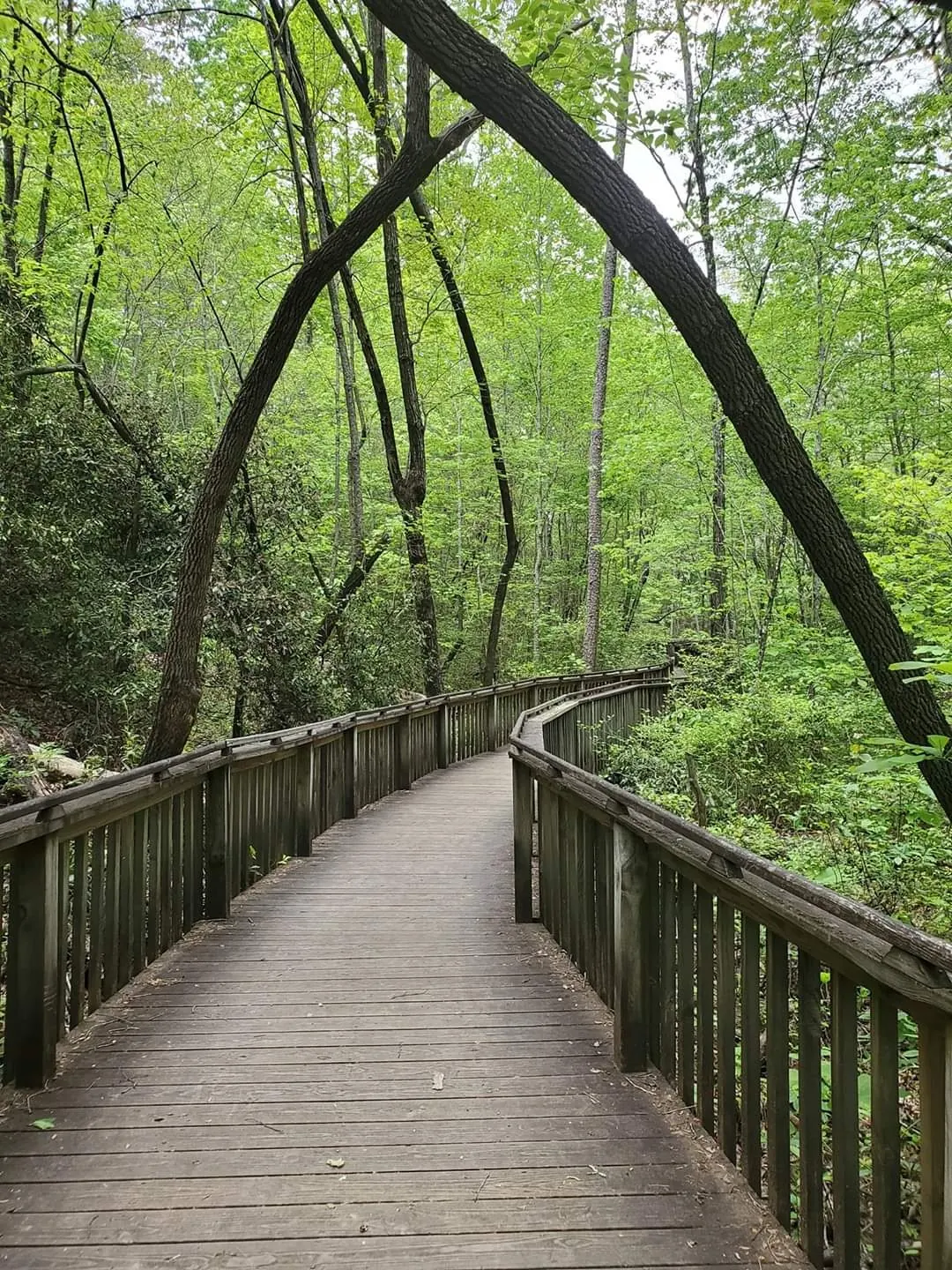
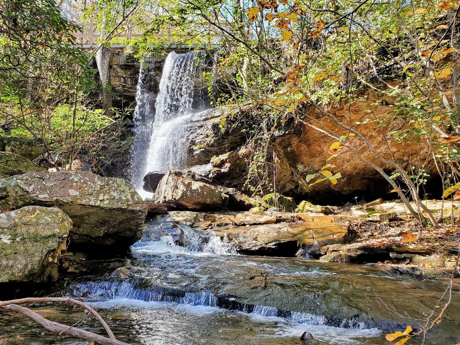
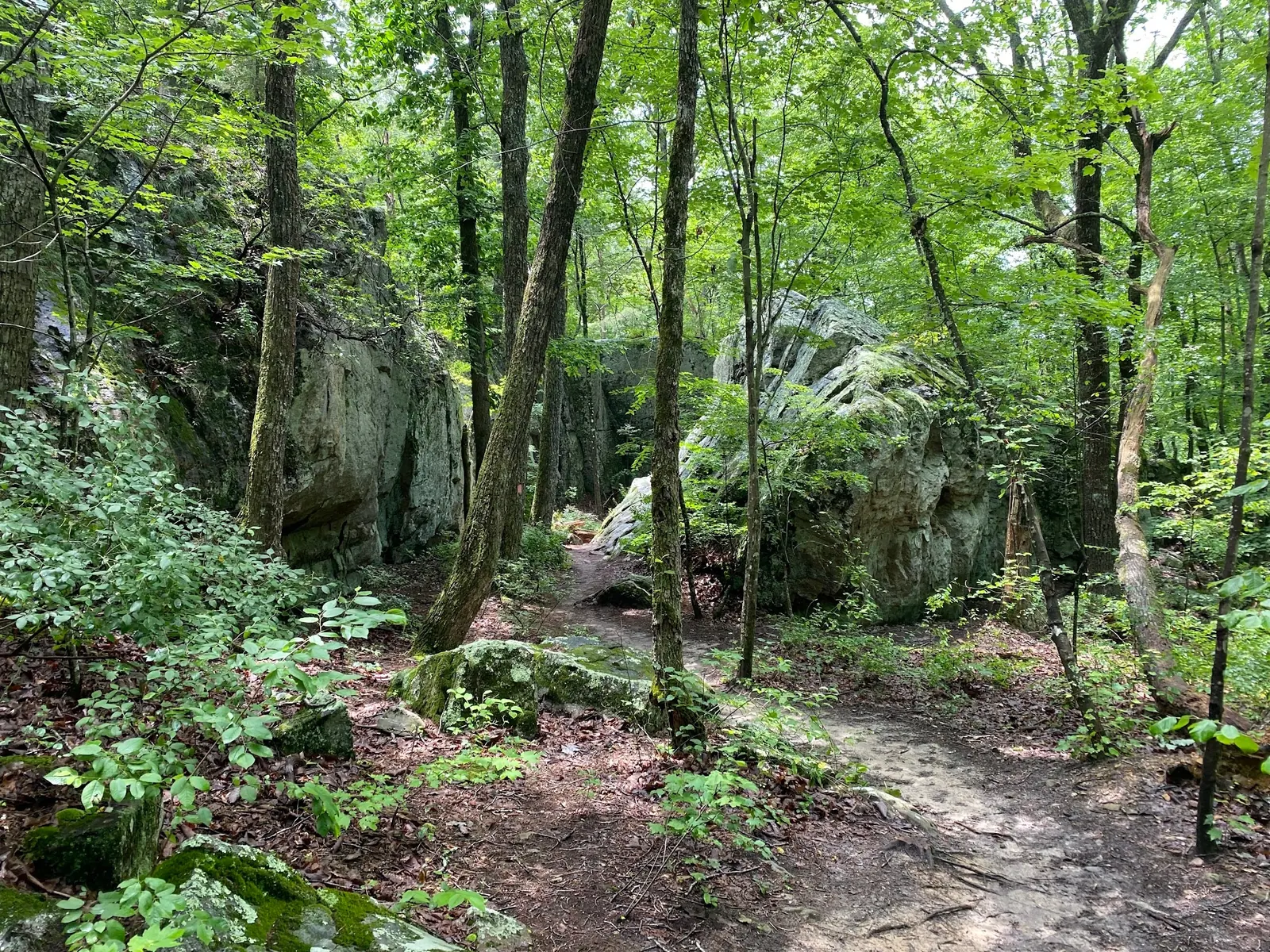
The historical photographs show contrasting DeSoto-area scenery: the large waterfall and gorge, a dam detail, a forest boardwalk, a waterfall beneath a footbridge and a rocky dirt trail. The small waterfall and trail photographs are park-collection context, not verified named routes or swimming entrances. A railing does not establish today's accessible route or equipment.
Keep these scenes separate from your swimming plan. The park's swimming guidance supports creek and West Fork recreation at your own risk and swimming above the A. A. Miller Dam, without river lifeguards. It does not turn the photographed main falls drop or dam spillway into a jumping location. The managed pool is separate; its published 2026 season ended at Labor Day. Use the official falls viewpoint information to choose a lawful viewing route, not the old hazardous descent narrative.
Use the current yellow DeSoto Scout Trail to reach the West Fork Little River rather than assuming old white-trail markings remain a complete route. At the falls follow official signed viewpoint trails; do not invent a scramble to the basin.
Use the current yellow DeSoto Scout Trail to reach the West Fork Little River rather than assuming old white-trail markings remain a complete route. At the falls follow official signed viewpoint trails; do not invent a scramble to the basin.
Confirm the entrance, parking arrangements, and legal access with the land manager. A map pin does not establish a public right of access. Follow posted routes and never block gates or driveways.
Alabama Parks allows swimming and wading in Laurel Creek and the West Fork through the park, and swimming above A. A. Miller Dam. Natural river areas have no lifeguards and variable water levels. No blanket permission or safety clearance for the main falls basin. Public park access does not necessarily include permission to swim. Respect private property and posted restrictions.
Water conditions can change quickly. This listing does not provide a current safety or water-quality assessment. Check official alerts and avoid entering water when conditions or permission are uncertain.
Bring sturdy water shoes to protect your feet on rocks and slippery surfaces. A waterproof dry bag keeps your phone, keys, and valuables safe. Pack a quick-dry towel, sun protection, and drinking water - never drink from the natural water source.
Nearby places from saved public map data, not necessarily facilities at the swimming spot. Confirm access, hours, fees, and amenities with the operator before you drive.
Map data retrieved 2026-06-15
Parking
Alabama
Gadsden is a city in and the county seat of Etowah County in the U.S. state of Alabama. It is located on the Coosa River about 56 miles northeast of Birmingham, 90 miles southwest of Chattanooga, ...
Hiking area
1500 Noccalula Rd, Gadsden, AL 35904
Public park whose centerpiece is a 90-foot waterfall, with a trail, petting zoo & covered bridge.
State park
7104 Desoto Pkwy NE, Fort Payne, AL 35967
Mountaintop 3,502-acre state park with waterfalls, a nature center, pool & 25 mi. of trails.
Park
969 Co Rd 144, Grove Oak, AL 35975
Park featuring a 35-ft. waterfall with a pedestrian bridge across it, plus scenic trails.
Campground
4122 Old Pump Station Rd, Gadsden, AL 35904
Campground
1 River Rd, Gadsden, AL 35901
Public bathroom
712 Forrest Ave, Gadsden, AL 35901
National forest
1001 North Street (Highway 21 North, 1001 North St E, Talladega, AL 35160
The operator allows swimming and wading in Laurel Creek and the West Fork Little River through the park. It also identifies swimming above A. A. Miller Dam at the separate falls picnic area.
No blanket basin permission or safe-depth clearance is established here. Use the current signed trails and manager guidance; the above-dam swimming statement has a specific scope.
The operator identifies the yellow DeSoto Scout Trail. Use the current park map rather than relying on the archive's old white-to-yellow trail description alone.
No. The operator says natural river swimming is at your own risk. Lifeguards at the constructed pool do not supervise Laurel Creek, the West Fork or the falls.
It lists $5 per vehicle parking and daylight-to-dusk access, with restrooms, picnic tables, grills and a small boat ramp. It is seven miles from the main park.
Its published 2026 season ended at Labor Day. Do not apply its summer hours to October; check the operator for a future season or booked activity.
Historic locator information preserved separately from current visitor instructions.
The reviewed gallery includes waterfall scenery, a dam detail, a boardwalk and a rocky forest trail. Use authorized viewpoints and keep water-entry decisions separate from photographs; a boardwalk image is not a current accessibility assessment.
Use permitted routes, pack out litter and protect banks. Follow current fire and land-use restrictions.
Browse every listed natural swimming spot in Alabama.
Find similar river destinations across the directory.
See under-the-radar places and local favorites in the same state.
Compare easier-access destinations and safer planning options.
Explore waterfall-focused swimming destinations in Alabama.
Use this safety guide before entering any natural water.
Safety & Access Notice
This information is for general planning only and may be incomplete, outdated, or inaccurate. Access rules, closures, water levels, currents, hazards, and legal restrictions can change at any time. Always verify current rules with the land manager or official source before visiting.
You are responsible for your own safety and for following all posted signs, laws, and local regulations. Read the full disclaimer.
The constructed pool's posted 2026 season ran Memorial Day weekend through Labor Day, not October operation. The park's lodging and campground are separate bookings; no informal overnight permission inferred at the river.
Loading weather data…
Safety & Access Notice
This information is for general planning only and may be incomplete, outdated, or inaccurate. Access rules, closures, water levels, currents, hazards, and legal restrictions can change at any time. Always verify current rules with the land manager or official source before visiting.
You are responsible for your own safety and for following all posted signs, laws, and local regulations. Read the full disclaimer.
Joshua Havens created Hidden Swimming Holes to make it easier for people to find — and safely visit — natural freshwater swimming destinations across the United States. He researches access conditions, water quality resources, and land management rules so you don't have to start from scratch. He holds a strong belief that good outdoor recreation information should be accurate, honest about its limitations, and freely available.
Discover other amazing natural swimming destinations across America