Blue Hole Day Use Area
Campground
4.6 (24)
Blue Hole Rd, Bergton, VA 22811
Public restroom

Background: generated illustration, not a photograph of this location.
Explore Blue Hole near Bergton with reviewed river photos, qualified directions and practical planning notes. Current swimming access and water conditions need checking.
Swimming permission unconfirmed
The Forest Service prohibits cliff diving and rope swings here. Its designated-site order restricts swimming outside designated swimming areas in developed recreation areas; no designated swim zone was verified for Blue Hole. Confirm permitted water access with the ranger district. Historical photos do not establish safe depth or water quality.
Official sources checked:
Location
A closer look
Photos show past visits, not current water levels or swimming conditions. Select a photo to view it larger.
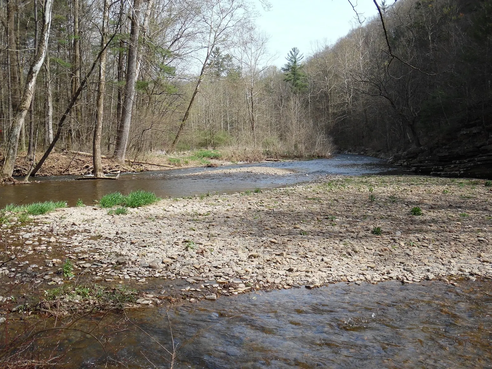
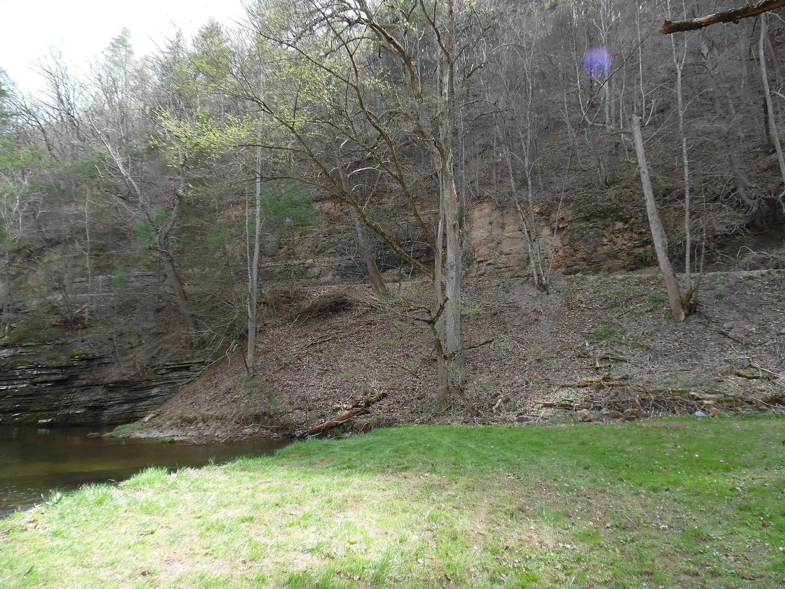
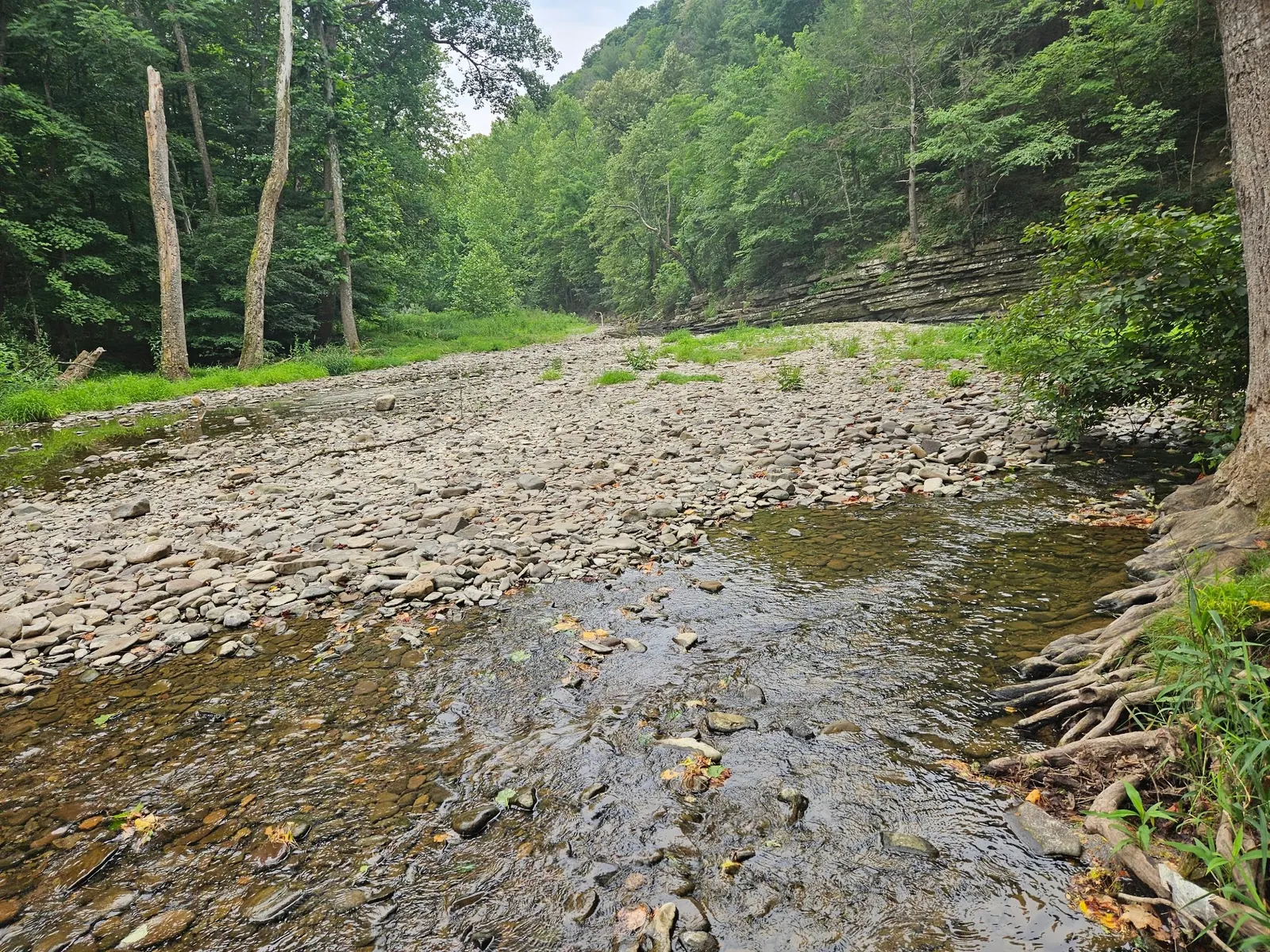
This is a desk-researched listing. A record update or map check does not confirm current swimming permission or water conditions.
Found an error? Send a correction with the location and a source. How we research listings.
This North Fork Shenandoah River location has layered rock banks and a gravel bar visible in the gallery. The Forest Service profile lists free, year-round day use from sunrise to sunset. A recreation-site opening is not a water-quality clearance or verification of swimming authorization.
Picnic tables are officially listed, but potable water is not available. The local community account reports no toilets; do not rely on the old outhouse description. This is a day-use destination, not an invitation to camp on the grassy bank.
The operator route from Broadway uses VA259 for about14.3miles, VA820 for about1.5miles, then FS302 toward the day-use area. Follow current signs and confirm lawful parking. The retained historical coordinates are unverified and should not be treated as an exact water entry.
The operator explicitly prohibits cliff diving and rope swings. Its designated-site order restricts swimming outside designated swimming areas in developed recreation sites. No designated swim zone was established here; confirm permitted water access with North River Ranger District at540-432-0187.
The DEQ station record is not a verified swimming entry, and we have not assessed current sampling results. Three reviewed historical landscape views document the river setting, not today's depth or flow. Do not jump or dive based on a photograph.
The Forest Service route from Broadway follows VA 259 about 14.3 miles, left onto VA 820 about 1.5 miles, then left onto FS 302 to Blue Hole Day Use Area. Follow current signs and confirm lawful parking. The retained historical coordinates differ from the published day-use location and are unverified; neither they nor the nearby water-monitoring station identify a confirmed swimming entry. Do not use an outhouse as a landmark.
The Forest Service lists Blue Hole open year-round for day use, sunrise to sunset. This establishes recreation-site hours, not a swimming season, designated swim zone or water-quality clearance. Check current alerts before travel.
Confirm the entrance, parking arrangements, and legal access with the land manager. A map pin does not establish a public right of access. Follow posted routes and never block gates or driveways.
The Forest Service prohibits cliff diving and rope swings here. Its designated-site order restricts swimming outside designated swimming areas in developed recreation areas; no designated swim zone was verified for Blue Hole. Confirm permitted water access with the ranger district. Historical photos do not establish safe depth or water quality. Public park access does not necessarily include permission to swim. Respect private property and posted restrictions.
Water conditions can change quickly. This listing does not provide a current safety or water-quality assessment. Check official alerts and avoid entering water when conditions or permission are uncertain.
Nearby places from saved public map data, not necessarily facilities at the swimming spot. Confirm access, hours, fees, and amenities with the operator before you drive.
Map data retrieved 2026-06-15
Campground
Blue Hole Rd, Bergton, VA 22811
Parking lot
15004 Bergton Rd, Bergton, VA 22811
Park & ride
15004 Bergton Rd, Bergton, VA 22811
Hiking area
13167 John Marshall Hwy, Linden, VA 22642
Hiking area
215 Afton Depot Ln, Afton, VA 22920
Campground
12480 Mountain Valley Rd, Broadway, VA 22815
Campground
8399 Brocks Gap Rd, Broadway, VA 22815
Campground
Unnamed Road, Bentonville, VA 22610
The local community account reports no toilets or drinking-water pump. Do not rely on the older outhouse description; bring water and plan restroom stops elsewhere.
The community account says camping is not allowed. Do not assume the grassy bank is an authorized campsite.
No designated swim zone was established from the operator profile. Confirm permitted water access with North River Ranger District; local history and saved photos do not establish safe depth or water-quality clearance.
The Forest Service lists no site fee and year-round day use from sunrise to sunset. Those hours are not a swimming-season guarantee.
No. The Forest Service explicitly prohibits cliff diving and rope swings at Blue Hole.
No. The monitoring-site coordinates are not a confirmed public swimming entry, and the existence of sampling records is not a current safety result.
Three reviewed historical landscape views show wooded banks, layered rocks, a gravel bar and an exposed rocky channel. They are not a report of today's river conditions.
The Bergton Fair community account describes Blue Hole as a long-used local river recreation spot.
Reviewed historical photos show the layered rock wall, wooded banks, gravel bar and exposed rocky channel. They do not establish today's depth, flow, water quality or access.
Pack out litter, avoid disturbing riverbank vegetation and keep access routes clear. Keep dogs on a leash no longer than six feet and observe the designated-site order's alcohol restrictions in picnic and parking areas.
Browse every listed natural swimming spot in Virginia.
Compare nearby options around Harrisonburg before you choose a route.
Find similar river destinations across the directory.
See under-the-radar places and local favorites in the same state.
Compare easier-access destinations and safer planning options.
Use this safety guide before entering any natural water.
Safety & Access Notice
This information is for general planning only and may be incomplete, outdated, or inaccurate. Access rules, closures, water levels, currents, hazards, and legal restrictions can change at any time. Always verify current rules with the land manager or official source before visiting.
You are responsible for your own safety and for following all posted signs, laws, and local regulations. Read the full disclaimer.
The Forest Service identifies day use only. The community account says camping is not allowed; do not assume the grassy bank is a campsite.
Loading weather data…
Safety & Access Notice
This information is for general planning only and may be incomplete, outdated, or inaccurate. Access rules, closures, water levels, currents, hazards, and legal restrictions can change at any time. Always verify current rules with the land manager or official source before visiting.
You are responsible for your own safety and for following all posted signs, laws, and local regulations. Read the full disclaimer.
Joshua Havens created Hidden Swimming Holes to make it easier for people to find — and safely visit — natural freshwater swimming destinations across the United States. He researches access conditions, water quality resources, and land management rules so you don't have to start from scratch. He holds a strong belief that good outdoor recreation information should be accurate, honest about its limitations, and freely available.
Discover other amazing natural swimming destinations across America