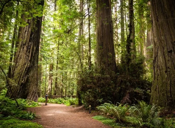
Sunlight filtering through tall Humboldt Redwoods trees above forest ferns
RiverCA

Humboldt Redwoods Swimming Holes

By Hidden Swimming Holes Team · Record updated

Background photo from a past visit, not current conditions. View photos and source links

Explore Humboldt Redwoods with official river-access options, day-use planning, algae cautions and reviewed redwood photos. No cliff-jumping or mill-gate directions.

Water type
River
Access
Informal
Fee
The park lists $8 vehicle day use, subject to change. Confirm the fee for your chosen facility and keep campground charges separate; do not assume every regional stop shares one admission arrangement.
Best season
Visit within posted hours for your chosen facility and check seasonal services before traveling
Nearby towns
Eureka, Scotia, Redcrest, Weott, Miranda, Garberville
Water body
Eel River, South Fork Eel River

Location

Map & Directions

CA
Nearby towns
Eureka, Scotia, Redcrest, Weott, Miranda, Garberville
Recreation-area reference location
40.3225, -123.9928
Recorded coordinates have not been source-checked. Confirm the entrance and legal access before using directions.

Sources & checks

This is a desk-researched listing. A record update or map check does not confirm current swimming permission or water conditions.

Swimming rules
Official sources checked . See the rules above and check for current closures.
Recreation-area reference location
The map uses a recreation-area reference coordinate from the manager, not a surveyed entrance, parking space or safe water-entry point. Follow current signs and confirm access before travelling.
Record updated
· This is a data update, not a field visit.

Found an error? Send a correction with the location and a source. How we research listings.

Choose a specific destination within the redwood region

Humboldt Redwoods is a broad outing area, not one swimming hole with one entrance. Begin with the official park page and choose the river location, walking route or campground that matches your plans. The map reference does not identify a water-entry point.

Replace informal directions with named park access

The park activities guide identifies river-access options. Confirm the exact route rather than following old industrial-gate directions. Neither a regional place name nor an inviting river photo establishes permission to cross private land.

Check water warnings, not just the forecast

A sunny day does not guarantee suitable river conditions. Review alerts before traveling and read signs at your chosen stop. If flow, water quality or an uncertain exit makes entry unsuitable, switch to a permitted forest walk or picnic.

Match facilities to your chosen stop

Confirm parking, toilets and drinking water for the actual location you will use. Carry essentials rather than transferring campground amenities to a river bar. Check seasonal visitor services and reserve overnight accommodation separately.

Preview the forest without confusing it with the river

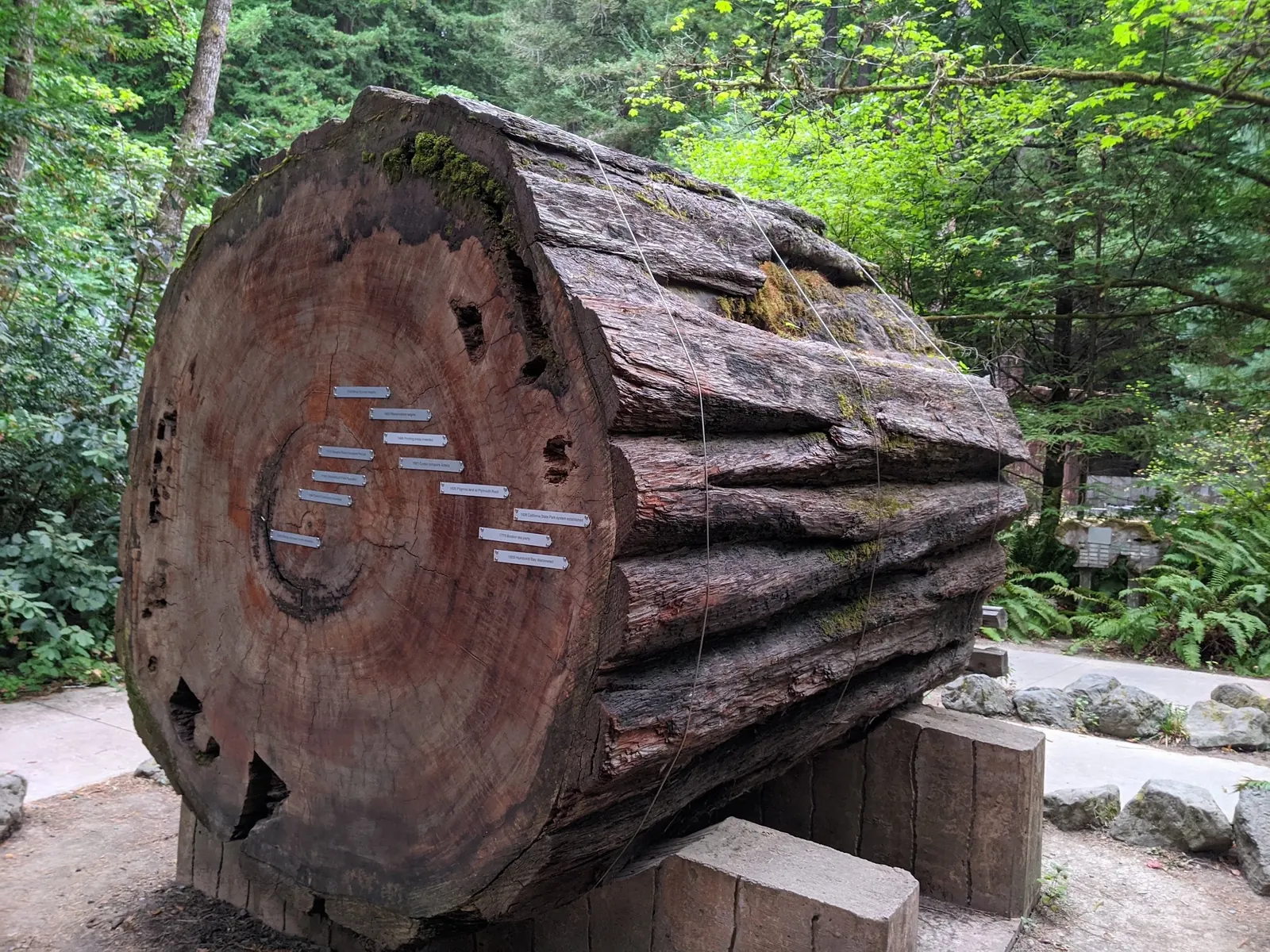
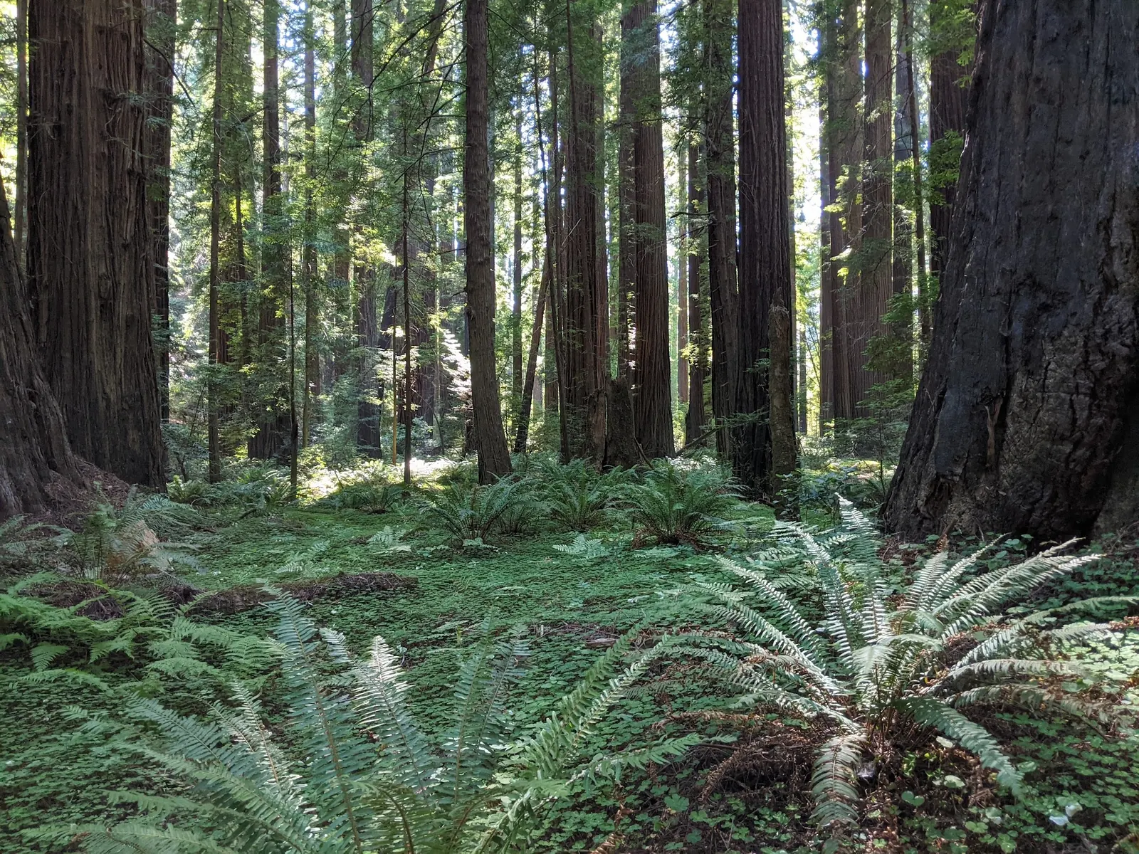
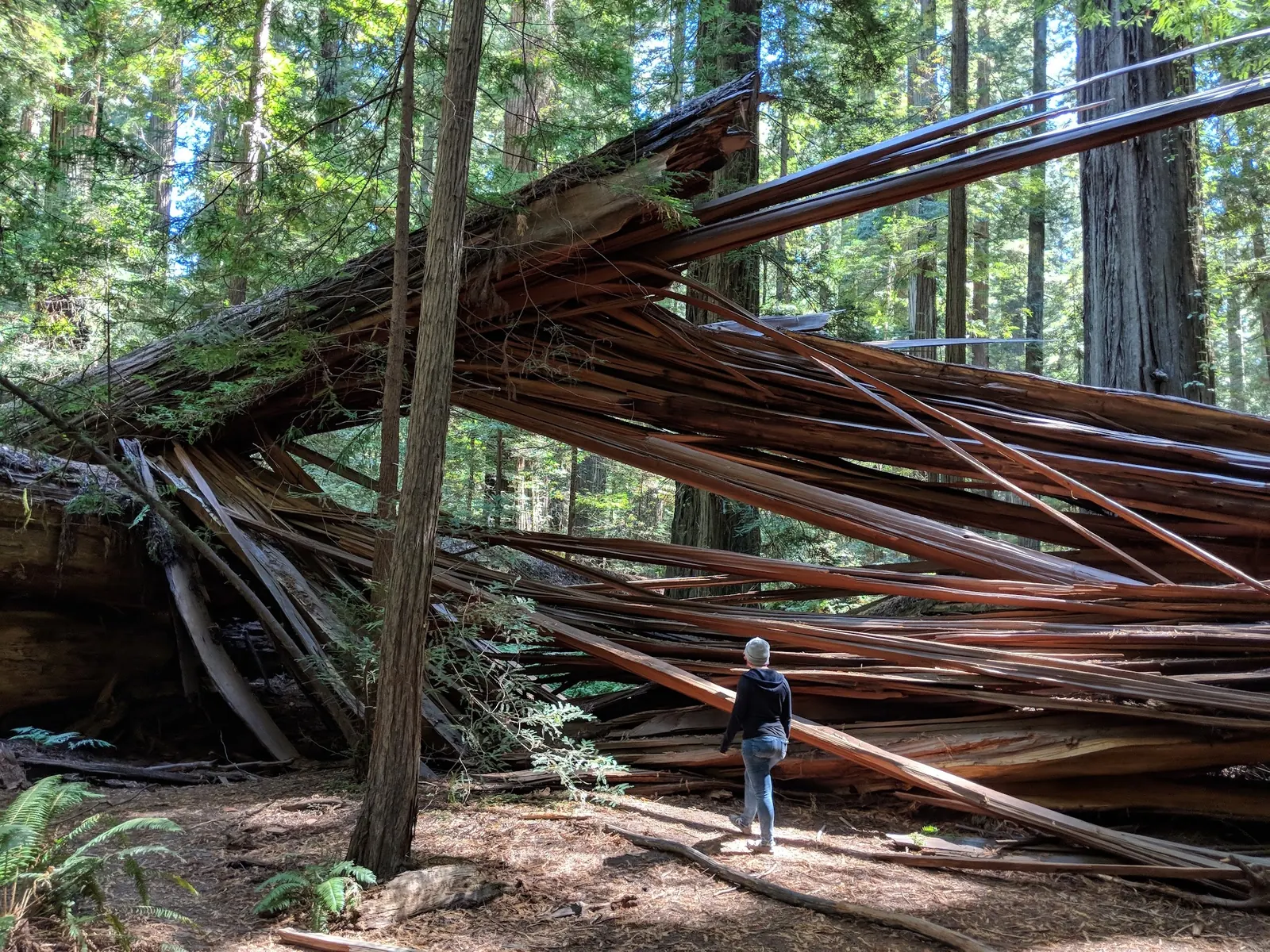
The gallery shows the redwood setting and tree interpretation, not a particular swimming entrance. It gives a useful preview for a combined forest-and-river outing while keeping the access decision tied to current park information.

Getting There

Choose a named access location from the official park activities page and use its current map and arrival information. The retained point is only a recreation-area reference. Do not follow the archived Scotia mill-gate route as a verified public swimming entrance.

Access Notes

River conditions change after rain. Check park alerts and water-quality notices before departure and again on arrival. Low-flow warm periods can bring harmful algae warnings, particularly relevant to children and pets.

Plan Your Visit

Parking & Access

Confirm the entrance, parking arrangements, and legal access with the land manager. A map pin does not establish a public right of access. Follow posted routes and never block gates or driveways.

Regulations & Fees

State Parks identifies river recreation at named park locations, including Lansdale Bar and Gould Bar. Check the exact access route and current warnings. No lifeguards are provided; regional swimming information does not sanction jumping or every Eel River bank. Public park access does not necessarily include permission to swim. Respect private property and posted restrictions.

Seasonality & Flow

Water conditions can change quickly. This listing does not provide a current safety or water-quality assessment. Check official alerts and avoid entering water when conditions or permission are uncertain.

What to Bring

Bring sturdy water shoes to protect your feet on rocks and slippery surfaces. A waterproof dry bag keeps your phone, keys, and valuables safe. Pack a quick-dry towel, sun protection, and drinking water - never drink from the natural water source.

Nearby Facilities

Nearby places from saved public map data, not necessarily facilities at the swimming spot. Confirm access, hours, fees, and amenities with the operator before you drive.

Map data retrieved 2026-06-15

Humboldt Redwoods State Park

State park

1 mi 4.9 (5169)

17119 Avenue of the Giants, Weott, CA 95571

This park with over 17,000 acres of old-growth redwoods offers camping, hiking, fishing & swimming.

Barbecue grillCycling lanesPicnic tablesPublic restroom

Albee Creek Campground

Campground

2.2 mi 4.6 (108)

Mattole Rd, Ferndale, CA 95536

Public restroomPublic showerRestroomTent sites

Hidden Springs Campground

Campground

7.5 mi 4.5 (199)

17119 Avenue of the Giants, Weott, CA 95571

Public restroomPublic showerRestroomRunning water

Drury-Chaney Trail

Hiking area

8.3 mi 4.9 (290)

30780-30784 Avenue of the Giants, Scotia, CA 95565

Avenue of the Giants Stafford RV Park and Campground

Campground

9.7 mi 3.7 (118)

385 North Rd, Scotia, CA 95565

Barbecue grillPicnic tablesPublic restroomPublic shower

Humboldt Redwood Company Bungalow

Parking lot

12 mi 2.4 (5)

Main St, Scotia, CA 95565

Nanning creek trail

Hiking area

12.7 mi 5 (2)

Scotia, CA 95565

Public Restrooms

Public bathroom

22.6 mi 4.4 (5)

524 Main St, Ferndale, CA 95536

Live Conditions Nearby

Checking nearby USGS water conditions…

Frequently Asked Questions About Humboldt Redwoods Swimming Holes

Does the map mark a specific swimming entrance?

No. It is a recreation-area reference. Choose and confirm a named park access location.

Can I use the old Scotia mill-gate directions?

Do not treat them as verified public access. Use current official park arrival information instead.

Are the photos of Lansdale Bar or Gould Bar?

No. The reviewed gallery shows the redwood park setting, not those specific river entrances.

Highlights

Redwood forest scenery
Named park river-access options
Walking and picnic alternatives

Location & Area Map

Safety Information

Important Safety Tips

  • Stay out during high flows or posted water-quality warnings
  • Keep children supervised, avoid slippery banks and submerged obstacles, and do not jump or dive
  • Check for a safe exit before entering

Cultural & Historical Context

Historical Background

The area reflects California’s lumber industry heritage, with the town of Scotia serving as a historic mill town. The redwoods and Eel River have inspired generations of conservation efforts.

Photography Guide

Photo Opportunities

Reviewed photos show redwood forest paths, tree interpretation and a split fallen trunk with a visitor seen from behind. They are forest-context images, not photographs of Lansdale Bar, Gould Bar or a verified swimming entrance. The fallen-tree view does not establish a river-access route.

Conservation & Ethics

Protect This Place

Help protect the delicate ecosystem by following Leave No Trace principles. Avoid littering, respect wildlife, and minimize impact on the natural environment.

Explore More Nearby Swimming Guides

You Might Also Like

At a Glance

Best Time to Visit
Visit within posted hours for your chosen facility and check seasonal services before traveling.
Difficulty Level
Routes vary across this regional listing. Confirm the distance, surface and river approach for the specific park stop you choose.
Fee
The park lists $8 vehicle day use, subject to change. Confirm the fee for your chosen facility and keep campground charges separate; do not assume every regional stop shares one admission arrangement.
Facilities
Facilities include parking at the ball field near Scotia Firemen’s Park and campground amenities at Hidden Springs, Burlington, and Albee Creek. Restrooms are available at campgrounds.
Activities
Permitted river recreation, redwood walks and picnicking subject to current restrictions
Phone
707-946-2409 (park)

Safety & Access Notice

This information is for general planning only and may be incomplete, outdated, or inaccurate. Access rules, closures, water levels, currents, hazards, and legal restrictions can change at any time. Always verify current rules with the land manager or official source before visiting.

You are responsible for your own safety and for following all posted signs, laws, and local regulations. Read the full disclaimer.
Camping Information

Use the official park page to choose a campground and check reservations. A park-wide listing does not establish availability or services at a particular site.

Loading weather data…

Safety & Access Notice

This information is for general planning only and may be incomplete, outdated, or inaccurate. Access rules, closures, water levels, currents, hazards, and legal restrictions can change at any time. Always verify current rules with the land manager or official source before visiting.

  • Do not swim where swimming is prohibited, unsafe, or not clearly allowed.
  • Follow posted signs, local regulations, closures, and private-property boundaries.
  • Assess conditions on site. Water flow, depth, temperature, and underwater hazards change quickly.
  • Never jump or dive without personally confirming depth and underwater obstacles.
  • Swim with a buddy and consider flotation for weak or non-swimmers.
  • Pack out all trash; respect wildlife and fragile environments.

You are responsible for your own safety and for following all posted signs, laws, and local regulations. Read the full disclaimer.
J
Joshua Havens
Founder & Editor, Hidden Swimming Holes

Joshua Havens created Hidden Swimming Holes to make it easier for people to find — and safely visit — natural freshwater swimming destinations across the United States. He researches access conditions, water quality resources, and land management rules so you don't have to start from scratch. He holds a strong belief that good outdoor recreation information should be accurate, honest about its limitations, and freely available.

Explore More Swimming Holes

Discover other amazing natural swimming destinations across America