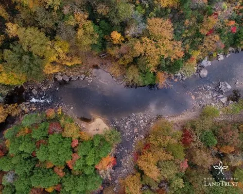
Explore swimming-hole listings in West Virginia and plan beyond the familiar stops.
"Hidden gem" is a browsing theme, not a promise of solitude, clear water or public access.
10
Planning candidates
22
Total in West Virginia
0
No entry fee listed
Use this collection to research places in West Virginia, then check each listing's sources and access notes.
Descriptive detail is not evidence that a site is uncrowded or that its water is suitable for swimming.
By Hidden Swimming Holes Team-
How We Selected These Hidden Gems
This shortlist uses discoverable records, whether free or fee-based. Records with a dated rules-source field come first, followed by records with source links, then a stable alphabetical order. Read the fee notes for each place; the separate budget guide focuses on records reporting no entry fee.
Description length, legacy confidence labels and photo counts do not affect placement. A recorded source date is not a current water-quality or access clearance.
We show up to ten candidates, not a ranking of safety or seclusion.
Confirm permission and any permit or reservation requirements
Check the actual route and parking location with the land manager
Read current closure and water-quality notices
Keep an alternative plan if the site is closed or crowded
Pro Tip
Download offline maps and save each stop before you drive - signal can vanish when you're closest to the good stuff.
Timing and Advisories in West Virginia
Check current conditions and local advisories for the exact waterbody before travelling.
Do not assume water is suitable simply because a day or two has passed since rain, or because it looks clear.
Follow posted closures and the land manager's guidance instead of a fixed waiting period.
See the CDC's natural-water swimming guidance for advisory checks, especially after heavy rain.
Access, Parking, and Navigation
Save the official entrance, permitted parking area and return route before leaving. A map pin can describe a broad
recreation area rather than the route to the water; read the pin note and approach details in each full listing.
Ask the operator about reservations, road access and the actual route surface and distance. Do not treat a photograph,
a turnout or a path worn by other visitors as permission to enter. Never block gates or use unauthorized parking.
Respect the Place
If authorized parking is full, use a separately checked backup plan. Do not create new paths or park in vegetation
to reach the water. A backup destination needs its own access and condition checks.
Pack for the Confirmed Route
Footwear appropriate to the confirmed approach, plus a towel and dry layers
Sun protection, drinking water and food matched to your trip
Saved maps, operator contacts and a way to carry out your waste
Any required permit or reservation confirmation; check equipment rules with the operator
Before You Go
Check the named destination's current rules and advisories before deciding whether to swim.
A quiet location or calm-looking surface does not establish suitable conditions. If permission or conditions
remain uncertain, keep the outing on land instead of looking for an unverified water entry.
Recreation.gov explicitly supports swimming in Anthony Creek at Blue Bend. Other informal Greenbrier River and downstream creek entrances require their own access and condition checks. Use the published Blue Bend approach: Route 92 north from White Sulphur Springs, then west at Alvon on Route 16 to the recreation…
Water Body:Anthony Creek; Separate Greenbrier River References
Recorded Timing:Check current operating notices and forecast before travel. The operator warns that flash flooding can make approach roads impassable and delay departure.
Fee Notes:Check current day-use, shelter and campsite terms with Blue Bend; a campground or shelter charge is not a universal fee for every regional river entry.
Greenbrier Valley tourism recognizes swimming at Anvil Rock. Do not adopt its jumping suggestion: no current safe depth, landing clearance or inspected access was established. Official regional tourism describes a Route 63 gravel pullout roughly a mile from Stuart's Smokehouse and a steep bank descent. Confirm…
Water Body:Greenbrier River
Recorded Timing:Check weather, river flow and current access signs. Summer tourism copy does not guarantee calm currents, suitable depth or a year-round maintained entrance.
Fee Notes:No current admission or parking arrangement established. A roadside description is not a guaranteed free public parking space or unrestricted bank permission.
The park activities page lists swimming in the Middle Fork River. This is natural river access, not a treated pool or confirmation of today's water quality. For an Audra camping weekend, the operator requires at least two consecutive nights covering Friday and Saturday; Sunday-through-Thursday bookings can be one…
Listing Planning Notes
Middle Fork River setting
Alum Cave hiking feature
Seasonal camping
Water Body:Middle Fork River
Recorded Timing:Check weather, river levels and current notices before travel.
Fee Notes:Confirm current day-use charges; camping and shelter reservations are separate.
This downtown West Virginia park offers three different experiences: a seasonal outdoor swimming pool, public springs for wading, and bookable bathhouse services. Do not confuse the historic stone basins and spring channels in the gallery with the swimming pool. The spring-fed pool has a published Memorial Day…
Listing Planning Notes
Seasonal spring-fed outdoor swimming pool
Year-round public springs for wading
Separate bathhouse services and reservations
Water Body:Hot Springs
Recorded Timing:For the outdoor pool, check its published summer season and current operating days. Bathhouses and public springs have separate schedules.
Fee Notes:Public spring access is free. Confirm separate pool and bathhouse charges with the park.
WVU documents swimming beside Big Bend Campground, while the operator describes river fishing and non-motorized boating. Swimming history does not certify a gentle circular tubing route or permission at every canyon pullout. Groups should distinguish Big Bend's individual sites from nearby Jess Judy Group Campground.…
Water Body:South Branch Potomac River
Recorded Timing:Confirm actual current campground and road notices. Flash flooding can make access roads impassable; published typical operating dates are not a live opening or suitable-swimming notice.
Fee Notes:Use the current booking quote for the selected site and ask about day-use arrangements. No blanket free swimming or universal camping rate established.
The land trust explicitly recognizes swimming areas including Blue Hole. Its bridge restriction changes access, not a riverwide swimming ban. Surrounding technical whitewater is for experienced paddlers, not casual swimming. WV Land Trust currently says Jenkinsburg Bridge cannot be crossed in a vehicle. Approach via…
Water Body:Big Sandy Creek and Cheat River
Recorded Timing:Read current land-trust bridge notices and dated Friends of the Cheat results. Jenkinsburg Bridge and Big Sandy Rockville samples are different stations, not clearance for every upstream pool.
Fee Notes:No current blanket admission or parking price established. Keep gates and passing places clear; absence of a fee does not permit parking on the closed-side approach.
Campbell Falls and Mash Fork Falls belong to the Camp Creek State Park and Forest outing. Brush Creek Falls is a separate destination. Treat this area guide as a planning comparison, not a single swimming entrance. The retained historical gallery contains one park cascade photo, not individually identified photos of…
Listing Planning Notes
Campbell Falls and Mash Fork Falls in the park and forest
Separate Brush Creek Falls viewing stop
Current operator links and location-specific access cautions
Water Body:Camp Creek, Mash Fork and Brush Creek
Recorded Timing:Check current weather, flow, trail conditions and park notices before visiting. Recent rainfall is not a reason to enter waterfall pools; it can create dangerous currents and runoff.
Fee Notes:Check current day-use, camping and shelter charges with the operator.
The Mon River Trails Conservancy describes Deckers Creek as a 19.5-mile rail-trail from Morgantown. That corridor is not a single swimming destination. Choose your trailhead and intended outing before departure; the retained coordinate is unverified, not a checked water-entry pin. MRTC rules prohibit camping and…
Listing Planning Notes
Rail-trail scenery
Site-specific gorge water-quality information
Informal gorge access
Water Body:Deckers Creek
Recorded Timing:Check current access, flow and dated water-quality results rather than relying on a swimming season.
Fee Notes:Gorge source describes free gravel parking; check current signs.
Upper Elk River near Webster Springs and Monterville, West Virginia
River/Falls
WVU identifies swimming along the Valley Fork/Bergoo Road corridor. State tourism places Whitaker Falls near Monterville in Randolph County; the legacy Webster County name does not place all three stops in that county. Choose Elk Hole, Whitaker Falls or Bergoo Hole individually using current source maps. The old…
Water Body:Upper Elk River
Recorded Timing:Check the chosen entrance, notices, rainfall and current flow. No fixed summer depth, safe sliding route or current sanitary result established.
Fee Notes:No current admission or parking quote established for these individual entries. Confirm the chosen property's terms; do not label all frontage free.
NPS identifies Glade Creek cascades and pools as local swimming holes. That supports genuine recreation, not a depth survey, a jump recommendation or five independently verified entrances. NPS lists Glade Creek Campground as first-come, first-served with no reservations, and distinguishes six walk-in tent sites from…
Water Body:Glade Creek in New River Gorge
Recorded Timing:The trail page currently retains a washout near the Kates Falls junction that can be impassable in high water. This is not proof of a whole-trail closure. Check current park alerts and turn back if the approach or return is unsuitable.
Fee Notes:Confirm campground terms through NPS rather than inferring a bathing admission from the trail page. No universal fee or campsite reservation entitlement is established by the swimming-hole description.